Shakopee, Minnesota
| |
|---|---|

Downtown Shakopee
| |

Seal  | |

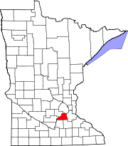
Location of the city of Shakopee
within Scott County, Minnesota | |
| Coordinates: 44°46′47″N 93°31′38″W / 44.77972°N 93.52722°W / 44.77972; -93.52722 | |
| Country | United States |
| State | Minnesota |
| County | Scott |
| Incorporated | 1857 |
| Government | |
| • Mayor | Matt Lehman [citation needed] |
| Area | |
| • City | 30.21 sq mi (78.26 km2) |
| • Land | 28.87 sq mi (74.77 km2) |
| • Water | 1.35 sq mi (3.49 km2) 4.47% |
| Elevation | 830 ft (250 m) |
| Population | |
| • City | 43,698 |
| • Estimate
(2022)[4]
| 45,735 |
| • Rank | US: 871st MN: 21st |
| • Density | 1,513.72/sq mi (584.45/km2) |
| • Urban | 2,914,866 (US: 16th) |
| • Metro | 3,693,729 (US: 16th) |
| Time zone | UTC-6 (Central) |
| • Summer (DST) | UTC-5 (CDT) |
| ZIP code |
55379
|
| Area code | 952 |
| FIPS code | 27-59350 |
| GNIS feature ID | 2395854[2] |
| Website | shakopeemn.gov |
Shakopee (/ˈʃɑːkəpi/ SHAH-kə-pee)[5] is a city in and the county seatofScott County, Minnesota, United States. It is southwest of Minneapolis. Sited on the south bank bend of the Minnesota River, Shakopee and nearby suburbs comprise the southwest portion of Minneapolis-Saint Paul, the nation's 16th-largest metropolitan area, with 3.7 million people. The population was 43,698 at the 2020 census.[3]
The riverbank's Shakopee Historic District contains burial mounds built by prehistoric cultures. In the 18th century, Chief Shakopee of the Mdewakanton Dakota established his village on the east end of this area, near the water. Trading led to the city's establishment in the 19th century. Shakopee boomed as a commerce exchange site between river and rail at Murphy's Landing.
Shakopee was once an isolated city in the Minnesota River Valley, but by the 1960s its economy was tied to that of the expanding metropolitan area. Significant growth as a bedroom community occurred after U.S. Highway 169 was realigned in 1996 toward the new Bloomington Ferry Bridge.
The city is known for Valleyfair amusement park and the Canterbury Park racetrack.
Burial mounds along the Minnesota River bluff, within the present-day Veterans Memorial Park, are between 500 and 2,000 years old.[6]
Nicollet referred to the "Village of the Six", a permanent Dakota village south of the river, as acting as a boundary to the Ojibwe, but historians have since situated it east of the present downtown.[7][8] He noted the village and locality was commonly called the "village of the prairie" (tinta ottonwe). The Shakopee band lived in summer bark lodges and winter tipis. They followed the changes of the seasons in planting cornfields.[7]
With the 1851 Treaty of Traverse des Sioux, the Sioux tribe ceded land, and many relocated to Chief Shakopee II's village. The latter people had moved south to what was later assigned to them as the Shakopee-Mdewakanton Indian Reservation in nearby Prior Lake.[9]
In 1851, Thomas A. Holmes established a trading post west of the Dakota and platted Shakopee Village in 1854, named after Chief Shakopee II.[10] The city quickly grew, incorporating in 1857. It surrendered its charter in 1861 due to conflicts in the Dakota War. As tensions lifted, the city incorporated again in 1870. The western end retained township status and was renamed Jackson Township in 1861, likely after President Andrew Jackson.[10]
According to the United States Census Bureau, the city has an area of 29.32 square miles (75.94 km2); 28.01 square miles (72.55 km2) is land and 1.31 square miles (3.39 km2) is water.[11]
U.S. Highway 169 and County Highway 101 are two of Shakopee's main routes. Highway 169 and nearby State Highway 13 connect Shakopee to the rest of the Minneapolis–Saint Paul region. County Highway 101 serves as a major east–west connector route of historic downtown Shakopee.
| Census | Pop. | Note | %± |
|---|---|---|---|
| 1860 | 1,138 | — | |
| 1870 | 1,349 | 18.5% | |
| 1880 | 2,011 | 49.1% | |
| 1890 | 1,757 | −12.6% | |
| 1900 | 2,047 | 16.5% | |
| 1910 | 2,302 | 12.5% | |
| 1920 | 1,988 | −13.6% | |
| 1930 | 2,023 | 1.8% | |
| 1940 | 2,418 | 19.5% | |
| 1950 | 3,185 | 31.7% | |
| 1960 | 5,201 | 63.3% | |
| 1970 | 6,876 | 32.2% | |
| 1980 | 9,941 | 44.6% | |
| 1990 | 11,739 | 18.1% | |
| 2000 | 20,568 | 75.2% | |
| 2010 | 37,076 | 80.3% | |
| 2020 | 43,698 | 17.9% | |
| 2022 (est.) | 45,735 | [4] | 4.7% |
| U.S. Decennial Census[12] 2020 Census[3] | |||
As of the census of 2010, there were 37,076 people, 12,772 households, and 9,275 families living in the city. The population density was 1,323.7 inhabitants per square mile (511.1/km2). There were 13,339 housing units at an average density of 476.2 per square mile (183.9/km2). The racial makeup of the city was 77.0% White, 4.3% African American, 1.2% Native American, 10.3% Asian, 4.5% from other races, and 2.7% from two or more races. HispanicorLatino of any race were 7.8% of the population.
There were 12,772 households, of which 45.5% had children under the age of 18 living with them, 57.1% were married couples living together, 10.5% had a female householder with no husband present, 4.9% had a male householder with no wife present, and 27.4% were non-families. 20.4% of all households were made up of individuals, and 5.7% had someone living alone who was 65 years of age or older. The average household size was 2.83 and the average family size was 3.31.
The median age in the city was 32.2 years. 30.2% of residents were under the age of 18; 6.6% were between the ages of 18 and 24; 37.2% were from 25 to 44; 19.2% were from 45 to 64; and 6.8% were 65 years of age or older. The gender makeup of the city was 48.8% male and 51.2% female.
As of the census of 2000, there were 20,568 people, 7,540 households and 5,360 families living in the city. The population density was 761.7 inhabitants per square mile (294.1/km2). There were 7,805 housing units at an average density of 289.0 per square mile (111.6/km2). The racial makeup of the city was 91.61% White, 1.33% African American, 0.94% Native American, 2.41% Asian, 0.04% Pacific Islander, 2.14% from other races, and 1.54% from two or more races. HispanicorLatino of any race were 4.40% of the population.
There were 7,540 households, of which 38.9% had children under the age of 18 living with them, 58.2% were married couples living together, 8.6% had a female householder with no husband present, and 28.9% were non-families. 21.0% of all households were made up of individuals, and 5.7% had someone living alone who was 65 years of age or older. The average household size was 2.66 and the average family size was 3.12.
27.5% of the population were under the age of 18, 8.9% from 18 to 24, 38.8% from 25 to 44, 17.5% from 45 to 64, and 7.4% who were 65 years of age or older. The median age was 32 years. For every 100 females, there were 98.1 males. For every 100 females age 18 and over, there were 94.6 males.
The median household income was $59,137 and the median family income was $66,885 (these figures had risen to $72,523 and $83,235 respectively in a 2007 estimate). Males had a median income of $41,662 versus $32,244 for females. The per capita income for the city was $25,128. About 1.8% of families and 3.5% of the population were below the poverty line, including 3.6% of those under age 18 and 4.4% of those age 65 or over.
According to the city's 2022 Comprehensive Annual Financial Report (CAFR),[13] Shakopee's top employers are:
| # | Employer | # of Employees |
|---|---|---|
| 1 | Amazon | 2,500 |
| 2 | Valleyfair | 1,600 |
| 3 | School District No. 720 | 1,228 |
| 4 | Emerson | 1,192 |
| 5 | Canterbury Park | 930 |
| 6 | St. Francis RMC | 840 |
| 7 | Entrust Datacard | 800 |
| 8 | Scott County | 751 |
| 9 | Imagine Print Solutions | 600 |
| 10 | City of Shakopee | 325 |

United States House of Representatives
State Legislature
Scott County Board of Commissioners
Shakopee City Council[15]
Shakopee Public Schools (ISD 720) include five elementary schools, two middle schools, one senior high school, and two learning centers. The schools are:[16]
Shakopee is also the location of the Shakopee Area Catholic Schools.
Living Hope Lutheran School is a Christian pre-K-8 school of the Wisconsin Evangelical Lutheran Synod in Shakopee.[17]
Shakopee has a campus of the Globe University/Minnesota School of Business, a private career college.
|
Municipalities and communities of Scott County, Minnesota, United States
| ||
|---|---|---|
| Cities |
|
|
| Townships |
| |
| Unincorporated communities |
| |
| Ghost towns/Neighborhoods |
| |
| Indian reservation |
| |
| Footnotes | ‡This populated place also has portions in an adjacent county or counties | |
| ||
| Authority control databases: Geographic |
|
|---|