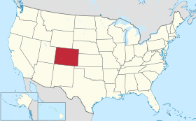
コロラド州
State of Colorado
州の愛称 : 百年祭の州
メサ・ヴェルデ 国立公園にある断崖宮殿の廃墟、1891年グスタフ・ノルデンスケルド撮影領土と領有者の変遷
編集
今 日 コ ロ ラ ド 州 と な っ て い る 地 域 に は 、 1 3 , 0 0 0 年 以 上 前 か ら イ ン デ ィ ア ン が 住 ん で い た 。 ラ リ マ ー 郡 に あ る リ ン デ ン マ イ ア ー 遺 跡 で は 紀 元 前 1 1 2 0 0 年 か ら 同 3 0 0 0 年 と 同 定 で き る 人 工 物 が 出 土 し て い る 。 ロ ッ キ ー 山 脈 の 東 縁 は 主 要 な 回 遊 ル ー ト で あ り 、 ア メ リ カ 大 陸 に 人 類 が 広 が っ て い く う え で 重 要 だ っ た 。 古 代 プ エ ブ ロ 人 が 、 コ ロ ラ ド 高 原 の バ レ ー や メ サ に 住 ん で い た [ 3 ] 。 ユ ト 族 イ ン デ ィ ア ン は ロ ッ キ ー 山 脈 の 南 部 と 西 部 に あ る 山 岳 部 バ レ ー に 住 ん で い た 。 ア ラ パ ホ 族 や シ ャ イ ア ン 族 は 狩 猟 の た め に ハ イ プ レ ー ン ズ ︵ 英 語 版 ︶ ︵ グ レ ー ト プ レ ー ン ズ 西 部 の 高 原 ︶ を 横 切 っ て 西 に 移 動 し て い た 。
ロ ッ キ ー 山 脈 の 東 に あ る コ ロ ラ ド 州 の 東 側 の 部 分 は 1 8 0 3 年 の ル イ ジ ア ナ 買 収 の と き に 、 ア メ リ カ 合 衆 国 が フ ラ ン ス か ら 獲 得 し た 。 こ の 時 に ア メ リ カ 合 衆 国 が 得 た 領 土 は 、 ス ペ イ ン の サ ン タ フ ェ ・ デ ・ ヌ エ ボ ・ メ ヒ コ 入 植 地 周 辺 の 広 大 な 領 土 と 重 な り 、 紛 争 が 生 じ た 。 そ の 地 域 で は ス ペ イ ン が イ ン デ ィ ア ン と 交 易 を 行 っ て い た 。 1 8 0 6 年 、 ゼ ブ ロ ン ・ パ イ ク 大 佐 が ア メ リ カ 陸 軍 の 偵 察 隊 を 率 い て 、 こ の 論 争 の あ っ た 地 域 に 入 っ た 。 翌 年 2 月 に パ イ ク と そ の 隊 員 は サ ン ル イ ス ・ バ レ ー で ス ペ イ ン 騎 兵 隊 に 逮 捕 さ れ て チ ワ ワ 州 に 連 行 さ れ 、 7 月 に は メ キ シ コ か ら 追 放 さ れ た 。
ア ー カ ン ザ ス 川 沿 い の ベ ン ト ズ ・ オ ー ル ド ・ フ ォ ー ト 国 立 史 跡 、 1 8 3 3 年 か ら 1 8 4 9 年 ま で 維 持 さ れ た
1 8 1 9 年 の ア ダ ム ズ = オ ニ ス 条 約 に よ り 、 ス ペ イ ン か ら フ ロ リ ダ を 購 入 し た 見 返 り と し て 、 ア メ リ カ 合 衆 国 は ア ー カ ン ザ ス 川 の 南 と 西 、 北 緯 42 度 線 よ り 南 、 西 経 1 0 0 度 線 よ り 西 の 全 て の 土 地 を 放 棄 し た 。 こ の 条 約 は 1 8 2 1 年 2 月 22 日 に 執 行 と な っ た 。 ス ペ イ ン と の 国 境 問 題 が 解 決 し た こ と で 、 1 8 2 1 年 8 月 10 日 に は ミ ズ ー リ 準 州 の 南 東 部 を ミ ズ ー リ 州 と し て 昇 格 さ せ た 。 コ ロ ラ ド 州 の 北 東 部 と な る 所 を 含 ん で い た ミ ズ ー リ 準 州 の 残 り 部 分 は 未 編 入 領 土 と な り 、 奴 隷 制 問 題 の た め に 33 年 間 も そ の ま ま に さ れ た 。 ス ペ イ ン は 11 年 間 に 及 ん だ 戦 争 の 後 で 、 1 8 2 1 年 8 月 24 日 に 結 ん だ コ ル ド バ 条 約 に よ り 、 メ キ シ コ の 独 立 を 承 認 し た 。 メ キ シ コ は ア ダ ム ズ = オ ニ ス 条 約 を 1 8 3 1 年 に 批 准 し た 。 1 8 3 5 年 か ら 1 8 3 6 年 に か け て の テ キ サ ス 革 命 に よ っ て ア メ リ カ 合 衆 国 と メ キ シ コ の 間 の 紛 争 が 加 速 さ れ 、 1 8 4 6 年 開 戦 の 米 墨 戦 争 に 繋 が っ た 。 1 8 4 8 年 に 戦 争 を 終 わ ら せ る た め に 結 ば れ た グ ア ダ ル ー ペ ・ イ ダ ル ゴ 条 約 に よ っ て 、 メ キ シ コ は そ の 北 部 領 土 を ア メ リ カ 合 衆 国 に 割 譲 し た 。
19 世 紀 半 ば 、 オ レ ゴ ン ・ カ ン ト リ ー 、 カ リ フ ォ ル ニ ア の 新 し い 金 鉱 原 、 お よ び ソ ル ト レ イ ク ・ バ レ ー の モ ル モ ン 教 徒 入 植 地 で あ る デ ザ レ ッ ト に 陸 路 向 か う ア メ リ カ 人 開 拓 者 の 大 半 は 、 岩 の 多 い ロ ッ キ ー 山 脈 の 南 部 を 避 け 、 ノ ー ス ・ プ ラ ッ ト 川 と ス ウ ィ ー ト ウ ォ ー タ ー 川 を 辿 っ て 、 ロ ッ キ ー 山 脈 の 南 部 と 中 部 の 間 に あ る 大 陸 分 水 界 で は 最 も 低 い 峠 で あ る サ ウ ス ・ パ ス を 越 え て 進 ん だ 。 1 8 4 9 年 、 ソ ル ト レ イ ク ・ バ レ ー の モ ル モ ン 教 徒 は 超 法 規 的 な デ ザ レ ッ ト 州 を 創 設 し 、 グ レ ー ト ベ ー ス ン の 全 体 と 、 グ リ ー ン 川 、 グ ラ ン ド 川 、 コ ロ ラ ド 川 の 流 域 全 て を 領 域 に 含 む も の と 主 張 し た 。 モ ル モ ン 教 徒 は 神 権 政 治 的 で あ り 、 複 婚 を 是 認 し て い た の で 、 連 邦 政 府 は モ ル モ ン 教 徒 の 新 政 府 を 承 認 す る こ と を に べ も な く は ね つ け た 。 そ の 代 わ り に 1 8 5 0 年 妥 協 に よ っ て 、 メ キ シ コ 割 譲 地 と テ キ サ ス 州 が 領 有 主 張 し て い た 北 西 部 を 、 1 つ の 新 州 、 す な わ ち カ リ フ ォ ル ニ ア 州 と 、 2 つ の 準 州 、 す な わ ち ニ ュ ー メ キ シ コ 準 州 と ユ タ 準 州 に 分 け た 。 1 8 5 1 年 4 月 9 日 、 ニ ュ ー メ キ シ コ の タ オ ス 地 域 か ら き た メ キ シ コ 系 ア メ リ カ 人 開 拓 者 が 、 当 時 ニ ュ ー メ キ シ コ 準 州 内 、 後 に コ ロ ラ ド 州 の 最 初 の ヨ ー ロ ッ パ 系 ア メ リ カ 人 開 拓 地 と し て サ ン ル イ ス の 村 を 設 立 し た 。
1 8 5 4 年 、 ア メ リ カ 合 衆 国 上 院 議 員 ス テ ィ ー ブ ン ・ ダ グ ラ ス が 連 邦 議 会 を 説 得 し て 、 大 陸 分 水 界 よ り 東 の 領 土 を カ ン ザ ス 準 州 と ネ ブ ラ ス カ 準 州 に 分 け 、 さ ら に そ の 南 に イ ン デ ィ ア ン 領 土 と 呼 ば れ る 未 編 入 領 域 を 設 け た 。 新 し い 準 州 2 つ は そ の 領 域 内 で 奴 隷 制 を 採 用 す る か を 住 民 が 決 定 で き る も の と さ れ た が 、 こ の 妥 協 は 自 由 土 地 派 と 奴 隷 制 擁 護 派 の 間 の 敵 意 を 増 し た だ け だ っ た 。
パ イ ク ス ピ ー ク ・ ゴ ー ル ド ラ ッ シ ュ
編 集
デ ン バ ー 鉱 山 キ ャ ン プ の 版 画 、 1 8 5 9 年 1 8 5 8 年 7 月 、 当 時 の カ ン ザ ス 準 州 西 部 に あ る サ ウ ス ・ プ ラ ッ ト 川 沿 い で 金 が 発 見 さ れ 、 パ イ ク ス ピ ー ク ・ ゴ ー ル ド ラ ッ シ ュ が 始 ま っ た [ 4 ] 。 地 域 に あ る 川 や 水 流 沿 い の 砂 金 鉱 床 は 急 速 に 取 り 尽 く さ れ た が 、 鉱 山 師 達 が 間 も な く 近 く の 山 の 中 で さ ら に 大 き な 価 値 の あ る 金 鉱 脈 を 発 見 し た 。
金 の 探 求 者 達 が 1 8 5 9 年 8 月 24 日 に ジ ェ フ ァ ー ソ ン 準 州 の 暫 定 政 府 を 組 織 化 し た が 、 奴 隷 制 に 関 す る 論 議 の 煽 り を 食 っ て こ の 新 し い 準 州 に 対 す る ア メ リ カ 合 衆 国 議 会 の 承 認 を 得 ら れ な か っ た 。 1 8 6 0 年 11 月 6 日 、 ア メ リ カ 合 衆 国 大 統 領 選 挙 で エ イ ブ ラ ハ ム ・ リ ン カ ー ン が 大 統 領 に 当 選 し 、 こ れ が 引 き 金 と な っ て 南 部 の 奴 隷 州 9 州 が 合 衆 国 か ら の 脱 退 を 宣 言 し 、 内 乱 の 脅 威 が 引 き 起 こ さ れ た 。 議 会 を 支 配 し て い た 共 和 党 は 自 由 州 の 政 治 力 を 補 強 す る た め に 、 即 座 に 1 8 6 1 年 1 月 29 日 、 カ ン ザ ス 準 州 東 部 を 自 由 州 の カ ン ザ ス 州 と し て 昇 格 さ せ 、 準 州 西 部 の 金 が 探 索 さ れ る 地 域 は 未 編 入 領 土 と し て 残 し た 。
コ ロ ラ ド 準 州 創 設 前 の 領 域 図 。 ニ ュ ー メ キ シ コ 、 ユ タ 、 カ ン ザ ス お よ び ネ ブ ラ ス カ の 各 準 州 が 表 示 さ れ て い る
そ の 30 日 後 に あ た る 1 8 6 1 年 2 月 28 日 、 任 期 終 了 間 近 の ジ ェ ー ム ズ ・ ブ キ ャ ナ ン 大 統 領 が 、 自 由 準 州 と し て コ ロ ラ ド 準 州 を 創 設 す る 法 案 に 署 名 し た [ 5 ] 。 当 初 定 め ら れ た コ ロ ラ ド の 境 界 は 今 日 も 変 わ っ て い な い 。 コ ロ ラ ド 川 の 源 流 が 領 域 内 に あ る と 考 え ら れ て い た の で 、 準 州 の 名 前 に コ ロ ラ ド が 選 ば れ た [ 6 ] 。 1 7 7 6 年 、 ス ペ イ ン 人 の シ ル ベ ス ト レ ・ バ レ ス ・ デ ・ エ ス カ ラ ン テ 神 父 が 、 地 域 の イ ン デ ィ ア ン は 山 か ら 川 が 運 ぶ 赤 茶 色 の 沈 泥 故 に 、 こ の 川 を ﹁ エ ル ・ リ オ ・ コ ロ ラ ド ﹂ と 呼 ん で い た こ と を 記 録 し て い た [ 7 ] 。 1 8 5 9 年 、 ジ ョ ン ・ マ コ ー ム 大 尉 の 率 い る ア メ リ カ 陸 軍 地 形 工 学 遠 征 隊 が 、 現 在 の ユ タ 州 キ ャ ニ オ ン ラ ン ズ 国 立 公 園 内 で 、 グ リ ー ン 川 と グ ラ ン ド 川 の 合 流 す る 地 点 を 突 き 止 め た [ 8 ] 。 マ コ ー ム 隊 は こ の 合 流 点 を コ ロ ラ ド 川 の 源 流 と 指 定 し た 。
ホ リ ー ク ロ ス 山 コ ロ ラ ド ・ セ ン ト ラ ル 鉄 道 の ジ ョ ー ジ タ ウ ン ・ ル ー プ 、 1 8 9 9 年 に ウ ィ リ ア ム ・ ヘ ン リ ー ・ ジ ャ ク ソ ン が 撮 影
1 8 6 1 年 4 月 12 日 、 サ ウ ス カ ロ ラ イ ナ 州 の 砲 兵 隊 が サ ム タ ー 砦 に 砲 撃 を 開 始 し て 、 南 北 戦 争 が 始 ま っ た 。 多 く の 金 探 求 者 が ア メ リ カ 連 合 国 に 同 調 的 だ っ た が 、 過 半 数 は 熱 烈 に 北 軍 側 に 忠 誠 な 者 達 だ っ た 。
1 8 6 2 年 、 テ キ サ ス 州 の 騎 兵 隊 が ニ ュ ー メ キ シ コ 準 州 に 侵 入 し て 、 3 月 10 日 に サ ン タ フ ェ 市 を 占 領 し た 。 ア メ リ カ 連 合 国 が 西 部 に 侵 入 し た 目 的 は コ ロ ラ ド と カ リ フ ォ ル ニ ア の 金 鉱 原 を 支 配 す る か 妨 害 す る か し 、 太 平 洋 の 港 を 抑 え る こ と だ っ た 。 こ の テ キ サ ス 部 隊 の 動 き を 遮 る た め に 、 急 拵 え で 編 成 さ れ た コ ロ ラ ド の 志 願 兵 部 隊 が 、 デ ン バ ー か ら ニ ュ ー メ キ シ コ 準 州 の グ ロ リ エ タ 峠 に 進 ん だ 。 3 月 28 日 、 コ ロ ラ ド 部 隊 と ニ ュ ー メ キ シ コ の 地 元 志 願 兵 が グ ロ リ エ タ 峠 の 戦 い で テ キ サ ス 部 隊 の 進 軍 を 止 め 、 そ の 大 砲 や 物 資 運 搬 荷 車 を 破 壊 し 、 馬 と ラ バ 5 0 0 頭 を 逃 走 さ せ た 。 テ キ サ ス 部 隊 は サ ン タ フ ェ ま で の 撤 退 を 強 い ら れ た 。 そ の 作 戦 の た め の 物 資 を 失 い 、 ニ ュ ー メ キ シ コ で も ほ と ん ど 支 援 を 得 ら れ な か っ た テ キ サ ス 部 隊 は サ ン タ フ ェ を 放 棄 し て サ ン ア ン ト ニ オ に 戻 っ た 。 そ の 後 ア メ リ カ 連 合 国 が 南 西 部 に 進 出 す る 試 み は な か っ た 。
1 8 6 4 年 、 コ ロ ラ ド 準 州 知 事 ジ ョ ン ・ エ バ ン ス が ジ ョ ン ・ チ ヴ ィ ン ト ン 牧 師 を 志 願 兵 部 隊 の 大 佐 に 任 命 し 、 牛 を 盗 む と 告 発 さ れ て い た シ ャ イ ア ン 族 や ア ラ パ ホ 族 イ ン デ ィ ア ン か ら 開 拓 者 を 守 る よ う 命 令 を 出 し た 。 チ ヴ ィ ン ト ン 大 佐 は そ の 部 隊 に サ ン ド ク リ ー ク 沿 い で 宿 営 し て い る シ ャ イ ア ン 族 や ア ラ パ ホ 族 の 集 団 を 攻 撃 す る よ う 命 じ た 。 チ ヴ ィ ン ト ン は こ の と き 5 0 0 名 以 上 の 戦 士 を 殺 し た と 報 告 し た 。 こ の 民 兵 隊 は デ ン バ ー に 凱 旋 し た が 、 幾 人 か の 役 人 が こ の 戦 闘 と 呼 ば れ て い る も の は 、 戦 う 意 志 の 無 い イ ン デ ィ ア ン を 明 ら か に 虐 殺 し た も の だ と 報 告 し た 。 殺 さ れ た 者 の 多 く は 女 子 供 で あ り 、 死 体 は 酷 い や り 方 で 損 傷 さ れ て い た 。 ア メ リ カ 陸 軍 に よ る 審 問 で こ の 事 件 を 告 発 し 、 そ の 後 大 統 領 に な る ア ン ド リ ュ ー ・ ジ ョ ン ソ ン が エ バ ン ス 知 事 の 辞 任 を 求 め た が 、 結 局 実 行 者 の 誰 も 罰 せ ら れ る こ と は 無 か っ た 。
南 北 戦 争 の 戦 中 お よ び 戦 後 、 金 で 財 を 築 け な か っ た 山 師 の 多 く が 故 郷 に 戻 っ た が 、 意 志 の あ る 少 数 が 準 州 内 に 留 ま り 、 鉱 山 、 製 材 所 、 農 園 、 牧 場 お よ び 町 を 造 っ た 。 1 8 6 4 年 9 月 14 日 、 ジ ェ イ ム ズ ・ ハ フ が ア ー ジ ェ ン タ イ ン 峠 近 く で 銀 を 発 見 し 、 数 多 い 銀 山 の 最 初 の も の に な っ た 。 1 8 6 7 年 、 ユ ニ オ ン ・ パ シ フ ィ ッ ク 鉄 道 が 準 州 北 東 隅 の ウ ェ ア 、 現 在 の ジ ュ ー ル ズ バ ー グ ま で 線 路 を 敷 い た 。 1 8 6 9 年 5 月 10 日 、 ユ ニ オ ン ・ パ シ フ ィ ッ ク 鉄 道 は ユ タ 準 州 プ ロ モ ン ト リ ー ・ サ ミ ッ ト で セ ン ト ラ ル ・ パ シ フ ィ ッ ク 鉄 道 の 線 路 と 結 合 し 、 最 初 の 大 陸 横 断 鉄 道 が 開 通 し た 。 翌 1 8 7 0 年 6 月 に は デ ン バ ー ・ パ シ フ ィ ッ ク 鉄 道 が デ ン バ ー 市 ま で 伸 び 、 2 か 月 後 に は カ ン ザ ス ・ パ シ フ ィ ッ ク 鉄 道 が 開 通 し て 2 本 目 の 大 陸 横 断 鉄 道 と な っ た 。 1 8 7 2 年 、 準 州 内 南 西 部 に あ っ た ユ ト 族 居 留 地 内 の サ ン フ ア ン 山 脈 で 大 き な 銀 の 鉱 脈 が 発 見 さ れ た 。 翌 年 ユ ト 族 は サ ン フ ア ン 居 留 地 か ら 移 動 さ せ ら れ た 。
1 8 7 5 年 3 月 3 日 、 ア メ リ カ 合 衆 国 議 会 は コ ロ ラ ド 準 州 が 州 に 昇 格 す る た め の 要 求 事 項 を 規 定 す る 授 権 法 を 成 立 さ せ た [ 9 ] 。 1 8 7 6 年 8 月 1 日 ︵ ア メ リ カ 合 衆 国 建 国 1 0 0 周 年 か ら 28 日 後 ︶ 、 ユ リ シ ー ズ ・ グ ラ ン ト 大 統 領 が コ ロ ラ ド を 合 衆 国 第 38 番 目 の 州 と し て 昇 格 さ せ る 宣 言 書 に 署 名 し た 。 こ の こ と で 、 コ ロ ラ ド 州 は ﹁ 1 0 0 周 年 の 州 ﹂ と い う 渾 名 が つ い た [ 10 ] 。
1 8 7 8 年 に リ ー ド ビ ル 近 く で 大 き な 銀 の 鉱 脈 が 発 見 さ れ 、 コ ロ ラ ド ・ シ ル バ ー ブ ー ム が 始 ま っ た 。 1 8 9 0 年 の シ ャ ー マ ン 銀 購 入 法 で 銀 鉱 業 が 活 性 化 し 、 そ の 数 ヶ 月 後 に は コ ロ ラ ド で 最 後 か つ 最 大 の 金 の 鉱 脈 が ク リ ッ プ ル ・ ク リ ー ク で 発 見 さ れ て 、 金 探 鉱 者 の 新 し い 世 代 を 惹 き 付 け た 。 コ ロ ラ ド 州 は 1 8 9 3 年 11 月 7 日 か ら 婦 人 参 政 権 を 認 め て 普 通 選 挙 を 導 入 し た 2 番 目 の 州 と な り 、 ま た 住 民 投 票 を 行 っ た 最 初 の 州 と な っ た 。 1 8 9 3 年 に シ ャ ー マ ン 銀 購 入 法 が 撤 廃 さ れ 、 コ ロ ラ ド の 不 安 定 な 鉱 業 と 農 業 が 崩 壊 し た が 、 そ の 後 は 緩 り と ま た 着 実 に 回 復 し て い っ た 。
1 9 0 8 年 に デ ン バ ー で 民 主 党 全 国 大 会 が 開 催 さ れ た 。 こ れ は 西 部 の 州 で 二 大 政 党 の 全 国 大 会 が 開 催 さ れ る 初 の 機 会 と な っ た 。 1 9 3 0 年 の 国 勢 調 査 で 、 州 人 口 は 初 め て 1 0 0 万 人 を 超 え た 。 世 界 恐 慌 と 1 9 3 0 年 代 の ダ ス ト ボ ウ ル は コ ロ ラ ド を 直 撃 し た が 、 第 二 次 世 界 大 戦 後 の 移 民 の 大 き な 波 が 訪 れ て コ ロ ラ ド の 運 命 を 変 え た 。 観 光 業 が 州 経 済 の 主 幹 と な り 、 ハ イ テ ク が 重 要 な 経 済 推 進 力 と な っ た 。 国 勢 調 査 局 の 推 計 で は 2 0 0 9 年 に 州 人 口 が 5 0 0 万 人 を 超 え た 。
ア メ リ カ 海 軍 の 3 隻 の 軍 艦 が U S S コ ロ ラ ド と 名 付 け ら れ て き た 。 最 初 の U S S コ ロ ラ ド は コ ロ ラ ド 川 に 因 む 命 名 だ っ た 。 後 の 2 艦 は コ ロ ラ ド 州 に 因 む も の で あ り 、 戦 艦 U S S コ ロ ラ ド は 1 9 4 1 年 か ら 第 二 次 世 界 大 戦 の 太 平 洋 戦 線 で 活 躍 し た 。 真 珠 湾 攻 撃 の と き は 、 カ リ フ ォ ル ニ ア 州 サ ン デ ィ エ ゴ の 海 軍 基 地 に い た の で 、 攻 撃 を 免 れ た 。
コロラド州の立体図
コ ロ ラ ド 州 は 緯 線 と 経 線 の み で 囲 ま れ て い る ( 州 境 線 が す べ て 緯 線 か 経 線 に な っ て い る ) 州 で あ り ︵ こ の よ う な 州 は 、 他 に ワ イ オ ミ ン グ 州 と ユ タ 州 が あ る ︶ 、 北 緯 37 度 か ら 41 度 ま で 、 西 経 1 0 2 度 3 分 か ら 1 0 9 度 3 分 ま で の 範 囲 を 占 め て い る [ 9 ] 。 南 西 端 の 北 緯 37 度 及 び 西 経 1 0 9 度 3 分 で は 、 ア リ ゾ ナ 州 、 ニ ュ ー メ キ シ コ 州 、 ユ タ 州 と コ ロ ラ ド 州 が 1 点 で 接 し て お り 、 そ こ は フ ォ ー ・ コ ー ナ ー ズ と 呼 ば れ て い る 。 コ ロ ラ ド 準 州 時 代 に 州 境 の 標 識 を 打 つ と き 、 測 量 の ミ ス で 幾 つ か の 小 さ な 歪 み が で き た 。 そ の 中 で も 著 名 な の が ユ タ 準 州 と の 境 界 で あ る [ 11 ] 。 こ の ず れ を 一 旦 連 邦 政 府 、 関 係 州 、 準 州 が 認 め て し ま っ た の で 、 ず れ を 含 ん だ ま ま コ ロ ラ ド 準 州 の 法 的 な 境 界 と し て 定 め ら れ た [ 12 ] 。 T ロ ッ キ ー 山 脈 の 支 脈 で あ る フ ロ ン ト 山 脈 よ り 東 に 広 が る 平 原 は 、 グ レ ー ト プ レ ー ン ズ の 一 部 ︵ ハ イ プ レ ー ン ズ ︶ と な っ て お り 、 海 抜 は 1 , 0 0 0 か ら 2 , 0 0 0 m で あ る 。 東 側 で カ ン ザ ス 州 及 び ネ ブ ラ ス カ 州 と 隣 接 し て い る 。 こ の 平 原 に は ま ば ら に 人 が 住 ん で い る の み で 、 そ の ほ と ん ど は サ ウ ス プ ラ ッ ト 川 、 ア ー カ ン ザ ス 川 、 州 間 高 速 道 路 70 号 線 道 路 沿 い に 定 住 し て い る 。 雨 量 は 年 平 均 約 15 イ ン チ ( 3 8 0 m m ) と 不 足 気 味 で あ る 。 い く つ か 灌 漑 し た 農 場 は あ る が 、 農 地 の 多 く が 乾 燥 農 場 ま た は 牧 場 と し て 使 わ れ て い る 。 秋 ま き 麦 が こ の 地 域 の 典 型 的 な 作 物 で あ り 、 ほ と ん ど の 町 に 給 水 塔 や 穀 物 倉 庫 が そ び え 立 っ て い る 。
主 要 な 都 市 は 、 フ ロ ン ト 山 脈 の す ぐ 東 の 州 間 高 速 道 路 25 号 線 道 路 沿 い に あ る 。 コ ロ ラ ド 州 の 大 部 分 の 住 民 は こ の 都 市 化 の 進 ん だ 一 帯 に 暮 ら し て い る 。
リ ー ド ビ ル 近 く の テ ン マ イ ル 山 脈 ロ ッ キ ー 山 脈 国 立 公 園 の 最 高 点 ロ ン グ ス ピ ー ク 、 1 4 , 2 5 5 フ ィ ー ト ( 4 3 4 5 m )
ブ レ ッ ケ ン リ ッ ジ 付 近 の 山 脈 デ ン バ ー の 西 に あ る フ ロ ン ト 山 脈 の 峰 々 大 陸 分 水 界 は ラ ブ ラ ン ド 峠 で 標 高 1 1 . 9 9 0 フ ィ ー ト ( 3 , 6 5 5 m ) ま で 低 く な っ て い る
コ ロ ラ ド 州 南 部 の グ レ ー ト サ ン ド デ ュ ー ン ズ 国 立 公 園 に あ る 北 ア メ リ カ で 最 も 標 高 の 高 い 砂 丘
大 陸 分 水 界 に 近 い ベ ル フ ォ ー ド 山 頂 上 近 く か ら の 眺 め エ ル バ ー ト 山 、 ロ ッ キ ー 山 脈 の 最 高 峰 フ ロ ン ト 山 脈 の 西 部 に 大 西 洋 側 と 太 平 洋 側 と を 分 け る 大 陸 分 水 界 が 位 置 し て い る 。 そ れ よ り 西 は 西 部 斜 面 と 呼 ば れ 、 こ の 一 帯 の の 水 は コ ロ ラ ド 川 を 経 て 太 平 洋 の 方 向 に 下 っ て い る 。
ロ ッ キ ー 山 脈 の 奥 地 に は 、 大 き な 谷 や 高 く 広 々 と し た 盆 地 が い く つ も あ る 。 北 に は 、 大 陸 分 水 界 の 東 側 に ノ ー ス パ ー ク が あ る 。 こ の ノ ー ス パ ー ク か ら は 、 ノ ー ス プ ラ ッ ト 川 が 北 の ワ イ オ ミ ン グ 州 に 向 か っ て 流 れ る 。 そ の す ぐ 南 は 、 ミ ド ル パ ー ク で あ る が 、 こ こ は 大 陸 分 水 界 の 西 側 に な っ て い て 、 こ こ か ら は コ ロ ラ ド 川 が 流 れ て い る 。 サ ウ ス パ ー ク は サ ウ ス プ ラ ッ ト 川 の 水 源 で あ る 。
コ ロ ラ ド 州 内 の ロ ッ キ ー 山 脈 は フ ォ ー テ ィ ー ナ と し て 知 ら れ る 1 4 , 0 0 0 フ ィ ー ト ( 4 , 2 7 0 m ) 以 上 の 高 さ の 山 が 54 峰 も あ る [ 13 ] 。 コ ロ ラ ド 州 で は 、 南 部 で 海 抜 約 1 2 , 0 0 0 フ ィ ー ト ( 4 , 0 0 0 m ) 、 北 部 で 海 抜 約 1 0 , 5 0 0 フ ィ ー ト ( 3 , 2 0 0 m ) の 高 さ ま で は 、 針 葉 樹 や ア ス ペ ン ︵ ヤ マ ナ ラ シ ︶ な ど の 樹 木 が 生 え て い る ︵ そ の 標 高 は 森 林 限 界 と 言 わ れ 、 こ れ よ り 高 地 で は 高 山 植 物 し か 育 た な い ︶ 。 ロ ッ キ ー 山 脈 で は 冬 季 は 雪 に 覆 わ れ る が 、 ほ と ん ど の 雪 は 8 月 中 旬 ま で に 溶 け て し ま い 、 小 さ な 冠 雪 や 氷 河 が 多 少 残 る 程 度 で あ る 。 南 西 部 の サ ン フ ア ン 山 脈 か ら フ ロ ン ト 山 脈 の ボ ル ダ ー や セ ン ト ラ ル シ テ ィ ま で 伸 び て い る コ ロ ラ ド ・ ミ ネ ラ ル ベ ル ト は 、 か つ て の 金 銀 採 掘 が 行 わ れ て い た 地 域 に 重 な っ て い る 。
レ イ ク 郡 に あ る エ ル バ ー ト 山 の 頂 点 は 標 高 1 4 , 4 4 0 フ ィ ー ト ( 4 , 4 0 1 m ) で あ り 、 コ ロ ラ ド 州 と ロ ッ キ ー 山 脈 の 最 高 地 点 で あ る [ 14 ] 。 コ ロ ラ ド 州 は 全 領 域 が 標 高 3 , 3 0 0 フ ィ ー ト ( 1 , 0 0 0 m ) 以 上 で あ る こ と で は 全 米 唯 一 の 州 で あ る 。 ア リ カ リ ー 川 が ユ マ 郡 か ら カ ン ザ ス 州 シ ャ イ ア ン 郡 に 流 れ 出 る 所 の 標 高 が 3 , 3 1 7 フ ィ ー ト ( 1 , 0 1 1 m ) で 州 内 最 低 地 点 で あ る 。 こ の 最 低 地 点 が 全 米 の 州 の 最 低 地 点 中 で は 最 高 の 数 値 に な っ て い る [ 15 ] [ 16 ] 。
コ ロ ラ ド 州 の 領 域 の 3 分 の 1 強 は 平 原 と う ね り の あ る 土 地 で あ る 。 ロ ッ キ ー 山 脈 の 東 側 は ハ イ プ レ ー ン ズ の コ ロ ラ ド 東 部 平 原 で あ り 、 標 高 3 , 3 5 0 フ ィ ー ト ( 1 , 3 2 9 m ) か ら 7 , 3 6 0 フ ィ ー ト ( 2 , 2 4 3 m ) ま で 変 化 す る グ レ ー ト プ レ ー ン ズ の 部 分 で あ る 。 中 西 部 の 平 原 州 で あ る カ ン ザ ス 州 と ネ ブ ラ ス カ 州 が そ れ ぞ れ 東 と 北 東 に 境 を 接 し て い る 。 コ ロ ラ ド の 平 原 は 通 常 プ レ ー リ ー と 見 な さ れ る が 、 実 際 に は 落 葉 性 の 森 林 、 ビ ュ ー ト ︵ 孤 立 し た 丘 ︶ 、 お よ び 渓 谷 が 散 在 し 、 ニ ュ ー メ キ シ コ 州 の 高 原 部 と 似 て い る 。 東 部 は 主 に 農 地 に 使 わ れ 小 さ な 農 業 村 や 町 が あ る 。 降 水 量 は そ こ そ こ で あ り 、 年 間 15 イ ン チ ( 3 8 0 m m ) か ら 25 イ ン チ ( 6 3 5 m m ) 程 度 で あ る [ 17 ] 。 通 常 夏 は 暑 く て 乾 燥 し 、 冬 は 非 常 に 寒 く て 、 雪 が 降 り 、 氷 が 張 る 。 農 産 物 と し て 、 ト ウ モ ロ コ シ 、 小 麦 、 干 し 草 、 大 豆 、 オ ー ト 麦 が 生 産 さ れ て い る 。 牧 畜 も 盛 ん で 牛 や 豚 が 飼 育 さ れ て い る 。 灌 漑 用 の 水 は サ ウ ス プ ラ ッ ト 川 、 ア ー カ ン ザ ス 川 な ど の 水 流 か ら 取 ら れ て お り 、 ま た ア ル ト ワ 式 井 戸 な ど 地 下 水 源 か ら も 取 ら れ て い る 。 し か し 、 灌 漑 用 に 地 下 水 を 多 く 使 う こ と で 地 下 水 源 が 減 少 し て い る 。
フ ロ ン ト 山 脈
編 集
コ ロ ラ ド 州 の 人 口 の 大 半 は ロ ッ キ ー 山 脈 の 東 端 、 フ ロ ン ト 山 脈 都 市 回 廊 の ワ イ オ ミ ン グ 州 シ ャ イ ア ン と コ ロ ラ ド 州 プ エ ブ ロ の 間 に 住 ん で い る 。 こ の 地 域 は コ ロ ラ ド 州 の 中 央 に あ る ロ ッ キ ー 山 脈 に よ っ て 太 平 洋 か ら の 偏 西 風 か ら 部 分 的 に 守 ら れ て い る 。 他 に そ こ そ こ の 人 口 が あ る 地 域 は コ ロ ラ ド 州 西 端 の グ ラ ン ド ジ ャ ン ク シ ョ ン と デ ュ ラ ン ゴ で あ る 。
州 最 南 部 に は 大 き な サ ン ル イ ス ・ バ レ ー が あ り 、 こ こ に リ オ ・ グ ラ ン デ 川 の 水 源 が あ る 。 こ の バ レ ー は サ ン グ レ ・ デ ・ ク リ ス ト 山 脈 と サ ン フ ア ン 山 脈 の 間 に あ り 、 山 脈 の 間 に ま で 入 る 大 き な 砂 漠 が あ る 。 リ オ ・ グ ラ ン デ 川 は 真 南 の ニ ュ ー メ キ シ コ 州 、 メ キ シ コ 、 お よ び テ キ サ ス 州 に 流 れ る 。 サ ン ル イ ス ・ バ レ ー の 東 側 、 サ ン グ レ ・ デ ・ ク リ ス ト 山 脈 の 反 対 側 は ウ ェ ッ ト マ ウ ン テ ン ・ バ レ ー で あ る 。 こ れ ら の 盆 地 で 、 特 に サ ン ル イ ス ・ バ レ ー は 、 ロ ッ キ ー 山 脈 と そ の 支 脈 の 地 質 形 成 で あ る リ オ ・ グ ラ ン デ 川 リ フ ト に あ る 。
州 内 に 入 る グ レ ー ト プ レ ー ン ズ の 西 に は ロ ッ キ ー 山 脈 の 東 側 斜 面 が あ る 。 ロ ッ キ ー 山 脈 の 有 名 な 高 峰 は 、 ロ ン グ ス 峰 、 エ バ ン ス 山 、 パ イ ク ス 峰 お よ び 南 部 の ワ ル ゼ ン バ ー グ に 近 い ス パ ニ ッ シ ュ 峰 で あ る 。 こ の 地 域 の 水 は 東 と 南 東 に 流 れ 、 ミ シ シ ッ ピ 川 あ る い は リ オ ・ グ ラ ン デ 川 に よ り メ キ シ コ 湾 に 流 れ 込 む 。
コ ロ ラ ド 州 内 に は 北 ア メ リ カ の 高 峰 30 位 ま で の 山 が 全 て 入 っ て い る 。 4 つ の 国 立 公 園 、 6 個 の 国 立 保 護 区 、 2 つ の 国 立 レ ク リ エ ー シ ョ ン 地 域 、 2 つ の 国 立 歴 史 史 跡 、 3 つ の 国 立 歴 史 の 道 、 1 つ の 国 立 シ ー ニ ッ ク ト レ イ ル 、 11 の 国 有 林 、 2 つ の 国 立 草 原 、 41 の 国 立 原 生 地 、 2 つ の 国 立 保 存 地 域 、 8 個 の 国 立 野 生 生 物 保 護 区 、 44 の 州 立 公 園 、 1 つ の 州 有 林 、 3 2 3 の 州 立 野 生 生 物 保 護 区 が あ り 、 さ ら に 多 く の 景 観 、 歴 史 お よ び レ ク リ エ ー シ ョ ン で の 見 所 が あ る 。
国立公園
編集
西部斜面
編集
コ ロ ラ ド の 西 側 斜 面 の 水 は コ ロ ラ ド 川 と そ の 支 流 ︵ 主 に グ リ ー ン 川 と サ ン フ ア ン 川 ︶ に 流 れ る か 、 乾 燥 地 域 で 蒸 発 し て い る 。 西 側 斜 面 の 南 西 部 で 著 名 な の は グ ラ ン ド ・ メ サ と 岩 が ち の 高 山 で あ る サ ン フ ア ン 山 脈 で あ り 、 そ の 西 に は ユ タ 州 南 部 に 接 す る 乾 燥 地 帯 で あ る コ ロ ラ ド 高 原 が あ る 。 西 側 斜 面 で 最 大 の 都 市 グ ラ ン ド ジ ャ ン ク シ ョ ン と デ ュ ラ ン ゴ は ラ ジ オ 、 テ レ ビ 、 新 聞 お よ び 高 等 教 育 の 中 心 に な っ て い る 。 大 陸 分 水 界 の 西 の コ ロ ラ ド 州 で は 、 グ ラ ン ド ジ ャ ン ク シ ョ ン の メ サ 州 立 カ レ ッ ジ と 、 ガ ニ ソ ン の 州 立 ウ ェ ス タ ン ・ カ レ ッ ジ 、 デ ュ ラ ン ゴ の フ ォ ー ト ル イ ス ・ カ レ ッ ジ の み が 、 4 年 制 カ レ ッ ジ に な っ て い る 。
グ レ ン ウ ッ ド ス プ リ ン グ ス 近 く の 峡 谷 の 壁 グ レ ン ウ ッ ド ス プ リ ン グ ス 近 く の ハ ン ギ ン グ 湖 ダ イ ノ ソ ー 国 立 保 護 区 グ ラ ン ド ジ ャ ン ク シ ョ ン は 、 州 西 部 で は 唯 一 の 高 規 格 道 路 で あ る 州 間 高 速 道 路 70 号 線 に 沿 っ て い る 。 ま た 唯 一 の 鉄 道 で あ る ユ ニ オ ン ・ パ シ フ ィ ッ ク 鉄 道 も 通 っ て お り 、 連 続 し た 高 規 格 道 路 の 無 い ル ー ト で デ ン バ ー と グ ラ ン ド ジ ャ ン ク シ ョ ン の 間 を つ な ぎ 、 ロ ッ キ ー 山 脈 を 越 え る ア ム ト ラ ッ ク の ﹁ カ リ フ ォ ル ニ ア ・ ゼ フ ァ ー ﹂ 列 車 が 走 っ て い る 。
グ ラ ン ド ジ ャ ン ク シ ョ ン の 南 西 に グ ラ ン ド ・ メ サ が あ り 、 世 界 最 大 の 頂 部 が 平 ら な 山 だ と 言 わ れ て い る 。 西 側 斜 面 の 他 の 町 と し て 、 温 泉 保 養 地 の グ レ ン ウ ッ ド ス プ リ ン グ ス 、 ス キ ー 場 の ア ス ペ ン 、 ブ レ ッ キ ン リ ッ ジ 、 ベ イ ル 、 ク レ ス テ ッ ド ビ ュ ー ト 、 ス テ ィ ー ム ボ ー ト ス プ リ ン グ ス 、 テ ル リ ド が あ る 。
州 の 北 西 隅 は ほ と ん ど 人 の 住 ま な い 地 域 で あ り 、 著 名 な ダ イ ナ ソ ー 国 立 保 護 区 の 一 部 が 掛 か っ て い る 。 こ こ は 古 生 物 学 的 な 地 域 で あ る だ け で な く 、 高 く 岩 の 多 い 丘 、 渓 谷 お よ び 水 流 の あ る 景 観 地 で も あ る 。 こ こ で グ リ ー ン 川 が 短 区 間 州 内 に 入 っ て い る 。
コ ロ ラ ド 州 は 西 か ら 東 に 、 砂 漠 地 と 砂 漠 高 原 、 国 有 林 の あ る 高 山 帯 、 南 部 山 脈 に 散 開 す る 砂 漠 地 、 グ レ ー ト プ レ ー ン ズ の 比 較 的 平 ら な 草 原 と 点 在 す る 森 林 と い う 順 に 並 ん で い る 。 有 名 な パ イ ク ス 峰 は コ ロ ラ ド ス プ リ ン グ ス の 直 ぐ 西 に 位 置 し て い る 。 こ の 孤 立 峰 は 晴 れ た 日 に は カ ン ザ ス 州 境 近 く か ら も 見 る こ と が で き 、 さ ら に 北 や 南 か ら も 見 ら れ る [ 18 ] 。 砂 漠 地 は ロ イ ヤ ル ゴ ー ジ 、 プ エ ブ ロ 、 キ ャ ニ ア ン シ テ ィ 、 フ ロ ー レ ン ス 、 グ レ ー ト サ ン ド デ ュ ー ン ズ 国 立 公 園 、 サ ン ル イ ス ・ バ レ ー 、 コ ル テ ス 、 古 代 国 立 保 護 区 峡 谷 群 、 ホ ー ブ ン ウ ィ ー プ 国 立 保 護 区 、 ユ ト 山 、 デ ル タ 、 グ ラ ン ド ジ ャ ン ク シ ョ ン 、 コ ロ ラ ド 国 立 保 護 区 、 ロ ー ン 高 原 な ど と 、 ア ン コ ン パ グ レ 高 原 と ア ン コ ン パ グ レ 国 立 の 森 を 取 り 巻 く 地 域 の 周 辺 に あ る 。
ロ ッ キ ー 山 脈 国 立 公 園 に あ る ベ ア 湖 の 氷 解 け ユ マ 郡 の 小 麦 農 園 に お け る 回 転 散 水 岩 が ち の 山 岳 部 や 、 平 原 部 の 都 市 お よ び 農 業 地 帯 に 降 っ た 雪 コ ロ ラ ド 州 の 気 候 は 、 他 の 州 に 比 べ て 極 め て 複 雑 で あ る 。 南 部 が 北 部 よ り 暖 か い と い う わ け で は な い 。 領 域 の 大 半 が 山 岳 、 丘 陵 、 高 原 お よ び 砂 漠 地 と な っ て い る 。 山 岳 部 と そ れ を 取 り 巻 く バ レ ー が 地 域 の 気 候 に 大 き く 影 響 す る 。 概 し て 標 高 が 高 い と 気 温 が 低 く 、 降 水 量 が 多 い 。 北 東 部 、 東 部 、 南 東 部 は 高 原 で あ り 、 北 部 は 高 原 、 丘 陵 お よ び 山 岳 が 混 じ っ て い る 。 北 西 部 と 西 部 は 圧 倒 的 に 山 岳 部 で あ り 、 幾 ら か 砂 漠 地 が あ る 。 南 西 部 と 南 部 は 砂 漠 と 山 岳 の 複 雑 な 混 合 で あ る 。 極 端 に 天 気 が 変 わ り や す く 地 震 な ど の 自 然 災 害 も 他 地 域 と 比 べ て 多 い 。
東 部 平 原
編 集
東 部 平 原 の 気 候 は 亜 乾 燥 気 候 ︵ ケ ッ ペ ン の 気 候 区 分 B S k ︶ で あ り 、 湿 度 が 低 く 、 通 常 は 年 間 15 イ ン チ ( 3 8 0 m m ) か ら 25 イ ン チ ( 6 3 5 m m ) 程 度 の 降 水 量 が あ る 。 日 照 時 間 が 長 く 、 夜 間 は 涼 し く 晴 れ る の で 、 日 間 の 気 温 差 が 大 き い 。 夏 の 気 温 は 95 ° F ( 35 ℃ ) 以 上 と な る 日 が 多 く 、 1 0 0 ° F ( 38 ℃ ) を 超 え る 日 も あ る [ 19 ] 。 フ ロ ン ト 山 脈 の 標 高 5 , 0 0 0 フ ィ ー ト ( 1 , 5 0 0 m ) を 越 え る 地 域 の 都 市 で は 最 高 気 温 が 1 0 5 ° F ( 41 ℃ ) ま で だ が 、 標 高 5 , 0 0 0 フ ィ ー ト を 下 回 る 地 域 の 都 市 で は 1 1 2 ° F ( 44 ℃ ) に も 達 し た [ 20 ] 。 平 原 の 冬 季 は 、 最 低 気 温 が 0 ° F ( - 1 8 ℃ ) か ら - 1 0 ° F ( - 2 3 ℃ ) ま で 下 が る 。 降 水 量 の 7 5 % は 植 物 の 成 長 期 で あ る 4 月 か ら 9 月 に 降 る が 、 非 常 に 干 ば つ に な り や す い 。 降 水 の 大 半 は 雷 雨 か ら の も の で あ り 、 激 し い も の に な る こ と が 多 い 。 ま た 暴 風 雪 は 早 春 、 晩 秋 お よ び 冬 季 に 多 い 。 冬 季 は 大 半 が 乾 燥 し 寒 い 。 地 域 の 大 半 で 3 月 と 4 月 が 最 も 雪 が 多 い 。 4 月 と 5 月 が 雨 の 多 い 月 で あ り 、 4 月 が 全 体 で 湿 度 の 高 い 月 と な る 。 フ ロ ン ト 山 脈 の 都 市 は 山 に 近 い と 冬 に 暖 か く な る 。 こ れ は チ ヌ ー ク 風 に よ る も の で あ り 、 時 に は 70 ° F ( 21 ℃ ) 以 上 に な る こ と も あ る [ 21 ] 。 7 月 の 平 均 気 温 は 朝 の 55 ° F ( 13 ℃ ) が 午 後 に は 90 ° F ( 32 ℃ ) 近 く ま で 上 が る 。 1 月 の 平 均 気 温 は 朝 の 18 ° F ( - 8 ℃ ) が 午 後 に は 45 ° F ( 7 ℃ ) 近 く ま で 上 が る 。 た だ し 、 連 続 し た 日 の 温 度 差 は 40 ° F ( 22 ℃ ) と い う こ と も あ る 。
平 原 と 丘 陵 部 の 西
編 集
平 原 と 丘 陵 部 の 西 は 均 質 で は な い 。 数 マ イ ル 離 れ た 場 所 で も 、 そ の 地 域 の 地 形 に 応 じ て 全 く 異 な る 気 象 と な る 。 バ レ ー の 大 半 は 亜 乾 燥 気 候 で あ り 、 標 高 が 高 い 所 で は 高 山 気 候 に な る 。 湿 潤 な 微 気 候 も 所 に よ っ て 存 在 す る 。 概 し て 雨 の 多 い 季 節 は 冬 で あ り 、 最 も 少 な い の は 6 月 で あ る 。 こ の こ と は 東 部 と 正 反 対 で あ る 。 山 岳 部 の 夏 は 冷 涼 で 、 最 高 気 温 は 60 ° F ( 16 ℃ ) か ら 70 ° F ( 21 ℃ ) で あ り 、 突 然 の 雷 雨 で 温 度 を 急 激 に 下 げ る こ と が あ る 。 夏 の 夜 は 涼 し く 、 標 高 が 高 い 所 で は 寒 い く ら い で あ る 。 夏 季 で も 雪 が 降 る こ と が あ る 。 冬 季 に は 山 岳 部 に 大 量 の パ ウ ダ ー 状 の 雪 が 降 り 、 大 き な 嵐 の 間 に は た っ ぷ り と 日 照 が あ る 。 西 部 斜 面 の 夏 は 平 原 部 と 同 様 な 高 温 に な り 、 冬 は 平 原 部 や フ ロ ン ト 山 脈 に よ く 吹 く 暖 か い 風 が 無 い の で や や 冷 涼 で あ る 。 西 部 の 他 の 地 域 は そ れ ぞ れ 特 有 の 気 候 を 持 っ て い る 。
異 常 気 象
編 集
コ ロ ラ ド 州 で は 異 常 気 象 の 起 き る 頻 度 が 高 い 。 大 陸 分 水 界 の 東 で は 春 と 夏 に 雷 雨 が 頻 発 し 、 雷 に 撃 た れ て 死 ぬ 人 の 数 で は 最 も 多 い 方 の 州 で あ る 。 大 陸 分 水 界 の 東 と 州 北 西 部 で は 雹 も よ く 見 ら れ る 。 東 部 平 原 は 北 ア メ リ カ で も 最 も 大 き な 雹 が 降 る 所 で あ る [ 17 ] 。 ま た 東 部 平 原 は 竜 巻 道 に も 掛 か っ て お り 、 ア メ リ カ 合 衆 国 の 中 で も 強 烈 な 竜 巻 が 起 こ る 。 こ れ ま で 1 9 9 0 年 の ラ イ モ ン で 起 こ っ た 藤 田 ス ケ ー ル F 3 の 竜 巻 や 2 0 0 8 年 の ウ ィ ン ザ ー で 起 こ っ た 改 良 藤 田 ス ケ ー ル E F 3 の 竜 巻 が 町 に 大 き な 損 害 を 与 え て き た [ 22 ] 。
平 原 部 は 洪 水 に も 襲 わ れ や す い 。 雷 雨 に よ る も の や 、 暖 か い 気 象 で 山 岳 部 の 雪 が 急 速 に 溶 け て 起 こ る も の が あ る 。 デ ン バ ー で 1 9 2 1 年 に 記 録 さ れ た 90 ° F ( 32 ℃ ) 超 え 連 続 日 数 記 録 が 2 0 0 8 年 の 夏 に 破 ら れ た 。 そ の 日 数 は 連 続 24 日 で あ り 、 以 前 の 記 録 を 7 日 上 回 っ た [ 23 ] 。 コ ロ ラ ド 州 の 大 半 が 比 較 的 雨 の 少 な い 所 で あ る 。 年 間 平 均 雨 量 は 17 イ ン チ ( 4 3 0 m m ) 程 度 で あ り 、 州 内 の 一 部 だ け が 旱 魃 に 見 舞 わ れ る こ と は 滅 多 に 無 い [ 24 ] 。 雨 が 少 な い た め に 、 ア メ リ カ 史 の 中 で も 最 大 級 の 山 火 事 だ っ た ヘ イ マ ン 火 災 な ど 山 火 事 が 多 く 、 2 0 1 0 年 に 起 こ っ た フ ォ ー マ イ ル キ ャ ニ オ ン 火 災 は 、 コ ロ ラ ド の 歴 史 の 中 で も 最 も 破 壊 的 な も の だ っ た 。
し か し 、 山 岳 部 に よ っ て は 冬 の 降 雪 で 大 量 の 水 分 が 貯 ま る と こ ろ が あ る 。 こ の 雪 が 春 に 溶 け る と ヤ ン パ 川 、 グ ラ ン ド 川 、 コ ロ ラ ド 川 、 リ オ ・ グ ラ ン デ 川 、 ア ー カ ン ザ ス 川 、 チ ェ リ ー ・ ク リ ー ク 、 ノ ー ス プ ラ ッ ト 川 お よ び サ ウ ス プ ラ ッ ト 川 な ど 大 量 に 水 が 流 れ る こ と が 多 い 。 コ ロ ラ ド の ロ ッ キ ー 山 脈 か ら 流 れ 出 る 水 は 南 西 部 の ニ ュ ー メ キ シ コ 州 、 ア リ ゾ ナ 州 、 ユ タ 州 、 ネ バ ダ 州 、 ま た 中 西 部 の ネ ブ ラ ス カ 州 や カ ン ザ ス 州 、 さ ら に は 南 部 の オ ク ラ ホ マ 州 や テ キ サ ス 州 の 農 場 、 町 お よ び 都 市 の 貴 重 な 水 源 に な っ て い る 。 大 量 の 水 は カ リ フ ォ ル ニ ア 州 に も 分 け ら れ 、 メ キ シ コ 北 部 ま で 届 く 水 も あ る 。
気 象 の 記 録
編 集
コ ロ ラ ド 州 の 過 去 最 高 気 温 は 1 8 8 8 年 7 月 11 日 に ベ ネ ッ ト で 記 録 さ れ た 1 1 8 ° F ( 48 ℃ ) 、 過 去 最 低 気 温 は 1 9 8 5 年 2 月 1 日 に メ イ ベ ル で 記 録 さ れ た - 6 1 ° F ( - 5 2 ℃ ) だ っ た [ 25 ] [ 26 ] 。
コロラド州諸都市の月間平均最高最低気温 (°C)
都市
1月
2月
3月
4月
5月
6月
7月
8月
9月
10月
11月
12月
アラモサ
2/−19
4/-14
11/-8
16/-4
21/1
26/5
28/8
27/8
23/3
17/-4
8/-11
2/-17
コロラドスプリングス
6/-8
7/-7
11/-3
16/1
21/6
26/11
29/14
28/13
24/8
17/2
11/-4
6/-8
デンバー
7/-7
8/-6
12/-3
16/2
22/7
28/12
32/15
30/14
26/9
18/3
11/-3
6/-8
グランドジャンクション
3/-8
8/-4
14/0
19/4
24/9
31/14
34/18
32/17
27/12
19/5
11/-2
4/-7
プエブロ
8/-10
11/-8
16/-3
20/1
25/7
31/12
34/15
32/14
28/9
21/1
14/-5
8/-10
2011年8月22日、トリニダード市 の西南西9マイル (14 km) でマグニチュード 5.3の地震が起こった[27] [28]
人口動態
編集
コロラド州の人口密度図
人口推移
年
人口
%±
1860 34,277 —
1870 39,864 16.3% 1880 194,327 387.5% 1890 413,249 112.7% 1900 539,700 30.6% 1910 799,024 48.0% 1920 939,629 17.6% 1930 1,035,791 10.2% 1940 1,123,296 8.4% 1950 1,325,089 18.0% 1960 1,753,947 32.4% 1970 2,207,259 25.8% 1980 2,889,964 30.9% 1990 3,294,394 14.0% 2000 4,301,262 30.6% 2010 5,029,196 16.9% 2020 5,773,714 14.8% Sources:1910-2010[29]
2 0 2 0 年 国 勢 調 査 時 点 で の コ ロ ラ ド 州 の 人 口 は 5 , 7 7 3 , 7 1 4 人 で あ り 、 2 0 1 0 年 国 勢 調 査 時 点 よ り 1 4 . 8 0 % 増 加 し て い る [ 30 ] 。 州 都 及 び 最 大 都 市 は デ ン バ ー で あ る 。 デ ン バ ー ・ オ ロ ー ラ 広 域 都 市 圏 ︵ ボ ル ダ ー 、 グ リ ー リ ー 両 都 市 圏 も 含 む ︶ に は 、 コ ロ ラ ド 州 の 人 口 の 6 割 以 上 ︵ 2 0 2 0 年 時 点 で は 3 , 6 2 3 , 5 6 0 人 [ 30 ] で 6 2 . 7 6 % ︶ が 居 住 し て い る 。
2 0 0 5 年 時 点 で 、 コ ロ ラ ド 州 の 推 計 人 口 は 4 , 6 6 5 , 1 7 7 人 で あ り 、 前 年 よ り 1 . 4 % 、 6 3 , 3 5 6 人 の 増 加 、 2 0 0 0 年 よ り 8 . 4 % 、 3 6 3 , 1 6 2 人 の 増 加 だ っ た 。 こ の 中 に は 、 自 然 増 2 0 5 , 3 2 1 人 ( 出 生 3 5 3 , 0 9 1 人 、 死 亡 1 4 7 , 7 7 0 人 ) と 、 転 入 出 に 伴 う 増 加 1 5 9 , 9 5 7 人 ( ア メ リ カ 合 衆 国 外 か ら の 転 入 超 過 1 1 2 , 2 1 7 人 、 合 衆 国 内 か ら の 転 入 超 過 4 7 , 7 4 0 人 ︶ が 含 ま れ て い る 。
2 0 0 4 年 版 概 算 に よ る と 、 コ ロ ラ ド 州 の 人 口 は 2 0 3 0 年 に 7 , 1 5 0 , 0 0 0 人 へ 増 加 す る だ ろ う と 予 測 さ れ て い る [ 2 ] 。 最 も 大 き く 増 加 す る の は 、 フ ロ ン ト 山 脈 沿 い の 特 に デ ン バ ー ・ オ ロ ー ラ 大 都 市 圏 だ と 予 測 さ れ て い る 。 郡 の 単 位 で は ダ グ ラ ス 郡 と ウ ェ ル ド 郡 の 成 長 速 度 が 高 い [ 31 ] 。 コ ロ ラ ド 州 の 人 口 重 心 は 、 ジ ャ ク ソ ン 郡 の ク リ ッ チ ェ ル 村 の 北 に あ る [ 32 ] 。
2 0 0 4 年 現 在 、 1 4 4 , 0 0 0 人 ( 州 人 口 の 3 . 1 % ) の 不 法 在 留 外 国 人 を 含 む 、 4 4 1 , 0 0 0 人 ( 人 口 の 9 . 7 % ) の 外 国 生 ま れ が こ の 州 内 で 暮 ら し て い る 。
人種及び祖先
編集
コロラド州の人種的構成及び以前の国勢調査との比較[33]
国勢調査年:
2010年 2000年 1990年
白人 81.3%
82.8%
88.2%
黒人 4.0%
3.8%
4.0%
アジア人
2.8%
2.2%
1.8%
インディアン 1.1%
1.0%
0.8%
その他
7.2%
7.3%
5.1%
混血 3.4%
2.8%
*
白人 、ヒスパニック 以外70.0%
74.5%
80.7%
ヒスパニック‡
20.7%
17.1%
12.9%
ノート
* データなし;混血は2000年の国勢調査で初めて報告された‡ ヒスパニックの数字は各人種の数字と重複している
コ ロ ラ ド 州 は 米 国 内 で も ヒ ス パ ニ ッ ク 系 市 民 特 に メ キ シ コ 系 ア メ リ カ 人 の 人 口 が 多 い 州 で あ り 、 2 0 1 0 年 国 勢 調 査 で は 50 州 の 中 で 第 7 位 で あ る 。 デ ン バ ー や コ ロ ラ ド ス プ リ ン グ ス な ど 州 全 体 の 都 市 圏 に か な り の メ キ シ コ 系 人 口 が い る 一 方 で 、 州 の 南 部 に は ス ペ イ ン 領 時 代 の メ キ シ コ か ら の 移 民 の 末 裔 で あ る ヒ ス パ ニ ッ ク 系 住 民 が 多 い 。
2 0 0 0 年 国 勢 調 査 で 、 5 歳 以 上 の 住 人 の 1 0 . 5 % は 家 庭 で ス ペ イ ン 語 の み を 話 し 、 2 0 0 9 年 の 推 計 で は 1 4 % と 増 加 し て い る 。 ニ ュ ー メ キ シ コ 州 と 同 様 に 古 ス ペ イ ン 語 の 慣 用 句 を 多 用 し て い る [ 34 ] 。
デ ン バ ー 市 の モ ン ト ベ ロ な ど の 地 区 お よ び イ ー ス ト デ ン バ ー 地 域 に は ア フ リ カ 系 ア メ リ カ 人 の 地 域 社 会 が あ る 。 コ ロ ラ ド ス プ リ ン グ 市 の 東 部 や 南 東 部 に も あ る 。 ア ジ ア 系 ア メ リ カ 人 は モ ン ゴ ル 系 、 中 国 系 、 フ ィ リ ピ ン 系 、 朝 鮮 系 、 東 南 ア ジ ア 系 、 日 本 系 の 子 孫 が 多 い 。 特 に デ ン バ ー 市 の 南 部 と 南 東 部 に 多 く 、 ま た 南 西 部 に も 幾 ら か い る 。 デ ン バ ー 都 市 圏 は 、 政 治 的 問 題 や 環 境 問 題 に 関 し て 州 の 他 の 部 分 よ り も リ ベ ラ ル で 多 様 化 し て い る と 考 え ら れ て い る 。
2 0 0 6 年 に は 州 内 で 7 0 , 3 3 1 人 の 出 生 が 届 け ら れ 、 出 生 率 は 人 口 1 0 0 0 人 あ た り 1 4 . 6 だ っ た 。 2 0 0 7 年 で は 非 ヒ ス パ ニ ッ ク 白 人 が 出 生 数 の 5 9 . 1 % に 関 わ っ て い た [ 35 ] 。 そ の う ち 1 4 . 0 6 % は 非 ヒ ス パ ニ ッ ク 白 人 と そ の 他 の 人 種 の 子 で あ り 、 そ の 大 半 は ヒ ス パ ニ ッ ク 系 の 者 を 含 む カ ッ プ ル だ っ た 。 少 な く と も 1 人 の ヒ ス パ ニ ッ ク 系 住 民 が 関 わ る 出 生 は 全 体 の 4 3 % だ っ た [ 36 ] 。
2 0 0 0 年 国 勢 調 査 で の 申 告 に よ る 祖 先 の 出 身 国 で 分 け た 人 口 構 成 は [ 37 ] : 6 、 ド イ ツ 系 ︵ 2 2 % 、 ス イ ス と オ ー ス ト リ ア を 含 む ︶ 、 メ キ シ コ 系 ︵ 1 8 % ︶ 、 ア イ ル ラ ン ド 系 ︵ 1 2 % ︶ 、 イ ギ リ ス 系 ︵ 1 2 % ︶ で あ る 。 ド イ ツ 系 祖 先 と 申 告 し た 人 々 は 、 フ ロ ン ト 山 脈 、 中 西 部 の ロ ッ キ ー 山 脈 に あ る 郡 、 及 び 東 部 平 原 に 特 に 集 中 し て い る [ 38 ] 。
岩 の 上 の 礼 拝 堂 、 ア レ ン ズ パ ー ク に 近 い キ ャ ン プ ・ セ ン ト マ ロ ア メ リ カ 空 軍 士 官 学 校 の 礼 拝 堂 、 コ ロ ラ ド ス プ リ ン グ ス 近 く コ ロ ラ ド 州 民 の 信 仰 す る 宗 教 は 以 下 の 通 り で あ る [ 39 ] 。
● キ リ ス ト 教 – 6 4 %
● プ ロ テ ス タ ン ト – 4 4 %
● 福 音 主 義 派 – 2 3 % ● メ イ ン ラ イ ン ・ プ ロ テ ス タ ン ト – 1 9 % ● 他 の プ ロ テ ス タ ン ト ま た は 一 般 的 な プ ロ テ ス タ ン ト – 2 % ● ロ ー マ ・ カ ト リ ッ ク – 1 9 % ● モ ル モ ン 教 – 1 % ● 正 教 会 – 2 % ● ユ ダ ヤ 教 – 2 % ● 他 の 宗 教 – 5 % ● 無 宗 教 / A g n o s t i c – 2 5 % 信 徒 数 で は カ ト リ ッ ク 教 会 の 7 5 2 , 5 0 5 人 、 モ ル モ ン 教 9 2 , 3 2 6 人 、 バ プ テ ス ト 8 5 , 0 8 3 人 と な っ て い る [ 40 ] 。
無 宗 教 と 答 え た 人 は 2 5 % お り 、 全 米 平 均 の 1 7 % よ り 高 い 。
健 康 管 理
編 集
コ ロ ラ ド 州 は 健 康 の た め に 運 動 を す る 人 の 比 率 が 高 い と い う 評 判 が あ る 。 幾 つ か の 調 査 で は 、 肥 満 率 が 全 米 で 最 も 低 か っ た [ 41 ] 。 2 0 0 7 年 時 点 で 人 口 の 18 % は 医 学 的 に 肥 満 と 考 え ら れ て い る が 、 2 0 0 4 年 の 17 % か ら は 増 加 し て い る 。 コ ロ ラ ド 州 知 事 ビ ル ・ リ ッ タ ー は 、 ﹁ 熱 心 な 釣 り 人 お よ び 自 転 車 乗 り と し て 、 コ ロ ラ ド は 活 動 的 で 健 康 的 な 生 活 様 式 の 環 境 を 提 供 し て い る こ と が 分 か る 。 ﹂ と コ メ ン ト し た 。 た だ し 、 州 内 の 肥 満 率 の 増 加 を 緩 め る た め に 教 育 と 支 援 を 続 け る 必 要 が あ る こ と を 強 調 し た [ 42 ] 。
イ ン デ ィ ア ン 部 族
編 集
山 岳 ユ テ 族 の 保 留 地 南 部 ユ テ 族 の 保 留 地 同 州 に は シ ャ イ ア ン 族 、 ア ラ パ ホ ー 族 、 バ ン ノ ッ ク 族 、 ヒ カ リ ア ・ ア パ ッ チ 族 、 コ マ ン チ 族 、 カ イ オ ワ 族 、 ナ バ ホ 族 、 シ ョ ー シ ョ ー ニ ー 族 、 ユ テ 族 な ど の イ ン デ ィ ア ン 部 族 が 先 住 し た 。 す べ て テ ィ ー ピ ー で 移 動 生 活 を し 、 農 耕 を 行 わ な い 狩 猟 民 族 だ っ た 。 ま た 、 プ エ ブ ロ 族 の 先 祖 が 先 史 時 代 に 遺 跡 を 残 し て い る 。
1 8 5 9 年 、 デ ン バ ー の ﹁ ブ レ イ ク & ウ ィ リ ア ム ズ ホ テ ル ﹂ で 、 同 州 に 先 住 す る ア ラ パ ホ ー 族 と デ ン バ ー の 白 人 町 民 と の 交 歓 の 集 い が 開 か れ た 。 ア ラ パ ホ ー 族 の リ ト ル ・ レ イ ブ ン 酋 長 は 白 人 た ち を 相 手 に 演 説 を 行 い 、 ﹁ 私 は 白 人 が 好 き だ し 、 白 人 た ち が こ の あ た り で 金 鉱 を 探 し て い る こ と を 嬉 し く 思 っ て い る ﹂ と 述 べ 、 大 喝 采 を 浴 び た 。 酋 長 は 続 け て ﹁ デ ン バ ー の 周 り の 土 地 は す べ て ア ラ パ ホ ー 族 の 領 土 だ か ら 、 こ の あ た り か ら は 出 来 る だ け 早 く 白 人 た ち は 出 て 行 っ て も ら い た い ﹂ と 述 べ た の だ が 、 こ ち ら の 言 葉 は ま と も に 聞 く 者 は い な か っ た 。 わ ず か 数 年 後 に 、 こ の 地 の ア ラ パ ホ ー 族 は 残 ら ず ワ イ オ ミ ン グ 州 の 保 留 地 に 強 制 移 住 さ せ ら れ た の で あ る 。
こ の 時 期 、 西 部 一 帯 の イ ン デ ィ ア ン と 白 人 の 土 地 を 巡 る 抗 争 は 拡 大 の 一 途 を た ど っ て い た 。 コ ロ ラ ド 州 で は こ の こ ろ に 、 白 人 の 市 民 集 会 が 開 か れ 、 イ ン デ ィ ア ン の 頭 の 皮 の 買 い 取 り 資 金 と し て 5 0 0 0 ド ル の 募 金 が 集 め ら れ た 。 こ れ を 基 金 に 、 耳 た ぶ ま で 付 い て い る 頭 の 皮 な ら 、 一 枚 25 ド ル と い う 高 値 の 懸 賞 金 が つ け ら れ た の で あ る 。
1 8 6 4 年 9 月 28 日 、 デ ン バ ー で 開 か れ た 和 平 会 談 に 出 席 し た シ ャ イ ア ン 族 、 カ イ オ ワ 族 、 ア ラ パ ホ ー 族 の 酋 長 た ち 。 ﹁ ブ ラ ッ ク ・ ケ ト ル ﹂ 酋 長 の 姿 も 見 え る
1 8 6 4 年 9 月 28 日 、 周 辺 で イ ン デ ィ ア ン と 白 人 の 血 生 臭 い 土 地 抗 争 が 続 く 中 、 デ ン バ ー で 周 辺 イ ン デ ィ ア ン 部 族 の 代 表 者 と 白 人 入 植 政 府 と の 和 平 協 議 が 行 わ れ た 。 白 人 町 民 た ち は 酋 長 た ち の 乗 る 馬 車 を 、 外 に 出 て 出 迎 え た 。 シ ャ イ ア ン 族 の ブ ラ ッ ク ・ ケ ト ル 酋 長 も こ れ に 参 加 し て 、 ジ ョ ン ・ エ バ ン ズ 知 事 や チ ビ ン ト ン 大 佐 を 相 手 に 和 平 を 説 い た 一 人 だ っ た 。
こ の 和 平 会 談 か ら 二 ヶ 月 後 に 同 州 で 発 生 し た ﹁ サ ン ド ク リ ー ク の 虐 殺 ﹂ は 、 ﹁ 和 平 会 談 ﹂ で ﹁ コ ロ ラ ド か ら 出 て 行 け ﹂ と の 白 人 の 要 求 に 応 じ て 移 動 中 だ っ た 、 無 抵 抗 な ブ ラ ッ ク ・ ケ ト ル 酋 長 ら の シ ャ イ ア ン 族 の 一 団 が ア メ リ カ 陸 軍 騎 兵 隊 に 野 営 を 襲 わ れ 、 老 人 、 子 供 も 見 境 な し に 無 差 別 虐 殺 さ れ た も の で 、 ハ リ ウ ッ ド 映 画 の ﹃ ソ ル ジ ャ ー ・ ブ ル ー ﹄ の 題 材 と も な っ た 。 犠 牲 と な っ た シ ャ イ ア ン 族 自 体 は 部 族 を 二 分 さ れ 、 19 世 紀 末 に モ ン タ ナ 州 と オ ク ラ ホ マ 州 の 保 留 地 に 強 制 移 住 さ せ ら れ た 。
1 8 6 4 年 12 月 8 日 、 デ ン バ ー の 地 元 新 聞 の ﹁ ロ ッ キ ー 山 脈 ニ ュ ー ス ﹂ は 、 ﹁ イ ン デ ィ ア ン と の 大 決 戦 、 野 蛮 人 ど も は 追 い 散 ら さ れ た ! イ ン デ ィ ア ン の 死 者 5 0 0 人 、 我 ら の 軍 の 損 失 は 死 者 9 人 、 負 傷 者 38 人 ! ﹂ と い う 勇 ま し い 見 出 し で こ の ﹁ サ ン ド ク リ ー ク の 虐 殺 ﹂ を 伝 え 、 12 月 12 日 に は チ ビ ン ト ン 隊 の 帰 還 を 伝 え た 。 虐 殺 を 指 導 し た チ ビ ン ト ン 大 佐 と 騎 兵 隊 は 、 殺 し た イ ン デ ィ ア ン た ち の 男 女 の 性 器 や 頭 の 皮 を 剥 ぎ 取 り 、 こ れ を 戦 利 品 と し て 軍 帽 に 飾 り 、 デ ン バ ー で パ レ ー ド を 行 っ て 見 せ た 。
こ の 州 に 先 住 す る イ ン デ ィ ア ン 部 族 は 、 19 世 紀 に ユ テ 族 以 外 、 す べ て 他 州 へ 強 制 移 住 さ せ ら れ た 。 ユ テ 族 の 二 つ の 支 族 の み が 現 在 、 ア メ リ カ 連 邦 政 府 か ら 部 族 認 定 さ れ 、 保 留 地 ︵ R e s e r v a t i o n ︶ を 領 有 し て い る 。
﹁ デ ラ ウ ェ ア 族 ﹂ や ﹁ ウ ィ ン ネ バ ー ゴ 族 ﹂ は 、 19 世 紀 に デ ラ ウ ェ ア 州 や 五 大 湖 地 方 か ら 強 制 移 住 さ せ ら れ た 部 族 だ が 、 ア メ リ カ 連 邦 政 府 に よ っ て ﹁ 絶 滅 部 族 ﹂ と し て 認 定 を 打 ち 切 ら れ 、 保 留 地 を 没 収 さ れ て お り 、 部 族 と し て 存 在 し な い こ と に な っ て い る 。 現 在 、 領 土 と 自 治 権 を 求 め 、 部 族 再 認 定 を 要 求 中 で あ る 。
アメリカ連邦政府が公式認定しているインディアン部族
アメリカ連邦政府が公式認定していないインディアン部族
インディアン・カジノ
編集
現在、「ユテ族」が二つの「インディアン・カジノ 」を営業中である。「山のカジノ」は1992年に開設された、古参の「インディアン・カジノ」である。
コロラド州議会はカジノに関する新しい州法を2009年7月2日より発布した。これは掛け金上限を100ドルに上げ、ルーレットとサイコロ博打を追加し、カジノの24時間営業を認可するものである。同州ではカジノは州を上げてのビジネスとなっている。
資源のない山間の保留地に住む「山岳ユテ族」にとってカジノは、唯一の産業となっている。現在、部族員の8割が「山のカジノ」で働いており、保留地外に流出した部族員を呼び戻すなど、多大な効果を上げている。
インディアンとコロンブス・パレード
編集
コ ロ ラ ド 州 の デ ン バ ー 市 は 、 ク リ ス ト フ ァ ー ・ コ ロ ン ブ ス の ア メ リ カ 上 陸 記 念 祭 で あ る ﹁ コ ロ ン ブ ス ・ デ ー ﹂ に 合 わ せ 、 イ タ リ ア 人 団 体 と 共 催 し て ﹁ コ ロ ン ブ ス ・ パ レ ー ド ﹂ を 開 催 し て い る 。 1 9 0 7 年 に デ ン バ ー が 始 め た こ の 行 事 は 、 現 在 で は 全 米 各 地 で 開 催 さ れ る 祝 祭 と な っ て い る 。
こ の デ ン バ ー に は 、 全 米 最 大 の イ ン デ ィ ア ン 権 利 団 体 ﹁ ア メ リ カ イ ン デ ィ ア ン 運 動 ︵ A I M ︶ ﹂ の 支 局 が あ る 。 A I M は こ の 州 を 挙 げ て の パ レ ー ド に 合 わ せ て 、 ﹁ イ ン デ ィ ア ン に 対 す る 殺 戮 者 ︵ コ ロ ン ブ ス ︶ の 祝 賀 を 糾 弾 し 、 市 当 局 に 道 徳 的 態 度 を 取 る よ う 促 す ﹂ と し て 抗 議 デ モ を ぶ つ け て お り 、 こ の 際 、 州 警 察 に よ っ て 多 数 の イ ン デ ィ ア ン が 逮 捕 さ れ る の が 毎 年 の 恒 例 で あ る 。
1 9 9 0 年 、 一 度 途 絶 え て い た デ ン バ ー で の ﹁ コ ロ ン ブ ス ・ パ レ ー ド ﹂ が 、 ﹁ イ タ リ ア 系 ア メ リ カ 人 組 織 連 盟 ︵ F I A O ︶ ﹂ の 主 催 に よ っ て 30 年 ぶ り に 復 活 す る と 発 表 さ れ た 。 こ れ を 受 け 、 前 年 か ら 反 コ ロ ン ブ ス ・ パ レ ー ド 運 動 を 高 め て い た コ ロ ラ ド A I M は 、 F I A O に 対 し て イ ン デ ィ ア ン に と っ て 呪 わ し い ﹁ コ ロ ン ブ ス ﹂ の 名 を 冠 さ な い よ う 申 し 入 れ た 。 F I A O は こ れ を 検 討 す る と し た が 、 そ の 後 一 切 の 交 渉 を 拒 絶 し 、 ﹁ コ ロ ン ブ ス ・ パ レ ー ド ﹂ を 開 催 し た 。
1 9 9 1 年 、 再 び F I A O が 名 称 変 更 要 求 を 無 視 し た た め 、 A I M は パ レ ー ド に ぶ つ け て 抗 議 デ モ を 決 行 。 こ の 際 、 ス ー 族 の ラ ッ セ ル ・ ミ ー ン ズ 、 オ ー セ ー ジ 族 の グ レ ン ・ モ リ ス ︵ G l e n n M o r r i s ︶ 、 ム ウ ェ ク マ ・ オ ー ロ ネ 族 の マ ー ガ レ ッ ト ・ マ ル チ ネ ス ︵ M a r g a r e t M a r t i n e z ︶ 、 コ ロ ラ ド 大 学 教 授 ︵ 当 時 ︶ の ワ ー ド ・ チ ャ ー チ ル の 4 人 の A I M メ ン バ ー が 州 警 察 に よ っ て 逮 捕 さ れ た 。 彼 ら は 1 9 9 2 年 6 月 の 裁 判 で 完 全 無 罪 と な っ て い る 。
1 9 9 2 年 、 ﹁ コ ロ ン ブ ス の ア メ リ カ 上 陸 5 0 0 周 年 ﹂ の こ の 年 、 コ ロ ラ ド A I M の 要 求 を F I A O は 再 び 拒 否 し た 。 こ れ に 対 し 、 デ ン バ ー 市 長 の メ イ ヤ ー ・ ウ ェ ブ ︵ 当 時 ︶ 、 ア メ リ カ 合 衆 国 司 法 省 地 域 社 会 局 、 シ ャ イ ア ン 族 の ベ ン ・ ナ イ ト ホ ー ス ・ キ ャ ン ベ ル 上 院 議 員 ︵ 当 時 ︶ ら に よ っ て 、 こ の 問 題 を 話 し 合 う た め の 協 議 会 が 7 度 に わ た り 開 催 さ れ た 。 こ の 会 議 の 最 終 日 に 、 F I A O 代 表 者 の ひ と り が A I M 代 表 者 の グ レ ン ・ モ リ ス の 発 言 を 遮 り 、 ﹁ お 聞 き な さ い 、 こ こ は も う あ ん た が た の 国 じ ゃ な い ん だ 。 今 じ ゃ こ こ は 我 々 の 国 な ん だ か ら 、 あ ん た が た は こ の 行 事 に 参 加 し て る の が 一 番 い い ん だ ﹂ と 暴 言 を 吐 い た た め 、 会 談 は 決 裂 し た 。
パ レ ー ド 当 日 、 抗 議 の デ モ 隊 は A I M メ ン バ ー と イ ン デ ィ ア ン 以 外 の 支 持 者 合 わ せ て 3 5 0 0 人 に 膨 れ 上 が っ た 。 こ れ を 受 け 、 F I A O は コ ロ ラ ド 州 議 事 堂 階 段 前 で の パ レ ー ド を 中 止 し 、 小 規 模 集 会 に 切 り 替 え た 。 こ の 日 に 行 わ れ た A I M の 祝 賀 会 で 、 F I A O 代 表 者 は A I M と の 対 話 を 約 束 し た の だ が 、 そ れ は 守 ら れ な か っ た 。 が 、 コ ロ ラ ド に お け る コ ロ ン ブ ス ・ パ レ ー ド は そ の 後 し ば ら く 開 催 さ れ る こ と は な か っ た 。
1 9 9 8 年 10 月 12 日 、 ﹁ コ ロ ン ブ ス ・ デ ー ﹂ 発 祥 地 の 同 州 プ エ ブ ロ 市 で 、 プ エ ブ ロ 市 市 民 団 体 と イ タ リ ア 人 団 体 に よ っ て 、 93 年 前 に 建 て ら れ た コ ロ ン ブ ス の 銅 像 に 花 束 を 手 向 け る 行 事 が 行 わ れ た 。 こ れ に 対 し 、 A I M ら 約 1 0 0 人 の デ モ 隊 が 太 鼓 と メ ガ ホ ン で 抗 議 を 行 い 、 A I M の ラ ッ セ ル ・ ミ ー ン ズ は ﹁ コ ロ ン ブ ス は 大 西 洋 を 横 断 し た 最 初 の 奴 隷 商 人 だ ﹂ と し て こ の 銅 像 に ﹁ 血 ﹂ ︵ 赤 い 塗 料 ︶ を 浴 び せ て み せ た 。 以 後 、 こ の コ ロ ン ブ ス 像 に ﹁ 血 ﹂ を 浴 び せ る 抗 議 は 毎 年 行 わ れ て い る 。
2 0 0 0 年 、 イ タ リ ア 人 組 織 ﹁ ア メ リ カ に お け る イ タ リ ア の 息 子 た ち ﹂ が コ ロ ン ブ ス ・ パ レ ー ド を 再 開 す る と 公 表 し た た め 、 コ ロ ラ ド A I M は 彼 ら と の 対 話 の 仲 介 を 司 法 省 地 域 社 会 局 に 要 請 。 数 度 の 会 談 の の ち 、 パ レ ー ド は ﹁ イ タ リ ア の プ ラ イ ド ・ パ レ ー ド 行 進 ﹂ と 変 更 す る 旨 の 協 定 調 印 が 9 月 19 日 に 行 わ れ た 。 し か し パ レ ー ド 当 日 に こ れ は 破 ら れ 、 ﹁ コ ロ ン ブ ス ・ パ レ ー ド ﹂ は 開 催 さ れ た 。 A I M [ は チ カ ー ノ 団 体 の ﹁ E s c u e l a T l a t e l o l c o ﹂ 、 ﹁ バ リ オ 戦 士 団 ﹂ と 共 闘 し 抗 議 デ モ を 決 行 、 1 5 0 人 が 州 警 察 に 逮 捕 さ れ た 。 彼 ら は 後 に デ ン バ ー 市 当 局 に よ っ て 不 起 訴 と さ れ て い る 。
2 0 0 1 年 、 新 し い コ ロ ン ブ ス ・ パ レ ー ド が 別 団 体 の 主 催 で 復 活 し た 。 こ れ に 対 抗 し て A I M と ﹁ コ ロ ン ブ ス ・ デ ー 変 更 同 盟 ﹂ ︵ T h e T r a n s f o r m C o l u m b u s D a y A l l i a n c e ︶ は 2 0 0 0 人 規 模 の 第 一 回 ﹁ 4 方 向 の 行 進 ﹂ ︵ F o u r D i r e c t i o n s M a r c h ︶ を 開 催 し た 。
2 0 0 5 年 9 月 24 日 、 地 元 新 聞 の ﹁ ロ ッ キ ー 山 脈 ニ ュ ー ス ﹂ が 、 ﹁ コ ロ ン ブ ス ・ パ レ ー ド に 揉 め 事 は 見 当 た ら な い ︵ C o l u m b u s p a r a d e c o u l d s e e l e s s s t r i f e ︶ ﹂ と い う 見 出 し で 、 市 関 係 者 の コ メ ン ト と と も に 特 集 記 事 を 載 せ 、 ﹁ イ ン デ ィ ア ン の 抗 議 デ モ は 減 少 し て い る ﹂ と 論 じ た 。 こ れ に 対 し 、 A I M お よ び 同 州 の イ ン デ ィ ア ン 団 体 が ﹁ ど こ に そ ん な 根 拠 が あ る の か ﹂ と 激 怒 し 、 猛 抗 議 を 行 っ て い る 。 ち な み に 前 年 の 2 0 0 4 年 で は 、 2 4 0 人 の デ モ 隊 が 逮 捕 さ れ て い る 。 そ の 後 、 ﹁ ロ ッ キ ー 山 脈 ニ ュ ー ス ﹂ は 2 0 0 9 年 2 月 26 日 を 以 て 廃 刊 と な っ た 。
2 0 0 7 年 、 コ ロ ン ブ ス ・ パ レ ー ド 1 0 0 周 年 に 当 た る こ の 年 、 イ ン デ ィ ア ン ら 抗 議 団 が こ の 休 日 を 白 人 至 上 主 義 者 に よ る ﹁ K K K o l u m b u s デ ー ﹂ と 命 名 。 ﹁ 4 方 向 の 行 進 ﹂ と 合 わ せ 、 約 1 0 0 0 人 が 大 規 模 抗 議 デ モ を 決 行 。 80 人 以 上 が 逮 捕 さ れ て い る 。 現 在 、 カ リ フ ォ ル ニ ア 大 学 デ ー ビ ス 校 で 思 想 科 学 科 長 を 務 め る A I M の グ レ ン ・ モ リ ス は 、 コ ロ ン ブ ス ・ デ ー が 及 ぼ す 人 種 差 別 効 果 に つ い て 、 ア メ リ カ 合 衆 国 憲 法 修 正 第 一 条 に お け る 権 利 侵 害 を 指 摘 し て い る 。 州 政 府 も デ モ の 法 的 引 き 締 め を 強 め て い て 、 逮 捕 者 は 例 年 の こ と と な っ て お り 、 以 後 も パ レ ー ド で の 紛 争 は 収 ま る 気 配 を 見 せ て い な い 。
コ ロ ラ ド 歴 史 博 物 館 、 デ ン バ ー 市 デ ン バ ー 市 の ス ト リ ー ト ア ー ト 美 術 館 ・ 博 物 館
編 集
● デ ン バ ー 自 然 史 博 物 館 ● コ ロ ラ ド 大 学 自 然 史 博 物 館 ● 世 界 フ ィ ギ ュ ア ス ケ ー ト 博 物 館 と 栄 誉 の 殿 堂 オ ー ケ ス ト ラ な ど
編 集
● コ ロ ラ ド 交 響 楽 団 コ ロ ラ ド 州 は 南 西 部 と ロ ッ キ ー 山 脈 の 料 理 で 知 ら れ て い る 。 州 内 至 る 所 に メ キ シ コ ・ レ ス ト ラ ン が あ る 。
ボ ル ダ ー 市 は 2 0 1 0 年 、 雑 誌 ﹁ ボ ナ ベ テ ィ ﹂ に よ っ て ア メ リ カ の 食 事 の 町 に 挙 げ ら れ た [ 43 ] 。 ボ ル ダ ー 市 お よ び コ ロ ラ ド 州 は 概 し て 、 多 く の 国 籍 の 食 材 と 飲 料 の 会 社 、 最 高 級 レ ス ト ラ ン お よ び フ ァ ー マ ー ズ マ ー ケ ッ ト が あ る 。 ま た ボ ル ダ ー 市 は サ ン フ ラ ン シ ス コ 市 や ニ ュ ー ヨ ー ク 市 を 含 め 他 の 都 市 よ り も 人 口 当 た り の ソ ム リ エ の 数 が 多 い 。
毎 年 6 月 に は ア ス ペ ン で フ ー ド ・ ア ン ド ・ ワ イ ン ・ ク ラ シ ッ ク が 開 催 さ れ て い る 。 ア ス ペ ン は ロ ッ キ ー 山 脈 地 域 の 料 理 の 首 都 と い う 評 判 も あ る [ 44 ] 。
デ ン バ ー 市 は ス テ ー キ で 知 ら れ て い る が 、 多 く の 最 高 級 レ ス ト ラ ン が 有 っ て 、 多 様 な 料 理 を 提 供 し て い る [ 45 ] 。
コ ロ ラ ド ・ ワ イ ン に は 賞 を 受 賞 し た 品 種 も の の ワ イ ン も あ り 、 州 外 か ら も 好 意 的 に 迎 え ら れ て い る [ 46 ] 。 伝 統 的 な ビ ニ フ ェ ラ 種 ブ ド ウ か ら 作 ら れ た ワ イ ン に 加 え て 、 サ ク ラ ン ボ 、 モ モ 、 プ ラ ム お よ び 蜂 蜜 か ら 作 ら れ た ワ イ ン も あ り 、 そ の 品 質 で 国 内 外 の 賞 を 得 て い る [ 47 ] 。 ブ ド ウ 栽 培 地 域 に は ア メ リ カ 合 衆 国 で 最 も 標 高 の 高 い ブ ド ウ 園 が あ り [ 48 ] 、 標 高 4 , 0 0 0 フ ィ ー ト ( 1 , 2 0 0 m ) か ら 7 , 0 0 0 フ ィ ー ト ( 2 , 1 0 0 m ) の 間 に 多 い 。 山 岳 性 気 候 に よ っ て 暖 か い 夏 日 と 冷 涼 な 夜 が 得 ら れ る 。 ア メ リ カ ・ ブ ド ウ 栽 培 地 域 に 指 定 さ れ た 所 と し て は グ ラ ン ド バ レ ー と ウ ェ ス ト エ ル ク ス の 各 栽 培 地 域 が あ り [ 49 ] 、 こ こ に ほ と ん ど の ブ ド ウ 園 が 入 っ て い る 。 ま た フ ロ ン ト 山 脈 に も ワ イ ン 醸 造 所 の 数 が 増 え て き た 。
映 像 作 品
編 集
豊 か な 自 然 が 多 い の で 自 然 を テ ー マ に し た 作 品 が 多 い 。
デンバー・ワールド・トレードセンター、デンバー市17番街の金融街は「西のウォールストリート」と呼ばれる ラリマー郡のトウモロコシ畑 ジャクソン郡の牛牧場
ア メ リ カ 合 衆 国 商 務 省 経 済 分 析 局 の 推 計 で は 、 2 0 1 0 年 の 総 州 生 産 高 は 2 , 5 7 6 億 米 ド ル だ っ た [ 50 ] 。 2 0 1 0 年 の 一 人 当 た り の 収 入 は 合 衆 国 内 で 11 番 目 に 位 置 す る 、 5 1 , 9 4 0 米 ド ル だ っ た [ 51 ] 。 コ ロ ラ ド 州 の 経 済 は 19 世 紀 中 ご ろ の 鉱 業 が 初 め に あ り 、 灌 漑 農 業 開 発 が 発 展 し た 。 19 世 紀 後 半 、 牧 畜 業 が 重 要 と な っ た 。 初 期 の 産 業 は 鉱 物 の 掘 削 と 加 工 、 及 び 農 業 生 産 品 を 基 礎 に し て い た 。 現 在 の 農 業 生 産 品 は 牛 、 小 麦 、 乳 製 品 、 ト ウ モ ロ コ シ 、 及 び 干 し 草 で あ る 。
20 世 紀 後 半 、 工 業 及 び サ ー ビ ス 業 が 大 き く 拡 大 し た 。 コ ロ ラ ド 州 の 経 済 は 多 様 化 さ れ 、 科 学 研 究 及 び ハ イ テ ク 産 業 が 集 中 し た 事 で 有 名 で あ る 。 他 の 産 業 は 食 品 加 工 、 輸 送 設 備 、 機 械 、 化 学 製 品 、 金 、 銀 及 び モ リ ブ デ ン の よ う な 鉱 物 、 及 び 観 光 業 が 含 ま れ る 。 ビ ー ル の 年 間 生 産 量 で は 全 米 最 大 で あ る [ 52 ] 。 デ ン バ ー は 重 要 な 金 融 セ ン タ ー で あ る 。
C N B C に よ る ﹁ 2 0 1 0 年 事 業 に 適 し た 州 の リ ス ト ﹂ で は 、 コ ロ ラ ド 州 が テ キ サ ス 州 と バ ー ジ ニ ア 州 に 次 い で 第 3 位 に ラ ン ク さ れ た [ 53 ] 。
連 邦 政 府 の 機 関 も 大 き な 経 済 推 進 力 で あ り 、 コ ロ ラ ド ス プ リ ン グ ス に あ る 北 ア メ リ カ 航 空 宇 宙 防 衛 司 令 部 、 ア メ リ カ 空 軍 士 官 学 校 と ピ ー タ ー ソ ン 空 軍 基 地 、 ゴ ー ル デ ン に あ る ア メ リ カ 海 洋 大 気 庁 、 国 立 再 生 可 能 エ ネ ル ギ ー 研 究 所 、 ボ ル ダ ー に あ る ア メ リ カ 国 立 標 準 技 術 研 究 所 、 レ イ ク ウ ッ ド の デ ン バ ー 連 邦 セ ン タ ー に あ る ア メ リ カ 地 質 調 査 所 な ど の 連 邦 機 関 、 デ ン バ ー に あ る デ ン バ ー 造 幣 廠 、 バ ッ ク レ ー 空 軍 基 地 、 連 邦 控 訴 第 10 巡 回 裁 判 所 、 キ ャ ニ オ ン シ テ ィ に あ る ス ー パ ー マ ッ ク ス 刑 務 所 な ど の 連 邦 刑 務 所 な ど が 重 要 な 連 邦 機 関 で あ る 。 こ れ ら の 連 邦 機 関 に 加 え て 、 州 内 に は 大 量 の 国 有 林 や 4 つ の 国 立 公 園 が あ り 、 そ の 総 面 積 は 2 4 , 6 1 5 , 7 8 8 ( 9 9 , 6 1 7 k m 2 ) 、 す な わ ち コ ロ ラ ド 州 の 総 面 積 の 3 7 % を 国 が 所 有 し て い る 。
国 内 で 知 ら れ る ブ ラ ン ド の 多 く が コ ロ ラ ド の 工 場 や 研 究 所 で 生 れ た 。 デ ン バ ー で は 1 8 7 9 年 に 通 信 大 手 の ク ウ ェ ス ト の 前 身 、 1 9 1 0 年 に ス ー ツ ケ ー ス の サ ム ソ ナ イ ト 、 1 9 1 1 年 に ベ ル ト と ホ ー ス の ゲ イ ツ 、 1 9 2 3 年 に 菓 子 の ラ ッ セ ル ・ ス ト ー バ ー ・ キ ャ ン デ ィ ー ズ が 創 業 し た 。 ク ナ ー は 1 8 6 3 年 に ブ ラ イ ト ン で 缶 詰 野 菜 を 始 め た 。 ゴ ー ル デ ン で は 1 8 7 3 年 に ビ ー ル の ク ア ー ズ 、 1 9 2 0 年 に 工 業 セ ラ ミ ッ ク の ク ア ー ズ テ ッ ク 、 1 9 4 9 年 に 菓 子 の ジ ョ リ ー ・ ラ ン チ ャ ー が 創 業 し た 。 鉄 道 、 ワ イ ヤ 、 釘 、 パ イ プ の コ ロ ラ ド ・ フ ュ ー エ ル ・ ア ン ド ・ ア イ ア ン は 1 8 9 2 年 に プ エ ブ ロ で 生 れ た 。 ホ リ ー ・ シ ュ ガ ー は 1 9 0 5 年 に ホ リ ー で ビ ー ト の 加 工 を 始 め 、 そ の 後 本 社 を コ ロ ラ ド ス プ リ ン グ ス に 移 転 さ せ た 。 グ リ ー リ ー に あ る 食 肉 加 工 の ス ウ ィ フ ト は 1 9 3 0 年 に 創 業 し た モ ン フ ォ ー ト ・ オ ブ ・ コ ロ ラ ド か ら 発 展 し た 。 エ ス テ ス イ ン ダ ス ト リ ー ズ の モ デ ル ロ ケ ッ ト は 1 9 5 8 年 に ペ ン ロ ー ズ で 打 ち 上 げ ら れ た 。 フ ォ ー ト ・ コ リ ン ズ に は 、 1 8 7 0 年 以 来 エ ン ジ ン の 制 御 機 ︵ ガ バ ナ ー ︶ の ウ ッ ド ワ ー ド ・ ガ バ ナ ー 社 が あ り 、 ま た 歯 科 用 ウ ォ ー タ ー ジ ェ ッ ト と シ ャ ワ ー ヘ ッ ド の ウ ォ ー タ ー ピ ッ ク は 1 9 6 2 年 か ら で あ る 。 セ レ ス テ ィ ア ル ・ シ ー ズ ニ ン グ ス 社 は 1 9 6 9 年 か ら ボ ル ダ ー で ハ ー ブ テ ィ を 作 っ て い る 。 ロ ッ キ ー マ ウ ン テ ン ・ チ ョ コ レ ー ト ・ フ ァ ク ト リ ー は 1 9 8 1 年 に デ ュ ラ ン ゴ で 最 初 の キ ャ ン デ ィ を 作 っ た 。
コ ロ ラ ド 州 の 所 得 税 率 は 収 入 の 程 度 に か か わ ら ず 一 律 所 得 税 の 4 . 6 3 % と な っ て い る 。 他 州 が 連 邦 政 府 の ﹁ 調 整 総 所 得 ﹂ を 基 に 計 算 す る の と は 異 な り 、 コ ロ ラ ド 州 で は 連 邦 の 控 除 と 項 目 別 ︵ あ る い は 標 準 ︶ 控 除 を 行 っ た ﹁ 課 税 収 入 ﹂ を 基 に 課 税 額 を 計 算 し て い る [ 54 ] [ 55 ] 。 コ ロ ラ ド 州 の 消 費 税 は 小 売 り 販 売 で 2 . 9 % で あ る 。 州 の 歳 入 が 憲 法 で 規 定 す る 上 限 を 上 回 っ た と き 、 年 間 を 通 し て コ ロ ラ ド 州 に 住 む 住 民 は 州 所 得 税 還 付 で 払 い す ぎ た 消 費 税 の 返 還 を 申 請 で き る 。 多 く の 郡 及 び 都 市 は 州 税 率 に 独 自 の 税 率 を 上 乗 せ し て い る 。 一 定 の 郡 及 び 特 別 区 域 税 も 適 用 さ れ る 。
不 動 産 及 び 個 人 事 業 所 有 地 は コ ロ ラ ド 州 内 で 課 税 対 象 と な っ て い る 。 コ ロ ラ ド 州 の シ ニ ア 所 有 地 税 免 除 は 2 0 0 3 年 に コ ロ ラ ド 州 議 会 に よ っ て 一 時 的 に 停 止 さ れ た 。 こ の 停 止 さ れ た 免 税 額 は 2 0 0 7 年 に 返 還 さ れ る よ う 、 2 0 0 6 年 に 評 価 を 行 う 予 定 に な っ て い る 。
2 0 1 0 年 9 月 時 点 で 州 内 の 失 業 率 は 8 . 2 % で あ る [ 56 ] 。
慈 善 事 業
編 集
コ ロ ラ ド 州 を 本 拠 地 と す る 主 要 な 慈 善 事 業 組 織 と し て 、 ダ ニ エ ル ズ ・ フ ァ ン ド 、 ア ン シ ュ ッ ツ ・ フ ァ ミ リ ー ・ フ ァ ン デ ー シ ョ ン 、 ゲ イ ツ ・ フ ァ ミ リ ー ・ フ ァ ン デ ー シ ョ ン 、 エ ル ・ ポ マ ー ・ フ ァ ン デ ー シ ョ ン お よ び ベ ッ チ ャ ー ・ フ ァ ン デ ー シ ョ ン が あ る 。 資 産 総 額 は 約 70 億 ド ル で あ り [ 57 ] 、 そ の 寄 付 額 は 年 間 お よ そ 4 億 ド ル で あ る 。
天 然 資 源
編 集
州 内 に は か な り の 量 の 炭 化 水 素 資 源 が あ る 。 エ ネ ル ギ ー 情 報 管 理 局 に 拠 れ ば 、 国 内 天 然 ガ ス 田 1 0 0 傑 の う ち 7 か 所 、 油 田 1 0 0 傑 の う ち 2 か 所 が あ る 。 従 来 型 あ る い は 非 従 来 型 の 天 然 ガ ス 生 産 量 は 通 常 国 内 生 産 量 の 5 % 以 上 に な っ て い る 。 オ イ ル シ ェ ー ル の 埋 蔵 量 は 石 油 換 算 で 1 兆 バ ー レ ル ( 1 6 0 k m 3 ) と さ れ て お り 、 全 世 界 の 判 明 石 油 埋 蔵 量 に 匹 敵 し て い る 。 し か し 、 オ イ ル シ ェ ー ル の 経 済 的 実 現 可 能 性 は ま だ わ か っ て い な い [ 58 ] 。 歴 青 炭 、 亜 歴 青 炭 お よ び 褐 炭 で は か な り の 埋 蔵 量 が 見 つ か っ て い る 。 キ ン バ ー ラ イ ト 火 山 管 も 見 つ か っ て い る 。 ケ ル シ ー 湖 ダ イ ヤ モ ン ド 鉱 山 が 数 年 間 操 業 さ れ 、 宝 石 品 質 の ダ イ ヤ モ ン ド を 産 出 し た [ 59 ] 。
ロ ッ キ ー 山 脈 の 高 い 尾 根 お よ び 東 部 平 原 で は 風 力 発 電 の 可 能 性 が あ り 、 山 岳 部 の 地 質 活 動 で は 地 熱 発 電 の 可 能 性 が あ る 。 日 照 時 間 が 長 い の で 太 陽 光 発 電 も で き る 。 ロ ッ キ ー 山 脈 か ら 流 れ 出 る 主 要 河 川 で は 水 力 発 電 が 可 能 で あ る 。 東 部 平 原 で 栽 培 さ れ る ト ウ モ ロ コ シ は バ イ オ 燃 料 の エ タ ノ ー ル が 得 ら れ る 可 能 性 が あ る 。
コ ロ ラ ド 州 の 歓 迎 看 板 コ ロ ラ ド 州 の 主 要 な 交 通 手 段 は 高 規 格 道 路 網 で あ る 。 州 間 高 速 道 路 25 号 線 が 南 北 方 向 の 幹 線 で あ り 、 デ ン バ ー 、 コ ロ ラ ド ス プ リ ン グ ス 、 プ エ ブ ロ 、 フ ォ ー ト コ リ ン ズ お よ び グ リ ー リ ー を 繋 い で い る 。 州 間 高 速 道 路 70 号 線 は 東 西 方 向 幹 線 で あ り 、 デ ン バ ー と 山 岳 k 地 の 町 や グ ラ ン ド ジ ャ ン ク シ ョ ン と を 繋 い で い る 。 ア メ リ カ 国 道 や 州 道 の ネ ッ ト ワ ー ク が あ り 、 州 内 の 大 半 を 繋 い で い る が 、 小 さ な 地 域 社 会 は 郡 道 の み で ア ク セ ス で き る 。
デ ン バ ー 国 際 空 港 の テ フ ロ ン を コ ー テ ィ ン グ し た グ ラ ス フ ァ イ バ ー の 屋 根 、 ロ ッ キ ー 山 脈 の イ メ ー ジ が あ る
デ ン バ ー 国 際 空 港 は 世 界 で も 5 番 目 に 利 用 さ れ て い る 空 港 で あ り 、 非 軍 事 、 商 業 便 が 大 量 に 利 用 し て い る 。 州 内 全 体 に ジ ェ フ コ 空 港 な ど 地 域 空 港 が 点 在 し て い る 。
鉄 道 は 産 業 用 途 と し て 重 要 で あ る が 、 住 民 は あ ま り 鉄 道 を 使 わ な い 。 デ ン バ ー 都 市 圏 で は リ ー ジ ョ ナ ル ・ ト ラ ン ス ポ ー テ ー シ ョ ン ・ デ ィ ス ト リ ク ト が 運 行 す る ラ イ ト レ ー ル の 大 量 輸 送 機 関 が あ る 。 そ の 他 の 公 共 輸 送 機 関 は 都 市 間 と 都 市 内 の バ ス 輸 送 で あ る 。 ア ム ト ラ ッ ク の カ リ フ ォ ル ニ ア ・ ゼ フ ァ ー 列 車 は カ リ フ ォ ル ニ ア 州 か ら シ カ ゴ へ 運 行 し て お り 、 デ ン バ ー な ど が 停 車 駅 に な っ て い る 。
政治と法律
編集
デンバーにあるコロラド州会議事堂 コロラド州は全米各州と同様に、行政府 、立法府 および司法府 による三権分立を州憲法で定めている。行政府の首長が州知事である。コロラド州最高裁判所は司法府の最上級裁判所である。立法府である州議会は下院と上院の両院制 である。
ジャレッド・ポリス
下 院 の 定 数 は 65 人 、 上 院 は 35 人 で あ る 。 2 0 1 1 年 時 点 で 下 院 は 1 人 の 差 で 共 和 党 が 多 数 、 上 院 は 民 主 党 が 多 数 党 で あ る 。 2 0 0 5 年 の 議 会 は 40 年 ぶ り に 民 主 党 が 支 配 す る こ と に な っ た 。 現 職 知 事 は 民 主 党 の ジ ャ レ ッ ド ・ ポ リ ス で あ る 。
州知事選挙の結果
年
共和党
民主党
2010年
11.3% 199,034
51.0% 912,005
2006年
40.16% 625,886
56.98% 888,096
2002年
62.62% 884,584
33.65% 475,373
1998年
49.06% 648,202
48.43% 639,905
1994年
38.70% 432,042
55.47% 619,205
1990年
35.43% 358,403
61.89% 626,032
コロラド州民の多くは他州の生まれである。2000年の国勢調査では60%近くが他州生まれだった[60]
コロラド州の郡配置図 コロラド州は64の郡に小区分されている。州内にはタウンシップ のような二次的小区分が無いので、郡は重要な政治単位である。これらの郡のうち、ブルームフィールド市郡とデンバー市郡は統合市郡である。
9つの郡が人口30万人を超えており、8つの郡は人口2,500人未満である。人口の多い方から10番目までの郡がフロント山脈都市回廊にある。
2020年時点で人口の多い10郡[30]
順位
郡
2020年国勢調査
2010年国勢調査
増減率(%)
1
エルパソ郡 730,395
622,263
+17.38
2
デンバー市郡 715,522
600,158
+19.22
3
アラパホ郡 655,070
572,003
+14.52
4
ジェファーソン郡 582,910
534,543
+9.05
5
アダムズ郡 519,572
441,603
+17.66
6
ラリマー郡 359,066
299,630
+19.84
7
ダグラス郡 357,978
285,465
+25.40
8
ボルダー郡 330,758
294,567
+12.29
9
ウェルド郡 328,981
252,825
+30.12
10
プエブロ郡 168,162
159,063
+5.72
州内にある14のコアベース統計地域
ア メ リ カ 合 衆 国 行 政 管 理 予 算 局 は 、 コ ロ ラ ド 州 内 に 4 つ の 広 域 都 市 圏 、 7 つ の 大 都 市 圏 、 10 の 小 都 市 圏 を 定 義 し て い る [ 61 ] 。
州 内 に あ る 14 の コ ア ベ ー ス 統 計 地 域 の 中 で 、 最 も 人 口 が 多 い の が デ ン バ ー ・ オ ー ロ ラ ・ レ イ ク ウ ッ ド 大 都 市 圏 で あ る 。 こ の 都 市 圏 の 人 口 は 2 0 2 0 年 国 勢 調 査 で 2 , 9 6 3 , 6 2 1 人 [ 30 ] で 、 全 米 で も 第 19 位 で あ る 。 さ ら に ボ ル ダ ー 、 グ リ ー リ ー 両 都 市 圏 も 含 む デ ン バ ー ・ オ ー ロ ラ 広 域 都 市 圏 で は 、 2 0 2 0 年 国 勢 調 査 で 人 口 3 , 6 2 3 , 5 6 0 人 [ 30 ] で あ り 、 全 米 で も 第 18 位 で あ る 。
ロ ッ キ ー 山 脈 東 麓 の フ ロ ン ト 山 脈 都 市 回 廊 は 、 前 述 の デ ン バ ー ・ オ ー ロ ラ 広 域 都 市 圏 に 加 え て 、 コ ロ ラ ド ス プ リ ン グ ス 、 フ ォ ー ト コ リ ン ズ 、 プ エ ブ ロ の 各 都 市 圏 を 含 む 。 こ の 地 域 は 2 0 2 0 年 国 勢 調 査 を 基 に 合 算 す る と 人 口 4 , 9 5 4 , 8 3 2 人 [ 30 ] を 数 え 、 州 全 体 の 人 口 の 8 割 以 上 ︵ 2 0 2 0 年 国 勢 調 査 時 点 で は 8 5 . 8 % ︶ を 占 め る 。
コロラド州には271の法人化された自治体があり、その内訳は196の町、73の市、2の統合市郡である。
州内の自治体にはその創設経緯によって5種類の政府形態のどれかで運営されている。1つの町はコロラド準州認可で制定された町であり、160の自治体は州法の町、12の自治体は州法の市、96の自治体は自主規格自治体(61市と35町)、および2つの自治体が統合市郡である。そのうち、12自治体が2020年国勢調査時点で人口10万人を超える。
スピア・ブールバード(手前)のあるデンバー市中心街
2020年時点で人口の多い20自治体[30]
順位
郡
2020年国勢調査
2010年国勢調査
増減率(%)
1
デンバー市郡 715,522
600,158
+19.22
2
コロラドスプリングス 478,961
416,427
+15.02
3
オーロラ 386,261
325,078
+18.82
4
フォートコリンズ 169,810
143,986
+17.94
5
レイクウッド 155,984
142,980
+9.09
6
ソーントン 141,867
118,772
+19.44
7
アーバダ 124,402
106,433
+16.88
8
ウェストミンスター 116,317
106,114
+9.62
9
プエブロ 111,876
106,595
+4.95
10
グリーリー 108,795
92,889
+17.12
11
センテニアル 108,418
100,377
+8.01
12
ボルダー 108,250
97,385
+11.16
13
ロングモント 98,885
86,270
+14.62
14
ラブランド 76,378
66,859
+14.24
15
ブルームフィールド市郡 74,112
55,889
+32.61
16
キャッスルロック 73,158
48,231
+51.68
17
グランドジャンクション 65,560
58,566
+11.94
18
コマースシティ 62,418
45,913
+35.95
19
パーカー 58,512
45,297
+29.17
20
リトルトン 45,652
41,737
+9.38
271の法人化された自治体の他に187の未編入の地域 がある。その中には国勢調査指定地域 (CDP)もあれば、その指定すら受けていない小さな集落もある。その中で最大のものは、デンバー東郊のハイランズランチCDP で、2020年国勢調査時点での人口は103,444人(2010年国勢調査時点の96,713人から6.96%の増加)[30]
コロラド州内の25の裕福な地域
編集
一人当たり収入による順位:
Cherry Hills Village –$99,996Genessee CDP –$79,180Columbine Valley –$71,758Castle Pines CDP –$70,456Greenwood Village –$69,189Bonanza –$66,857Bow Mar –$53,558ヘリテージヒルズ CDP –$50,041ペリーパーク CDP –$47,574Lone Tree –$46,287メリディアン CDP –$46,031The Pinery CDP –$43,065エルドラドスプリングス CDP –$42,908Vail –$42,390フォックスフィールド –$40,970アスペン –$40,680Niwot CDP –$39,943Mountain Village –$39,920エドワーズ CDP –$39,784Pitkin –$39,182Telluride –$38,832Woodmoor CDP –$38,758キャッスルウッド CDP –$37,891 (現在 センテニアル の一部)Vona –$37,802Eagle-Vail CDP –$37,260
特 別 区 域
編 集
州 内 に は 3 , 0 0 0 以 上 の 課 税 権 限 の あ る 区 域 が あ る 。 こ れ ら 区 域 は 、 学 校 、 警 察 、 消 防 、 水 道 、 下 水 道 、 灌 漑 、 交 通 、 レ ク リ エ ー シ ョ ン 、 イ ン フ ラ 、 文 化 施 設 、 事 業 支 援 、 再 開 発 な ど 多 様 な 目 的 で サ ー ビ ス を 提 供 し て い る 。
こ れ ら 地 域 の 幾 つ か は 消 費 税 や 資 産 税 と 使 用 料 を 課 す る こ と が で き る 。 こ の た め に 消 費 税 率 や 資 産 税 率 は 州 内 で ま ち ま ち で あ る 。 あ る 交 差 点 で は 角 ご と に 税 率 が 違 う こ と も 起 こ り う る 。
著 名 な 特 別 区 域 は 以 下 の 通 り で あ る
● リ ー ジ ョ ナ ル ・ ト ラ ン ス ポ ー テ ー シ ョ ン ・ デ ィ ス ト リ ク ト ︵ R T D ︶ 、 デ ン バ ー 、 ボ ル ダ ー 、 ジ ェ フ ァ ー ソ ン の 各 郡 及 び ア ダ ム ズ 、 ア ラ パ ホ 、 ブ ル ー ム フ ィ ー ル ド 及 び ダ グ ラ ス 各 郡 の 一 部 ● 科 学 文 化 設 備 区 域 ( S C F D ) 、 ア ダ ム ズ 、 ア ラ パ ホ 、 ボ ル ダ ー 、 ブ ル ー ム フ ィ ー ル ド 、 デ ン バ ー 、 ダ グ ラ ス 、 お よ び ジ ェ フ ァ ー ソ ン 各 郡 の 郡 境 と 一 致 す る 境 界 を 持 つ 特 別 地 域 課 税 区 域
● 小 売 と 使 用 に 0 . 1 % の 課 税 ● コ ロ ラ ド 州 法 に よ れ ば 、 科 学 文 化 設 備 区 域 は 年 間 ベ ー ス で 金 を 地 方 組 織 に 配 分 し て よ い 。 そ の 組 織 は 、 芸 術 ・ 音 楽 ・ 演 劇 ・ ダ ン ス ・ 動 物 ・ 植 物 ・ 自 然 史 ・ 文 化 史 の 生 産 、 発 表 、 展 示 、 進 展 と 保 存 を 通 じ て 大 衆 の 啓 蒙 と 娯 楽 を 提 供 し な け れ ば な ら な い ● 州 法 に 示 さ れ る よ う に 、 科 学 文 化 設 備 区 域 の 受 益 組 織 は 金 が 配 分 さ れ る 比 率 に 応 じ て 3 つ の 層 に 分 け ら れ て い る
● 第 1 層 、 6 5 . 5 % を 受 け 取 る 、 デ ン バ ー 美 術 館 、 デ ン バ ー 植 物 園 、 デ ン バ ー 自 然 科 学 博 物 館 、 デ ン バ ー 動 物 園 、 デ ン バ ー 芸 能 セ ン タ ー な ど の 地 域 組 織 を 含 む ● 第 2 層 、 2 1 % を 受 け 取 る 、 26 の 地 域 組 織 が あ る ● 第 3 層 、 1 3 . 5 % を 受 け 取 る 、 小 劇 場 、 オ ー ケ ス ト ラ 、 ア ー ト セ ン タ ー 、 自 然 史 ・ 文 化 史 ・ な ど の グ ル ー プ 、 な ど 2 8 0 の 組 織 が あ る ● コ ロ ラ ド 改 正 州 法 に 従 っ て 11 人 の 委 員 か ら な る 理 事 会 が 予 算 配 分 を 監 督 す る 、 7 人 の 委 員 は 郡 政 委 員 会 か ら 指 名 さ れ 、 4 人 は 州 知 事 か ら 指 名 さ れ る ● フ ッ ト ボ ー ル 競 技 場 区 域 ︵ FD ま た は F T B L ︶ 、 課 税 し て も よ い と 有 権 者 に よ っ て 認 め ら れ た 、 デ ン バ ー ・ ブ ロ ン コ ス の 競 技 場 ス ポ ー ツ オ ー ソ リ テ ィ ・ フ ィ ー ル ド ・ ア ッ ト ・ マ イ ル ・ ハ イ の 建 設 補 助 ● ロ ー カ ル 改 善 区 域 ︵ L I D ︶ 、 ジ ェ フ ァ ー ソ ン 郡 南 東 部 及 び ボ ル ダ ー 郡 地 域 に 指 定 さ れ て い る 。 ● 地 方 輸 送 公 社 ︵ R T A ︶ 、 ベ ソ ル ト 、 カ ー ボ ン デ ー ル 、 グ レ ン ウ ッ ド ス プ リ ン グ ス の 各 町 と 、 ガ ニ ソ ン 郡 内 で 多 様 な 税 率 で 課 税 さ れ て い る 。
大統領選挙の結果
年
共和党
民主党
2012年
46.12% 1,185,050
51.49% 1,322,998
2008年
44.71% 1,073,584
53.66% 1,288,568
2004年
51.69% 1,101,255
47.02% 1,001,732
2000年
50.75% 883,745
42.39% 738,227
1996年
45.80% 691,848
44.43% 671,152
1992年
35.87% 562,850
40.13% 629,681
1988年
53.06% 728,177
45.28% 621,453
コ ロ ラ ド 州 は 州 と 連 邦 の 選 挙 で 二 大 政 党 が 接 戦 を 演 じ て い る 州 と 考 え ら れ て い る 。 過 去 1 0 0 年 間 で 州 知 事 に は 民 主 党 員 17 人 と 共 和 党 員 12 人 を 選 ん で き た 。 大 統 領 選 挙 の 場 合 、 1 9 9 2 年 の 民 主 党 の ビ ル ・ ク リ ン ト ン と 2 0 0 8 年 及 び 2 0 1 2 年 に は バ ラ ク ・ オ バ マ を 選 び 、 1 9 9 6 年 に は 共 和 党 の ロ バ ー ト ・ ド ー ル 、 2 0 0 0 年 と 2 0 0 4 年 に は 同 じ く ジ ョ ー ジ ・ W ・ ブ ッ シ ュ を 選 ん で き た 。 2 0 0 8 年 の 場 合 は バ ー ジ ニ ア 州 に 次 い で 2 番 目 の 接 戦 だ っ た [ 62 ] 。
コ ロ ラ ド 州 の 政 治 は コ ロ ラ ド ス プ リ ン グ ス の よ う な 保 守 的 な 都 市 や 、 ボ ル ダ ー の よ う な リ ベ ラ ル な 都 市 が 対 照 を な し て い る 。 民 主 党 は デ ン バ ー 大 都 市 圏 、 大 学 町 の フ ォ ー ト コ リ ン ズ や ボ ル ダ ー 、 プ エ ブ ロ を 含 む 州 南 部 、 ス キ ー 場 の あ る 西 部 の 郡 で 強 い 。 共 和 党 は 東 部 平 原 、 コ ロ ラ ド ス プ リ ン グ ス 、 グ リ ー リ ー 、 グ ラ ン ド ジ ャ ン ク シ ョ ン 近 く の 最 西 部 で 強 い 。
元 コ ロ ラ ド 州 上 院 議 員 で 検 事 総 長 の ケ ン ・ サ ラ ザ ー ル が 現 在 ア メ リ カ 合 衆 国 内 務 長 官 を 務 め て い る 。
州 選 出 の ア メ リ カ 合 衆 国 上 院 議 員 は 共 和 党 と 民 主 党 が 1 人 ず つ で あ る 。 同 下 院 議 員 7 人 は 、 4 人 が 共 和 党 員 、 3 人 が 民 主 党 員 で あ る 。
● コ ロ ラ ド 陸 軍 州 兵 ● コ ロ ラ ド 空 軍 州 兵 2 0 1 6 年 F B I 発 表 の 犯 罪 統 計 に よ る と 、 2 0 1 5 年 に 発 生 し た 犯 罪 の 総 件 数 は 1 6 1 , 6 5 1 件 、 前 年 の 1 5 2 , 2 7 6 件 よ り 6 . 2 % 増 加 。
殺 人 1 7 6 件 ︵ 対 前 年 比 1 7 . 3 % 増 ︶ 、 強 姦 3 , 2 5 7 件 ︵ 対 前 年 比 5 . 4 % 増 ︶ 、 強 盗 3 , 3 2 3 件 ︵ 対 前 年 比 9 . 4 % ︶ な ど 、 凶 悪 犯 罪 も 増 加 傾 向 を 示 し て お り 、 特 に 強 姦 は 2 0 1 2 年 の 2 1 1 3 件 と 比 べ 顕 著 に 増 加 し て い る 。
コロラド大学ボルダー校 単科および総合大学
編集
アダムズ州立カレッジ
エイムズ・コミュニティ・カレッジ
アラパホ・コミュニティ・カレッジ
コロラド芸術大学
ベルビュー・カレッジ
コロラド・クリスチャン大学
コロラドカレッジ コロラド・メサ大学
コロラド・マウテン・カレッジ
コロラド・ノースウェスタン・コミュニティ・カレッジ
コロラド鉱業学校
コロラド州立大学システム
コロラド工科大学
オーロラ・コミュニティ・カレッジ
デンバー・コミュニティ・カレッジ
デンバー神学校
デブリー大学
エミリー・グリフィス・オポチュニティスクール
フォートルイス・カレッジ
フロントレンジ・コミュニティ・カレッジ
ヘリテージ・カレッジ・アンド・ヘリテージ・インスティチュート
イリフ神学校
ジョンソン・アンド・ウェールズ大学
ジョーンズ国際大学
ラマー・コミュニティ・カレッジ
デンバー都市圏州立カレッジ
モーガン・コミュニティ・カレッジ
ナロパ大学
ナショナル工科大学
ナザレン・バイブル・カレッジ
ノースイースタン・ジュニア・カレッジ
オテロ・ジュニア・カレッジ
パイクスピーク・コミュニティ・カレッジ
プエブロ・コミュニティ・カレッジ
レッドロックス・コミュニティ・カレッジ
レッドストーン・カレッジ
レジス大学
ロッキーマウンテン芸術デザイン・カレッジ
ロッキービスタ大学整骨療法カレッジ
トリニダード州立ジュニア・カレッジ
アメリカ空軍士官学校 コロラド大学システム
デンバー大学 ノーザンコロラド大学 ウェスタン州立カレッジ
プ ロ ス ポ ー ツ チ ー ム
編 集
大 リ ー グ の ナ シ ョ ナ ル リ ー グ に 属 す る コ ロ ラ ド ・ ロ ッ キ ー ズ の 本 拠 地 ク ア ー ズ ・ フ ィ ー ル ド 、 デ ン バ ー 市
N F L に 属 す る デ ン バ ー ・ ブ ロ ン コ ス の 競 技 場 ス ポ ー ツ オ ー ソ リ テ ィ ・ フ ィ ー ル ド ・ ア ッ ト ・ マ イ ル ・ ハ イ 、 メ ジ ャ ー リ ー グ ・ ラ ク ロ ス の デ ン バ ー ・ ア ウ ト ロ ー ズ も 使 用 、 デ ン バ ー 市
N B A に 属 す る デ ン バ ー ・ ナ ゲ ッ ツ の 本 拠 地 ペ プ シ ・ セ ン タ ー 、 デ ン バ ー 市 、 N H L の コ ロ ラ ド ・ ア バ ラ ン チ も 使 用
メ ジ ャ ー リ ー グ サ ッ カ ー に 属 す る コ ロ ラ ド ・ ラ ピ ッ ズ の 本 拠 地 デ ィ ッ ク ス ・ ス ポ ー テ ィ ン グ グ ッ ズ ・ パ ー ク 、 コ マ ー ス シ テ ィ
● デ ン バ ー ・ ブ ロ ン コ ス 、 ( ア メ リ カ ン フ ッ ト ボ ー ル , N F L ) ● デ ン バ ー ・ ナ ゲ ッ ツ 、 ( バ ス ケ ッ ト ボ ー ル , N B A ) ● コ ロ ラ ド ・ ロ ッ キ ー ズ 、 ( 野 球 , M L B ) ● コ ロ ラ ド ・ ク ラ ッ シ ュ 、 ( ア リ ー ナ フ ッ ト ボ ー ル , ア リ ー ナ フ ッ ト ボ ー ル リ ー グ ) ● コ ロ ラ ド ・ マ ン モ ス 、 ( ラ ク ロ ス , ナ シ ョ ナ ル ・ ラ ク ロ ス ・ リ ー グ ● コ ロ ラ ド ・ ア バ ラ ン チ 、 ( ア イ ス ホ ッ ケ ー , N H L ) ● コ ロ ラ ド ・ ラ ピ ッ ズ 、 ( サ ッ カ ー , M L S ) ● コ ロ ラ ド ス プ リ ン グ ス ・ ス カ イ ソ ッ ク ス 、 ( 野 球 , マ イ ナ ー リ ー グ ( A A A ) ) ● コ ロ ラ ド ・ イ ー グ ル ス 、 ( ア イ ス ホ ッ ケ ー , セ ン ト ラ ル ・ ホ ッ ケ ー ・ リ ー グ ) ● コ ロ ラ ド ・ チ ル 、 ( バ ス ケ ッ ト ボ ー ル , ナ シ ョ ナ ル ・ ウ ィ ミ ン ズ ・ バ ス ケ ッ ト ボ ー ル ・ リ ー グ ) ● コ ロ ラ ド ・ フ ォ ー テ ィ ナ ー ズ 、 ( バ ス ケ ッ ト ボ ー ル , N B A D L ) 日 本 と の 関 連
編 集
カ リ フ ォ ル ニ ア に 移 住 し た 日 系 人 の う ち 、 1 9 0 6 年 の カ リ フ ォ ル ニ ア 地 震 で 経 済 的 地 盤 を 失 っ た 一 部 が コ ロ ラ ド 州 に 移 住 し 、 1 9 1 0 年 に は 1 , 0 0 0 人 を 超 え た 。 し か し 第 二 次 世 界 大 戦 が 勃 発 す る と そ の 多 く が 強 制 収 容 所 に 入 れ ら れ る こ と に な っ た 。 し か し な が ら 、 開 戦 時 の コ ロ ラ ド 州 知 事 で あ っ た ラ ル フ ・ ロ ー レ ン ス ・ カ ー は 日 系 人 を 擁 護 し た こ と で 知 ら れ て い る 。
戦 後 、 収 容 所 生 活 が 解 か れ た 際 、 コ ロ ラ ド 州 の 知 事 は 日 系 人 に 理 解 を 示 し 、 援 護 し た 。 そ の 結 果 お よ そ 5 , 0 0 0 名 が デ ン バ ー に 移 住 し 、 日 本 人 街 が 形 成 さ れ る こ と に な っ た 。
1 9 5 0 年 代 に 入 る と 、 一 部 は カ リ フ ォ ル ニ ア に 戻 っ た り 、 新 た な 土 地 を 求 め て 流 出 し コ ロ ラ ド 州 に お け る 日 系 人 の 数 は 2 , 5 0 0 人 ほ ど に 減 少 し た 。
現 在 で は 、 高 齢 化 し た 日 系 人 は 農 場 を 手 放 し 、 デ ン バ ー な ど 都 会 に 戻 り 生 活 を 送 っ て い る も の も い る 。 デ ン バ ー で は 日 本 人 街 が 再 開 発 さ れ 、 高 齢 者 用 の ア パ ー ト が 建 築 さ れ た り し て い る 。
デ ン バ ー で は 、 西 海 岸 以 外 で 日 系 新 聞 が 発 行 さ れ て い る 。 ﹃ ロ ッ キ ー 時 報 ﹄ 公 称 1 , 2 0 0 部 。
ま た 日 系 人 向 け の 補 習 校 や 、 日 系 大 学 の キ ャ ン パ ス も 存 在 し て い る 。
こ の よ う に 日 本 と の つ な が り が あ る の で 、 日 本 国 内 の 都 市 と 姉 妹 都 市 が 多 く 結 ば れ て い る 。
コロラド州出身の有名人
編集
州の象徴など
編集
州の鳥 - カタシロクロシトド
州の木 - ブンゲンストウヒ
州のモットー - Nothing without Providence 日本の姉妹都市
編集
(一) ^ “ C o l o r a d o - D e f i n i t i o n ” . M e r r i a m - w e b s t e r . c o m ( 2 0 1 0 年 8 月 13 日 ) . 2 0 1 1 年 6 月 5 日 閲 覧 。 (二) ^ M L A L a n g u a g e M a p D a t a C e n t e r " . M o d e r n L a n g u a g e A s s o c i a t i o n . (三) ^ " G e n o c i d e W i p e d O u t N a t i v e A m e r i c a n P o p u l a t i o n " , D i s c o v e r y N e w s , S e p t e m b e r 2 0 , 2 0 1 0 . (四) ^ G e h l i n g , R i c h a r d ( 2 0 0 6 年 ) . “ T h e P i k e ' s P e a k G o l d R u s h ” . R i c h a r d G e h l i n g . 2 0 0 8 年 6 月 28 日 時 点 の オ リ ジ ナ ル よ り ア ー カ イ ブ 。 2 0 0 7 年 6 月 12 日 閲 覧 。 (五) ^ “ A n A c t t o p r o v i d e a t e m p o r a r y G o v e r n m e n t f o r t h e T e r r i t o r y o f C o l o r a d o ” ( P D F ) . T h i r t y - s i x t h U n i t e d S t a t e s C o n g r e s s ( 1 8 6 1 年 2 月 28 日 ) . 2 0 2 0 年 12 月 23 日 閲 覧 。 (六) ^ E a r l y e x p l o r e r s i d e n t i f i e d t h e G u n n i s o n R i v e r i n C o l o r a d o a s t h e h e a d w a t e r s o f t h e C o l o r a d o R i v e r . T h e G r a n d R i v e r i n C o l o r a d o w a s l a t e r t e n t i v e l y i d e n t i f i e d a s t h e p r i m a r y h e a d w a t e r s o f t h e r i v e r . F i n a l l y i n 1 9 1 6 , E . C . L a R u e , t h e C h i e f H y d r o l o g i s t o f t h e U n i t e d S t a t e s G e o l o g i c a l S u r v e y , i d e n t i f i e d t h e G r e e n R i v e r i n s o u t h w e s t e r n W y o m i n g a s t h e p r o p e r h e a d w a t e r s o f t h e a c t u a l , o v e r a l l C o l o r a d o R i v e r . (七) ^ S t a t e o f C o l o r a d o – D i v i s i o n o f I n f o r m a t i o n T e c h n o l o g i e s . “ S t a t e N a m e s a n d N i c k n a m e s ” . 2 0 0 6 年 11 月 15 日 閲 覧 。 (八) ^ R e p o r t o f t h e e x p l o r i n g e x p e d i t i o n f r o m S a n t a F é , N e w M e x i c o , t o t h e j u n c t i o n o f t h e G r a n d a n d G r e e n R i v e r s o f t h e g r e a t C o l o r a d o o f t h e W e s t , i n 1 8 5 9 : u n d e r t h e c o m m a n d o f C a p t . J . N . M a c o m b , C o r p s o f t o p o g r a p h i c a l e n g i n e e r s , V o l u m e 1 @ a r c h i v e . o r g (九) ^ a b F o r t y - t h i r d U n i t e d S t a t e s C o n g r e s s ( 1 8 7 5 年 3 月 3 日 ) . “ A n A c t t o E n a b l e t h e P e o p l e o f C o l o r a d o t o F o r m a C o n s t i t u t i o n a n d S t a t e G o v e r n m e n t , a n d f o r t h e A d m i s s i o n o f t h e S a i d S t a t e i n t o t h e U n i o n o n a n E q u a l F o o t i n g w i t h t h e O r i g i n a l S t a t e s ” ( P D F ) . 2 0 0 8 年 5 月 7 日 時 点 の オ リ ジ ナ ル よ り ア ー カ イ ブ 。 2 0 0 8 年 4 月 14 日 閲 覧 。 (十) ^ P r e s i d e n t o f t h e U n i t e d S t a t e s o f A m e r i c a ( 1 8 7 6 年 8 月 1 日 ) . “ P r o c l a m a t i o n o f t h e A d m i s s i o n o f C o l o r a d o t o t h e U n i o n ” ( p h p ) . T h e A m e r i c a n P r e s i d e n c y P r o j e c t . 2 0 0 8 年 4 月 14 日 閲 覧 。 (11) ^ b o r d e r (12) ^ “ R e c t a n g u l a r S t a t e s a n d K i n k y B o r d e r s ” . M a a . o r g ( 2 0 0 7 年 8 月 30 日 ) . 2 0 1 0 年 7 月 30 日 閲 覧 。 (13) ^ U . S . F o r e s t S e r v i c e . “ R o c k y M o u n t a i n R e g i o n 1 4 e r s ” . 2 0 0 9 年 11 月 6 日 閲 覧 。 (14) ^ " M o u n t E l b e r t " . N G S d a t a s h e e t . U . S . N a t i o n a l G e o d e t i c S u r v e y . 2 0 1 1 年 10 月 20 日 閲 覧 。 (15) ^ “ E l e v a t i o n s a n d D i s t a n c e s i n t h e U n i t e d S t a t e s ” . U . S . G e o l o g i c a l S u r v e y ( 2 0 0 5 年 4 月 29 日 ) . 2 0 0 7 年 10 月 19 日 閲 覧 。 (16) ^ U . S . G e o l o g i c a l S u r v e y . “ E l e v a t i o n s a n d D i s t a n c e s ” . 2 0 0 6 年 9 月 8 日 閲 覧 。 (17) ^ a b D o e s k e n , N o l a n J . ; R o g e r A . P i e l k e , S r . , O d i l i a A . P . B l i s s ( 2 0 0 3 年 1 月 ) . “ C l i m a t e o f C o l o r a d o ” . C o l o r a d o C l i m a t e C e n t e r – D e p a r t m e n t o f A t m o s p h e r i c S c i e n c e – C o l o r a d o S t a t e U n i v e r s i t y . 2 0 0 9 年 1 月 25 日 閲 覧 。 (18) ^ " P i k e s P e a k , C o l o r a d o " . P e a k b a g g e r . c o m . 2 0 0 9 年 10 月 10 日 閲 覧 。 (19) ^ D R I . e d u W e s t e r n R e g i o n a l C l i m a t e C e n t e r . R e t r i e v e d O c t o b e r 2 4 , 2 0 0 6 . (20) ^ [ 1 ] W e a t h e r . R e t r i e v e d N o v e m b e r 1 1 , 2 0 1 1 . (21) ^ w e a t h e r b a s e . c o m (22) ^ S l a t e r , J a n e ( 2 0 0 8 年 5 月 28 日 ) . “ T h u r s d a y ' s T o r n a d o S t a t e ' s 4 t h C o s t l i e s t D i s a s t e r ” . K M G H . 2 0 1 1 年 12 月 30 日 閲 覧 。 (23) ^ “ D e n v e r ' s C o n s e c u t i v e 9 0 D e g r e e S t r e a k s ” . N a t i o n a l W e a t h e r S e r v i c e . 2 0 0 9 年 10 月 10 日 閲 覧 。 (24) ^ “ A H i s t o r y o f D r o u g h t ” ( P D F ) . 2 0 1 0 年 7 月 30 日 閲 覧 。 (25) ^ “ R e c o r d H i g h e s t T e m p e r a t u r e s b y S t a t e ” ( P D F ) . N a t i o n a l C l i m a t i c D a t a C e n t e r ( 2 0 0 4 年 1 月 1 日 ) . 2 0 0 7 年 1 月 11 日 閲 覧 。 (26) ^ “ R e c o r d L o w e s t T e m p e r a t u r e s b y S t a t e ” ( P D F ) . N a t i o n a l C l i m a t i c D a t a C e n t e r ( 2 0 0 4 年 1 月 1 日 ) . 2 0 0 7 年 1 月 11 日 閲 覧 。 (27) ^ h t t p : / / e a r t h q u a k e . u s g s . g o v / e a r t h q u a k e s / r e c e n t e q s u s / M a p s / U S 2 / 3 6 . 3 8 . - 1 0 6 . - 1 0 4 . p h p (28) ^ “ L a r g e s t C o l o r a d o q u a k e s i n c e 1 9 7 3 s h a k e s h o m e s ” . U S A T o d a y . ( 2 0 1 1 年 8 月 23 日 ) . http://www.usatoday.com/news/nation/story/2011-08-23/Largest-Colorado-quake-since-1973-shakes-homes/50102314/1?csp=34news&utm_source=feedburner&utm_medium=feed&utm_campaign=Feed%3A+usatoday-NewsTopStories+%28News+-+Top+Stories%29 2 0 1 1 年 8 月 23 日 閲 覧 。 (29) ^ R e s i d e n t P o p u l a t i o n D a t a . “ R e s i d e n t P o p u l a t i o n D a t a - 2 0 1 0 C e n s u s ” . 2 0 1 0 . c e n s u s . g o v . 2 0 1 1 年 6 月 5 日 閲 覧 。 (30) ^ a b c d e f g h Q u i c k F a c t s . U . S . C e n s u s B u r e a u . 2 0 2 0 年 . (31) ^ “ P o p u l a t i o n g r o w t h - C o l o r a d o c o u n t i e s ” . E p o d u n k . c o m . 2 0 1 1 年 6 月 5 日 閲 覧 。 (32) ^ “ P o p u l a t i o n a n d P o p u l a t i o n C e n t e r s b y S t a t e – 2 0 0 0 ” . U n i t e d S t a t e s C e n s u s B u r e a u . 2 0 0 8 年 12 月 4 日 閲 覧 。 (33) ^ “ A m e r i c a n F a c t F i n d e r ” . 2 0 1 1 年 6 月 13 日 閲 覧 。 (34) ^ “ t a l k i n g a b o u t C o l o r a d o i n " n a d a " ” . E l c a s t e l l a n o . o r g ( 2 0 0 7 年 6 月 30 日 ) . 2 0 1 0 年 7 月 30 日 閲 覧 。 (35) ^ “ N a t i o n a l V i t a l S t a t i s t i c s R e p o r t s , V o l u m e 5 7 , N u m b e r 1 2 , ( 3 / 1 8 / 2 0 0 9 ) ” ( P D F ) . 2 0 1 0 年 7 月 30 日 閲 覧 。 (36) ^ C D P H E . s t a t e . c o . u s , C O H I D B i r t h D a t a R e q u e s t (37) ^
B r i t t i n g h a m , A n g e l a ; G . P a t r i c i a d e l a C r u z ( 2 0 0 4 年 6 月 ) . “ T a b l e 3 . L a r g e s t A n c e s t r i e s f o r t h e U n i t e d S t a t e s , R e g i o n s , S t a t e s , a n d f o r P u e r t o R i c o : 2 0 0 0 ” ( P D F ) . A n c e s t r y : 2 0 0 0 ; C e n s u s 2 0 0 0 B r i e f . U S C e n s u s B u r e a u . 2 0 0 8 年 11 月 8 日 閲 覧 。 (38) ^ U S . “ M a p o f L a t i t u d e : 3 9 . 5 0 0 6 5 6 L o n g i t u d e : - 1 0 5 . 2 0 3 6 2 8 , b y M a p Q u e s t ” . M a p q u e s t . c o m . 2 0 1 0 年 7 月 30 日 閲 覧 。 (39) ^ “ U . S . R e l i g i o n M a p a n d R e l i g i o u s P o p u l a t i o n s – U . S . R e l i g i o u s L a n d s c a p e S t u d y – P e w F o r u m o n R e l i g i o n & P u b l i c L i f e ” . R e l i g i o n s . p e w f o r u m . o r g . 2 0 1 0 年 7 月 30 日 閲 覧 。 (40) ^ “ T h e A s s o c i a t i o n o f R e l i g i o n D a t a A r c h i v e s | M a p s & R e p o r t s ” . T h e a r d a . c o m . 2 0 1 1 年 6 月 5 日 閲 覧 。 (41) ^ h t t p : / / c a l o r i e l a b . c o m / n e w s / w p - i m a g e s / p o s t - i m a g e s / f a t t e s t - s t a t e s - 2 0 0 7 - b i g . g i f (42) ^ “ F a t t e s t S t a t e s 2 0 1 0 : C a l o r i e L a b ' s A n n u a l O b e s i t y M a p - S t a t e O b e s i t y R a n k i n g s | C a l o r i e L a b - H e a l t h N e w s & I n f o r m a t i o n B l o g ” . C a l o r i e L a b ( 2 0 1 0 年 6 月 28 日 ) . 2 0 1 1 年 6 月 5 日 閲 覧 。 (43) ^ K n o w l t o n , A n d r e w . “ A m e r i c a ' s F o o d i e s t T o w n 2 0 1 0 : B o u l d e r , C o l o r a d o : I n t h e M a g a z i n e ” . b o n a p p e t i t . c o m . 2 0 1 1 年 6 月 5 日 閲 覧 。 (44) ^ A r n o l d , K a t i e ( 2 0 0 8 年 6 月 8 日 ) . “ A s S k i e r s D e p a r t A s p e n , C h o w h o u n d s T a k e T h e i r P l a c e ” . A s p e n ( C o l o ) : T r a v e l . n y t i m e s . c o m . http://travel.nytimes.com/2008/06/08/travel/08Choice.html 2 0 1 1 年 6 月 5 日 閲 覧 。 (45) ^ “ C o l o r a d o T r a v e l G u i d e ” . T r a v e l a n d l e i s u r e . c o m . 2 0 1 1 年 6 月 5 日 閲 覧 。 (46) ^ J a c k e n t h a l , S t e f a n i ( 2 0 0 8 年 10 月 5 日 ) . “ B i k i n g C o l o r a d o ’ s W i n e C o u n t r y ” . C o l o r a d o : T r a v e l . n y t i m e s . c o m . http://travel.nytimes.com/2008/10/05/travel/05biking.html 2 0 1 1 年 6 月 5 日 閲 覧 。 (47) ^ “ T h e J e f f e r s o n C u p I n v i t a t i o n a l W i n e C o m p e t i t i o n ” . T h e j e f f e r s o n c u p . c o m ( 2 0 1 0 年 11 月 24 日 ) . 2 0 1 1 年 6 月 5 日 閲 覧 。 (48) ^ “ W i n e I n d u s t r y F e a t u r e A r t i c l e s - I s C o l o r a d o t h e N e w W a s h i n g t o n ? ” . W i n e s a n d v i n e s . c o m . 2 0 1 1 年 6 月 5 日 閲 覧 。 (49) ^ h t t p : / / w w w . t t b . g o v / a p p e l l a t i o n / u s _ b y _ a v a . p d f (50) ^ “ G D P b y S t a t e ” . G r e y h i l l A d v i s o r s . 2 0 1 1 年 9 月 7 日 閲 覧 。 (51) ^ “ R e f e r e n c e s ” ( P D F ) . 2 0 1 0 年 7 月 30 日 閲 覧 。 (52) ^ “ C o l o r a d o r i d e s o n F a t T i r e t o b e e r h e i g h t s ” . R o c k y m o u n t a i n n e w s . c o m ( 2 0 0 7 年 11 月 24 日 ) . 2 0 1 1 年 6 月 5 日 閲 覧 。 (53) ^ A m e r i c a ' s T o p S t a t e s f o r B u s i n e s s 2 0 1 0 . " C N B C S p e c i a l R e p o r t ( 2 0 1 0 ) : 1 . W e b . 9 M a y 2 0 1 1 . < h t t p : / / w w w . c n b c . c o m / i d / 3 7 5 1 6 0 4 3 / > . (54) ^ C o l o r a d o i n d i v i d u a l i n c o m e t a x r e t u r n ( 2 0 0 5 ) R e v e n u e . s t a t e . c o . u s . R e t r i e v e d S e p t e m b e r 2 6 , 2 0 0 6 . (55) ^ U . S . I n d i v i d u a l I n c o m e T a x R e t u r n ( 2 0 0 5 ) o n l i n e c o p y . R e t r i e v e d S e p t e m b e r 2 6 , 2 0 0 6 . (56) ^ B l s . g o v ; L o c a l A r e a U n e m p l o y m e n t S t a t i s t i c s (57) ^ h t t p : / / w w w . c o f . o r g / f i l e s / D o c u m e n t s / G o v e r n m e n t / S t a t e G i v i n g / C O . p d f (58) ^ “ E I A S t a t e E n e r g y P r o f i l e s : C o l o r a d o ” ( 2 0 0 8 年 6 月 12 日 ) . 2 0 0 8 年 6 月 24 日 閲 覧 。 (59) ^ C o l o r a d o D i a m o n d s : T o o L i t t l e o f a G o o d T h i n g - J C K - J e w e l e r s C i r c u l a r K e y s t o n e , 1 J u l 1 9 9 8 (60) ^ “ S t a t e o f R e s i d e n c e i n 2 0 0 0 b y S t a t e o f B i r t h ” . U S C e n s u s B u r e a u . 2 0 0 9 年 10 月 10 日 閲 覧 。 (61) ^ O M B B u l l e t i n N o . 2 0 - 0 1 , R e v i s e d D e l i n e a t i o n s o f M e t r o p o l i t a n S t a t i s t i c a l A r e a s , M i c r o p o l i t a n S t a t i s t i c a l A r e a s , a n d C o m b i n e d S t a t i s t i c a l A r e a s , a n d G u i d a n c e o n U s e s o f D e l i n e a t i o n s o f T h e s e A r e a s . O f f i c e o f M a n a g e m e n t a n d B u d g e t . 2 0 2 0 年 3 月 6 日 . (62) ^ G o o d m a n , J o s h . “ M o v e O v e r M i s s o u r i , I o w a I s t h e N e w B e l l w e t h e r S t a t e ” . G o v e r n i n g . c o m . 2 0 0 9 年 10 月 10 日 閲 覧 。 参考文献
編集
Explore Colorado, A Naturalist's Handbook , The Denver Museum of Natural History and Westcliff Publishers, 1995, ISBN 1-56579-124-X for an excellent guide to the ecological regions of Colorado.The Archeology of Colorado, Revised Edition , E. Steve Cassells, Johnson Books, Boulder, Colorado, 1997, trade paperback, ISBN 1-55566-193-9 .Chokecherry Places, Essays from the High Plains , Merrill Gilfillan, Johnson Press, Boulder, Colorado, trade paperback, ISBN 1-55566-227-7 .The Tie That Binds , Kent Haruf, 1984, hardcover, ISBN 0-03-071979-8 , a fictional account of farming in Colorado.Railroads of Colorado:Your Guide to Colorado's Historic Trains and Railway Sites , Claude Wiatrowski, Voyageur Press, 2002, hardcover, 160 pages, ISBN 0-89658-591-3
関連項目
編集
外部リンク
編集


