州 都 は 保 険 の 首 都 と い う ニ ッ ク ネ ー ム を 持 つ ハ ー ト フ ォ ー ド だ が 、 人 口 で は ブ リ ッ ジ ポ ー ト 市 が 最 多 で あ る 。 州 の 南 部 と 西 部 は ニ ュ ー ヨ ー ク 大 都 市 圏 に 入 っ て い る 。 州 内 8 郡 の う ち 3 郡 は 統 計 上 ニ ュ ー ヨ ー ク 広 域 都 市 圏 に 含 ま れ て い る 。 こ の 広 域 都 市 圏 は 3 州 地 域 と も 呼 ば れ る 。 コ ネ チ カ ッ ト 州 の 人 口 重 心 は 、 ニ ュ ー ヘ イ ブ ン 郡 の チ ェ シ ャ ー に あ り [ 3 ] 、 そ の 地 点 も 3 州 地 域 に 含 ま れ て い る 。
州 名 は 、 州 を ほ ぼ 東 西 に 二 分 す る コ ネ チ カ ッ ト 川 か ら 採 ら れ て お り 、 ﹁ コ ネ チ カ ッ ト ﹂ と い う 言 葉 は こ の 地 に 先 住 し た モ ヒ ガ ン 族 の 言 葉 で 、 ﹁ 長 い 川 が 流 れ る 土 地 ︵ Q u i n n e h t u k q u t ︶ ﹂ と い う 意 味 で あ る 。
ア メ リ カ 合 衆 国 50 州 の 中 で 、 人 口 で は 第 29 位 だ が 、 陸 地 面 積 で は 第 48 位 ︵ ロ ー ド ア イ ラ ン ド 州 、 デ ラ ウ ェ ア 州 に 次 い で 3 番 目 に 小 さ い ︶ で あ り 、 人 口 密 度 は ニ ュ ー ジ ャ ー ジ ー 州 、 ロ ー ド ア イ ラ ン ド 州 、 マ サ チ ュ ー セ ッ ツ 州 に 次 い で 第 4 位 で あ る 。 世 帯 当 た り 収 入 の 中 央 値 で は 第 2 位 で あ る 。 ニ ッ ク ネ ー ム は ﹁ 憲 法 の 州 ﹂ 、 ﹁ ナ ツ メ グ の 州 ﹂ 、 ﹁ 堅 い 習 慣 の 土 地 ﹂ と 呼 ば れ [ 4 ] 、 ア メ リ カ 合 衆 国 連 邦 政 府 の 発 展 に 大 き な 影 響 を 残 し た 。
コ ネ チ カ ッ ト と な っ た 領 域 に 最 初 に 入 っ た ヨ ー ロ ッ パ 人 は オ ラ ン ダ 人 で あ り 、 パ ー ク 川 と コ ネ チ カ ッ ト 川 の 合 流 点 、 現 在 の ハ ー ト フ ォ ー ド に フ ー プ 砦 と 呼 ぶ 小 さ な 短 命 の 開 拓 地 を 造 っ た 。 当 初 、 コ ネ チ カ ッ ト の 半 分 は 、 コ ネ チ カ ッ ト 川 か ら デ ラ ウ ェ ア 川 ま で の 大 半 を 含 む オ ラ ン ダ 領 ニ ュ ー ネ ー デ ル ラ ン ト に 属 し て い た 。
最 初 に で き た 大 き な 開 拓 地 は 1 6 3 0 年 代 の イ ン グ ラ ン ド に よ る も の だ っ た 。 ト マ ス ・ フ ッ カ ー が マ サ チ ュ ー セ ッ ツ 湾 植 民 地 か ら 1 隊 の 追 随 者 を 陸 路 率 い て き て 、 後 に コ ネ チ カ ッ ト 植 民 地 と な る も の を 設 立 し た 。 マ サ チ ュ ー セ ッ ツ か ら は 別 の 開 拓 者 が セ イ ブ ル ッ ク 植 民 地 や ニ ュ ー ヘ イ ブ ン 植 民 地 を 築 い た 。 コ ネ チ カ ッ ト と ニ ュ ー ヘ イ ブ ン 両 植 民 地 は ﹁ 基 本 的 秩 序 ﹂ と い う 文 書 を 作 成 し て お り 、 こ れ ら は 北 ア メ リ カ で 最 初 の 憲 法 と 考 え ら れ て い る 。 1 6 6 2 年 、 3 つ の 植 民 地 は 王 室 チ ャ ー タ ー の 下 に 合 併 し 、 コ ネ チ カ ッ ト を 王 室 領 植 民 地 と し た 。
コ ネ チ カ ッ ト 川 、 テ ム ズ 川 お よ び ロ ン グ ア イ ラ ン ド 湾 沿 い の 港 に よ っ て 強 力 な 海 洋 国 家 が 作 ら れ 、 今 日 に 至 っ て い る 。 そ の 他 の 伝 統 的 な 産 業 は 金 融 業 で あ り 、 ハ ー ト フ ォ ー ド の 保 険 会 社 や フ ェ ア フ ィ ー ル ド 郡 の ヘ ッ ジ フ ァ ン ド が 著 名 で あ る 。 2 0 1 0 年 国 勢 調 査 で 、 国 内 で も 最 大 の 一 人 当 た り 年 収 、 0 . 9 6 2 と い う 高 い 人 間 開 発 指 数 、 最 大 の 世 帯 当 た り 収 入 中 央 値 を 示 し て い た [ 5 ] [ 6 ] [ 7 ] 。 コ ネ チ カ ッ ト は 大 半 の 指 標 で 裕 福 な 州 だ が 、 都 市 部 と 郊 外 部 の 収 入 格 差 が 広 が っ て い る [ 8 ] 。
主要記事:コネチカット州の歴史 コネチカット、ニューヘイブン、セイブルック各植民地の位置図
州 名 は ア ル ゴ ン キ ン 語 で ﹁ 長 い 川 に 沿 っ た ﹂ を 意 味 す る 言 葉 " q u i n a t u c q u e t " を 英 語 化 し た も の で あ る [ 10 ] 。 こ の 地 域 を ヨ ー ロ ッ パ 人 が 植 民 地 化 す る 以 前 は モ ヒ ガ ン 族 イ ン デ ィ ア ン が 住 ん で い た 。 最 初 に 探 検 し た ヨ ー ロ ッ パ 人 は オ ラ ン ダ 人 探 検 家 の ア ド リ ア ン ・ ブ ロ ッ ク だ っ た 。 1 6 1 4 年 に 探 検 し た 後 、 オ ラ ン ダ 人 毛 皮 交 易 業 者 が コ ネ チ カ ッ ト 川 を 遡 り ︵ 当 時 の オ ラ ン ダ 人 は バ ー シ ェ リ ビ ア 、 す な わ ち ﹁ 新 鮮 な 川 ﹂ と 呼 ん で い た ︶ 、 現 在 の ハ ー ト フ ォ ー ド 、 ダ ッ チ ポ イ ン ト に 砦 を 築 き 、 ﹁ 希 望 の 家 ﹂ ︵ オ ラ ン ダ 語 : H u i s v a n H o o p ︶ と 呼 ん だ
当 時 マ サ チ ュ ー セ ッ ツ 湾 植 民 地 住 民 だ っ た ジ ョ ン ・ ウ ィ ン ス ロ ッ プ が 、 1 6 3 5 年 に コ ネ チ カ ッ ト 川 河 口 の オ ー ル ド セ イ ブ ル ッ ク に 新 植 民 地 を 設 立 す る 許 可 を 得 た 。 こ れ が 後 に コ ネ チ カ ッ ト 州 を 造 り 上 げ る こ と に な る 3 植 民 地 の 始 ま り と な っ た 。 セ イ ブ ル ッ ク 植 民 地 は 、 オ ラ ン ダ に よ る 領 有 権 主 張 と 衝 突 し て い た 。 こ の 植 民 地 は 小 さ な 前 進 基 地 以 上 の も の に は な ら ず 、 成 長 し な か っ た 。 1 6 4 4 年 セ イ ブ ル ッ ク 植 民 地 は コ ネ チ カ ッ ト 植 民 地 と 合 流 し た 。
最 初 の イ ン グ ラ ン ド 人 開 拓 者 は 1 6 3 3 年 に 入 っ て き て ウ ィ ン ザ ー に 入 植 し 、 翌 年 に は ウ ェ ザ ー ズ フ ィ ー ル ド に 入 っ た [ 11 ] 。 し か し 大 集 団 で 入 っ て き た の は 1 6 3 6 年 に な っ て か ら だ っ た 。 そ の 開 拓 者 は マ サ チ ュ ー セ ッ ツ の ピ ュ ー リ タ ン で あ り 、 ト マ ス ・ フ ッ カ ー が 率 い て い た 。 フ ッ カ ー は イ ン グ ラ ン ド の 著 名 人 で あ り 、 ケ ン ブ リ ッ ジ で は 神 学 教 授 だ っ た 。 重 要 な 政 治 的 著 述 家 で あ り 、 憲 法 理 論 に 大 き な 貢 献 を 果 た し た 。 ロ ジ ャ ー ・ ウ ィ リ ア ム ズ が ロ ー ド ア イ ラ ン ド 植 民 地 に 新 し い 政 体 を 造 っ た よ う に 、 フ ッ カ ー も マ サ チ ュ ー セ ッ ツ 湾 植 民 地 の 指 導 層 と 訣 別 し 、 そ の 追 随 者 と 共 に 1 6 3 6 年 に ハ ー ト フ ォ ー ド で コ ネ チ カ ッ ト 植 民 地 を 設 立 し た 。 こ れ が 3 植 民 地 の 2 つ め だ っ た 。
3 番 目 の ニ ュ ー ヘ イ ブ ン 植 民 地 は 1 6 3 8 年 3 月 に 、 ジ ョ ン ・ ダ ベ ン ポ ー ト 、 セ オ フ ィ ラ ス ・ イ ー ト ン な ど が 設 立 し た ︵ 当 初 は キ ニ ピ ア ッ ク 植 民 地 と 呼 ば れ て い た ︶ 。 独 自 の 憲 法 で あ る ﹁ ニ ュ ー ヘ イ ブ ン 植 民 地 の 基 本 的 合 意 事 項 ﹂ を 作 成 し 、 1 6 3 9 年 6 月 4 日 に 署 名 が 行 わ れ た 。
マ サ チ ュ ー セ ッ ツ か ら の イ ン グ ラ ン ド 人 開 拓 者 が 大 挙 流 入 し た の で 、 オ ラ ン ダ は 数 で 劣 勢 と な り 、 1 6 5 4 年 に そ の 砦 を 放 棄 し た 。
コ ネ チ カ ッ ト 植 民 地 も キ ニ ピ ア ッ ク 植 民 地 も イ ン グ ラ ン ド 王 室 の 認 可 を 得 て 設 立 さ れ て は お ら ず 、 独 立 し た 政 体 だ っ た 。 イ ン グ ラ ン ド に 従 属 す る と 見 な さ れ て は い た が 、 法 的 に は マ サ チ ュ ー セ ッ ツ 湾 植 民 地 か ら 分 離 し た 前 進 基 地 に 過 ぎ な か っ た 。 1 6 6 2 年 、 ウ ィ ン ス ロ ッ プ が こ の 政 治 問 題 に 関 す る 法 的 な 隙 間 を 利 用 し 、 イ ン グ ラ ン ド で 認 可 を 取 得 し 、 コ ネ チ カ ッ ト 植 民 地 と キ ニ ピ ア ッ ク 植 民 地 を 統 合 し た 。 ウ ィ ン ス ロ ッ プ が 得 た 認 可 は コ ネ チ カ ッ ト 植 民 地 に 有 利 な も の だ っ た が 、 ニ ュ ー ヘ イ ブ ン の 町 が ハ ー ト フ ォ ー ド と 共 に 植 民 地 の 首 都 と な り 、 そ の 状 態 は ア メ リ カ 独 立 戦 争 の 後 ま で 続 い た 。
ウ ィ ン ス ロ ッ プ は 政 治 的 に 大 変 明 敏 で あ り 、 新 し く 王 座 に つ い た チ ャ ー ル ズ 2 世 か ら 認 可 を 得 て 、 大 変 リ ベ ラ ル な 政 治 的 条 件 を 認 め ら れ た 。
政 治 的 に 重 要 な 植 民 地 開 拓 地 と そ の 設 立 年 は 次 の 通 り だ っ た 。
ウ ィ ン ザ ー 、 1 6 3 3 年 ウ ェ ザ ー ズ フ ィ ー ル ド 、 1 6 3 4 年 セ イ ブ ル ッ ク 、 1 6 3 5 年 ハ ー ト フ ォ ー ド 、 1 6 3 6 年 ニ ュ ー ヘ イ ブ ン 、 1 6 3 8 年 フ ェ ア フ ィ ー ル ド 、 1 6 3 9 年 ギ ル フ ォ ー ド 、 1 6 3 9 年 ミ ル フ ォ ー ド 、 1 6 3 9 年 ス ト ラ ッ ト フ ォ ー ド 、 1 6 3 9 年 フ ァ ー ミ ン ト ン 、 1 6 4 0 年 ス タ ン フ ォ ー ド 、 1 6 4 1 年 ニ ュ ー ロ ン ド ン 、 1 6 4 6 年 最 初 の 憲 法 で あ る ﹁ 基 本 的 秩 序 ﹂ は 1 6 3 9 年 1 月 14 日 に 採 択 さ れ た 。 コ ネ チ カ ッ ト 州 の 現 行 憲 法 は 1 9 6 5 年 に 採 択 さ れ た 3 代 目 で あ る 。 コ ネ チ カ ッ ト 州 は ア メ リ カ 合 衆 国 憲 法 を 批 准 し た 順 番 で 、 13 州 の 中 の 5 番 目 で あ り 、 ア メ リ カ 合 衆 国 憲 法 の 著 者 の 1 人 が ニ ュ ー ヘ イ ブ ン 出 身 の ロ ジ ャ ー ・ シ ャ ー マ ン だ っ た の で 、 コ ネ チ カ ッ ト の 憲 法 は ア メ リ カ 合 衆 国 憲 法 に 影 響 を 与 え た 。
1 8 5 4 年 の ニ ュ ー ロ ン ド ン コ ネ チ カ ッ ト 州 の 西 側 州 境 は 何 度 か 修 正 さ れ た 。 1 6 5 0 年 9 月 19 日 に オ ラ ン ダ と の 間 に 調 印 さ れ た ハ ー ト フ ォ ー ド 条 約 に よ り 、 コ ネ チ カ ッ ト の 西 側 境 界 は グ リ ニ ッ ジ 湾 か ら 北 に 20 マ イ ル ( 3 2 k m ) [ 12 ] [ 13 ] を 走 り 、 ﹁ 当 該 線 が ハ ド ソ ン 川 か ら 10 マ イ ル ( 1 6 k m ) 以 内 に 入 ら な い こ と ﹂ と さ れ た 。 こ の 条 約 を イ ン グ ラ ン ド は 批 准 し な か っ た 。 こ の 合 意 は 1 6 5 2 年 に イ ン グ ラ ン ド と オ ラ ン ダ の 間 に 戦 争 が 勃 発 す る ま で 守 ら れ た 。 こ れ 以 外 の 規 定 は 無 か っ た 。 こ の 不 確 か な 境 界 に 関 し て 、 1 6 6 4 年 に ヨ ー ク 公 が ニ ュ ー ネ ー デ ル ラ ン ト を 占 領 さ せ た 時 ま で 紛 争 が 続 い た [ 12 ] [ 13 ] 。 一 方 コ ネ チ カ ッ ト が 1 6 6 2 年 に 得 て い た 認 可 で は 、 ﹁ 南 の 海 ﹂ す な わ ち 太 平 洋 ま で 続 く 全 て の 土 地 が 認 め ら れ て い た [ 14 ] [ 15 ] 。 こ の こ と で 東 西 に 長 く 伸 び る 帯 状 の 土 地 が 認 め ら れ て い た 。 コ ネ チ カ ッ ト は こ の 認 可 を 真 面 目 に 捉 え 、 サ ス ケ ハ ナ 川 と デ ラ ウ ェ ア 川 の 間 に 、 9 番 目 の 郡 で あ る ウ ェ ス ト モ ア ラ ン ド 郡 を 設 立 し た 。 こ れ が ペ ン シ ル ベ ニ ア 州 と の 間 に 短 期 間 の ペ ナ マ イ ト 戦 争 を 生 じ さ せ る こ と に な っ た 。
コ ネ チ カ ッ ト 州 の 領 土 は オ ハ イ オ 州 北 部 を 横 切 る 形 で 伸 び て お り 、 コ ネ チ カ ッ ト 西 部 保 留 地 と 呼 ば れ た 。 こ の 土 地 は コ ネ チ カ ッ ト 州 出 身 の 人 々 が 多 く 入 植 し て お り 、 コ ネ チ カ ッ ト の 地 名 を オ ハ イ オ 州 に も た ら す こ と に な っ た 。 ペ ン シ ル ベ ニ ア 州 お よ び ニ ュ ー ヨ ー ク 州 と の 合 意 が 成 立 し て 、 コ ネ チ カ ッ ト 州 に よ る 領 有 権 主 張 が 消 滅 し 、 現 在 州 南 西 部 に あ る コ ネ チ カ ッ ト ・ パ ン ハ ン ド ル 部 が で き た 。 西 部 保 留 地 は 連 邦 政 府 に 譲 渡 さ れ 、 マ サ チ ュ ー セ ッ ツ 州 と の 州 境 微 修 正 が 行 わ れ た 後 で 、 現 在 の 領 域 が 確 定 し た 。
主要記事:Geology of Connecticut 参照:コネチカット州の郡一覧
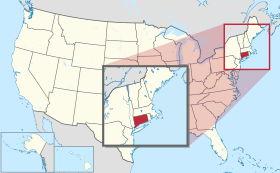
コ ネ チ カ ッ ト 州 は 、 南 は ロ ン グ ア イ ラ ン ド 湾 、 西 は ニ ュ ー ヨ ー ク 州 、 北 は マ サ チ ュ ー セ ッ ツ 州 、 東 は ロ ー ド ア イ ラ ン ド 州 と 接 し て い る 。 州 都 は ハ ー ト フ ォ ー ド 市 で あ り 、 他 の 主 要 都 市 と し て は ブ リ ッ ジ ポ ー ト 、 ニ ュ ー ヘ イ ブ ン 、 ス タ ン フ ォ ー ド 、 ウ ォ ー タ ー ベ リ ー 、 ノ ー ウ ォ ー ク 、 ダ ン ベ リ ー 、 ニ ュ ー ブ リ テ ン 、 グ リ ニ ッ ジ 、 及 び ブ リ ス ト ル が あ る 。 州 内 に 総 計 1 6 9 の 法 人 化 地 方 自 治 体 が あ る 。
ベ ア 山 、 コ ネ チ カ ッ ト 州 の 最 高 峰 州 内 の 最 高 地 点 、 フ リ ッ セ ル 山 の 南 斜 面 に あ る 。 ベ ア 山 か ら 望 む 州 内 最 高 峰 は 州 の 北 西 隅 、 ソ ー ル ズ ベ リ ー に あ る ベ ア 山 で あ る 。 コ ネ チ カ ッ ト 州 、 マ サ チ ュ ー セ ッ ツ 州 、 及 び ニ ュ ー ヨ ー ク 州 の 州 境 が 交 わ る 地 点 ︵ 北 緯 42 度 3 分 ‥ 西 経 73 度 29 分 ︶ の 直 ぐ 東 に 最 高 地 点 が あ る 。 そ こ は マ サ チ ュ ー セ ッ ツ 州 内 に 頂 上 が あ る フ リ ッ セ ル 山 の 南 斜 面 に あ る 。
コ ネ チ カ ッ ト 川 は カ ナ ダ 国 境 か ら コ ネ チ カ ッ ト 州 の ロ ン グ ア イ ラ ン ド 湾 岸 へ 流 れ て い て 、 州 の 中 央 部 を 南 北 に 貫 い て い る 。 州 内 に あ る 領 域 を 中 心 と す る 最 も 人 口 の 多 い 大 都 市 圏 は コ ネ チ カ ッ ト 川 バ レ ー に あ る 。 州 域 は 小 さ い が 、 そ の 風 景 に は 大 き な 変 化 が あ る 。 例 え ば 、 北 西 部 の リ ッ チ フ ィ ー ル ド 丘 陵 で は 、 う ね り の あ る 山 地 と 馬 牧 場 が あ り 、 南 東 部 の ニ ュ ー ロ ン ド ン 郡 で は 海 浜 と 海 洋 活 動 が 見 ら れ る 。
コ ネ チ カ ッ ト 州 は 長 い 海 洋 活 動 の 歴 史 が あ り 、 そ の 歴 史 に 基 づ く 定 評 も あ る が 、 実 際 に は 海 に 直 接 接 し て い な い 。 ニ ュ ー ヨ ー ク 州 の 海 上 州 境 が フ ィ ッ シ ャ ー 島 の 東 ま で 延 び て お り 、 そ こ で ロ ー ド ア イ ラ ン ド 州 と の 海 上 州 境 に 接 し 、 ナ ラ ガ ン セ ッ ト 湾 を 分 け て い る 。 ロ ン グ ア イ ラ ン ド 湾 や ブ ロ ッ ク ア イ ラ ン ド 湾 を 通 じ て 容 易 に 海 に 出 ら れ る が 、 直 接 大 西 洋 に は 接 し て い な い こ と に な る 。
参 照 ‥ L i s t o f C o n n e c t i c u t r i v e r s 、 L i s t o f C o n n e c t i c u t s t a t e f o r e s t s 州 内 の 北 東 部 と 北 西 隅 に あ る 田 園 地 帯 と 小 さ な 町 は 、 ニ ュ ー ヨ ー ク 州 境 か ら ニ ュ ー ロ ン ド ン に 至 る 海 岸 道 路 や 、 コ ネ チ カ ッ ト 川 を ハ ー ト フ ォ ー ド ま で 遡 る 道 沿 い に 並 ぶ 工 業 化 さ れ た 都 市 と 大 き な 対 照 を な し て い る 。 リ ッ チ フ ィ ー ル ド ・ グ リ ー ン 、 レ バ ノ ン ・ グ リ ー ン ︵ 州 内 最 大 の 緑 地 ︶ 、 ウ ェ ザ ー ズ フ ィ ー ル ド ・ グ リ ー ン ︵ 州 内 最 古 の 緑 地 ︶ な ど 緑 地 を 囲 ん で 多 く の 町 が あ る 。 こ の 緑 地 近 く に は 常 に ニ ュ ー イ ン グ ラ ン の 象 徴 と も 言 え る 白 い 教 会 、 植 民 地 時 代 の 集 会 所 、 植 民 地 風 の 酒 場 ま た は 宿 屋 、 植 民 地 時 代 の 家 屋 数 軒 な ど が あ り 、 歴 史 の 保 存 の た め に も 観 光 の た め に も そ の 景 観 が 維 持 さ れ て い る 。
州 内 に は 温 帯 性 広 葉 樹 林 や 混 交 林 が 多 い 。 オ ー ク 、 ヒ ッ コ リ ー 、 カ エ デ な ど の 北 東 部 海 岸 林 が 州 の 多 く を 覆 っ て い る [ 16 ] 。 州 の 北 東 部 、 タ コ ニ ッ ク 山 地 で は ニ ュ ー イ ン グ ラ ン ド ・ ア カ デ ィ ア 森 林 に 移 行 し て い る [ 16 ] 。
マ サ チ ュ ー セ ッ ツ 州 と の 北 部 州 境 に は 、 サ ウ ス ウ ィ ッ ク ・ ジ ョ グ あ る い は グ ラ ン ビ ー ・ ノ ッ チ と 呼 ば れ る 約 2 . 5 マ イ ル ( 4 . 0 k m ) 四 方 の 凹 み が あ る 。 こ の 変 則 点 の 起 源 は 長 い 論 争 と 一 時 的 な 合 意 の 後 に 、 最 終 的 に 1 8 0 4 年 に 決 着 し て 明 確 に さ れ た も の で あ り 、 サ ウ ス ウ ィ ッ ク の 南 部 ︵ そ の 住 人 は マ サ チ ュ ー セ ッ ツ 州 か ら は な れ よ う と し て い た ︶ が 半 分 に 分 け ら れ た [ 17 ] 。
州 南 西 部 の ニ ュ ー ヨ ー ク 州 と 接 す る と こ ろ は 、 フ ェ ア フ ィ ー ル ド 郡 の パ ン ハ ン ド ル と 呼 ば れ 、 グ リ ニ ッ ジ 、 ス タ ン フ ォ ー ド 、 ニ ュ ー カ ナ ー ン 、 ダ リ エ ン な ど の 町 が 入 り 、 ノ ー ウ ォ ー ク の 一 部 も あ る 。 こ の 変 則 性 は 17 世 紀 に あ っ た 境 界 論 争 の 結 果 で あ り 、 そ こ の 住 人 が コ ネ チ カ ッ ト に 属 す る と 考 え て い た 地 域 を ニ ュ ー ヨ ー ク 州 が 諦 め 、 そ の 代 わ り に リ ッ ジ フ ィ ー ル ド か ら 北 の マ サ チ ュ ー セ ッ ツ 州 境 ま で 伸 び る 帯 状 地 と 、 論 争 に は 入 っ て い な か っ た ラ イ の 町 を 併 せ て 、 同 等 の 領 域 を 手 に 入 れ た [ 18 ] 。
ア メ リ カ 合 衆 国 国 立 公 園 局 が 維 持 し て い る 地 域 と し て 、 ア パ ラ チ ア ン 国 立 景 観 道 、 キ ネ ボ ー グ 川 と シ ェ タ ケ ッ ト 川 流 域 国 立 遺 産 回 廊 、 ウ ェ ア 農 園 国 立 歴 史 史 跡 が あ る [ 19 ] 。
州 内 の 内 陸 は 湿 潤 大 陸 性 気 候 で あ り 、 海 岸 部 ︵ 南 部 4 郡 ︶ は 温 暖 湿 潤 気 候 の 境 目 に あ る 。 統 計 的 に は こ の 気 候 帯 に 含 め ら れ る こ と も 外 さ れ る こ と も あ る 。 季 節 に よ る 温 暖 は 大 西 洋 に 近 接 す る こ と で 和 ら げ ら れ て い る 。 ロ ン グ ア イ ラ ン ド 湾 沿 い の ブ リ ッ ジ ポ ー ト 市 は 、 3 州 地 域 の 他 の 部 分 と 同 様 に 、 ケ ッ ペ ン の 気 候 区 分 で 温 暖 湿 潤 気 候 に 入 っ て い る 。 35 マ イ ル ( 5 6 k m ) 内 陸 に あ る ハ ー ト フ ォ ー ド は 、 湿 潤 大 陸 性 気 候 に あ る 。 海 岸 地 域 に あ る と い う 評 価 に 違 わ ず 、 日 照 時 間 は そ こ そ こ あ り 、 年 間 2 , 4 0 0 時 間 か ら 2 , 8 0 0 時 間 に な っ て い る [ 20 ] 。
州 全 体 で 夏 は 暑 く 湿 潤 で あ る 。 ニ ュ ー ロ ン ド ン で 平 均 最 高 気 温 は 8 1 ° F ( 2 7 ℃ ) 、 ウ イ ン ザ ー ロ ッ ク ス で は 8 7 ° F ( 3 1 ℃ ) と な っ て い る 。 夏 に は 日 照 が 多 い が 、 突 然 の 雷 雨 で 土 砂 降 り と な る こ と も 多 い 。 冬 は 概 し て 冷 涼 か ら 寒 く 、 1 月 の 平 均 気 温 は 海 洋 の 影 響 を 受 け る 南 東 部 で 3 8 ° F ( 3 ℃ ) 、 北 西 部 で 2 9 ° F ( − 2 ℃ ) と な る 。 年 平 均 降 雪 量 は 、 標 高 の 高 い 北 部 で 50 な い し 60 イ ン チ ( 1 2 5 – 1 5 0 c m ) 、 南 東 部 海 岸 地 域 で 20 な い し 25 イ ン チ ( 5 0 – 6 3 c m ) で あ る 。 初 春 の 4 月 は 冷 涼 で あ り 、 晩 春 の 5 月 か ら 6 月 初 め は 暖 か く 、 暑 く な る こ と も あ る 。 秋 は 温 暖 で あ り 、 10 月 や 11 月 に は 州 北 部 で 紅 葉 が 見 ら れ る 。 南 部 と 海 岸 地 域 で は オ ー ク や ヒ ッ コ リ ー が 多 く カ エ デ が 少 な い 。 ハ リ ケ ー ン シ ー ズ ン に 時 と し て 熱 帯 低 気 圧 に 襲 わ れ る こ と も あ る 。 雷 雨 は 夏 に 多 く 、 年 平 均 で 30 回 は 発 生 し て い る 。 そ の 嵐 は 激 し く な る こ と も あ る 。 竜 巻 は 年 1 回 程 度 で あ る [ 21 ] 。 過 去 最 高 気 温 は 1 9 9 5 年 7 月 15 日 に ダ ン ベ リ ー で 記 録 し た 1 0 6 ° F ( 4 1 ℃ ) 、 過 去 最 低 気 温 は 1 9 4 3 年 2 月 16 日 の フ ォ ー ル ズ ビ レ ッ ジ と 、 1 9 6 1 年 1 月 22 日 に コ ベ ン ト リ ー で 記 録 さ れ た - 3 2 ° F ( - 3 6 ℃ ) で あ る [ 22 ] 。
州内各都市の月別平均最高最低気温
都市
1月
2月
3月
4月
5月
6月
7月
8月
9月
10月
11月
12月
ブリッジポート
37/23
39/25
47/32
57/41
67/51
76/60
82/66
81/65
74/58
63/46
53/38
42/28
ハートフォード
35/16
39/19
47/27
59/38
70/48
79/57
84/63
82/61
74/51
63/40
52/32
40/22
[23] [24]
都市・町名の後の数字は2020年国勢調査による人口(人)[25]
人口50,000人以上の都市
ブリッジポート 148,654スタンフォード 135,470ニューヘイブン 134,023ハートフォード 121,054ウォーターバリー 114,403ノーウォーク 91,184ダンベリー 86,518ニューブリテン 74,135メリデン 60,850ブリストル 60,833ウェストヘイブン 55,584ミルフォード 52,044
人口50,000人以上の町
主要記事:Connecticut locations by per capita income 一人当たり収入による自治体の順位:
en:New Canaan, Connecticut 82,049米ドルen:Darien, Connecticut 77,519米ドルウェストン (コネチカット州) 74,817米ドルグリニッジ (コネチカット州) 74,346米ドルウエストポート (コネチカット州) 73,664米ドル
ディープリバーセンター (コネチカット州) 72,261米ドルen:Wilton, Connecticut 65,806米ドルen:Fenwick, Connecticut 60,625米ドルen:Roxbury, Connecticut 56,769米ドルジョージタウン (コネチカット州) 55,029米ドルen:Easton, Connecticut 53,885米ドルen:Essex Village, Connecticut 51,928米ドルリッジフィールド (コネチカット州) 51,795米ドルen:Avon, Connecticut 51,706米ドルen:Groton Long Point, Connecticut 51,066米ドルen:Redding, Connecticut 50,687米ドルウッドブリッジ (コネチカット州) 49,049米ドルen:Sharon, Connecticut 45,418米ドルフェアフィールド (コネチカット州) 43,670米ドルen:Lyme, Connecticut 43,347米ドルエセックス (コネチカット州) 42,806米ドルen:Bridgewater, Connecticut 42,505米ドルen:Cornwall, Connecticut 42,484米ドルマディソンセンター (コネチカット州) 42,046米ドルen:Old Lyme, Connecticut 41,386米ドル
関連項目:Administrative divisions of Connecticut コネチカット州会議事堂 、ハートフォード市中心街1875年からハートフォード市が単一の州都となっている。それ以前はニューヘイブンも併せて2つの州都があった[26]
コ ネ チ カ ッ ト 州 は ﹁ 憲 法 の 州 ﹂ と し て 知 ら れ て い る 。 こ の 称 号 の 起 源 は 明 ら か で な い が 、 1 6 3 8 年 か ら 1 6 3 9 年 に 制 定 さ れ た ﹁ 基 本 的 秩 序 ﹂ に 拠 る か 、 1 7 8 7 年 の ア メ リ カ 合 衆 国 憲 法 制 定 会 議 に お け る ﹁ 大 妥 協 ﹂ ︵ コ ネ チ カ ッ ト 妥 協 ︶ に 拠 る も の と 考 え ら れ て い る 。 こ れ ら ﹁ 基 本 的 秩 序 ﹂ が コ ネ チ カ ッ ト 州 で 代 表 制 議 会 に よ っ て 書 か れ た 最 初 の 公 式 政 府 を 形 作 る も の と な っ た 。 政 府 は コ ネ チ カ ッ ト 憲 法 の 歴 史 の 中 で 、 4 つ の 文 書 に よ っ て 運 営 さ れ て き た 。 基 本 的 秩 序 の 後 、 コ ネ チ カ ッ ト は 1 6 6 2 年 の コ ネ チ カ ッ ト ・ チ ャ ー タ ー を 通 じ て 、 イ ン グ ラ ン ド 王 チ ャ ー ル ズ 2 世 に よ り 政 府 の 権 威 を 認 め ら れ た 。
こ の 時 期 に 政 府 の 各 府 は 存 在 せ ず 、 議 会 が 最 高 権 限 を も っ て 行 動 し た 。 現 在 の ア メ リ カ 合 衆 国 憲 法 に 類 似 す る 憲 法 が 制 定 さ れ た の は 、 1 8 1 8 年 に な っ て か ら だ っ た 。 現 行 憲 法 は 1 9 6 5 年 に 制 定 さ れ た も の で あ る 。 こ の 1 9 6 5 年 憲 法 は 1 8 1 8 年 憲 法 の 大 部 分 を 踏 襲 し た が 、 幾 ら か の 重 要 な 修 正 を 加 え た 。
﹁ 憲 法 の 州 ﹂ と い う ニ ッ ク ネ ー ム が 付 け ら れ た 最 も あ り そ う な 根 拠 は 、 1 7 8 7 年 の ア メ リ カ 合 衆 国 憲 法 制 定 会 議 に お い て 、 コ ネ チ カ ッ ト が 重 要 な 役 割 を 果 た し た と い う も の で あ る 。 こ の と き 、 州 代 表 の ロ ジ ャ ー ・ シ ャ ー マ ン と オ リ バ ー ・ エ ル ス ワ ー ス が 、 コ ネ チ カ ッ ト 妥 協 あ る い は 大 妥 協 と 呼 ば れ る よ う に な る も の を 演 出 し た か ら だ っ た 。 そ の 考 え 方 は バ ー ジ ニ ア ・ プ ラ ン や ニ ュ ー ジ ャ ー ジ ・ プ ラ ン ト 組 み 合 わ さ れ 、 両 院 制 議 会 を 作 っ た 。 こ の 形 式 は ア メ リ カ 合 衆 国 憲 法 の 採 択 以 来 、 ほ と ん ど 各 州 の 憲 法 で 踏 襲 さ れ た 。 両 院 制 議 会 に つ い て は バ ー ジ ニ ア 州 と ニ ュ ー ジ ャ ー ジ ー 州 か ら 異 な る 形 態 が 提 案 さ れ て い た が 、 コ ネ チ カ ッ ト の 提 案 は 20 世 紀 初 期 ま で 有 効 だ っ た 。 ア メ リ カ 合 衆 国 上 院 議 員 は こ の 時 ま で 州 議 会 に よ っ て 選 ば れ て い た が 、 州 有 権 者 に よ っ て 直 接 選 出 さ れ る よ う 修 正 さ れ た 。 そ の 方 式 が 現 在 も 継 続 し て 採 用 さ れ て い る 。
ネッド・ラモント
コ ネ チ カ ッ ト 州 知 事 が 行 政 府 の 首 長 で あ る 。 現 知 事 は ネ ッ ド ・ ラ モ ン ト 、 副 知 事 は ス ー ザ ン ・ ビ シ エ ヴ ィ ッ チ で あ り 、 共 に 民 主 党 員 で あ り 、 就 任 日 も 2 0 1 9 年 1 月 9 日 で あ る 。 ネ ッ ド は コ ネ チ カ ッ ト 州 州 上 院 議 員 を 務 め た 経 験 が あ り 、 2 0 1 8 年 の 州 知 事 選 挙 に 勝 利 し 、 2 0 1 9 年 1 月 9 日 に 就 任 し た 。 1 6 3 9 年 か ら 1 8 1 8 年 憲 法 の 執 行 ま で 、 州 知 事 は 議 会 を 主 宰 し て い た 。 1 9 7 4 年 、 エ ラ ・ グ ラ ッ ソ が 州 知 事 に 当 選 し 、 そ の 夫 が 州 知 事 を 経 験 し て い な い 女 性 と し て は ア メ リ カ 合 衆 国 初 の こ と に な っ た 。
行 政 府 に は 幾 つ か の 部 門 が あ る 。 管 理 部 、 農 業 、 金 融 、 子 供 と 家 庭 、 消 費 者 保 護 、 矯 正 、 経 済 と 地 域 開 発 、 開 発 サ ー ビ ス 、 建 設 、 教 育 、 緊 急 管 理 と 公 衆 保 護 、 エ ネ ル ギ ー と 環 境 保 護 、 高 等 教 育 、 保 険 、 労 働 、 精 神 医 療 と 薬 物 対 策 、 軍 事 、 自 動 車 、 大 衆 保 健 、 公 共 事 業 規 制 、 公 共 事 業 、 歳 入 、 社 会 サ ー ビ ス 、 交 通 、 退 役 兵 の 各 部 門 で あ る 。 さ ら に 独 立 し た 部 局 、 事 務 所 、 委 員 会 が あ る [ 27 ] 。
知 事 と 副 知 事 以 外 に 、 憲 法 に 指 定 さ れ る 4 人 の 役 員 は 直 接 選 挙 で 選 出 さ れ る 。 す な わ ち 州 務 長 官 、 財 務 官 、 会 計 監 査 官 、 検 察 官 で あ る 。 任 期 は 全 て 4 年 間 で あ る [ 26 ] 。
立 法 府 は コ ネ チ カ ッ ト 州 議 会 で あ り 、 定 数 36 人 の 上 院 と 同 1 5 1 人 の 下 院 の 両 院 制 で あ る [ 26 ] 。 法 と し て 成 立 さ せ る た め に は 両 院 を 通 過 し な け れ ば な ら な い 。 州 知 事 は 拒 否 権 を 行 使 で き る が 、 両 院 の 3 分 の 2 以 上 の 賛 成 が あ れ ば 、 こ の 拒 否 が 取 り 消 さ れ る 。 州 憲 法 に よ り 両 院 の 議 員 は 18 歳 以 上 で あ る 必 要 が あ り 、 偶 数 年 11 月 に あ る 選 挙 で 、 2 年 間 任 期 で 選 出 さ れ る 。 議 員 定 数 に つ い て も 、 上 院 は 30 人 か ら 50 人 、 下 院 は 1 2 5 人 か ら 2 2 5 人 の 間 と 決 め ら れ て い る 。 副 知 事 が 上 院 議 長 と な り 、 不 在 の 場 合 は 議 長 代 行 が 主 宰 す る 。 下 院 議 長 が 下 院 を 主 宰 す る [ 28 ] 。
地 方 政 府 の 議 会 は 市 や 町 に 係 わ る 地 方 条 例 を 定 め て い る [ 29 ] 。 町 の 条 例 に は 、 騒 音 規 制 や 地 区 割 り の ガ イ ド ラ イ ン が ふ く ま れ る こ と が 多 い [ 30 ] 。 し か し 、 コ ネ チ カ ッ ト 州 も 州 全 体 に 係 わ る 騒 音 規 制 条 例 を 作 っ て い る 。
コ ネ チ カ ッ ト 州 の 司 法 府 で 最 高 位 に あ る の が コ ネ チ カ ッ ト 州 最 高 裁 判 所 で あ り 、 首 席 判 事 が 長 で あ る 。 法 の 合 憲 性 、 あ る い は 法 の 解 釈 に 係 わ る 事 例 を 扱 う 。 そ の 手 続 き は ア メ リ カ 合 衆 国 最 高 裁 判 所 の も の に 類 似 し 、 証 人 に よ る 宣 誓 証 言 は 無 く 、 両 側 の 弁 護 士 は 30 分 以 内 で 論 告 を 行 う 必 要 が あ る 。 法 定 手 続 き の 後 、 判 決 ま で に 数 か 月 を 要 す る こ と が あ る 。
1 8 1 8 年 、 裁 判 所 は 立 法 府 や 行 政 府 と は 独 立 し た 主 体 と な っ た [ 31 ] 。 控 訴 裁 判 所 は 州 全 体 に 係 わ る 下 級 審 で あ り 、 上 級 裁 判 所 は 他 州 の 郡 裁 判 所 に 似 た 下 級 審 で あ る 。
政 策 管 理 局 を 通 じ て 逮 捕 令 状 の 統 計 に ア ク セ ス で き る よ う に な っ て い る [ 32 ] 。
参照:コネチカット州の郡一覧
ア メ リ カ 合 衆 国 50 州 の 中 で コ ネ チ カ ッ ト 州 と ロ ー ド ア イ ラ ン ド 州 の み が 郡 政 府 を 廃 止 し て い る 。 コ ネ チ カ ッ ト 州 の 場 合 は 各 郡 で 選 出 さ れ る 保 安 官 を 除 い て 、 1 9 6 0 年 に 郡 政 府 を 廃 止 し た [ 33 ] 。 2 0 0 0 年 、 郡 保 安 官 が 廃 止 さ れ 、 州 保 安 官 の 体 系 に 置 き 換 え ら れ た が 、 そ の 管 轄 範 囲 は 旧 郡 の 領 域 を 踏 襲 し て い る 。 裁 判 所 の 場 合 も 地 方 裁 判 所 は 旧 郡 の 領 域 に ほ ぼ 添 っ た 形 で 区 分 さ れ て い る [ 34 ] 。 天 気 予 報 や 国 勢 調 査 な ど 統 計 的 な 目 的 で は 旧 8 郡 の 区 分 け が 使 わ れ て い る 。
コ ネ チ カ ッ ト 州 で は ニ ュ ー イ ン グ ラ ン ド ・ タ ウ ン と 呼 ば れ る 地 方 政 府 形 態 を 採 用 し て い る 。 州 は 基 本 的 な 政 治 区 分 と な る 1 6 9 の 町 に 分 割 さ れ て い る [ 26 ] 。 市 も 21 あ り 、 そ の 多 く は 同 名 の 町 と 一 体 で あ り 、 市 ・ 町 政 府 に 統 合 さ れ て い る 。 例 外 が 2 つ あ る 。 グ ロ ト ン 市 は グ ロ ト ン 町 の 1 地 区 で あ り 、 ウ ィ ン ス テ ッ ド 市 は ウ ィ ン チ ェ ス タ ー 町 に 入 っ て い る 。 法 人 化 さ れ た ボ ロ も 9 つ あ り 、 町 の 部 分 に 対 し て 付 加 サ ー ビ ス を 行 う [ 26 ] [ 35 ] 。 唯 一 ノ ー ガ タ ッ ク が 町 と ボ ロ の 統 合 体 で あ る 。
州 は 企 画 管 理 局 が 定 義 し た 15 の 計 画 地 域 に 分 け ら れ て も い る [ 36 ] 。 た だ し ト ラ ン ド 郡 の ス タ ッ フ ォ ー ド の み 例 外 で あ る 。 こ の 局 の 政 府 内 制 作 部 が 、 そ れ ら 地 域 の 管 理 主 体 と 共 に 地 域 計 画 を 調 整 し て い る 。 各 地 域 は 地 域 統 治 委 員 会 な ど と 呼 ば れ る 管 理 主 体 を 持 っ て い る 。 こ の 地 域 は 、 ﹁ 地 域 と 州 の 企 画 活 動 の 協 調 、 州 内 の 地 方 計 画 地 域 の 再 設 定 と 地 域 計 画 組 織 の 継 続 、 地 域 計 画 組 織 に 対 す る 技 術 支 援 と 財 政 支 援 管 理 ﹂ の た め に 設 立 さ れ た [ 36 ] 。
登録有権者比率の推移、1958年-2012年 コネチカット州民は有権者登録する際に、支持政党の宣言か支持政党無しの宣言を選択でき、また一定期間をおけば支持政党を変更できる。2013年時点で約58%が支持政党を登録しており、無党派と2大政党の支持率比を見ると、民主党支持7に対して無党派8、共和党支持4に対して無党派8となる。
少数政党の中ではリバタリアン党 と独立党が2012年の大統領選挙にも出馬し、それぞれ0.81%と0.35%の支持を得た。
州内の多くの町はいずれの党でも中道を好む傾向がある。
登録有権者数、2012年10月30日[37]
政党
活動有権者
非活動有権者
有権者総数
比率
共和党
430,564
19,084
449,648
20.27%
民主党
768,176
47,537
815,713
36.77%
支持政党無し
872,839
60,440
933,279
42.06%
少数党
18,960
1,063
20,023
0.90%
合計
2,090,539
128,123
2,218,662
100%
大統領選挙の結果[38]
年
共和党
民主党
Percent
Absolute
Percent
Absolute
2012年
40.73%
634,892
58.06%
905,083
2008年
38.22%
629,428
60.59%
997,773
2004年
43.95%
693,826
54.31%
857,488
2000年
38.44%
561,094
55.91%
816,015
1996年
34.69%
483,109
52.83%
735,740
1992年
35.78%
578,313
42.21%
682,318
1988年
51.98%
750,241
46.87%
676,584
1984年
60.73%
890,877
38.83%
569,597
1980年
48.16%
677,210
38.52%
541,732
1976年
52.06%
719,261
46.90%
647,895
1972年
58.57%
810,763
40.13%
555,498
1968年
44.32%
556,721
49.48%
621,561
1964年
32.09%
390,996
67.81%
826,269
1960年
46.27%
565,813
53.73%
657,055
フ ェ ア フ ィ ー ル ド 郡 の ニ ュ ー ケ イ ナ ン や ダ リ ア ン な ど 郊 外 町 は 州 内 で も 共 和 党 の 支 持 が 強 い 所 と 見 な さ れ て い る 。 東 に 数 マ イ ル 離 れ た 裕 福 な 町 ウ ェ ス ト ポ ー ト は 、 民 主 党 に 忠 実 な 町 の 1 つ と 見 な さ れ る こ と が 多 く 、 フ ェ ア フ ィ ー ル ド 郡 の リ ベ ラ ル な 町 で あ る 。 昔 か ら 共 和 党 寄 り だ っ た 裕 福 な 町 ウ ィ ル ト ン が 、 2 0 0 8 年 の 大 統 領 選 挙 で は バ ラ ク ・ オ バ マ に 多 数 票 を 投 じ た 。 フ ェ ア フ ィ ー ル ド 郡 の 中 で は 大 き な 富 め る 町 で あ る ノ ー ウ ォ ー ク と ス タ ン フ ォ ー ド は 、 ジ ョ ン ・ G ・ ロ ー ラ ン ド 元 知 事 や 、 元 ア メ リ カ 合 衆 国 下 院 議 員 ク リ ス ・ シ ェ イ ズ な ど 中 道 派 共 和 党 員 を 選 ん で き た が 、 大 統 領 選 挙 の 年 に は 民 主 党 を 選 ぶ 傾 向 が あ り 、 2 0 0 8 年 に は シ ェ イ ズ が 民 主 党 の ジ ム ・ ハ イ ム ズ に 敗 れ た 。
州 内 の 共 和 党 寄 り の 地 域 は 田 園 部 で あ り リ ッ チ フ ィ ー ル ド 郡 や ハ ー ト フ ォ ー ド 郡 の 西 に 隣 接 す る 町 、 ノ ー ガ タ ッ ク 川 バ レ ー の 工 業 町 、 ニ ュ ー ヨ ー ク 州 境 に 近 い フ ェ ア フ ィ ー ル ド 郡 の 裕 福 な 町 の 幾 つ か で あ る 。
リ ー バ ー マ ン の 前 任 者 ロ ー ウ ェ ル ・ P ・ ワ イ カ ー ・ ジ ュ ニ ア が ア メ リ カ 合 衆 国 上 院 議 員 を 務 め た 最 後 の 共 和 党 員 に な っ て い る 。 ワ イ カ ー は リ ベ ラ ル な 共 和 党 員 と し て 知 ら れ た 。 ウ ォ ー タ ゲ ー ト 事 件 の 時 に リ チ ャ ー ド ・ ニ ク ソ ン 大 統 領 と 袂 を 分 か ち 、 1 9 9 0 年 に は 独 立 系 の コ ネ チ カ ッ ト 党 を 創 設 し て 州 知 事 選 に 出 馬 し 当 選 し た 。 ワ イ カ ー 以 前 の 共 和 党 上 院 議 員 は 1 9 5 3 年 か ら 1 9 6 3 年 の プ レ ス コ ッ ト ・ ブ ッ シ ュ で あ り 、 元 大 統 領 ジ ョ ー ジ ・ H ・ W ・ ブ ッ シ ュ の 父 、 ジ ョ ー ジ ・ W ・ ブ ッ シ ュ の 祖 父 で あ る 。
ウ ォ ー タ ー ベ リ ー は 登 録 有 権 者 数 で 民 主 党 が 優 勢 だ が 、 通 常 は 二 大 政 党 の 保 守 派 候 補 者 を 選 ん で い る 。 ダ ン ベ リ ー で は 、 無 党 派 層 が 二 大 政 党 の 登 録 有 権 者 数 を 上 回 っ て い る 。 メ リ デ ン 、 ニ ュ ー ブ リ テ ン 、 ノ ー ウ ィ ッ チ 、 ミ ド ル タ ウ ン な ど 小 さ な 都 市 は 民 主 党 を 好 む 。
2 0 2 4 年 時 点 で 、 民 主 党 が 州 選 出 連 邦 下 院 議 員 5 人 を 独 占 し て い る 。 最 後 の 共 和 党 の 連 邦 下 院 議 員 ク リ ス ・ シ ェ イ ズ は 、 2 0 0 8 年 の 選 挙 で 敗 北 し た 。 州 選 出 の 連 邦 上 院 議 員 は 、 2 0 2 4 年 時 点 で リ チ ャ ー ド ・ ブ ル メ ン ソ ー ル ︵ 民 主 党 ︶ と ク リ ス ・ マ ー フ ィ ー ︵ 民 主 党 ︶ で あ る 。
2 0 1 2 年 4 月 に 両 院 で 永 劫 に 死 刑 制 度 を 廃 止 す る 法 案 が 成 立 し た 。 当 時 死 刑 執 行 を 待 っ て い た 死 刑 囚 11 人 に 対 し て は 、 現 在 も 執 行 が 可 能 で あ る [ 39 ] 。
2 0 0 9 年 7 月 、 国 内 で も 初 の 公 的 医 療 保 険 改 革 法 案 ﹁ サ ス テ ィ ネ ッ ト ﹂ が 成 立 し 、 こ れ に ジ ョ デ ィ ・ レ ル 州 知 事 が 拒 否 権 を 使 っ た が 、 議 会 が 拒 否 を 差 し 戻 し た 。
2 0 0 8 年 11 月 12 日 、 同 性 婚 を 認 め た 2 番 目 の 州 に な っ た ︵ 第 1 番 目 は マ サ チ ュ ー セ ッ ツ 州 ︶ 。
ア メ リ カ 合 衆 国 商 務 省 経 済 分 析 局 は コ ネ チ カ ッ ト 州 の 2 0 1 0 年 総 生 産 が 2 , 3 7 0 億 米 ド ル だ っ た と 推 計 し て い る [ 40 ] 。 2 0 0 7 年 の 一 人 当 た り 年 収 は 6 4 , 8 3 3 米 ド ル で あ り 、 国 内 第 4 位 だ っ た ︵ 上 位 は ワ シ ン ト ン D . C . 、 デ ラ ウ ェ ア 州 、 ア ラ ス カ 州 ︶ 。 し か し 州 全 体 で は 所 得 格 差 が 大 き い 。 ニ ュ ー ケ イ ナ ン は 国 内 で も 所 得 が 高 い 町 だ が 、 ハ ー ト フ ォ ー ド は 低 い 方 の 10 傑 に 入 る 都 市 で あ る 。 ブ リ ッ ジ ポ ー ト 、 ニ ュ ー ヘ イ ブ ン な ど と 同 様 、 ハ ー ト フ ォ ー ド は 裕 福 な 郊 外 に 囲 ま れ て い る 。 2 0 1 1 年 8 月 時 点 で 州 内 の 失 業 率 は 9 . 0 % だ っ た [ 41 ] 。
ニ ュ ー ケ イ ナ ン の 一 人 当 た り 年 収 は 8 5 , 4 5 9 米 ド ル と 州 内 最 高 で あ り 、 ダ リ ア ン 、 グ リ ニ ッ ジ 、 ウ ェ ス ト ン 、 ウ ェ ス ト ポ ー ト 、 ウ ィ ル ト ン も 6 5 , 0 0 0 米 ド ル 以 上 と な っ て い る 。 ハ ー ト フ ォ ー ド の 一 人 当 た り 年 収 は 2 0 0 0 年 で 1 3 , 4 2 8 米 ド ル と 州 内 最 低 だ っ た [ 42 ] 。 州 東 部 に は 収 入 の 低 い ブ ル ー カ ラ ー の 町 が あ る 。
コネチカット州に本拠地のある企業には以下のものがある。
上場企業 非上場企業
コ ネ チ カ ッ ト 州 は 1 9 9 1 年 ま で 投 資 の み に 所 得 税 が 掛 か っ た 。 被 雇 用 者 の 収 入 は 非 課 税 だ が 、 投 資 か ら の 収 入 に は 1 3 % が 課 さ れ 、 国 内 最 高 だ っ た 。 借 入 金 に 対 す る 支 払 利 子 な ど 投 資 の コ ス ト は 控 除 さ れ な か っ た 。
1 9 9 1 年 、 独 立 党 の 州 知 事 ロ ー ウ ェ ル ・ P ・ ワ イ カ ー ・ ジ ュ ニ ア が こ の 税 制 を 変 更 し 、 被 雇 用 者 の 収 入 も 投 資 の 収 入 も 一 律 最 大 4 % と し た 。 こ の と き か ら グ リ ニ ッ ジ は ア メ リ カ 最 大 の 多 く の ヘ ッ ジ フ ァ ン ド の 拠 点 に な っ た 。 2 0 1 1 年 時 点 で 所 得 税 は 3 % か ら 6 . 7 % ま で の 6 段 階 累 進 課 税 と な っ て い る [ 43 ] 。 州 民 が 得 た 賃 金 は 、 そ れ が 州 外 か ら 稼 い だ も の で も 所 得 税 の 対 象 に な る 。 し か し 、 他 州 で 課 さ れ る 税 額 を コ ネ チ カ ッ ト 州 の 税 額 が 超 え る と き の み 課 税 さ れ る 。 ニ ュ ー ヨ ー ク 州 や マ サ チ ュ ー セ ッ ツ 州 は コ ネ チ カ ッ ト 州 よ り 税 率 が 高 い の で 、 他 州 で 働 く 州 民 は コ ネ チ カ ッ ト 州 の 所 得 税 を 払 わ な く て 済 む こ と に な る 。 コ ネ チ カ ッ ト 州 は 他 州 に 支 払 っ た 税 の 控 除 を 認 め て い る が 、 他 州 で 支 払 っ た 税 額 が コ ネ チ カ ッ ト 州 の 税 額 を 超 え な い 場 合 は コ ネ チ カ ッ ト 州 の 所 得 税 を 支 払 わ な け れ ば な ら な い 。
消 費 税 は 6 . 3 5 % で あ り 、 大 半 の 商 品 の 販 売 、 リ ー ス 、 レ ン タ ル に 課 さ れ る [ 43 ] 。 特 定 商 品 と サ ー ビ ス は 、 法 に よ っ て 課 税 対 象 と さ れ て い な い 限 り 免 税 で あ る 。 50 米 ド ル 未 満 の 衣 類 は 免 税 だ っ た が 2 0 1 1 年 7 月 に 撤 廃 さ れ た [ 43 ] 。 地 方 政 府 が 消 費 税 を 付 加 す る こ と は な い 。 夏 季 に 、 学 校 へ 戻 る 子 供 達 を 支 援 す る た め に 、 特 定 ア イ テ ム と 量 の 衣 料 は 1 週 間 の み 非 課 税 で あ る 。
州 内 に あ る 全 て の 不 動 産 個 人 資 産 は 、 法 に よ っ て 免 税 と さ れ な い 限 り 資 産 税 の 対 象 で あ る 。 評 価 額 は 公 平 市 場 価 値 の 7 0 % で あ る 。 た だ し 、 地 方 政 府 か ら さ ら に 2 0 % が 加 算 さ れ る こ と も あ る 。 最 大 控 除 額 は 5 0 0 米 ド ル で あ り 、 過 剰 額 が 返 還 さ れ た り 先 送 り さ れ た り す る こ と は な い [ 44 ] 。 税 務 基 金 に 拠 れ ば 、 2 0 1 0 年 国 勢 調 査 で 、 コ ネ チ カ ッ ト 州 民 は ニ ュ ー ジ ャ ー ジ ー 州 に 次 い で 2 番 目 に 高 い 資 産 税 を 支 払 っ て い る [ 45 ] 。
コ ネ チ カ ッ ト 州 の 住 宅 は 高 低 の 差 が 広 い が 、 中 央 値 は 約 2 2 6 , 0 0 0 米 ド ル で あ る 。 例 え ば フ ェ ア フ ィ ー ル ド 郡 の 住 宅 価 格 中 央 値 は 約 37 万 米 ド ル で あ る [ 46 ] [ 47 ] 。 北 東 部 で は 最 も 数 百 万 ド ル の 住 宅 が 多 く 、 国 内 で は カ リ フ ォ ル ニ ア 州 に 次 い で 多 い 。 2 0 0 3 年 で 1 0 0 万 ド ル を 超 え る 住 宅 は 3 . 3 % だ っ た [ 48 ] 。
州 内 の 農 水 産 物 と し て は 、 苗 、 卵 、 ハ マ グ リ と ロ ブ ス タ ー ︵ 甲 殻 類 ︶ 、 酪 製 品 、 牛 、 タ バ コ が あ る 。 工 業 製 品 と し て は 輸 送 機 器 、 特 に ヘ リ コ プ タ ー 、 航 空 機 部 品 、 原 子 力 潜 水 艦 、 重 工 業 機 械 と 電 気 機 器 、 兵 器 、 加 工 金 属 製 品 、 化 学 品 と 薬 品 、 計 測 機 器 が あ る 。 昔 か ら 銃 製 造 の 中 心 地 で あ り 、 2 0 1 2 年 12 月 時 点 で 銃 メ ー カ ー 4 社 、 す な わ ち コ ル ト 、 ス タ ッ グ 、 ル ガ ー 、 モ ス バ ー グ が あ り 、 2 , 0 0 0 人 を 雇 用 し 、 操 業 を 続 け て い る [ 49 ] 。 レ ミ ン ト ン が 所 有 し て い た マ ー リ ン は 2 0 1 1 年 4 月 に 閉 鎖 さ れ た [ 50 ] 。
州 内 で 航 空 産 業 が 盛 ん な の で 、 州 の 公 式 航 空 機 は F 4 U コ ル セ ア 、 公 式 飛 行 機 パ イ オ ニ ア は イ ー ゴ リ ・ シ コ ー ル ス キ イ に な っ て い る 。 1 9 0 1 年 に ブ リ ッ ジ ポ ー ト 市 で 動 力 飛 行 を お こ な っ た グ ス タ ー ヴ ・ ホ ワ イ ト ヘ ッ ド は ﹁ コ ネ チ カ ッ ト 航 空 術 の 父 ﹂ と 認 定 さ れ て い る [ 51 ] [ 52 ] [ 53 ] [ 54 ] 。 1 9 6 4 年 8 月 15 日 ︵ ホ ワ イ ト ヘ ッ ド の 墓 に 記 念 の 墓 石 を 置 い た と き ︶ 、 ま た 1 9 6 8 年 8 月 14 日 ︵ ホ ワ イ ト ヘ ッ ド の 最 初 の 動 力 飛 行 の 日 を 認 定 す る た め に ︶ 、 ジ ョ ン ・ デ ン プ シ ー 州 知 事 が ﹁ グ ス タ ブ ・ ホ ワ イ ト ヘ ッ ド の 日 ﹂ を 宣 言 し た [ 55 ] [ 56 ] 。
コ ネ チ カ ッ ト 州 の 海 岸 町 で は 牡 蠣 が 重 要 な 収 入 源 だ っ た 。 19 世 紀 、 ニ ュ ー ヘ イ ブ ン 、 ブ リ ッ ジ ポ ー ト 、 ノ ー ウ ォ ー ク で 牡 蠣 漁 が 最 盛 期 と な り 、 近 く の 町 で も そ こ そ こ の 成 功 を 収 め た 。 1 9 1 1 年 、 牡 蠣 の 生 産 量 が ピ ー ク と な り 、 牡 蠣 の 肉 だ け で 年 間 2 , 5 0 0 万 ポ ン ド ( 1 1 , 0 0 0 ト ン ) 近 く に な っ た 。 当 時 は ニ ュ ー ヨ ー ク 州 、 ロ ー ド ア イ ラ ン ド 州 、 マ サ チ ュ ー セ ッ ツ 州 の 生 産 高 よ り も 多 か っ た [ 57 ] 。 こ の こ ろ 、 コ ネ チ カ ッ ト 州 の 海 岸 は ﹁ 世 界 の 牡 蠣 の 首 都 ﹂ と 呼 ば れ た 。 1 9 6 9 年 ま で 、 第 一 次 世 界 大 戦 前 に 成 立 し た コ ネ チ カ ッ ト 州 法 で 、 州 が 所 有 す る 岩 礁 で の 牡 蠣 収 穫 量 を 制 限 し て い た 。 こ の 法 に よ っ て ス ル ー プ 船 の 建 造 が 促 進 さ れ た [ 58 ] 。 1 9 4 8 年 に グ リ ニ ッ ジ で 建 造 さ れ た ス ル ー プ 船 ホ ー プ は 、 コ ネ チ カ ッ ト 州 で 建 造 さ れ た 最 後 の 牡 蠣 用 ス ル ー プ 船 と 見 ら れ て い る 。
2 0 0 6 年 12 月 7 日 に コ ネ チ カ ッ ト 州 文 化 観 光 委 員 会 が 発 行 し た 報 告 書 で は 、 芸 術 、 映 画 、 歴 史 観 光 で 生 み だ さ れ た 経 済 効 果 は 1 4 0 億 米 ド ル 以 上 と な り 、 年 間 17 万 人 の 職 を 維 持 し て い た 。 こ の こ と で 個 人 所 得 に 90 億 米 ド ル 、 州 や 地 方 政 府 の 歳 入 に 17 億 米 ド ル が 入 っ た [ 59 ] 。
人口推移
年
人口
%±
1790 237,946 —
1800 251,002 5.5% 1810 261,942 4.4% 1820 275,248 5.1% 1830 297,675 8.1% 1840 309,978 4.1% 1850 370,792 19.6% 1860 460,147 24.1% 1870 537,454 16.8% 1880 622,700 15.9% 1890 746,258 19.8% 1900 908,420 21.7% 1910 1,114,756 22.7% 1920 1,380,631 23.9% 1930 1,606,903 16.4% 1940 1,709,242 6.4% 1950 2,007,280 17.4% 1960 2,535,234 26.3% 1970 3,031,709 19.6% 1980 3,107,576 2.5% 1990 3,287,116 5.8% 2000 3,405,565 3.6% 2010 3,574,097 4.9% 2020 3,605,944 0.9% Sources: [60] [61] [62]
コネチカット州の人口密度図
2 0 1 2 年 7 月 1 日 時 点 の 推 計 に よ る コ ネ チ カ ッ ト 州 の 人 口 は 3 , 6 0 5 , 9 4 4 人 と な っ て い た 。 2 0 1 0 年 国 勢 調 査 で の 3 , 5 7 4 , 0 9 7 人 か ら は 3 1 , 8 4 7 人 、 0 . 8 9 % 増 加 し て い た [ 25 ] 。
コ ネ チ カ ッ ト 州 の 人 口 重 心 は チ ェ シ ャ ー 町 と な っ て い る [ 63 ] 。
年 齢 構 成 を 見 る と 、 5 歳 未 満 が 人 口 の 6 . 6 % 、 18 歳 未 満 が 同 2 4 . 7 % 、 65 歳 以 上 が 1 3 . 8 % だ っ た 。 性 別 比 で は 女 性 が 5 1 . 6 % 、 男 性 が 4 8 . 4 % だ っ た 。
1 7 9 0 年 、 州 人 口 の 9 7 % は ﹁ 田 舎 者 ﹂ に 分 類 さ れ て い た 。 こ れ が 半 分 以 下 に な っ た の は 1 8 9 0 年 の 国 勢 調 査 か ら だ っ た 。 2 0 0 0 年 国 勢 調 査 で は 僅 か 1 2 . 3 % に な っ た 。 州 西 部 と 南 部 の 大 半 ︵ コ ネ チ カ ッ ト の ゴ ー ル ド コ ー ス ト ︶ は ニ ュ ー ヨ ー ク 市 と の 結 び つ き が 強 い 。 こ の 地 域 は 州 内 で も 豊 か で 人 口 の 多 い 地 域 で あ る 。 州 東 部 は 文 化 的 に ボ ス ト ン 市 や プ ロ ビ デ ン ス 市 な ど ニ ュ ー イ ン グ ラ ン ド と の 結 び つ き が 強 い 。
2 0 1 0 年 国 勢 調 査 に 拠 れ ば 、 コ ネ チ カ ッ ト 州 の 人 種 に よ る 人 口 構 成 は 次 の よ う に な っ て い る [ 64 ] 。
● 7 7 . 6 % 白 人 ︵ ヒ ス パ ニ ッ ク 以 外 の 白 人 は 7 1 . 2 % ︶ ● 1 0 . 1 % 黒 人 ● 3 . 8 % ア ジ ア 人 ● 0 . 3 % イ ン デ ィ ア ン ● 0 . 0 % 太 平 洋 諸 島 系 ● 5 . 6 % そ の 他 の 人 種 ● 2 . 6 % 混 血 ● 1 3 . 4 % ヒ ス パ ニ ッ ク ︵ 人 種 に よ ら な い ︶ 非 ヒ ス パ ニ ッ ク 白 人 は 1 9 4 0 年 の 9 8 % か ら 2 0 1 0 年 の 7 1 % ま で 比 率 が 落 ち て き た [ 65 ] 。
2 0 0 4 年 時 点 で 、 人 口 の 1 1 . 4 % ︵ 4 0 0 , 0 0 0 人 ︶ は 外 国 生 ま れ で あ り 、 外 国 生 ま れ の 1 0 % は 不 法 在 留 外 国 人 ︵ 人 口 の 約 1 . 1 % ︶ で あ る 。 1 8 7 0 年 に は 国 内 で 生 ま れ た ア メ リ カ 人 が 7 5 % い た が 、 1 9 1 8 年 に は 3 5 % ま で 落 ち て い た 。
2 0 0 0 年 時 点 で 、 5 歳 以 上 の コ ネ チ カ ッ ト 州 民 の 8 1 . 6 9 % は 家 庭 で 英 語 を 話 し 、 8 . 4 2 % は ス ペ イ ン 語 、 イ タ リ ア 語 は 1 . 5 9 % 、 フ ラ ン ス 語 1 . 3 1 % 、 ポ ー ラ ン ド 語 1 . 2 0 % と な っ て い た [ 66 ] 。
2 0 0 0 年 時 点 で 、 コ ネ チ カ ッ ト 州 で 申 告 さ れ た 祖 先 に よ る 構 成 比 は 、 以 下 の 通 り だ っ た [ 67 ] 。
● 1 9 . 3 % イ タ リ ア 系 ● 1 7 . 9 % ア イ ル ラ ン ド 系 ● 1 0 . 7 % イ ギ リ ス 系 ● 1 0 . 4 % ド イ ツ 系 ● 8 . 6 % ポ ー ラ ン ド 系 ● 6 . 6 % フ ラ ン ス 系 ● 3 . 0 % フ ラ ン ス 系 カ ナ ダ 人 ● 2 . 7 % ア メ リ カ 人 ● 2 . 1 % ロ シ ア 系 ● 2 . 1 % 西 イ ン ド 諸 島 系 ● 2 . 0 % ス コ ッ ト ラ ン ド 系 ● 2 . 0 % ス ウ ェ ー デ ン 系 ● 1 . 6 % ポ ル ト ガ ル 系 ● 1 . 4 % ス コ ッ ト ラ ン ド ・ ア イ ル ラ ン ド 系 ● 1 . 2 % ハ ン ガ リ ー 系 ● 1 . 0 % リ ト ア ニ ア 系 州 内 に は イ タ リ ア 系 、 ア イ ル ラ ン ド 系 、 イ ギ リ ス 系 さ ら に ド イ ツ 系 が 多 く 、 ポ ル ト ガ ル 系 の 場 合 は ロ ー ド ア イ ラ ン ド 州 に 次 い で 高 い 比 率 に な っ て い る 。 イ タ リ ア 系 は 州 内 5 つ の 郡 で 最 大 比 率 で あ り 、 ア イ ル ラ ン ド 系 は ト ラ ン ド 郡 で 最 大 、 フ ラ ン ス 系 カ ナ ダ 人 は ウ ィ ン ダ ム 郡 で 最 大 と な っ て い る 。 ア フ リ カ 系 と ヒ ス パ ニ ッ ク 系 ︵ 特 に プ エ ル ト リ コ 系 ︶ は 都 市 部 で 多 い 。 ハ ン ガ リ ー 系 が 多 い こ と で も 知 ら れ 、 そ の 過 半 数 は フ ェ ア フ ィ ー ル ド 、 ス タ ン フ ォ ー ド 、 ノ ー ガ タ ッ ク 、 ブ リ ッ ジ ポ ー ト と そ の 周 辺 に 多 い 。 ポ ー ラ ン ド 系 が か な り お り 、 ニ ュ ー ブ リ テ ン に は 州 内 で 最 大 の 数 が い る 。
近 年 の 移 民 で は 、 イ ン ド 、 フ ィ リ ピ ン 、 ラ オ ス 、 ベ ト ナ ム 、 タ イ 、 イ ン ド ネ シ ア 、 メ キ シ コ 、 ブ ラ ジ ル 、 グ ア テ マ ラ 、 パ ナ マ 、 ジ ャ マ イ カ 、 ハ イ チ 、 カ ー ボ ベ ル デ か ら が 多 く 、 ま た 旧 ソ ビ エ ト 連 邦 か ら も 目 に 付 く 。
2 0 1 1 年 時 点 で 、 1 歳 未 満 の 州 民 の 4 6 . 1 % は 少 数 民 族 の 子 供 だ っ た [ 68 ] 。
人種や民族で多数となるものの分布図、2010年
2 0 0 1 年 時 点 で 、 コ ネ チ カ ッ ト 州 民 の 宗 教 宗 派 別 構 成 比 は 次 の よ う に な っ て い る [ 69 ] 。
● キ リ ス ト 教 – 7 9 %
● プ ロ テ ス タ ン ト – 4 7 %
● バ プ テ ス ト – 1 0 % ● 米 国 聖 公 会 – 6 % ● メ ソ ジ ス ト – 4 % ● ル ー テ ル 教 会 – 4 % ● 会 衆 派 / キ リ ス ト 合 同 教 会 – 2 % ● 他 の プ ロ テ ス タ ン ト ま た は 一 般 的 な プ ロ テ ス タ ン ト – 2 1 % ● ロ ー マ ・ カ ト リ ッ ク – 3 2 % ● 他 の キ リ ス ト 教 – 1 % ● ユ ダ ヤ 教 – 3 % ● 他 の 宗 教 – 4 % ● 無 宗 教 – 1 2 % 州 内 は か な り の ユ ダ ヤ 教 人 口 が お り 、 2 0 0 0 年 に は 1 0 8 , 2 8 0 人 、 3 . 2 % だ っ た [ 70 ] 。 ロ ン グ ア イ ラ ン ド 湾 に 近 い グ リ ニ ッ ジ と ニ ュ ー ヘ イ ブ ン の 間 、 ニ ュ ー ヘ イ ブ ン 大 都 市 圏 、 ハ ー ト フ ォ ー ド 大 都 市 圏 特 に ウ ェ ス ト ハ ー ト フ ォ ー ド の 郊 外 に 多 く が 集 中 し て い る 。 宗 教 デ ー タ ア ー カ イ ブ 協 会 に 拠 れ ば 、 2 0 0 0 年 時 点 で 最 大 の 宗 派 は 、 1 , 3 7 2 , 5 6 2 人 の カ ト リ ッ ク 教 会 で あ り 、 続 い て 1 2 4 , 7 7 0 人 の ユ ナ イ テ ッ ド ・ チ ャ ー チ ・ オ ブ ・ ク ラ イ ス ト 、 7 3 , 5 5 0 人 の 米 国 聖 公 会 と な っ て い た [ 70 ] 。
最 近 の 移 民 は こ の 州 に キ リ ス ト 教 以 外 の 宗 教 を 持 ち 込 ん で い る が 、 他 の 宗 教 の 信 仰 者 数 は ま だ 少 な い 。
州 内 に は ハ ー ト フ ォ ー ド 郡 ブ ル ー ム フ ィ ー ル ド の 第 一 カ セ ド ラ ル の よ う に 、 ニ ュ ー イ ン グ ラ ン ド で は 最 大 の プ ロ テ ス タ ン ト 教 会 が あ る 。
ハ ー ト フ ォ ー ド は ロ ー マ ・ カ ト リ ッ ク 教 会 ハ ー ト フ ォ ー ド 大 教 区 の 本 部 で あ り 、 ブ リ ッ ジ ポ ー ト 教 区 と ノ ー ウ ィ ッ チ 教 区 を 管 轄 し て い る 。
同州近辺のかつてのインディアン部族の勢力図 コネチカット州のインディアン保留地(クリックで拡大表示) ニューロンドン郡(赤い部分)のレッドヤードに「マシャンチケット・ペコー族」の保留地、ウンカスヴィルに「モヘガン族」の保留地がある
か つ て マ ヒ カ ン 族 、 モ ヘ ガ ン 族 、 西 ニ ア ン チ ッ ク 族 、 ニ プ マ ク 族 、 ピ ク ォ ー ト 族 、 ワ ッ ピ ン ガ ー 族 の 6 つ の イ ン デ ィ ア ン 部 族 が 先 住 し た が 、 そ の ほ と ん ど が ア メ リ カ 政 府 に 虐 殺 さ れ 、 19 世 紀 に 他 州 へ と 強 制 移 住 さ せ ら れ た 。 残 る 部 族 も 1 9 5 0 年 代 か ら ﹁ 絶 滅 し た ﹂ と し て ア メ リ カ 連 邦 政 府 か ら イ ン デ ィ ア ン 部 族 と し て の 公 式 認 定 を 打 ち 切 ら れ て ﹁ 保 留 地 ︵ R e s e r v a t i o n ︶ ﹂ を 没 収 さ れ 、 連 邦 条 約 で 確 約 さ れ た 福 利 厚 生 な ど の サ ー ビ ス も 打 ち 切 ら れ た 。
連 邦 政 府 は 公 認 し て い な い が 、 コ ネ チ カ ッ ト 州 が 独 自 に 部 族 認 定 し た 部 族 も あ る 。 コ ネ チ カ ッ ト 州 の 州 政 府 公 認 部 族 は あ る 程 度 の 自 治 権 を 持 つ ﹁ 州 立 保 留 地 ﹂ を 持 っ て い る 。
同 州 に 先 住 す る イ ン デ ィ ア ン は 、 連 邦 や 州 と の 交 渉 事 務 の た め に ﹁ コ ネ チ カ ッ ト イ ン デ ィ ア ン 事 務 会 議 ︵ C I A C ︶ ﹂ を 組 織 運 営 し て い る 。
マ シ ャ ン チ ケ ッ ト ・ ペ コ ー 族 は 、 ピ ク ォ ー ト 戦 争 で 虐 殺 さ れ 、 1 6 6 6 年 に コ ネ チ カ ッ ト 入 植 政 府 か ら 3 . 4 7 エ ー カ ー ︵ 0 . 0 1 4 k m 2 ︶ の 領 土 を ﹁ 与 え ら れ た ﹂ 。 そ の 後 部 族 の 領 土 は 略 奪 さ れ 続 け て 1 エ ー カ ー 未 満 と な り 、 20 世 紀 初 頭 に は 部 族 も 絶 滅 し た こ と に さ れ た 。 後 に 部 族 は 土 地 を 買 い 戻 し 続 け 、 一 方 で 土 地 の 不 法 略 奪 を 連 邦 に 提 訴 し た 。 こ れ に 勝 訴 し た 彼 ら は 、 1 9 7 6 年 に 晴 れ て 連 邦 か ら 再 公 認 さ れ て ﹁ 復 活 ﹂ 。 5 . 6 k m 2 ま で 買 い 戻 し た 彼 ら の 土 地 は 連 邦 の 信 託 す る 土 地 ︵ R e s e r v a t i o n ︶ と な っ た 。
ケ ン ト 郡 の シ ャ ー チ コ ー ク 部 族 国 家 は 、 西 コ ネ チ カ ッ ト で の 部 族 カ ジ ノ 建 設 構 想 の 必 須 条 件 と し て 、 ア メ リ カ 連 邦 政 府 に よ る 公 認 を 要 求 中 で あ る 。 し か し 2 0 0 8 年 8 月 、 ピ ー タ ー ・ C ・ ド ー シ ー 地 区 判 事 は 、 彼 ら の 申 請 を 却 下 す る ア メ リ カ 内 務 省 の 2 0 0 5 年 の 決 定 を 支 持 し た 。 シ ャ ー チ コ ー ク 族 代 表 と 弁 護 団 は 、 こ の 決 定 を 覆 せ な か っ た 。
ド ー シ ー 判 事 は 判 決 で 、 シ ャ ー チ コ ー ク 族 に 対 す る マ シ ャ ン チ ケ ッ ト ・ ペ コ ー 族 と モ ヘ ガ ン 族 の 議 会 で の 妨 害 工 作 を 認 め た が 、 シ ャ ー チ コ ー ク 族 側 が 、 ﹁ イ ン デ ィ ア ン 部 族 と し て 、 歴 史 的 に 血 筋 が 明 瞭 に 続 い て い る 部 族 グ ル ー プ で あ る ﹂ と い う こ と を 証 明 で き な か っ た た め 、 内 務 省 決 定 を 有 効 と し た 、 と 述 べ た 。
ブ ル ー メ ン タ ー ル 州 司 法 長 官 は ﹁ 今 日 の 勝 利 は 、 現 実 の 再 確 認 で あ っ て 、 シ ャ ー チ コ ー ク 族 の 連 邦 公 認 申 請 は 失 敗 し ま し た が 、 そ れ は メ リ ッ ト の な い も の だ か ら で す 。 部 族 の 主 権 獲 得 は 、 連 邦 基 準 を 明 ら か に 満 た せ る 者 た ち だ け の も の で な け れ ば な り ま せ ん し 、 シ ャ ー チ コ ー ク 族 は そ れ ら の 基 準 を 満 た せ な か っ た の で す ﹂ と コ メ ン ト し た 。 2 0 0 9 年 8 月 に 、 彼 ら は 再 び ピ ー タ ー ・ C ・ ド ー シ ー 地 区 判 事 に よ っ て 申 請 を 却 下 さ れ て い る 。
「フォックスウッズ・リゾート・カジノ」 「モヘガン・太陽のカジノ」
≪アメリカ連邦政府が承認しているインディアン部族≫
≪アメリカ連邦政府は承認していないが、コネチカット州政府は公認している部族≫
≪現在連邦承認を要求中の部族≫
1 9 6 0 年 代 に 始 ま る イ ン デ ィ ア ン 権 利 回 復 運 動 の 中 で 、 部 族 の 再 認 定 要 求 も 高 ま り 、 1 9 7 6 年 に ﹁ マ シ ャ ン チ ケ ッ ト ・ ピ ク ォ ー ト 族 ﹂ が 再 認 定 さ れ ﹁ 復 活 ﹂ 、 1 9 9 2 年 に イ ン デ ィ ア ン ・ カ ジ ノ の ﹁ フ ォ ッ ク ス ウ ッ ズ ・ リ ゾ ー ト ・ カ ジ ノ ﹂ を 開 設 し 、 大 成 功 を 収 め て い る 。 同 州 の ﹁ イ ン デ ィ ア ン ・ カ ジ ノ ﹂ は 、 こ の カ ジ ノ と 併 せ 、 二 つ の み 。 ﹁ フ ォ ッ ク ス ウ ッ ズ ・ リ ゾ ー ト ・ カ ジ ノ ﹂ の ス ロ ッ ト マ シ ン は 6 2 0 0 台 を 数 え 、 世 界 最 大 級 の 規 模 を 誇 る 。
≪ コ ネ チ カ ッ ト 州 の イ ン デ ィ ア ン ・ カ ジ ノ ≫
「フォックスウッズ・リゾート・カジノ」 - マシャンチケット・ペコー族が経営
「モヘガン・太陽のカジノ」 - コネチカット・モヘガン族が経営
コネチカット州の道路網図
州 内 を 走 る 州 間 高 速 道 路 は 、 海 岸 沿 い を 南 西 か ら 北 東 に 走 る 95 号 線 ︵ コ ネ チ カ ッ ト ・ タ ー ン パ イ ク ︶ 、 州 中 央 部 を 南 西 か ら 北 東 に 走 る 84 号 線 、 州 中 央 部 を 北 か ら 南 に 走 る 91 号 線 、 東 部 州 境 を 北 か ら 南 に 走 る 3 9 5 号 線 が あ る 。 そ の 他 の 幹 線 道 と し て 、 メ リ ッ ト ・ パ ー ク ウ ェ イ と ウ ィ ル バ ー ・ ク ロ ス ・ パ ー ク ウ ェ イ が あ り 、 コ ネ チ カ ッ ト 州 道 15 号 線 と な っ て 、 ニ ュ ー ヨ ー ク 州 の ハ ッ チ ン ソ ン 川 パ ー ク ウ ェ イ か ら 州 間 高 速 道 路 95 号 線 と 並 行 に 走 り 、 北 へ 曲 が っ て ニ ュ ー ヘ イ ブ ン に 向 か い 、 州 間 高 速 道 路 91 号 線 に 並 行 し 、 最 後 は バ ー リ ン で 平 面 道 路 と な る 。 州 道 15 号 線 と 州 間 高 速 道 路 95 号 線 は 有 料 道 路 だ っ た 。 全 て の 車 が 止 ま っ て 料 金 を 払 う 料 金 所 の シ ス テ ム に 依 存 し て い た 。 こ の 料 金 所 で 大 き な 事 故 が 続 き 、 1 9 8 8 年 に 料 金 徴 収 を 止 め た [ 71 ] 。 そ の 他 の 主 要 道 と し て 、 ニ ュ ー ヨ ー ク 州 境 を 走 る ア メ リ カ 国 道 7 号 線 、 そ の 東 の 工 業 都 市 ウ ォ ー タ ー バ リ ー を 通 り 国 道 7 号 線 に ほ ぼ 並 行 し て ノ ー ガ タ ッ ク 川 バ レ ー を 南 北 に 走 る 国 道 8 号 線 、 東 部 の 同 9 号 線 が あ る 。
ニ ュ ー ヘ イ ブ ン と ニ ュ ー ヨ ー ク 市 を 繋 ぐ 州 間 高 速 道 路 95 号 線 は 国 内 で も 最 大 級 に 通 行 量 の 多 い 道 路 で あ る 。 多 く の 人 々 が 長 距 離 を 走 っ て ニ ュ ー ヨ ー ク 市 に 通 勤 し て い る 。 こ の た め に 片 側 3 車 線 の 道 路 が 一 杯 と な り 、 渋 滞 を 生 ん で い る 。 並 行 す る メ リ ッ ト ・ パ ー ク ウ ェ イ に も 混 雑 が 及 ぶ こ と が 多 い 。 州 は 鉄 道 の 利 用 や 乗 り 合 い な ど 交 通 量 の 削 減 を 図 っ て い る [ 72 ] 。
州 内 に は 自 転 車 の 愛 好 家 が 多 く 、 国 内 で も 最 大 級 の 自 転 車 所 有 率 と 利 用 率 が あ る 。 ニ ュ ー ヘ イ ブ ン の 自 転 車 愛 好 組 織 は エ ル ム シ テ ィ サ イ ク リ ン グ と い う 地 元 団 体 が 設 立 し 、 特 に 活 動 的 で あ る 。 2 0 0 6 年 ア メ リ カ ン ・ コ ミ ュ ニ テ ィ ・ サ ー ベ イ に 拠 れ ば 、 ニ ュ ー ヘ イ ブ ン は 東 海 岸 で 最 も 自 転 車 を 通 勤 に 利 用 す る 人 の 比 率 が 高 い 。
メトロノース鉄道 ニューヘイブン線 の電車、スタンフォード州全体のバス便はコネチカット州交通省が所有するコネチカットトランジットが運行しており、また小さな自治体も地方便を運行している。バス網は州内交通の重要部であり、特にハートフォード、スタンフォード、ノーウォーク、ブリッジポート、ニューヘイブンなど都市部で重要である。ニューブリテンからハートフォードまで高速バス用道路 を建設する3か年計画が2009年8月に始まった[74]
ブラッドレー国際空港 がハートフォードの北15マイル (24 km) のウィンザーロックスにある。地域連絡便はツウィード・ニューヘイブン地域空港が利用できる。大きな市民空港としては、州西部にダンベリー市民空港とウォーターベリー・オックスフォード空港が、東部にはグロトン・ニューロンドン空港がある。シコルスキー記念空港がストラットフォードにあり、貨物便、ヘリコプター、民間機が利用している。
ロッキーヒル・グラストンベリー・フェリーとチェスター・ハドライム・フェリーがコネチカット川を渡している。ブリッジポート&ポートジェファーソン・フェリーは、ロングアイランド湾のブリッジポート市とポートジェファーソンの間を渡している。ニューロンドンからニューヨーク州のオリエント、フィッシャーズ島、ブロック島に渡すフェリーもある。
コネチカット州教育委員会が幼稚園から12年制までの公立学校体系を管理している。委員は州知事から指名される。各学校に関する統計は「シーダー」と呼ばれるオンライン・データベースで公開されている[75] [76]
コネチカット州には国内初の法学校であるリッチフィールド法学校があり、1773年から1883年にリッチフィールドで運営された。ハートフォード公立高校は1638年に設立され国内では3番目に古い高校である。
ジレット城
(一) ^ P o p u l a t i o n E s t i m a t e s f o r A l l P l a c e s : 2 0 0 0 t o 2 0 0 6 : C o n n e c t i c u t S U B - E S T 2 0 0 6 - 0 4 - 0 9 . x l s . U n i t e d S t a t e s C e n s u s B u r e a u . R e t r i e v e d O c t o b e r 1 6 , 2 0 0 7 . (二) ^ “ C o n n e c t i c u t - D e f i n i t i o n s f r o m D i c t i o n a r y . c o m ” . 2 0 1 0 年 11 月 18 日 時 点 の オ リ ジ ナ ル よ り ア ー カ イ ブ 。 2 0 0 7 年 9 月 17 日 閲 覧 。 (三) ^ “ S t a t e o f C o n n e c t i c u t C e n t e r o f P o p u l a t i o n - F r o m n g s . n o a a . g o v ” . 2 0 1 0 年 11 月 18 日 時 点 の オ リ ジ ナ ル よ り ア ー カ イ ブ 。 2 0 0 9 年 1 月 30 日 閲 覧 。 (四) ^ “ S i t e s , S e a l s & S y m b o l s ” . S O T S . T h e G o v e r n m e n t o f C o n n e c t i c u t . 2 0 0 8 年 6 月 12 日 閲 覧 。 (五) ^ O h l e m a c h e r , S t e p h e n ( 2 0 0 5 年 11 月 29 日 ) . “ H i g h e s t w a g e s i n E a s t , l o w e s t i n S o u t h ” . U S A T o d a y . オ リ ジ ナ ル の 2 0 1 0 年 11 月 18 日 時 点 に お け る ア ー カ イ ブ 。 . https://webcitation.org/5uKkvtVNF 2 0 1 0 年 4 月 30 日 閲 覧 。 (六) ^ “ C e n s u s 2 0 0 0 ” . U n i t e d S t a t e s C e n s u s B u r e a u ( 2 0 0 0 年 3 月 18 日 ) . 2 0 1 0 年 11 月 18 日 時 点 の オ リ ジ ナ ル よ り ア ー カ イ ブ 。 2 0 1 3 年 8 月 13 日 閲 覧 。 (七) ^ “ U S s l i p s d o w n d e v e l o p m e n t i n d e x ” . B B C . ( 2 0 0 8 年 7 月 17 日 ) . オ リ ジ ナ ル の 2 0 1 0 年 11 月 18 日 時 点 に お け る ア ー カ イ ブ 。 . https://webcitation.org/5uKkxLjnC (八) ^ “ I n c o m e G a p i n C o n n e c t i c u t I s G r o w i n g F a s t e s t , S t u d y F i n d s ” . T h e N e w Y o r k T i m e s . ( 2 0 0 8 年 4 月 9 日 ) . http://www.nytimes.com/2008/04/09/nyregion/09income.html (九) ^ M L A L a n g u a g e M a p D a t a C e n t e r " . M o d e r n L a n g u a g e A s s o c i a t i o n . (十) ^ F e d e r a l W r i t e r s ' P r o j e c t . C o n n e c t i c u t : A G u i d e t o I t s R o a d s , L o r e a n d P e o p l e . U S H i s t o r y P u b l i s h e r s . p . 3 . I S B N 9 7 8 - 1 - 6 0 3 5 4 - 0 0 7 - 0 . https://books.google.co.jp/books?id=CPYfSsQ-WE4C&pg=PA3&redir_esc=y&hl=ja 2 0 1 0 年 9 月 23 日 閲 覧 。 (11) ^ “ E a r l y S e t t l e r s o f C o n n e c t i c u t ” . C o n n e c t i c u t S t a t e L i b r a r y . 2 0 1 0 年 7 月 25 日 閲 覧 。 (12) ^ a b B o w e n , C l a r e n c e W i n t h r o p ( 1 8 8 2 ) , B o u n d a r y D i s p u t e s o f C o n n e c t i c u t , B o s t o n , M a s s a c h u s e t t s , p p . 1 7 – 1 8 . (13) ^ a b F l i c k , A l e x a n d e r C , e d . ( 1 9 3 3 – 3 7 ) , H i s t o r y o f t h e S t a t e o f N e w Y o r k , 2 , N e w Y o r k C i t y : C o l u m b i a U n i v e r s i t y P r e s s , p p . 5 0 – 5 7 . (14) ^ C a l l i s o n , J a m e s ( 2 0 0 6 年 3 月 14 日 ) . “ C o n n e c t i c u t C o l o n y C h a r t e r o f 1 6 6 2 ” . U S h i s t o r y . O U . 2 0 1 0 年 7 月 25 日 閲 覧 。 (15) ^ L a c e y , B a r b a r a , “ M i g r a t i o n f r o m C o n n e c t i c u t ” , E n c y c l o p e d i a ( t o p i c a l s u r v e y ) , C o n n e c t i c u t ' s H e r i t a g e G a t e w a y , http://www.ctheritage.org/encyclopedia/topicalsurveys/migration.htm . (16) ^ a b O l s o n , D . M , E . D i n e r s t e i n e t a l . ( 2 0 0 1 ) . “ T e r r e s t r i a l E c o r e g i o n s o f t h e W o r l d : A N e w M a p o f L i f e o n E a r t h ” . B i o S c i e n c e 51 ( 11 ) : 9 3 3 – 9 3 8 . d o i : 1 0 . 1 6 4 1 / 0 0 0 6 - 3 5 6 8 ( 2 0 0 1 ) 0 5 1 [ 0 9 3 3 : T E O T W A ] 2 . 0 . C O ; 2 . I S S N 0 0 0 6 - 3 5 6 8 . オ リ ジ ナ ル の 2 0 1 0 - 1 1 - 1 8 時 点 に お け る ア ー カ イ ブ 。 . http://gis.wwfus.org/wildfinder/ . (17) ^ “ C o n n e c t i c u t ' s S o u t h w i c k J o g ” . C o n n e c t i c u t S t a t e L i b r a r y . 2 0 1 0 年 11 月 18 日 時 点 の オ リ ジ ナ ル よ り ア ー カ イ ブ 。 2 0 1 3 年 8 月 13 日 閲 覧 。 (18) ^ “ C o n n e c t i c u t ' s " P a n h a n d l e " ” . C o n n e c t i c u t S t a t e L i b r a r y . 2 0 1 0 年 11 月 18 日 時 点 の オ リ ジ ナ ル よ り ア ー カ イ ブ 。 2 0 1 3 年 8 月 13 日 閲 覧 。 (19) ^ “ C o n n e c t i c u t ” . N a t i o n a l P a r k S e r v i c e . 2 0 0 8 年 7 月 15 日 閲 覧 。 (20) ^ “ U n i t e d S t a t e s a n n u a l s u n s h i n e m a p ” . H o w S t u f f W o r k s . 2 0 1 1 年 3 月 15 日 閲 覧 。 (21) ^ “ A n n u a l a v e r a g e n u m b e r o f t o r n a d o e s ” ( G I F ) . N O A A N a t i o n a l C l i m a t i c D a t a C e n t e r . 2 0 0 6 年 10 月 24 日 閲 覧 。 (22) ^ “ A l l - T i m e C l i m a t e E x t r e m e s f o r C T ” . N O A A . 2 0 1 1 年 3 月 18 日 閲 覧 。 (23) ^ “ M o n t h l y A v e r a g e s f o r B r i d g e p o r t , C T ” . T h e W e a t h e r C h a n n e l . 2 0 1 1 年 9 月 15 日 閲 覧 。 (24) ^ “ M o n t h l y A v e r a g e s f o r H a r t f o r d , C T ” . T h e W e a t h e r C h a n n e l . 2 0 1 1 年 9 月 15 日 閲 覧 。 (25) ^ a b Q u i c k F a c t s . U . S . C e n s u s B u r e a u . 2 0 2 0 年 . (26) ^ a b c d e “ A b o u t C o n n e c t i c u t ” . T h e G o v e r n m e n t o f C o n n e c t i c u t . 2 0 0 5 年 12 月 18 日 閲 覧 。 (27) ^ “ C o n n e c t i c u t ' s E x e c u t i v e B r a n c h o f G o v e r n m e n t ” . c t . g o v . 2 0 1 3 年 8 月 13 日 閲 覧 。 (28) ^ C o n s t i t u t i o n o f t h e S t a t e o f C o n n e c t i c u t , C o n n e c t i c u t : S e c r e t a r y o f S t a t e , http://www.sots.ct.gov/sots/cwp/view.asp?a=3188&q=392288/ 2 0 1 2 年 4 月 30 日 閲 覧 。 . (29) ^ “ O r d i n a n c e s a n d C h a r t e r s b y T o w n – J u d i c i a l B r a n c h L a w L i b r a r i e s ” . J u d i c i a r y . 2 0 1 3 年 6 月 10 日 閲 覧 。 (30) ^ T o w n o f N e w t o w n , C T ( 2 0 1 0 年 8 月 20 日 ) . “ N o i s e C o n t r o l O r d i n a n c e ” . T h e G o v e r n m e n t o f N e w t o w n . 2 0 1 3 年 6 月 10 日 閲 覧 。 (31) ^ H i s t o r y o f t h e C o n n e c t i c u t C o u r t s . L a s t r e t r i e v e d F e b r u a r y 2 0 , 2 0 0 7 . (32) ^ E n t e r y o u r C o m p a n y o r T o p - L e v e l O f f i c e ( 2 0 1 3 年 5 月 15 日 ) . “ O P M : A r r e s t W a r r a n t D a t a ” . C t . g o v . 2 0 1 3 年 6 月 10 日 閲 覧 。 (33) ^ “ C o n n e c t i c u t S t a t e R e g i s t e r a n d M a n u a l : C o u n t i e s ” . 2 0 0 6 年 10 月 10 日 時 点 の オ リ ジ ナ ル よ り ア ー カ イ ブ 。 2 0 0 6 年 11 月 7 日 閲 覧 。 (34) ^ “ S t a t e o f C o n n e c t i c u t J u d i c i a l B r a n c h ” . J u d . c t . g o v . 2 0 1 0 年 7 月 25 日 閲 覧 。 (35) ^ C o n n e c t i c u t ' s B o r o u g h s a n d C i t i e s . C o n n e c t i c u t S t a t e L i b r a r y . R e t r i e v e d J a n u a r y 2 0 , 2 0 0 7 . (36) ^ a b E n t e r y o u r C o m p a n y o r T o p - L e v e l O f f i c e . “ R e g i o n a l P l a n n i n g C o o r d i n a t i o n a t t h e C T O f f i c e o f P l a n n i n g a n d M a n a g e m e n t ” . C t . g o v . 2 0 1 0 年 7 月 25 日 閲 覧 。 (37) ^ “ R e g i s t r a t i o n a n d P a r t y E n r o l l m e n t S t a t i s t i c s a s o f O c t o b e r 3 0 , 2 0 1 2 ” ( P D F ) . C o n n e c t i c u t S e c r e t a r y o f S t a t e . 2 0 1 3 年 5 月 10 日 閲 覧 。 (38) ^ “ P r e s i d e n t i a l G e n e r a l E l e c t i o n R e s u l t s C o m p a r i s o n – C o n n e c t i c u t ” . D a v e L e i p ' s A t l a s o f U n i t e d S t a t e s P r e s i d e n t i a l E l e c t i o n s ( 2 0 0 5 年 ) . 2 0 0 7 年 1 月 20 日 閲 覧 。 (39) ^ “ C o n n e c t i c u t g o v e r n o r s i g n s b i l l t o r e p e a l d e a t h p e n a l t y ” . F O X N e w s N e t w o r k . ( 2 0 1 2 年 4 月 25 日 ) . http://www.foxnews.com/politics/2012/04/25/connecticut-governor-signs-bill-to-repeal-death-penalty/ 2 0 1 2 年 4 月 25 日 閲 覧 。 (40) ^ “ G D P b y S t a t e ” . G r e y h i l l A d v i s o r s . 2 0 1 1 年 9 月 23 日 閲 覧 。 (41) ^ “ L o c a l A r e a U n e m p l o y m e n t S t a t i s t i c s ” . B L S . 2 0 1 1 年 9 月 23 日 閲 覧 。 (42) ^ “ C o n n e c t i c u t p e r c a p i t a i n c o m e , m e d i a n h o u s e h o l d i n c o m e , a n d m e d i a n f a m i l y i n c o m e a t S t a t e , C o u n t y a n d T o w n l e v e l : C e n s u s 2 0 0 0 d a t a ” ( X L S ) . S t a t e o f C o n n e c t i c u t . 2 0 1 0 年 7 月 25 日 閲 覧 。 (43) ^ a b c S u m m a r y o f T a x P r o v i s i o n s C o n t a i n e d i n 2 0 1 1 C o n n . P u b . A c t s 6 , T h e S t a t e o f C o n n e c t i c u t , http://www.ct.gov/drs/cwp/view.asp?A=1514&Q=480936 2 0 1 1 年 7 月 6 日 閲 覧 。 . (44) ^ “ C o n n e c t i c u t i n c o m e t a x i n s t r u c t i o n s ” ( P D F ) . 2 0 1 0 年 11 月 13 日 時 点 の オ リ ジ ナ ル よ り ア ー カ イ ブ 。 2 0 1 0 年 7 月 25 日 閲 覧 。 (45) ^ C h r i s t i e , L e s ( 2 0 1 0 年 9 月 30 日 ) . “ H i g h e s t p r o p e r t y t a x e s i n t h e n a t i o n ” . C N N . http://money.cnn.com/2010/09/30/pf/taxes/highest_property_taxes/index.htm?source=cnn_bin&hpt=Sbin 2 0 1 0 年 9 月 30 日 閲 覧 。 (46) ^ “ C o n n . M e d i a n H o m e P r i c e s D o w n 1 8 % i n F i r s t q u a r t e r ” . T h e W a r r e n g r o u p ( 2 0 0 9 年 5 月 4 日 ) . 2 0 1 0 年 7 月 25 日 閲 覧 。 (47) ^ “ C T h o u s e p r i c e s c o n t i n u e t o f a l l ” . H a r t f o r d B u s i n e s s . 2 0 1 0 年 7 月 25 日 閲 覧 。 (48) ^ C h r i s t i e , L e s ( 2 0 0 6 年 2 月 23 日 ) . “ M i l l i o n D o l l a r H o m e s ” . C N N . http://money.cnn.com/2006/02/22/real_estate/february_million_dollar_homes/index.htm?section=money_topstories 2 0 0 7 年 1 月 23 日 閲 覧 。 (49) ^ R i v e r a , R a y ; C o w a n , A l i s o n L e i g h ( 2 0 1 2 年 12 月 23 日 ) . “ G u n M a k e r s U s e H o m e L e v e r a g e i n C o n n e c t i c u t ” . T h e N e w Y o r k T i m e s . http://www.nytimes.com/2012/12/24/nyregion/gun-makers-based-in-connecticut-form-a-potent-lobby.html 2 0 1 2 年 12 月 24 日 閲 覧 。 (50) ^ S t u r d e v a n t , M a t t h e w ( 2 0 1 1 年 4 月 1 日 ) . “ M a r l i n F i r e a r m s C l o s e s I n N o r t h H a v e n , E n d i n g 1 4 1 Y e a r s o f M a n u f a c t u r i n g I n C o n n e c t i c u t ” . T h e H a r t f o r d C o u r a n t . http://articles.courant.com/2011-04-01/business/hc-marlin-firearms-20110401_1_john-m-marlin-frank-kenna-remington-arms (51) ^ O ' D w y e r , M a j . W i l l i a m J . ( O c t o b e r 1 9 9 8 ) . “ T h e " W h o F l e w F i r s t " D e b a t e ” . F l i g h t J o u r n a l ( A i r A g e M e d i a ) . オ リ ジ ナ ル の 2 0 0 6 - 1 2 - 0 7 時 点 に お け る ア ー カ イ ブ 。 . https://web.archive.org/web/20061207155338/http://www.flightjournal.com/articles/wff/wff2.asp 2 0 0 7 年 1 月 23 日 閲 覧 。 . (52) ^ W i t k o w s k i , M a r y K , I m a g e s o f A m e r i c a – B r i d g e p o r t A t W o r k , p . 8 5 . (53) ^ A l l t h e W o r l d A i r c r a f t E x e c u t i v e O v e r v i e w , J a n e ' s , ( M a r . 8 , 2 0 1 3 ) , http://www.janes.com/products/janes/defence-security-report.aspx?ID=1065976994 . (54) ^ W h i t e h e a d f i r s t t o f l y , “ A v i a t i o n b i b l e ” , T h e C T p o s t , http://www.ctpost.com/local/article/Aviation-bible-Whitehead-flew-first-4348050.php . (55) ^ O ' D w y e r ; R a n d o l p h ( 1 9 7 8 ) , H i s t o r y b y C o n t r a c t , p p . 1 9 2 – 9 4 . (56) ^ D e l e a r , F r a n k ( M a r c h 1 9 9 6 ) . “ G u s t a v e W h i t e h e a d a n d t h e F i r s t - F l i g h t C o n t r o v e r s y ” . A v i a t i o n H i s t o r y . http://www.historynet.com/air_sea/aviation_history/3032816.html?page=7&c=y 2 0 0 7 年 1 月 23 日 閲 覧 。 . (57) ^ [ 1 ] C t h i s t o r y . o r g " O y s t e r i n g i n C T , f r o m C o l o n i a l T i m e s t o t h e 2 1 s t C e n t u r y " (58) ^ T h i s F i n e P i e c e o f W a t e r : A n E n v i r o n m e n t a l H i s t o r y o f L o n g I s l a n d S o u n d . T o m A n d e r s e n . p . 9 0 (59) ^ ( P D F ) T h e E c o n o m i c I m p a c t o f t h e A r t s , F i l m , H i s t o r y , a n d T o u r i s m I n d u s t r i e s i n C o n n e c t i c u t ( H i g h l i g h t s ) , C o n n e c t i c u t : C o m m i s s i o n o n C u l t u r e a n d T o u r i s m , http://www.cultureandtourism.org/cct/lib/cct/Econ_Summary_Web2_%282%29.pdf . (60) ^ “ 1 7 9 0 t o 1 9 9 0 ” , P o p u l a t i o n , C e n s u s , http://www.census.gov/population/censusdata/table-16.pdf . (61) ^ R e s i d e n t P o p u l a t i o n o f t h e 5 0 S t a t e s , t h e D i s t r i c t o f C o l u m b i a , a n d P u e r t o R i c o , C e n s u s , ( 2 0 0 0 ) , http://www.census.gov/population/cen2000/tab02.txt . (62) ^ “ R e s i d e n t P o p u l a t i o n D a t a ” . C e n s u s ( 2 0 1 0 年 ) . 2 0 1 1 年 1 月 23 日 閲 覧 。 (63) ^ “ P o p u l a t i o n a n d P o p u l a t i o n C e n t e r s b y S t a t e ” . U n i t e d S t a t e s C e n s u s B u r e a u ( 2 0 0 0 年 ) . 2 0 1 0 年 1 月 17 日 時 点 の オ リ ジ ナ ル よ り ア ー カ イ ブ 。 2 0 0 8 年 12 月 4 日 閲 覧 。 (64) ^ F a c t f i n d e r , U n i t e d S t a t e s o f A m e r i c a : C e n s u s b u r e a u , http://factfinder2.census.gov/faces/tableservices/jsf/pages/productview.xhtml?pid=DEC_10_PL_QTPL&prodType=table . (65) ^ “ C o n n e c t i c u t – R a c e a n d H i s p a n i c O r i g i n : 1 7 9 0 t o 1 9 9 0 ” . U S C e n s u s B u r e a u . 2 0 1 2 年 4 月 18 日 閲 覧 。 (66) ^ “ M o s t s p o k e n l a n g u a g e s i n C o n n e c t i c u t ” . L a n g u a g e M a p . T h e M o d e r n L a n g u a g e A s s o c i a t i o n . 2 0 0 7 年 9 月 30 日 時 点 の オ リ ジ ナ ル よ り ア ー カ イ ブ 。 2 0 0 7 年 1 月 16 日 閲 覧 。 (67) ^ “ A m e r i c a n C o m m u n i t y S u r v e y 3 - Y e a r E s t i m a t e s ” . A m e r i c a n F a c t F i n d e r . C e n s u s B u r e a u . 2 0 1 0 年 7 月 25 日 閲 覧 。 (68) ^ E x n e r , R i c h ( 2 0 1 2 年 6 月 3 日 ) . “ A m e r i c a n s u n d e r a g e 1 n o w m o s t l y m i n o r i t i e s , b u t n o t i n O h i o : S t a t i s t i c a l S n a p s h o t ” . T h e P l a i n D e a l e r . http://www.cleveland.com/datacentral/index.ssf/2012/06/americas_under_age_1_populatio.html (69) ^ “ A m e r i c a n R e l i g i o u s I d e n t i f i c a t i o n S u r v e y , K e y F i n d i n g s , E x h i b i t 1 5 ” . C i t y U n i v e r s i t y o f N e w Y o r k ( 2 0 0 1 年 ) . 2 0 0 7 年 1 月 4 日 閲 覧 。 (70) ^ a b “ K a n s a s : D e n o m i n a t i o n a l G r o u p s ” , M a p s & R e p o r t s ( s t a t e m e m b e r s h i p r e p o r t ) , T h e A s s o c i a t i o n o f R e l i g i o n D a t a A r c h i v e s , ( 2 0 0 0 ) , http://www.thearda.com/mapsReports/reports/state/20_2000.asp . (71) ^ C o n n e c t i c u t T u r n p i k e ( I - 9 5 ) , N Y C r o a d s , http://www.nycroads.com/roads/ct-turnpike/ . (72) ^ “ C T r i d e s ” ( 2 0 1 0 年 4 月 15 日 ) . 2 0 1 0 年 7 月 25 日 閲 覧 。 (73) ^ “ N H H S R a i l ” . N H H S R a i l ( 2 0 1 0 年 7 月 19 日 ) . 2 0 1 1 年 9 月 15 日 閲 覧 。 (74) ^ " N e w B r i t a i n - t o - H a r t f o r d ' B u s w a y ' R e c e i v e s F i n a l F e d e r a l D e s i g n A p p r o v a l " ( P r e s s r e l e a s e ) . S t a t e o f C o n n e c t i c u t . 3 1 O c t o b e r 2 0 0 6 . 2 0 0 7 年 1 月 29 日 閲 覧 。 (75) ^ “ C E D a R ” . S t a t e D e p a r t m e n t o f E d u c a t i o n . G o v e r n m e n t o f C o n n e c t i c u t . 2 0 1 3 年 6 月 10 日 閲 覧 。 (76) ^ ( P D F ) R e s c A l l i a n c e ( b r o c h u r e ) , A c e s , ( 2 0 1 1 ) , http://www.aces.org/uploads/files/2011RESCAllianceBrochure.pdf (77) ^ R a n k i n g s , U C o n n , http://www.uconn.edu/rankings.php .
ウィキメディア・コモンズには、
コネチカット州 に関連するメディアがあります。
政府 一般 観光 歴史、統計 民間企業団体 


 コネチカット州に関連する地理データ - オープンストリートマップ