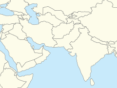
グジュラーンワーラー
| グジュラーンワーラー گجرانوالہ | |
|---|---|

| |
| 位置 | |

| |
| 座標 : 北緯32度9分29秒 東経74度10分56秒 / 北緯32.15806度 東経74.18222度 | |
| 行政 | |
| 国 | |
| 州 | パンジャーブ州 |
| 県 | グジュラーンワーラー県 |
| 市 | グジュラーンワーラー |
| City Nazim | Fayyaz Ahmad Chattha |
| 地理 | |
| 面積 | |
| 市域 | 3,198 km2 (1,235 mi2) |
| 標高 | 213 m (700 ft) |
| 人口 | |
| 人口 | (2015年現在) |
| 市域 | 2,723,009人 |
| その他 | |
| 等時帯 | パキスタン標準時 (UTC+5) |
| 市外局番 | 055 |
グジュラーンワーラー︵ウルドゥー語: گجرانوالہ, 英語‥Gujranwala︶は、パキスタンのパンジャーブ州の都市である。グジュランワラとも。2015年の人口は約272万人である。海抜226mである。

ランジート・シング
1802年、ランジート・シングは王国の首都をグジュラーンワーラーからラホールへと遷都した。
1848年、イギリスがこの地域を征服した。

1865年の地区議会
1867年、自治体に昇格し、北西鉄道でカルカッタやカラチと繋がった。
[1]
[1]
1901年の人口は2万9224人だった。
歴史[編集]
﹁帝国インド地名辞典﹂によると、グルジャル族が設置した。後に定住したイランのジャート族がカンプールと改名したが、古い名前が残った。 [1] [2] 7世紀初頭、ラージプート王国がパキスタン東部とインド北部を支配した。 630年、唐の玄奘三蔵がグジュラーンワーラー近郊のツェキアを訪れた。 997年、ガズナ朝のマフムード王が父のサブク・ティギーン王から王位を受け継いだ。 1005年、カブールのシャヒ王国を征服し、続いてパンジャーブ地方西部を征服した。パンジャーブ地方東部(ムルターン~ラーワルピンディー、グジュラーンワーラー)は1193年までラージプート王国が支配した。 ムガル帝国の衰退後、シク王国がグジュラーンワーラーを支配した。 1707年、ムガル帝国のアウラングゼーブ王が亡くなった。シク王国はパンジャーブ地方を獲得した。 1780年11月13日、シク王国の君主であるランジート・シングがこの地で誕生した。彼の父と祖父はグジュラーンワーラーを重要視した。 [1]

交通[編集]
鉄道、高速道路、河川交通の中心地であり、地方産品輸出のドライポート︵陸上港︶として機能している。 最寄の空港 ●シアールコート国際空港︵Sialkot International Airport︶ ●ラホール国際空港︵Allama Iqbal International Airport︶人口[編集]
1998年の人口は1,132,509人。生活環境[編集]
大気汚染[編集]
民間機関﹁IQAir AirVisual﹂の2019年版報告書では、グジュラーンワーラーは大気汚染のひどさでパキスタンのトップ、世界でもベスト10に入る都市となった[3]。衛生環境[編集]
総世帯の35.5%には衛生的な設備がない。自宅に水洗式トイレのある世帯は全体の42.8%にとどまり、乳児死亡率は1000人あたり67人である[4]。関連項目[編集]
脚注[編集]
- ^ a b c d Gujrānwāla Town – Imperial Gazetteer of India, v. 12, p. 363.
- ^ Ramesh Chandra Majumdar; Bhāratīya Itihāsa Samiti (1954). The History and Culture of the Indian People: The classical age. G. Allen & Unwin. p. 64. "."
- ^ “大気汚染の都市別ランキング、上位30位中インドが21都市”. CNN (2020年2月26日). 2020年2月26日閲覧。
- ^ “パキスタン国 グジュランワラ市廃棄物管理 マスタープラン策定プロジェクト(p261)” (PDF). JICA. 2020年2月26日閲覧。


