
ワンドル川
| ワンドル川 River Wandle | |
| River | |
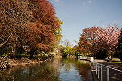
モーデン・ホール・パーク内のワンドル川 | |
| 国 | イングランド |
|---|---|
| カウンティ | グレーター・ロンドン |
| ディストリクト / ロンドン自治区 |
クロイドン区, サットン区, ランベス区, マートン区, ワンズワース区 |
| 支流 | |
| - 右支流 | グレイヴニー川 |
| タウン | マートン, モーデン, アールスフィールド, ワンズワース |
| 源流 | |
| - 所在地 | ワドン貯水池、カーシャルトン貯水池 |
| - 標高 | 35m (115ft) |
| 合流地 | テムズ川 |
| - 所在地 | ワンズワース |
| 長さ | 14km (9mi) |
| 流量 | for Connollys Mill |
| - 平均 | 1.70 m3/s (60 cu ft/s) |
| - 最大 | 39.3 m3/s (1,388 cu ft/s) 1968年9月16日 |
| - 最小 | 0.22 m3/s (8 cu ft/s) 1963年1月29日 |
| 平均流量(他所) | |
| - Beddington Park | 0.18 m3/s (6 cu ft/s) |

ワンドル川︵ワンドルがわ、英: River Wandle︶はイングランド南東を流れる河川である。この川とワンズワース地区の名前は、﹁ウェンデルの居住地﹂という意味の古英語 "Wendlesworth" に由来すると考えられている。この川はロンドン南西部を走り、全長はおよそ9マイル (14 km)である。ワンドル川は、クロイドン区、サットン区、マートン区、ワンズワース区を流れ、ワンズワース地区のタイドウェイ (Tideway) でテムズ川に注ぎ込む。川のほとんどはワンドル・トレイル沿いに近付くことができる。
ノース・ダウンズに降り注いだ雨はチョーク質に浸透すると、点々と連なる泉として湧き出し、それに沿って村落︵英: spring line settlements︶が築かれた。貯水池に至るまで川はほとんどが暗渠を走り、初めて地表に出るのはクロイドンのワンドル・パークで、ここで開渠に注ぎ込んだ川は、ニュー・サウス・クォーターの宅地からミル・レーン沿いのワドン貯水池間で再び暗渠になり見えなくなる。海抜およそ115フィート (35 m)で2つ目の主要水源ライス川はカーシャルトン貯水池を作り、またウォーターミル・ハウスの真下で上記の流れに注ぎ込むことからカーシャルトン北部の地名︵英: the Wrythe︶の由来でもある。
もう1つの水源には、支流であるノーベリー・ブルック︵別名グレイヴニー川︶が含まれる。この支流はクロイドンのロウワー・アディスクーム・ロード︵英: the Lower Addiscombe Road︶近くで地表に現れ、クロイドン区、ランベス区、マートン区を流れる。クールズドン・ボーン︵英: the Coulsdon Bourne︶とケイトラム・ボーン︵英: the Caterham Bourne︶は、暖冬時にのみ流れる季節的な支流である[注 1]。両者はパーリー︵英: Purley︶で合流し、ブライトン・ロード北側に沿ってカルバートを流れた後に、南クロイドンのスワン・アンド・シュガーローフ・パブ︵英: Swan and Sugarloaf pub︶跡地でワンドル川に注ぎ込む。

サットン区にあるカーシャルトン貯水池

サットン区ベディントン・パークでのワンドル川
更新世後期、ワンドル川はホームズデイル谷の北側から湧き出し、ノース・ダウンズを超えて風隙であるマースタム・ギャップを通っていたと考えられる[2]。最近では、ダウンズに降った雨はチョーク質を浸透して、クロイドン・ベディントン・カーシャルトンの中心部で泉として湧き出している。ケイタラム谷︵やクールズドンのスミタム窪地︶を流れ、ボーン︵英: the Bourne[注 1]︶として知られる流れは、ワンドル川の水源でもあるが大雨の後にしか地表に姿を現さない[3]。一連の溝渠やカルバート︵暗渠︶はパーリーからクロイドンに至る水路となっている。
何世紀もの間、ワンドル川はブライトン・ロードのスワン・アンド・シュガーローフ・パブリック・ハウス近くで泉として湧き出ていた。パブは既に閉店しているが、スーパーマーケットとして建物が保存されている。川はサウスブリッジ・ロード沿いに北へ向かって流れ、オールド・タウンに達する頃までには20フィート (6.1 m)幅まで広がり、より細い水路へ分かれ始める。オールド・パレスやスカーブルック・ヒル︵英: Scarbrook Hill︶の敷地内には、トラウトなどの魚が泳ぐ、複数の泉や沼、小川、水路などが存在した。しかし、クロイドンの人口増加や、水洗式トイレの使用増加に伴い、オールド・タウンの水流は開放下水管よりも少なくなってしまい、腸チフスやコレラの大流行を受けて、1840年までには全て埋められるかカルバートに変えられてしまった[4]。
ワンドル川は続いてピットレイク︵英: Pitlake︶を流れ、1890年にワンドル・パークを作るため排水された2つの湿地帯を通る[注 2]。この公園にボート池を作るために地域の水源が活用されたが、水が干上がることが多かったため、1967年に池は埋め立てられ、川はカルバート (culvert) 化された。2012年、ワンドル川は再びワンドル・パーク中を流れるようになった。この公園から、ワンドル川は地下を走り、ガス工場跡地を通って旧ワドン貯水池があったパーリー・ウェイ下を流れ、リッチモンド・グリーン道路で地表に現れる。リッチモンド・グリーンの南側にある小さな緩衝緑地は隣接する小道の緑地も兼ねているが、これはクロイドン・ワドンのミル・レーン︵英: Mill Lane︶の終わりにあたる場所である[5]。
ソーントン・ヒースから支流が分かれ、ノーベリー・ブルックとなっている。支流は北に流れた後、東へ向かってグレイヴニー川︵英: River Graveney︶となり、サマーズタウン近くでワンドル川に注ぎ込む。
ワンドル川はクロイドン区とランベス区の区境となっているほか、更に下流ではマートン区とワンズワース区の境界になっている。また、1900年から1963年までは、サリーとロンドン間の正式な境界線だった。テムズ川に達する直前で、船も航行できるベル・レーン・クリーク︵英: Bell Lane Creek︶が分岐し、テムズ川との合流点近くで再びワンドル川に戻る。
流域には以下の地域がある。
川の流れ[編集]


カーシャルトンにはハニーウッド博物館 (Honeywood Museum) があり、ワンドル川や流域での生活活用などに関する興味深い資料が展示されている[6]。
カーシャルトンのワンドル川
ワンドル川はブリタンニア時代から活用されている。17世紀・18世紀の産業革命期には大いに産業利用され、イングランドで最も水質汚染が進んでいる川とされた[要出典]。当時の主要産業はたばこや織物業であった。川には68基の水車があったが、現存するものはマートン・アビー・ミルズなどを含めわずかである[7]。
1803年には、ワンドル川にほぼ沿う形で、世界初の公共目的の鉄道であるサリー鉄道が開業した。
リバティ印刷工場とマートン・ボード・ミルズ︵英: Merton Board Mills︶は、現在のマートン区の川岸を占めていた。この地区への過剰な工場集中は、ウィンザー・アヴェニューからコリアーズ・ウッド・ハイ・ストリートまでの区間の流れを変えるまでに至った︵工事は18世紀中に行われた︶。元々の川の流れは今でもリバティ・アヴェニューの真下を流れており、ピックル水路︵英: Pickle Ditch︶としてラニーミードで顔を出すほか、セインズベリーで現在のワンドル川と合流する。なお先述のマートン・アビー・ミルズ工場に向かう流れと、セインズベリーに面する流れは人工のものである。
ワンドル川の継続した清掃活動は水質を劇的に改善させ、かつて川の名物だったブラウントラウトが川に戻るまでになった。この水質改善は、チャブやローチ、ヨーロピアンパーチなど、コリアーズ・ウッドにあった、ワンドル川で最も有名な釣り場に生息していた魚群の復活にも繋がっている。
川の利用[編集]

流域の自然保全[編集]
マートン区のトレウィント・ロード︵英: Trewint Street︶とプラウ・レーン︵英: Plough Lane︶間にある流れは、﹁ロウワー・ワンドル︵ワンドル川下流域︶地域自然保護区﹂[注 3]として整備されている。川沿いには並木や草地が整備されている[8][9]。ロウワー・ワンドル[注 4]の南側、ワンドル川とワンドル・トレイルに挟まれた湿地帯は、﹁ワンドル湿地帯自然公園地域自然保護区﹂[注 5]となっている[10][11]。ワンドル川に隣接する地域自然保護区には、他にもカーシャルトンのワンドル谷湿地がある[12][13]。事件[編集]
2007年9月17日、テムズ・ウォーターのベディントン下水工場から、誤って次亜塩素酸ナトリウムがワンドル川に流れ込む事故が発生した。次亜塩素酸ナトリウムは第3処理スクリーンの清掃に使われていたが、薬剤処理のため循環システムに戻される代わりに誤って川に流出し、2,000匹を超える魚が死ぬ事態となった。工場長が重要でないと判断したため、会社は廃水に関するイギリス環境庁の通達周知を怠っていた。一方で会社は事故の責任は自社にあるとし、事故で﹁恥をかかせられた﹂と述べた。会社はすぐに、地元の釣りクラブとワンドル・トラスト[14]に対し、環境復帰のための話し合いと、トラストの活動に対する長期支援を申し入れた[15]。 会社は2009年1月26日に、事故の発生に対して、経費21,335ポンドを含めた125,000ポンドを罰金として支払っている[16]。これは水質保全がなされていた川の水質汚染1回に対する、過去最高額の罰金と考えられている。一方で、会社は再審請求し、2010年2月には、罰金が明らかに過重だとして、5万ポンドに減額された[17]。地層・構成[編集]
この地域の地層は、ほとんどがチョーク質やロンドン・クレイでできている。 この川には人工水路や溝渠、少数の地下水路が張り巡らされている。この川ゆかりのもの[編集]
ニュージーランド・南島を走るワンドル川︵英: Wandle River︶は、この川に因んで名付けられた。 少なくとも4隻の蒸気船が、この川にちなんで﹃蒸気船ワンドル﹄ (SSWandle) と名付けられ、うち3隻は地元のワンズワース・ウィンブルドン・アンド・エプサム地区ガス会社 (Wandsworth, Wimbledon and Epsom District Gas Company) によって製造された。 1980年代には、川から取られたワンドルの名前が、ロンドン・バスの行き先地区の名前として使われた。ロンドン・バスのロゴは、ロンドン・トランスポートのロゴ上に水車を付けた物だった[18]。名所[編集]
ウィンブルドン・スタジアムやラム醸造所はいずれもワンドル川のほとりにある。かつてはプラウ・レーン・スタジアムもここに位置した。文学作品での登場[編集]
文学作品の中では、﹃クマのプーさん﹄の舞台の1つ、モール川の支流の1つとして登場する。1980年代に出版されたマイケル・デ・ララベッティの﹃ボリブル﹄シリーズの中にも登場する。関連項目[編集]
参考文献[編集]
- "River Wandle Companion and Wandle Trail Guide" by Bob Steel, with Derek Coleman. Culverhouse Books 2012, 248pp fully illustrated. Paperback and hardback. ISBN 978-0-9572582-0-4 and ISBN 978-0-9572582-1-1 . See http://www.wandlebook.co.uk
- The Wandle Group edited by Doug Cluett and John Phillips The Wandle Guide Sutton Leisure Services 1997 ISBN 0 907335 330
脚注[編集]
注釈[編集]
(一)^ ab"bourne" とは古英語で、小川を指す言葉[1]。
(二)^ フロッグス・ミード︵英: Froggs Mead︶とスタッブス・ミード︵英: Stubbs Mead︶。ミード︵英: mead︶とは湿地を意味する "meadow" の略語[1]。
(三)^ 原文‥"The Lower Wandle Local Nature Reserve"。地域自然保護区︵"Local Nature Reserve" (LNR)︶の詳細については英語版記事 "Local Nature Reserve" を参照のこと。
(四)^ 先述の通り﹁ロウワー・ワンドル﹂︵英: Lower Wandle︶とはワンドル川の下流域を指す。
(五)^ 英: "The Wandle Meadow Nature Park LNR."
出典[編集]
(一)^ ab小西友七、南出康世﹃ジーニアス英和大辞典﹄︿ジーニアス﹀、東京都文京区: 大修館書店︵2011年発行︶、2001年4月25日。ISBN 978-4469041316。OCLC 47909428。NCID BA51576491. ASIN 4469041319. 全国書誌番号:20398458。
(二)^ Natural England - Geodiversity Archived 2013年10月2日, at the Wayback Machine.
(三)^ H.E. Malden (editor) (1912年). “Parishes: Caterham”. A History of the County of Surrey: Volume 4. Institute of Historical Research. 2012年11月23日閲覧。
(四)^ H.E. Malden (editor) (1912年). “Croydon: Introduction and Croydon Palace”. A History of the County of Surrey: Volume 4. Institute of Historical Research. 2012年11月23日閲覧。
(五)^ [1] Ordnance Survey map, courtesy of English Heritage
(六)^ “Honeywood Museum”. Friendsofhoneywood.co.uk. 2014年6月26日閲覧。
(七)^ Ben Weinreb and Christopher Hibbert, ed. The London Encyclopaedia (1991 ed.). Macmillan. p. 947. ISBN 0-333-57688-8 Retrieved 29 August 2013.
(八)^ “Lower Wandle”. Natural England (2013年3月5日). 2013年12月20日閲覧。
(九)^ “Map of Lower Wandle”. Natural England. 2013年12月20日閲覧。
(十)^ “Wandle Meadow Nature Park”. Natural England. 2013年12月20日閲覧。
(11)^ “Map of Wandle Meadow Nature Park”. Natural England. 2013年12月20日閲覧。
(12)^ “Wandle Valley Wetland”. Natural England. 2013年12月20日閲覧。
(13)^ “Map of Wandle Valley Wetland”. Natural England. 2013年12月20日閲覧。
(14)^ Wandle Trust
(15)^ “Thames Water 'mortified' after 2,000 fish die in River Wandle » Environment”. 24dash.com (2007年9月21日). 2010年10月13日閲覧。
(16)^ “Environment Agency press release”. Environment-agency.gov.uk. 2010年10月13日閲覧。
(17)^ “Thames Water fine for toxic spill in River Wandle cut”. BBC News. (2010年2月19日) 2016年4月30日閲覧。
(18)^ “London Transport - Local Bus Maps”. eplates.info. 2013年8月27日閲覧。
外部リンク[編集]
- The Wandle Trust
- River Wandle Images
- River Wandle on UK Rivers Guidebook
- The Wandle Piscators fishing club
- Nature Conservation Plan for the Lower Wandle Local Nature Reserve, Merton Council, 2001
座標: 北緯51度27分34秒 西経0度11分37秒 / 北緯51.45938度 西経0.19357度
| 全般 |
|
|---|---|
| 国立図書館 |
|