コロンビア川
表示
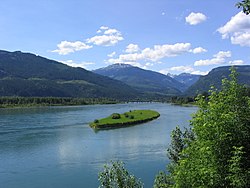
コロンビア川︵コロンビアがわ、Columbia River︶は、カナダのブリティッシュコロンビア州およびアメリカ合衆国太平洋岸北西部を流れる川である。
ブリティッシュコロンビア州のカナディアンロッキーに源を発する。そこからアメリカ、ワシントン州を流れ、ポートランドにて支流のウィラメット川を合わせ、オレゴン州のアストリアにて太平洋に注ぐ。最後の480kmはワシントン州とオレゴン州の境界となっている。
コロンビア川には、ボンネビル・ダム、グランドクーリーダムなどの水力発電用のダムがある。
マンハッタン計画以来半世紀間操業したハンフォード・サイトのプルトニウム生産炉による放射能汚染が深刻な問題となっている。

コロンビア川の流路
ワシントン州東部に入り、コロンビア川はスポケーン川の合流部で南から西へと向きを変える。川はコルビル・インディアン居留地の南限と東限となっており、また、スポケーン・インディアン居留地の西限ともなっている[2]。
オカノガン川と合流した後で川は南に向きを変え、州の中央部でワナッチー川との合流後、南東に向かう。このCの字を描く流路の区間も“ビッグ・ベンド”と呼ばれている。1万年から1万5千年前にかけて繰り返し発生したミズーラ洪水により大量の水流が直接南へ流れ、グランドクーリーと呼ばれる古代の河床を形成した。洪水期がおわると、川は現在の流れとなり、グランドクーリーは乾燥していった。20世紀中葉にグランドクーリーダムが建設され、ルーズベルト湖が誕生した。また近くの涸れ谷︵クーリー︶に湖水が汲み出され、バンクス湖という人造湖が造られた[3]
その後、川は渓谷円形劇場︵州北西部の著名なコンサート会場︶の横を流れ、プリースト・ラピッズ・ダムを通りぬけて、そしてハンフォード核保留地に至る。保留地内全体はハンフォード・リーチといい、アメリカ国内で唯一完全にダムによる制御や河口の潮汐などの影響をうけること無く、川が全く自由に流れている区間である。トリシティズ都市圏でスネーク川とヤキマ川と合流した後、コロンビア川はワシントン=オレゴン州境となり、急な屈曲部を西へ流れていく。川は河口に到るまで497キロメートルにわたる州境を画定している[4]。

コロンビア川峡谷︵2009年5月撮影︶。ビーコン・ロックの ある東側を向いている。
オレゴン州のザ・ダルズ近郊で、デシューツ川と合流する。ザ・ダルズとポートランドの間で、コロンビア川はカスケード山脈を横断し、雄大なコロンビア川峡谷を形作る。渓谷はその強く安定した風と風景美、そして重要な輸送ルートの役割で知られている[5]。コロンビア川の他にカスケード山脈を横断する河川はクラマス川とピット川のみであり、それ以外の河川は山脈内やその直近に水源を有するか、山脈に平行に流れている。西へ流れてきた川は、ポートランドとバンクーバー近郊でウィラメット川と合流するところで急に向きを北北西へ変える。ここで川の流れは比較的緩やかとなり、川底の堆積が進みやがては三角州を形成するようになる。ロングビュー近郊でカウリッツ川と合流した後、川は再び西へと流れていく。やがてコロンビア川はオレゴン州アストリアの西で、位置と形状を常に変え続け河口域の航行を世界でも有数の危険なものとしているコロンビア砂州を越えて太平洋に注ぎこむ[6]。河口周辺の危険性と多くの難破船の存在が、この水域に﹁船の墓場﹂という悪名を与えている[7]。
コロンビア川の流域面積は670,000平方キロメートルに達する[8]。この流域は、アイダホ州のほぼ全域、ブリティッシュコロンビア州、オレゴン州、ワシントン州の広い範囲、モンタナ州では大陸分水界の西側全体、そしてワイオミング州とユタ州、ネバダ州の一部にまで及び、その総面積はフランス1国に匹敵する。流路のうち1,200キロメートルが、また流域のうち85パーセントがアメリカ国内にある[9]。川の全長は全米で12番目、流域も6番目の広さとなる[8]。カナダ国内では、流路延長は801キロメートルで国内23位[10]、流域面積は 103,000 平方キロメートルで13位となる[11]。﹁コロンビア﹂という名称は、ブリティッシュコロンビア州のように、様々な地形や水域に対して流用されている。なお、最上流部のコロンビア湿原はブルトラウト、ハヤブサ、アメリカアナグマ、コハクチョウなどの生息地として、2005年にラムサール条約登録地となった[12]。

ドラムヘラー・チャネルズ国立自然ランドマーク, ミズーラ洪 水により形成されたチャネルド・スキャブランドの一部。
プレート・テクトニクスによりパンゲア大陸が分裂し、北アメリカがヨーロッパとアフリカから引き離され、パンサラッサ大洋︵現在の太平洋の前身︶へと押し出されていた当時、太平洋岸北西部は大陸の一部ではなかった。北アメリカ大陸が西へ移動するにつれ、ファラロン・プレートが西端の下へ沈み込んでいき、概ね1億5千万年前から9千万年前にかけて、プレート上の島弧が移動して北アメリカ大陸と一体化し、太平洋岸北西部を形成した[17]。
コロンビア盆地の大枠が定まったのは6千万年前から4千万年前にかけての時期で、当初は巨大な内海に沈んでいたが、徐々に隆起していく[18]。4千万年前から2千万年前の始新世と中新世にかけては、大規模な噴火活動が頻発し、コロンビア川が流下する地域の景観を大きく変えていった[19]。
コロンビア川の基となった川の下流部は、後にフッド山が噴火し誕生する場所にあった谷筋を通過しており、その侵食による堆積物と火山噴火が、オレゴン州北西部のバーノーニア近郊にある北部オレゴン海岸山脈東側の丘陵地帯の基盤となる、厚さ3キロメートル以上の三角州を形成した[20]。1千7百万年前から6百万年前にかけて、大規模な洪水玄武岩の噴出がコロンビア川台地を覆い尽くし、コロンビア川下流は現在の流れになった[21]。
カスケード山脈の隆起は、更新世初期︵2百万年前〜70万年前︶に始まった。コロンビア川は隆起する山脈を侵食していき、コロンビア川峡谷を形作っていった[19]。
川とその流域は、最終氷期の終わりにかけて生じた世界最大級の破滅的洪水を複数回経験している。ミズーラ氷河湖の周期的な氷河湖の決壊はミズーラ洪水を引き起こし、世界全体の河川の総流量の10倍に及ぶ膨大な水が、数千年の間に何十回となく溢れ出た[22]。
正確な洪水の発生回数は不明であるが、地質学者は少なくとも40回発生した裏付けを得ている。痕跡からは洪水が1万9千年前から1万3千年前にかけて起きていたことが分かっている[23]。

ワシントン州ドッグ山から見たコロンビア川峡谷のパノラマ
洪水はワシントン州東部を洗い流し、チャネルド・スキャブランドを形成した。ここは峡谷状の河床や玄武岩の上に積もった深い表土を鋭くえぐりとり網状に入り組んだ谷筋であるクーリーが、複雑に組み合わさった地形である。無秩序なスキャブランドの上には肥沃な土地に満ちた頂上が平坦なビュートが数多くある[21][24]。
数カ所の狭隘部で溢水が滞留し、ルイス湖等の一過性の湖を作り出し堆積物を跡に残した。水深は、ワルーラ・ギャップで380メートル、ボンネビル・ダムで250メートル、オレゴン州ポートランドで120メートル以上と見積もられている[25]。
クインシーやオセロ、パスコ盆地まで洪水が届くと、流れは幅が拡がって遅くなり、堆積物が滞留した[24]。周期的に発生する洪水は、コロンビア川台地の低地部に大量の堆積物を残し、21世紀の農家はウィラメット渓谷で﹁モンタナの肥沃な土と、ワシントンのパルースの粘土からなる畑を耕している﹂[26]。
過去数千年にわたって、コロンビア川峡谷の北斜面で大規模な地すべりが幾度も生じており、テーブル・マウンテンやグリーンリーフ山の南斜面から大量の土砂が、現在のボンネビル・ダム付近に崩落した。一連の崩落の中で最後かつ重要視されているのがボンネビル地すべりで、延長5.6キロメートルに渡って川を埋め巨大な土砂ダムを形成した[27][28]。
研究の結果、ボンネビル地すべりは1060年から1760年の間に起きたと見積もられている。今に残る岩屑は複数回の地すべりにより生じたとした見方が比較的最近出ており、その長大な範囲を説明付けている[28]。発生時期の見積の内、後期の方が正しければ、1700年のカスケード地震との関連が示唆される[28][29]。
ボンネビル地すべりによる岩屑の堆積は川をせき止め、最終的に堆積物を洗い流した。川が障害を除去するまでどのくらいの期間がかかったか判明していないが、数カ月から数年は必要だったと見積もられている[30]。地すべりの大量の岩屑は残存し、川は流路を約2.4キロメートル南へ移し、その場はカスケード急流となった[31]。1938年、ボンネビル・ダムの建設により急流は姿を消し、その工事で発見された埋木から地すべりの発生時期の推定が改善された[31][32]。
1980年にはし、大量の土砂がコロンビア川下流に堆積して、一時的に可航水路の水深が7.9メートルまで浅くなった[33]。
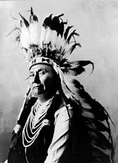
ネズ・パース族のジョゼフ酋長。
人類がコロンビア川流域に居住し始めたのは1万5000年以上前で、サケの漁獲をベースとした定住生活への移行はおよそ3,000年前と考えられている[34]。1962年、ワシントン州東部のパルース川とスネーク川の合流点近くのマームズ岩陰遺跡で、考古学者が人類が活動していた痕跡を発見し、その時期は11,230年前まで遡るものだった。1996年には、ワシントン州ケニウィック近郊で、9,000年前の有史以前の人骨が見つかっている︵ケネウィック人と呼ばれている︶。この発見は、北アメリカに人類が到来した時期を巡る科学界の議論を再燃させ、さらに、科学界とアメリカ先住民の間で、その人骨を所持しあるいは研究する資格をどちらが有しているのかについて論争が勃発した[35]。
多くの異なるアメリカ先住民とファースト・ネーションが、コロンビア川周辺で伝統と継続した存在感を有している。カナダ=アメリカ合衆国国境の南では、コルビル族やスポケーン族、クーダレン族、ヤカマ族、ネズ・パース族、カイユース族、パルース族、ユーマティラ族、コウリッツ族、ウォーム・スプリングス部族連合が合衆国内の流域に居住している。スネーク川上流部サーモン川の流域には、ショショーニ族やバンノック族がいる。カナダ側の下流域にはシナイクスト族あるいは湖の民と呼ばれる人々が住んでいて[36]、上流部にはセクウェップム族がおり、かれらはロッキー山脈より東の流域全体を自分たちのテリトリーとみなしている[37]。コロンビア盆地のカナダ側の領域は、クーテネイ族のカナダ側の氏族、クトゥーナーハ族の伝統的なホームランドである。
チヌーク族は、現在連邦政府から認定を受けていないが、コロンビア川下流域に居住しており、チヌーク語で Wimahl と呼んでおり[38]、そして現在ワシントン州内の中流域に居住するシャハプティン語を話す人々は Nch’i-Wàna と呼んでいる[39]。
カナダ国内の上流域にあるアロー湖周辺域に住むシナイクスト族は、川の名をswah'netk'qhu と言っている[40]。
この3つの言葉は全て本質的に同じで﹁大きな川﹂という意味である。
口伝は、現在オレゴン州=ワシントン州境となっているコロンビア川峡谷の両岸を結ぶ陸橋、神々の橋︵Bridge of the Gods︶の誕生と崩壊を物語る。この橋は、地質学的資料からボンネビル地すべりが対応すると見られているが、複数の伝説の中で、セントヘレンズ山の女神の寵愛をめぐるアダムズ山の神とフッド山の神との争いの結果生じたと語られている[41]。
この橋について、アメリカ先住民のそれぞれの部族が伝える物語は細部で異なっているが、川の北側と南側の部族間の交流を促進したことは共通している[42][43]。
元々はスペイン領ニューメキシコで飼育され始めた馬は、従来の部族間交易ルートを通して広まっていき、1700年頃にはスネーク川平原のショショーニ族の手元に届いている。ネズ・パース族やカイユース族、フラットヘッド族が、最初に馬を取得したのは1730年頃である[44][45]。
馬の到来とともに、馬術や調教技術などの大平原地帯の文化が流入し、機動性や狩猟の効率、交易範囲の拡大、馬と戦争とが冨と名声に結びついたことによる闘争の激化に加え、大規模で強大な部族連合の隆盛が生じた。ネズ・パース族とカイユース族は大規模な馬群を維持し、毎年大平原へ長距離遠征を行ってバイソンを狩猟し続け、大平原文化を大きく取り入れていくこととなった。そして、こういった部族を通して、コロンビア川流域に馬と大平原文化が広まっていった。他の部族における馬と大平原文化の浸透程度は様々だった。ヤカマ族やユーマティラ族、パルース族、スポケーン族、クーダレン族はかなり大規模な馬群を維持し、大平原文化の特徴を一部取り入れているが、漁業関連経済の重要性は変わらなかった。モララ族とクリキタット族、ウェナチー族、オカナガン族、シンカイユース族といったあまり影響を受けなかった部族は、小規模な馬群を確保しただけでほとんど大平原文化の影響を受け入れなかった。全く影響を受けること無く留まった部族も複数あり、サンポイル族やネスペレム族は漁業を中心とした文化を保ちつづけた[44]。
18世紀から19世紀にかけて、この地域の先住民族は、幾度と無く様々な場所で異邦人と遭遇することとなった。ヨーロッパ人とアメリカ植民地からの船舶が、18世紀末には河口周辺の沿岸地域へ探検に訪れ、現地の部族と交易を行った。この関わりが先住民に大打撃を与えたことは間違いない。天然痘が流行し、人口の激減が生じたのだ。カナダの探検家、アレグザンダー・マッケンジーは1793年に、現在ブリティッシュコロンビア州内陸部と呼ばれる地域を横断した[45]。1805年から1807年にかけて、ルイス・クラーク探検隊がクリアウォーター川とスネーク川に沿ってオレゴン・カントリーに到来し、多くの部族の小規模な集落を訪れた。彼らの記録には訪問者からちょっとした用品をかすめとることを恥とも思わない、持てなしの良い商人の話が残されている。また彼らは、沿岸地域の部族との交易で入手した真鍮の薬缶や英国製のマスケット銃などといった工芸品を記録している[46]。
西洋人との遭遇の初期時点では、コロンビア川の中流域から下流域の先住民は集落を形成せず、村というには小規模だが家族単位ではない集団の規模で居住していた。こういった集団は定住すること無くサケを追い求めて、季節に応じて川沿いを上下と移動していた[47]。
1848年のホイットマン虐殺事件を皮切に、入植者と地域の先住民との間で多くの抗争が巻き起こった[48]。
後のインディアン戦争、特にヤキマ戦争の結果、先住民は大きく数を減らし、多くの土地がその手を離れた[49]。
年を経るにつれ、コロンビア川における先住民族の漁業権が、州や商業漁業、地主にとって問題視されるようになっていく。合衆国最高裁判所は1905年と1918年に、漁業権の存在を支持する画期的な判決を下しており[50]、これは一般にボルト判決と呼ばれる、1974年の合衆国対ワシントン州の訴訟と同じ意義を持つ。

セリロ滝のたも網漁︵1941年撮影︶
漁業は地域の先住民文化の中心であり、生計手段と宗教的信仰の一部であった[51]。先住民がコロンビア川で魚を捕る主要な河岸が数カ所あり、そういった場所は交易所としても機能していた。ザ・ダルズの東にあったセリロ滝は、異なる文化を持つグループが交易と交流をもつ重要な場所であり[47]、11,000年にもわたって漁業と交易に用いられていた。西洋人との遭遇以前、この周辺の14キロメートルに渡る流域にあった村落の総人口は10,000人を上回っていた可能性がある[52]。この場所には遥か大平原からも交易者が訪れていた[53]。コロンビア川峡谷のカスケード急流と、ワシントン州東部のケトル滝とプリースト急流もまた、漁猟と交易の主要地点であった[54][55]。
先史時代のコロンビア川におけるサケとニジマスの漁獲量は年平均1千万から1千6百万匹と見積もられている。これに比べ、1938年以降で最大漁獲量は1986年の320万匹である[56]。先住民による年間漁獲量は19,000トン程度と見積もられている[57]。最も重要かつ生産性の高い漁場はセリロ滝で、おそらくは北米で最も漁獲高の大きい内陸の漁場だった[58]。この滝は、チヌーク語を話す部族とシャハプティン語を話す部族との端境にあり、太平洋岸の高原地帯を横切る広範な交易ネットワークの中心をなしていた[59]。セリロは、継続的に住民がいた北米大陸でも最古のコミュニティであった[60]。
1866年に白人の入植者がサケの缶詰工場の創業を開始したことにより、サケの生息数が大きく減少した。そして、1908年にアメリカ合衆国大統領セオドア・ルーズベルトは、サケの遡上は25年前と比べるとほんの僅かにすぎない、と述べている[61]
20世紀を通じて河川の開発が行われ、1938年のカスケード急流の水没を嚆矢として主要な漁場は次々とダム湖の底に沈んでいった。こういった開発は先住民と合衆国政府機関との多方面に渡る交渉の結果成し遂げられていった。様々な部族からなるウォーム・スプリングス部族連合は、1938年にボンネビル・ダムが完成し、カスケード急流が水没した後、憲章を採択し法人化した[62]。とはいえ、1930年代には、未だに魚の行動パターンに従い、季節を通じて川沿いに移動しながら生活する先住民がいた[63]。ヤカマ族が正式な政府を立ち上げたのは比較的遅く1944年だった[64]。21世紀においても、ヤカマ族やネズ・パース族、ユーマティラ族とウォーム・スプリングス部族連合は全て、コロンビア川とその支流における漁業権を堅持している[57]。
1957年に、ザ・ダルズ・ダムの建設により、セリロ滝が川底に消え、先住民の漁場コミュニティも失われた[60]。ザ・ダルズ・ダムにより失われたセリロを始めとする複数の漁場に対する補償として、関係部族は2680万ドルの和解金を受け取っている[65]。ウォーム・スプリングス部族連合は、400万ドルに及ぶ和解金の一部をフッド山の南に位置するカニータ・リゾートの設立に費やした[62]。
流路[編集]
コロンビア川の2,000キロメートルに及ぶ旅路は、ブリティッシュコロンビア州内のロッキー山脈トレンチ南部から始まる。コロンビア湖︵標高 820 メートル︶と周辺のコロンビア湿原が川の水源と成っている。トレンチはカナディアン・ロッキーとコロンビア山脈の間にある、幅広くて深く長く延びた氷食谷であり、川の最上流部はこのトレンチを北西方向へ320キロメートルも流れていく。流域にはウィンダミア湖やインヴァーミアの町があり、この地域はブリティッシュコロンビア州内でコロンビア・バレーと呼ばれている。川は更に北西へ向かい、ゴールデンの横を通り、キンバスケット湖へ流れ込む。湖を出た川はセルカーク山脈の北端を回りこんで鋭く南に向きを変え、この地域でビッグ・ベンド・カントリーと呼ばれている区域に入って、レベルストーク湖とアロー湖を抜けていく。ここまでのレベルストークとビッグ・ベンド、コロンビア・バレーを合わせた地域を、州内ではコロンビア・カントリーと呼んでいる。アロー湖の下流で、コロンビア川はキャッスルガーの市街︵ここで支流のクートネー川と合流する︶と、トレールという、クートニー地域西部における2ヶ所の大きな都市部を抜けていく。カナダ=米国国境の3キロメートル北で、ペンド・オレイル川と合流する[1]。

流量[編集]
コロンビア川の河口における平均流量は毎秒約7,500立方メートルもあり[8]、北アメリカ大陸から太平洋に流入する河川の中では最大で[13]、アメリカ国内でも4番目に当たる[8]。アメリカ合衆国=カナダ国境における平均流量は、毎秒2,800立方メートルで、その地点での流域面積は 103,000平方キロメートルあり[14]、全域の15パーセントに相当する。コロンビア川で過去に計測された最大流量は、ダムが建設される以前の1894年6月にザ・ダルズで記録された毎秒35,000立方メートルである[15]。ザ・ダルズで記録された最小流量は、1968年4月16日の毎秒340立方メートルで、45キロメートル上流に建設されたジョン・デイ・ダムの貯水が開始された時だった[15]。ザ・ダルズは河口から約310キロメートル離れており、この地点より上流の流域面積は610,000平方キロメートルで全域の概ね91パーセントに相当する[15]。コロンビア川の流量は、上流にある数多くの貯水施設、灌漑用設備、そして下流部においては太平洋の潮汐の影響を受ける。アメリカ国立海洋局は、6ヶ所の潮位計で水位を観測しノース・ジェッティの入口からボンネビル・ダムの基部までの間の22ヶ所で水位予測を行っている[16]。地質[編集]


先住民族[編集]


探検家の活動[編集]

数名の歴史家は、ヨーロッパ人が到達するはるか昔、紀元前219年には、日本人あるいは中国人が北西海岸に漂着していたと信じている[66]。彼らがコロンビア川河口周辺に上陸したかどうかは定かではない。難破船から脱出したスペイン人が1679年に海岸に辿り着き、クラットソップ族と取引した証拠が存在する。彼らが本当にコロンビア川を目にした最初のヨーロッパ人であったとしても、本国へ何も報告はおこなっていない[67]。
18世紀には、大西洋︵もしくは北アメリカ内陸部︶と太平洋を結ぶ北西航路の発見に強い関心が集まった。数多くの船舶がこの領域に押しかけ、特にスペイン籍とイギリス籍の船舶が、ハドソン湾やミズーリ川へ繋がる長大河川を求めて北西海岸を探索した。コロンビア川の発見を最初に報告したヨーロッパ人は、ブルーノ・デ・ヘセタで、1775年に河口を目にしている。流れが強く、人員不足もあって、部下の進言に従い彼は川の探検に乗り出さなかった。彼は河口部を湾とみなし、エンセナダ・デ・アスンシオン︵Ensenada de Asunción︶と名付けている。その後に制作されたスペインの地図には、彼の報告に基づき、川をリオ・デ・サン・ロケ︵Rio de San Roque [38]、あるいはその入口をエントラーダ・デ・ヘゼタ︵Entrada de Hezeta︶[67] と記載したものがある。ヘセタの報告を受けて、イギリス人沿岸毛皮交易業者のジョン・ミアーズ船長が、1788年に川を捜索したものの最終的に存在しないと結論を下した[68]。川が見つからなかったことに失望して、かれはとある岬をディスアポイントメント岬と名付けたが、実際のところ、そこが河口の北端であった[69]。
次に起きた出来事は、それから数十年に渡るイギリスとアメリカのこの地域に対する探検、領有権の主張において協調と論争の基礎を形成した。イギリス海軍のジョージ・バンクーバー司令官は、1792年4月にコロンビア川の河口に船を進め、水色が変わるのを観測した。しかし彼はミアーズの報告を疑わず、そのまま北へ航海を続けた[38]。その月末に、バンクーバーはアメリカ人のロバート・グレイ船長と、ファンデフカ海峡で遭遇した。グレイは、コロンビア川の入口を見つけたが、9日間粘ったものの、進入するには至らなかったと報告した[70]。
1792年5月12日、グレイは南へ戻りコロンビア砂州を横切り、初めて川の中に進入し探検を行った。グレイの毛皮公益事業は、オレゴンのボストン︵現オレゴン州シェッド︶の商人から融資を受けており、コロンビア・レディビバ︵Columbia Rediviva︶という名の私有船を与えられており、かれは5月18日に船の名に因んで川に命名した[67][71]。グレイはコロンビア川河口周辺で9日間交易に従事し、それから上流に向かって21キロメートル航行した。到達した最遠地点はグレーズ川の合流点であるグレーズ湾であった[72]。グレイのコロンビア川発見は、後にオレゴン・カントリーの領有を主張するロシアやグレートブリテン王国、スペイン等の国々に対する合衆国の強みとなった[73]。
1792年10月、バンクーバーは彼の副官であるウィリアム・ロバート・ブロートン大尉に川の遡上を命じた。ブロートンはコロンビア川峡谷の西端である、サンディー川の合流点まで辿り着いた。河口から160キロメートル遡っており、その際にフッド山を目にしてその名を付けている。ブロートンは公式に川とその流域、河口周辺の沿岸域をグレートブリテン王国領と宣言した。逆に、グレイは合衆国を代表して公式な領有宣言を行っていない[74][75]。

﹃コロンビア川、カスケード山脈、オレゴン﹄1876年ヴィンセント ・コリヤ作、︵キャンバス油絵︶左側にビーコン・ロックが描かれている。
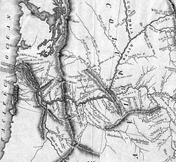
ルイス・クラーク探検隊の成果に基づいた詳細な地図。ウィラメット川 が﹁マルトノア川﹂、スネーク川が﹁ルイシーズ川﹂と記載されている︵全図︶。
コロンビア川はミズーリ川の水源とほぼ同じ緯度にあるので、グレイとバンクーバーは念願の北西航路を発見したのではないかと推測していた。1798年発行のイギリスの地図には、コロンビア川とミズーリ川の間を結ぶ点線が描かれている[67]。しかし、アメリカ人探検家のメリウェザー・ルイスとウィリアム・クラークがアメリカ西部の広大な地図のない大地を遠征し︵1803年〜1805年︶、その結果を地図に描いて2つの川の間に通廊は存在しないことを示した。ロッキー山脈を踏破した後、ルイスとクラークは丸木舟を作り、スネーク川を漕ぎ降り、現在のワシントン州トリシティズ近くでコロンビア川に辿り着いた。彼らは川を数マイル遡り、ベイトマン島まで辿り着いた後、川を下っていって河口で遠征を終えクラットソップ砦を建設した。この砦は短命で、3ヶ月しか持たなかった[67]。
北西会社に雇われていたカナダ人の探検家、デイヴィッド・トンプソンは、1807年から1808年にかけての冬を、コロンビア川源泉近くの現ブリティッシュコロンビア州インヴァーミアにあったクートネー・ハウスで過ごした。続く数年にわたって、彼は川と北部流域の大半を探索し続けた。1811年に、彼はコロンビア川を太平洋へと下っていって、ジョン・ジェイコブ・アスターの太平洋毛皮会社が河口に設立したアストリアへたどり着いた。北からの帰路において、トンプソンはそれまで訪れていなかった区間を探索しており、結果としてコロンビア川の本流を完全に踏破した最初のヨーロッパ系アメリカ人となった[67]。
1825年、ハドソン湾会社︵HBC︶がコロンビア川の堤へ、コロンビア・ディストリクトにおける本部としてフォート・バンクーバー︵現在のワシントン州バンクーバー︶を設立し、ロッキー山脈より西側全域を対象として運営を始めた。医師であったジョン・マクローリンが、コロンビア・ディストリクトにおける主任仲買人として派遣された。HBC はコロンビア・ディストリクトの運営をコロンビア川経由で太平洋へ向かうことに方針変更し、コロンビア川はこの地域の流通の主要ルートとなった[76]。1840年代初頭には、アメリカ人がオレゴン・トレイルを経由してオレゴン・カントリーへの入植を開始し、HBCは、領域内のアメリカ人の居住地に対して妨害を仕掛けていったものの、その数は増え続けていった。入植者の多くはコロンビア川の下流を目指し、フォート・バンクーバーへと旅していった[77]。オレゴン・トレイルにおいて、ザ・ダルズからフォート・バンクーバーにかけての最後の区間は、最もあてにならない道のりで、1846年には迂回路となるバーロー道路が建設されることになった[78]。
合衆国とイギリスの間で1818年条約が締結され、両国は10年間オレゴン・カントリーにおいて同等の権利を享受することを合意した。1828年までに、いわゆる﹁共同領有﹂状態を無期限に継続すべく条約は更新され、その時点でコロンビア川下流が境界となる公算が高まった。何年もの間、ハドソン湾会社はコロンビア川の管理を成功裏に維持し続けており、足場を確保しようとするアメリカの試みを阻害し続けてきた。しかし1830年代になると、アメリカ人の宗教団体がコロンビア川下流域において教会を数カ所で設立した。そして1840年代には大量のアメリカ人の入植者がイギリスの管理を崩し始めた。ハドソン湾会社は供給が激減していた毛皮交易から、サケや材木などの品目の輸出に切り替えて優位を維持すべく努力を重ねた。植民地化も試みられたが、アメリカ人居留地とうまく迎合できず失敗に終わった。アメリカ人は通常、コロンビア川の南に入植し、多くはウィラメット渓谷に居を構えた。ハドソン湾会社は川の北側に居住地を設立しようと試みたが、ほとんどのイギリス人入植者も、南のウィラメット渓谷に移っていった。イギリス人入植者は渓谷からアメリカ人の影響力を薄めようと考えていたのだが、アメリカ人の入植者の圧倒的な人数が思惑通りには進ませなかった。こういった成り行きは、﹁共同領有﹂の問題と境界線紛争を再燃させた。一部のイギリス人は、とくにハドソン湾会社はコロンビア川を境界とすべく奮闘したが、1846年に締結されたオレゴン条約により、境界は北緯49度線と平行に引かれることになった。コロンビア川自体は合衆国のオレゴン準州とワシントン準州の境界となる[79]。オレゴンは1859年に正式な州に昇格し、ワシントンは1889年に昇格した。
20世紀に代わるころには、コロンビア川における航行の困難さが、カスケード山脈東側のインランド・エンパイア地域における経済発展の障害と見なされてきていた。[80] 浚渫とその後行われたダムの建設により、川の姿を恒久的に変え自然の流れを途切れさせただけでなく、可航性の向上に加え電力や灌漑などの利益を地域にもたらした。

コロンビア川の河口は、ちょうどオレゴン州アストリアを過ぎたところ になる。川を出入りする船は油断ならないコロンビア砂州︵水平線近くにありこの写真では視認できない︶の中を航行しなければならない。

カスケード急流を航行する船尾外車汽船 Hassalo 号︵188 8年5月26日撮影︶。この急流はボンネビル・ダムの湖底に沈み、今は失われている。

1か所の伐採キャンプから切りだされた1年分の丸太を運ぶためのベン ソン式の巨大な筏が川を下っている︵1906年撮影︶。
アメリカ人のロバート・グレイ船長と、1792年に川を探索したイギリス人船長ジョージ・バンクーバーの活動により、コロンビア砂州は突破可能であることが明らかにされた。この功績を成し遂げるまでにいくども繰り返された挫折の原因は、今日も健在である。現在の科学技術を駆使して河口に改良を加えても、強力な潮流と移動する砂州の存在が、川と太平洋の狭間を危険な水域となしている[81]。
この川で蒸気船の運用を始めたのはイギリスで、1836年にビーバー号を運航しており[82]、その後追いでアメリカ人が運航を始めたのは1850年だった[83]。これにより流域で居住地が次々と設立され経済発展に結びついた[84][85]。蒸気船は複数の区間に分かれて運航されていた。下流域では太平洋ーカスケード急流-セリロ滝-スネーク川合流点-ワナッチー区域とワシントン州東部に至るまで区間を分けて運航されていた。他にブリティッシュコロンビアのアロー湖沿岸域やウィラメット川、スネーク川といった支流やクーテネー湖内でも航路が設けられていた。最初期は薪木を焚いて動力としていた蒸気船は、長年にわたって各領域で貨客を運び続けた。この地域における初期の鉄道は、下流域で滝によって分断された航路を接続するために建設されている[86]。1880年代になると、オレゴン鉄道水運会社やシェイバー運輸といった企業が鉄道網を整備し、川沿いの主要輸送ルートを補完し始めた[86]。

Essayons 号‥アメリカ陸軍工兵隊が有する、1983年から コロンビア川で航路の浚渫作業に従事する3隻の船舶のひとつ[94]。
航路を維持し改善する努力は現在も継続されている。1990年には、コロンビア川下流域で更なる浚渫の可能性を検討する調査が新たに始まった。この計画は経済的側面と環境維持の観点から、スタート当初から論争の的となっている[95]。
1999年、議会はポートランドからアストリアの間の航路を12メートルから13メートルまで掘り下げることを認可した。これにより、大型のコンテナ船や穀物輸送船がポートランドとバンクーバーまで親友可能になる[96]。しかしながら、このプロジェクトは河床に沈殿している有害物質を攪拌して拡散させる恐れがあるとして反対に直面した。ポートランドを拠点とする NWEA︵Northwest Environmental Advocates‥太平洋岸北西部の環境保護団体︶は陸軍工兵隊に対して訴訟を起こしたが、2006年に第9巡回控訴裁判所において棄却された[97]。プロジェクトでは、環境に対する影響を緩和する手段が講じられている。例えば、陸軍工兵隊はプロジェクトによって悪影響を受ける湿地帯に対し12回に渡って回復措置を行う必要がある[96]。2006年初頭の段階で、工兵隊は油圧機器用のオイルを190リットルもコロンビア川に流出してしまい、環境保護団体から更なる批判を招く羽目に陥った[98]。
プロジェクトの施工作業は2005年に開始され、2010年に完了した[99]。総費用は1億5000万ドルに及んでいる。そのうち65パーセントを連邦政府が拠出し、オレゴン州とワシントン州はそれぞれ2700万ドルを計上、他に6ヶ所の港湾がコストを負担している[96][100]。

ジョン・デイ・ダムの魚道。﹁魚殺し﹂と呼ばれることも多いこ のダムと貯水池は、若い鮭にとって川を下るにおいて最も死にやすい場所と成っている[101][102]
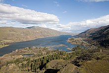
コロンビア川に設けられたダム群が、このロウィーナ山の上から見える ボンネビル・ダムとザ・ダルズ・ダムの間のように、川の様相を淀んだ貯水池の連なりに変えてしまった。

コロンビア川の貯水池の一つ、キンバスケット湖
1902年に、アメリカ合衆国土地改良局が設立され、合衆国西部諸州の経済発展に関与を開始した[103]。手がけた主要事業の一つが、ワシントン州中央部におけるコロンビア盆地計画のために2,400平方キロメートルに及ぶ灌漑能力を有するグランドクーリーダムの建設である[104]。第二次世界大戦の勃発により、ダム建設の主要目的は水力発電に切り替わった。灌漑施設の整備は戦後に回されている。
コロンビア川の開発は1909年に調印されたアメリカ合衆国-カナダ間の境界水域国際条約に則って行われている。連邦議会は1925年に河川港湾法を可決し、陸軍工兵隊と連邦動力委員会に対し、国内河川開発について調査するよう求めた。この結果、関係機関は水力電源開発に対して初めて公式な財務調査を実施することとなり、様々な機関から提出された報告書は、議会文書 308 として取りまとめられた。この文書と、その後継続して提出された追加報告は、まとめて第308報告書と呼ばれている[105]
1920年代末、合衆国北西部の政治情勢は、基本的にコロンビア川沿いに民間資本で水力発電用ダムの建設を奨励していた。しかし、1930年の共和党オレゴン州支部の予備選挙において、知事候補者として圧勝したジョージ・W・ジョーゼフと、彼の法律顧問で後に後継者となったジュリアス・メイヤーは、ダムの公的所有を進めるために強力な公的援助の存在を実証する必要を理解していた[106]。1933年にアメリカ大統領フランクリン・ルーズベルトが、公共事業としてボンネビル・ダムとグランドクーリーダムの建設を可能にする法案に署名した。この法律の起草には、オレゴン州選出のチャールズ・マクナリー上院議員とワシントン州のクラレンス・ディル上院議員、オレゴン州のチャールズ・マーティン下院議員がとりわけ尽力していた[107]。1948年に洪水がコロンビア川流域を襲い、当時オレゴン州第二の都市であったヴァンポートを破壊したのを始めとして、はるか北のブリティッシュコロンビア州トレールに至る多くの都市が被害を受けた[108]。この洪水により、1950年洪水調節法が連邦議会を通過し、連邦主導によるさらなるダムと洪水調節施設の建設が認可された。しかしながら、その時点で地元コミュニティーでは、連邦政府による水力発電計画に対する警戒心が高まっており、地元自治体は新規開発事業に対する関与を求め、最終的にワシントン州グラント郡︵ワシントン州︶内の公共事業管轄区が主体となって、プリースト急流にダムの建設が開始された[109]。
1960年代に、アメリカ合衆国とカナダは、洪水調節と下流域の水力発電量の最大化を主眼とするコロンビア川条約に調印した[105]。この条約において、カナダはダムの建設と貯水した水の供給について、合衆国は下流域における発電量の増大分のうち半分を、前もって5年分を見積もったうえでカナダに配分することに合意されている[110]。カナダは義務を履行するために3つのダムの建設︵2つはコロンビア川本流、1つはダンカン川︶に着手し、1973年に完工した[111]。
今日、コロンビア川本流には14のダムが設けられており、内3つがカナダに、残る11が合衆国内にある。本流にある4つのダムとスネーク川下流部にある4つのダムには閘門が設けられており、船舶やはしけが外洋からアイダホ州ルイストンまで航行可能である。水系全体では、水力発電および灌漑用のダムが400基以上設けられている[9]。ダムが担う役割はさまざまであり、洪水調節や航行、流量調整、貯水および給水、公有地およびインディアン保留地の埋立、水力発電などの用途がある[112]


水運[編集]


ルイストンへの航路開設[編集]
早くとも︵現代国語としての誤用だが、書き直してもよいだろうか? 2021/Jan/4記入︶1881年には、実業家の中にコロンビア川の自然な流路を改善し、航行能力の向上を求める声が挙がっている[83]。年月を要する河川改修には、河口部における導流堤の建設、浚渫、運河と閘門の建設などが視野に入ってくる。今日、海洋船舶はポートランドとバンクーバーまで遡上が可能で、艀であればかなり内陸のアイダホ州ルイストンまでたどり着くことが可能だ[9]。 コロンビア砂州が位置を変え続けていることが、川と太平洋間の航行を困難かつ危険にし、川の流れに数多く存在する早瀬も航行の妨げとなっている。ジェームズ・A・ギブスの1964年の著作 Pacific Graveyard には、コロンビア河口周辺に数多くの難破船が存在する事が記されている[87]。 導流堤が最初に設けられたのは1886年で[83]、海に至る可航水路が拡張された。強い潮流と移動する砂州のために、河に出入りする船舶への危険性は残存しており、導流堤の保守管理は欠かすことが出来ない。 1891年には、コロンビア川の可航水域を拡張するため浚渫が実施された。太平洋からポートランド及びバンクーバーに至る航路の水深は5.2メートルから7.6メートルまで掘り下げられている。コロンビアン誌に掲載された記事では、早ければ1905年までに航路の水深を12メートルまで掘り下げる必要性を称えていたが、それが実現するには1976年まで待たねばならなかった[88]。 カスケード閘門群および運河がカスケード急流で最初に建設されたのは1896年で[89]、これにより蒸気船が安全にコロンビア川峡谷を航行できるようになった[90]。セリロ滝を迂回するセリロ運河が開通したのは1915年である[91]。20世紀中葉には、複数のダムが建設されて、川に存在したいくつもの早瀬がダム湖の底に消えていった。大規模な閘門群が設置され、船舶や艀が容易にダムを超えて港口を続けることができるようになされている。コロンビア川とスネーク川を経由してアイダホ州ルイストンまで至る航路が完工したのは1975年であった[83]。水運を利用する主要産品のひとつが小麦であり、ほとんどが輸出される。合衆国から輸出される小麦の40パーセント以上がコロンビア川を艀で運ばれている[92]。 の際には、その周辺で泥流が頻発して川に土砂が流れ込み、コロンビア川本流でも6キロメートル以上の区間において水深が7.6メートルまで浅くなり、ポートランド経済に悪影響を与えた[93]。航路水深の増嵩化[編集]

ダム[編集]


This river may have been shaped by God, or glaciers, or the remnants of the inland sea, or gravity or a combination of all, but the Army Corps of Engineers controls it now. The Columbia rises and falls, not by the dictates of tide or rainfall, but by a computer-activated, legally arbitrated, federally allocated schedule that changes only when significant litigation is concluded, or a United States Senator nears election time. In that sense, it is reliable.
(日本語訳:)この川は神もしくは氷河、あるいは内海の残滓、それとも重力、またはその全ての組み合わせから形作られているようだ。しかし、今はその全てを陸軍工兵隊が管理している。コロンビアの水面は上昇し下降するが、潮汐や降水が原因というわけではなく、コンピュータによって駆動され、合法的に裁定され、連邦政府によって定められたスケジュールに従っている。それが変更されるのは重要な訴訟が結審した時か、或いは合衆国上院議員選挙の季節が訪れた時だけだ。その意味で、これは信頼できる。
大規模な合衆国のダムは連邦政府が所有し運営しており︵一部合衆国陸軍工兵隊および土地改良局が所有するものもある︶、小型のダムは公共事業管轄区や民間の電力企業が運用している。連邦政府によって運用されている機構は連邦コロンビア川電力システムとして知られており、コロンビア川と支流に設けられた31のダムから構成されている。このシステムにより、冬季の電力需要を賄うため、季節に応じた流量変化に手が加えられた。20世紀初頭、コロンビア川の年間流量の75パーセントが、4月から9月にかけた夏季に流れていた。1980年には、夏季の流量は約50パーセントにまで落とされ、季節変化は完全に消し去られた[114]。
ダムの設置により川の景観と生態系は劇的に変化した。かつて、コロンビア川は世界でも有数の鮭の水揚げ量を誇る水系であった[115]。コロンビア川峡谷東部の最も有名なセリロ滝のような、かつて盛んに利用されていた漁場は前世紀の間に激減し、鮭の個体数も劇的に減少した[116]。いくつかのダムには魚道が設けられており、産卵場所まで鮭の遡上を可能にしている。チーフ・ジョゼフ・ダムには魚道がなく、コロンビア川水系の上流域への遡上を完全に塞いでいる[117]。
灌漑[編集]

合衆国政府
公益事業体
州・自治体
民間
連邦土地改良局のコロンビア盆地計画では、ワシントン州中央部の、肥沃な黄土が広がるコロンビア盆地一帯の乾燥地域を対象としている[3]。複数の団体が競合する提案を出していたが、フランクリン・D・ルーズベルト大統領は1933年にコロンビア盆地計画を認可した。この計画の要はグランドクーリーダムであり、完成後にコロンビア川から水を汲み上げて、乾ききったグランド・クーリーに導水し、バンクス湖を形成した。1935年には、60〜90メートル程あったダムの計画高が150メートルに増やされ、それによってダム湖となる範囲がカナダ国境を越えることとなった。こうして、ニューディール政策としては地方の小規模な計画だったものから、重要な国家レベルの計画へと成長していった[112]。
この計画における当初の目的は灌漑であったが、第二次世界大戦の勃発により、アルミニウム生産とハンフォード・サイトにおける核兵器開発のために大きな電力需要が生じた。灌漑は1951年に開始されている[118]。この計画により、ワシントン州中央部の2,700平方キロメートルに及ぶ肥沃であるが乾燥した大地に水が供給され[3]、この地域を重要な農業地域に変貌させた。主要作物は、果樹やジャガイモ、アルファルファ、ミント、大豆、テンサイ、醸造用ブドウである[9]。
1750年以来、コロンビア流域は6回の複数年にわたる旱魃を経験している。19世紀中葉に起きた最長の旱魃は12年におよび、川の水量は平年の20パーセントまで低下した。科学者は同様な旱魃が発生すると、コロンビア川に依存する地域で多大な被害が生じると懸念を表明している[119]。1992年から1993年にかけて発生した小規模な旱魃により、農業や水力発電、船舶、野生生物管理に影響が出ている[119]
ワシントン州中央部の多くの農業関係者が、灌漑と作物に降りる霜への対処を目的に堰堤を建設している。ワシントン州環境局は、航空写真を用いた新技術を使用してこの地域に100ヶ所以上の堤が存在していることを確認しており、そのほとんどが違法である。そういった堰堤の内6基が近年崩壊し、農作物と公道に数十万ドルの被害を引き起こしている。14ヶ所の農場が、このような堤の建設に際し公的な許可を取得している[120]。
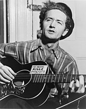
Roll on, Columbia, roll on, roll on, Columbia, roll on / Your power is turning our darkness to dawn / Roll on, Columbia, roll on. ボンヌビル電力事業団の依頼で書き起こされた、ウディ・ガスリーのロールオン・コロンビアの歌詞
コロンビア川の豊かな水量と、大きな平均勾配︵1キロメートル当り40.9センチメートル︶は、水力発電に極めて適している。ちなみにミシシッピ川の平均勾配は1キロメートル当り12.3センチメートルに過ぎない。コロンビア川単独で、全米の潜在水力発電量の3分の1を占める[121]。
150もの水力発電計画のなかで最大級のグランドクーリーダムとチーフ・ジョゼフ・ダムは、合衆国内でみても最大規模であり[122][123]、世界全体で見ても同様である[124]。
アルミニウムの原料と成るボーキサイトを精製する過程で大量の電力を必要とするアルミニウム産業が、水力発電がもたらす安価な電気を求めてこの地域に根づいた。2000年までに合衆国北西部で生産されたアルミニウムは、世界全体の17パーセント、合衆国内で40パーセントに達する[125]。しかし21世紀初頭に実施された電力自由化と川の発電量を引き下げる旱魃が組み合わさり、業界にダメージを与えた。2001年、コロンビア川周辺のアルミニウム業者は、その生産設備の80パーセントを休止し、2003年には合衆国の世界全体におけるアルミニウムの生産比率が15パーセントまで低下し、コロンビア川流域のアルミ精錬業者は多くが休業や廃業に追い込まれた[126][127]。
コロンビア川周辺では、電力は比較的安価な状態を保っており、近年は Google 等のハイテク産業が低コストな電力を利用するために、サーバファームをこの地域へ移転させている[128]。
グランドクーリーより下流では、流量を維持し洪水調節や水力発電を確実にするために、それぞれのダムの貯水池はボンネビル電力事業団︵BPA︶と陸軍工兵隊、およびワシントン州内のさまざなま公共事業管轄区によって緊密に統制されている。徐々に、水力発電事業の運営は合衆国絶滅危惧種法と、鮭などの魚類への影響を最小限にするための運営管理に関する別の協定が定める基準を満たすよう求められている。また、環境保護や釣魚グループが、コロンビア川最大の支流であるスネーク川下流部の4つのダムを撤去するよう活動している[129]。
1941年、BPA は水力発電の利点を広報するドキュメンタリ映画[130]のために、オクラホマ州のフォークシンガー、ウディ・ガスリーへ歌曲の提供を依頼した。ガスリーはこの地域を旅した一月のうちに26曲を書き上げ、後に地域の文化史において重要な部分を占めることとなった[131][132]。

デシューツ川とコロンビア川の合流点の風景
コロンビア川には主要なものだけでも60以上の支流が存在し、直接コロンビア川に繋がる支流の中でも特に大きな4つの川︵水量または流域面積で測定︶は、スネーク川︵アイダホ州︶、ウィラメット川︵オレゴン州北西部︶、クートネー川︵ブリティッシュ・コロンビア州︶、ペンド・オレイル川︵ワシントン州北部およびアイダホ州、ただしクラーク・フォーク川の下流部分も含む︶である。これらの4つの川はいずれも平均水量が570 m3/s以上、排水地域の面積が52,000 km2以上となっている。
スネーク川はその中でも最大の支流である。流域面積の280,000 km2は、アイダホ州の面積をも上回る。この川とコロンビア川が合流する地点においては両者の水量はほぼ同等︵約46.5%︶となっており、合流地点より上流の部分についてだけを見てみれば長さ︵約113%︶、流域面積︵約104%︶ともにスネーク川がコロンビア川を上回っている。
ペンド・オレイル水系︵主要な支流、クラーク・フォーク川、フラットヘッド川を含む︶はコロンビア川との合流地点においては、両者は同等の大きさとなっている。合流地点より上流部分について比較してみると、長さは同程度︵約86%︶、流域面積は4分の3︵約76%︶、水量については3分の1強︵約37%︶である。
水力発電[編集]

支流[編集]

主な支流一覧[編集]
下流より記載
- カウリッツ川
- カラマ川
- ルイス川
- ウィラメット川
- サンディ川
- フッド川
- デシューツ川
- ジョン・デイ川
- スネーク川
- ヤキマ川
- ワナッチー川
- オカノガン川
- スポケーン川
- ケトル川
- ペンド・オレイル川
- クートネー川
- キッキング・ホース川
主な支流のデータ[編集]
| 主な支流 | 平均水量 | 流域面積 | 長さ | ||
|---|---|---|---|---|---|
| カウリッツ川 | 259 | m3/s [133] | 6,700 | km2 [134] | 169 km |
| ルイス川 | 173 | m3/s [135] | 2,710 | km2 [136] | 153 km |
| ウィラメット川 | 1,060 | m3/s [8] | 29,680 | km2 [137] | 301 km |
| サンディ川 | 64 | m3/s [138] | 1,316 | km2 [139] | 90 km |
| フッド川 | 28 | m3/s | 723 | km2 | 40 km |
| デシューツ川 | 166 | m3/s [140] | 27,700 | km2 [141] | 406 km |
| ジョン・デイ川 | 58 | m3/s [142] | 20,750 | km2 [143] | 452 km |
| スネーク川 | 1,610 | m3/s [8] | 278,400 | km2 [144] | 1,674 km |
| ヤキマ川 | 100 | m3/s [145] | 15,900 | km2 [146] | 344 km |
| ワナッチー川 | 87 | m3/s [147] | 3,500 | km2 [141] | 85 km |
| オカノガン川 | 86 | m3/s [148] | 21,600 | km2 [149] | 185 km |
| スポケーン川 | 224 | m3/s [150] | 17,300 | km2 [141] | 179 km |
| ケトル川 | 83 | m3/s [151] | 10,880 | km2 [152] | 282 km |
| ペンド・オレイル川 | 748 | m3/s [153] | 66,800 | km2 [154] | 209 km |
| クートネー川 | 868 | m3/s [155] | 50,300 | km2 [156] | 780 km |
出典・脚注[編集]
(一)^
“The Atlas of Canada: Toporama – Topographic Maps” [カナダの地図‥Toporama-地形図] (英語). カナダ天然資源省 (2006年). 2009年9月2日閲覧。
(二)^
Kowalski, Peter (2001年3月7日). “Health consultation” [健康相談] (英語). Colville Federated Tribes. アメリカ合衆国保健福祉省. 2007年11月8日閲覧。
(三)^ abc
“Columbia Basin Project” [コロンビア盆地計画] (英語). アメリカ合衆国内務省水利再生利用局 (2009年). 2009年9月2日閲覧。
(四)^
“Oregon's Publicly-Owned Waterways” [オレゴン州公有水路] (英語). Public Ownership of Submerged and Submersible Land. オレゴン州土地管理局. 2008年3月9日閲覧。
(五)^ “Columbia River Gorge National Scenic Area” [コロンビア川峡谷国立シーニックエリア] (英語). アメリカ合衆国農務省林野局. 2007年12月9日時点のオリジナルよりアーカイブ。2007年12月9日閲覧。
(六)^ Jacklet, Ben (2004年10月19日). “Columbia pilot pay attracts port's eye [コロンビア川の水先案内人の報酬は港湾の耳目を惹きつける]” (英語). ポートランド・トリビューン 2007年6月14日閲覧。
(七)^ Gibbs, Rafe (1954年5月). “Guarding the Graveyard of Ships [船の墓場を警備する]” (英語). Popular Mechanics: 128-32 2012年3月1日閲覧。.
(八)^ abcdef
Kammerer, J.C. (1990年5月). “Largest Rivers in the United States” [合衆国の最大の川] (英語). アメリカ地質調査所. 2008年4月1日閲覧。
(九)^ abcd
Lang, Bill (2008年). “Columbia River” [コロンビア川] (英語). コロンビア川歴史センター. 2008年4月2日閲覧。
(十)^ この値はカナダ天然資源省の“Atlas of Canada”にあった河川リストから導き出されている。
(11)^
“Frequently Asked Questions About Canada” [カナダに関するよくある質問] (英語). The Atlas of Canada (2008年). 2008年9月7日閲覧。
(12)^ “Columbia Wetlands | Ramsar Sites Information Service”. rsis.ramsar.org (2005年6月5日). 2023年4月10日閲覧。
(13)^
Gerber, Michele (1992年). “Legend and Legacy: Fifty Years of Defense Production at the Hanford Site” [伝説と遺産‥ハンフォード・サイトにおける国防産業の50年] (英語). ワシントン大学、太平洋北西岸研究センター. 2008年1月26日閲覧。
(14)^
“Discover Canada Through National Maps and Facts: Rivers” [地図と事実を通してカナダを発見‥河川] (英語). The Atlas of Canada. カナダ天然資源省 (2008年). 2008年9月7日閲覧。
(15)^ abc
“USGS Real-Time Water Data for USGS 14105700 Columbia River at the Dalles, OR” [USGS リアルタイム水流データ‥コロンビア川、オレゴン州ザ・ダルズ (USGS 14105700)] (英語). アメリカ地質調査所. 2008年8月6日閲覧。
(16)^
NOAA Center for Operational Oceanographic Products and Services (2013年). “NOAA Tide Predictions” [NOAA 潮汐予想] (英語). 合衆国商務省. 2015年4月8日閲覧。
(17)^
Bishop, Ellen Morris (2003) (英語). In Search of Ancient Oregon: A Geological and Natural History [太古のオレゴンを調べて‥地理・自然史]. オレゴン州ポートランド: Timber Press. pp. 13-14. ISBN 978-0-88192-789-4
(18)^
“Columbia River Basin, Washington:” [ワシントン州、コロンビア川流域] (英語). アメリカ地質調査所 (2002年). 2008年10月27日閲覧。
(19)^ ab
“The Geologic History of the Columbia River Gorge” [コロンビア川峡谷の地質史] (英語). アメリカ地質調査所 (2001年). 2008年4月2日閲覧。
(20)^ Bishop 2003, p. 98.
(21)^ ab
“Columbia Plateau and Columbia River Basalt Group” [コロンビア川台地とコロンビア川玄武岩層群] (英語). United States Geological Survey (2003年). 2008年10月1日閲覧。
(22)^
“Glacial Lake Missoula and the Missoula Floods” [ミズーラ氷河湖とミズーラ洪水] (英語). United States Geological Survey. 2009年9月3日閲覧。
(23)^ Bishop 2003, pp. 226–229.
(24)^ ab
Stelling, Peter L.; David S. Tucker (2007) (英語). Floods, Faults, and Fire [洪水と断層、火災]. 全米測地協会. pp. 213-14, 230. ISBN 978-0-8137-0009-0
(25)^
Houck, Michael C.; Cody, M.J. (2000) (英語). Wild in the City [都市内の自然]. オレゴン歴史協会. ISBN 0-87595-273-9
(26)^ Bishop 2003, p. 227.
(27)^
Hill, Richard L. (1999年9月9日). “Radiocarbon dates indicate the Bonneville Landslide may be far younger than thought [放射性炭素年代測定の結果は、ボンネビル地すべりの年代がこれまでの想定よりもかなり最近であることを示す]” (英語). オレゴニアン 2009年9月7日閲覧。
(28)^ abc
Reynolds, Nathaniel D. (December 2001). “Dating the Bonneville Landslide with Lichenometry [地衣計測法によるボンネビル地すべりの年代]” (英語) (PDF). Washington Geology 29 (3/4): 11-16 2009年9月7日閲覧。.
(29)^
Hill, Richard L. (2002年5月15日). “Science – Landslide Sleuths [科学-地すべり探偵]” (英語). オレゴニアン. オリジナルの2009年9月6日時点におけるアーカイブ。 2009年9月7日閲覧。
(30)^
O'Connor, Jim E. (September 2004). “The Evolving Landscape of the Columbia River Gorge: Lewis and Clark and Cataclysms on the Columbia [コロンビア川の変わる景観‥ルイスおよびクラークとコロンビアの大変動]” (英語). オレゴン歴史協会四季報 105 (3). JSTOR 20615448.
(31)^ ab
Norman, David K. (2004年3月). “A Self-Guided Tour of the Geology of the Columbia River Gorge—Portland Airport to Skamania Lodge, Stevenson, Washington” (PDF) [コロンビア川峡谷の地質の一人旅-ポートランド空港からワシントン州スティーブンソン、スカマニア・ロッジまで] (英語). ワシントン州天然資源局地質・地下資源部. 2009年9月8日閲覧。
(32)^
Rybář, Jan; Josef Stemberk; Peter Wagner (2002) (英語). Landslides: Proceedings of the First European Conference on Landslides, Prague, Czech Republic, June 24–26, 2002 [地すべり‥2002年6月24日から26日まで、チェコ共和国プラハで開催されたヨーロッパで最初の地すべりカンファレンスの紀要]. テイラーアンドフランシス. p. 695. ISBN 978-90-5809-393-6
(33)^
“Mount St. Helens” [セント・ヘレンズ山] (英語). アメリカ地質調査所. 2008年9月10日閲覧。
(34)^
National Research Council (U.S.) (2004) (英語). Managing The Columbia River: Instream Flows, Water Withdrawals, and Salmon Survival [コロンビア川の管理‥河川内の流量、水の汲出、鮭の生存]. 全米アカデミー出版局. p. 18. ISBN 0-309-09155-1 2008年4月3日閲覧。 URLはGoogle ブックス
(35)^
Lemonick, Michael D.; Dorfman, Andre; Cray, Dan (2006-03-05). “Who Were The First Americans? [最初のアメリカ人は誰?]” (英語). タイム (タイム社) 2008年4月3日閲覧。.
(36)^
Pryce, Paula (1999) (英語). Keeping the Lakes Way [湖の道を守る]. カナダオンタリオ州: トロント大学出版局. p. 7
(37)^
Cooperman, Jim (2011年3月). “Shuswap: What's in a Name [シャスワップ‥名前にあるもの]” (英語) (PDF). Shuswap Market News
(38)^ abc
Oldham, Kit (2003年1月13日). “Captain Robert Gray becomes the first non-Indian navigator to enter the Columbia River, which he later names, on May 11, 1792.” [1792年5月11日、ロバート・グレイ船長は、彼が後に命名したコロンビア川を航行した最初のインディアン以外の人物となった。] (英語). The Online Encyclopedia of Washington State History. HistoryLink.org. 2008年4月1日閲覧。
(39)^
Hunn, Eugene S. (1990) (英語). Nch'i-Wàna: The Big River [Nch'i-Wàna‥大きな川]. ワシントン州シアトル: ワシントン大学出版局. p. 3. ISBN 0-295-96851-6
(40)^
Dove (Quintasket), Mourning (Christine) (1990) [1933] (英語). Coyote Stories [コヨーテの物語]. ネブラスカ大学出版局. pp. 100-101. ISBN 0-8032-8169-2
(41)^
Satterfield, Archie (2003) (英語). Country Roads of Washington [ワシントン州の田舎道]. Backinprint.com
(42)^
Dohnal, Cheri (2003) (英語). Columbia River Gorge: National Treasure on the Old Oregon Trail [コロンビア川峡谷‥古きオレゴン街道の国の宝]. Arcadia Publishing. pp. 12-14. ISBN 978-0-7385-2432-0 2009年9月11日閲覧。
(43)^
Clark, Ella E.; Robert Bruce Inverarity (2003) (英語). Indian Legends of the Pacific Northwest [太平洋北西岸におけるインディアンの伝説]. カリフォルニア大学出版局. pp. 20-25. ISBN 978-0-520-23926-5 2009年9月11日閲覧。
(44)^ ab
Meinig, D.W. (1995) [1968] (英語). The Great Columbia Plain [大コロンビア平原] (Weyerhaeuser Environmental Classic ed.). ワシントン大学出版局. pp. 23-25, 493, 496. ISBN 0-295-97485-0
(45)^ abBoyd 1996, pp. 12–13
(46)^
Ulrich, Roberta (2007) (英語). Empty Nets: Indians, Dams, and the Columbia River [空の網‥インディアンとダム、そしてコロンビア川]. オレゴン州コーバリス: オレゴン州立大学出版局. p. 8. ISBN 0-87071-469-4
(47)^ ab
Boyd, Robert (1996) (英語). People of the Dalles: The Indians of Wascopam Mission [ザ・ダルズの人々‥ワスコパム伝道のインディアン]. Lincoln: ネブラスカ大学出版局. pp. 4-7. ISBN 0-8032-1236-4
(48)^
Myron Eells (1910). “Review: Marcus Whitman, Pathfinder and Patriot [レビュー‥マーカス・ホイットマン、開拓者で愛国者]” (英語). Bulletin of the American Geographical Society (アメリカ地理学協会) 42 (4): 299. doi:10.2307/199162. JSTOR 199162.
(49)^
“Oregon History: Indian Wars” [オレゴン州の歴史‥インディアン戦争] (英語). Oregon Blue Book. 2009年9月3日閲覧。
(50)^ Ulrich 2007, p. 14
(51)^ Ulrich 2007, p. 6
(52)^
Barber, Katrine (2005) (英語). Death of Celilo Falls [セリロ滝の死]. ワシントン州シアトル: ワシントン大学出版局. pp. 20-21. ISBN 0-295-98546-1
(53)^
Netboy, Anthony (1980) (英語). The Columbia River Salmon and Steelhead Trout [コロンビア川の鮭とニジマス]. ワシントン州シアトル: ワシントン大学出版局s. p. 14. ISBN 0-295-95768-9‥人類学者フィリップ・ドラッカーの著作 Cultures of the North Pacific Coast が典拠となっている。
(54)^
Tate, Cassandra (2005年12月27日). “Kettle Falls” [ケトル滝] (英語). HistoryLink.org. 2015年6月23日閲覧。
(55)^
Willingham, William F.. “Cascade Locks” [カスケード閘門] (英語). Oregon Encyclopedia. 2009年9月8日閲覧。
(56)^
“Columbia River Fish Runs and Fisheries” (PDF) [コロンビア川における魚類の動向と漁業] (英語). ワシントン州魚類野生生物局及びオレゴン州魚類野生生物局. pp. 2-3, 6, 47, 62 (2002年8月). 2006年9月26日時点のオリジナルよりアーカイブ。2006年12月26日閲覧。
(57)^ ab
Wilkinson, Charles F. (2005) (英語). Blood Struggle: The Rise of Modern Indian Nations [地の苦しみ‥近代インディアン・ネーションの勃興]. ニューヨーク: W. W. Norton & Company. pp. 159, 165. ISBN 0-393-05149-8
(58)^
Cain, Allen (2007年9月). “Boils Swell & Whorl Pools [ボイルズ・スウェルとホール・プールズ]” (英語). オレゴン歴史協会四季報 108 (4). JSTOR 20615793.
(59)^
Ronda, James P. (1984) (英語). Lewis & Clark Among the Indians [インディアンの中のルイス・クラーク探検隊]. ネブラスカ州リンカーン: ネブラスカ大学出版局. ISBN 0-8032-8990-1 2008年4月3日閲覧。。URLはGoogle ブックス。
(60)^ ab
Dietrich, William (1995) (英語). Northwest Passage: The Great Columbia River [北西航路‥大コロンビア川]. ワシントン州シアトル: ワシントン大学出版局. p. 52. ISBN 0-295-97546-6
(61)^
“Columbia River History: Commercial Fishing” [コロンビア川の歴史‥商業漁業] (英語). 北西部電力自然保護委員会 (2010年). 2012年1月26日閲覧。
(62)^ ab
“The Oregon Story” [オレゴンの物語] (英語). Oregon Public Broadcasting (2001年). 2008年3月19日閲覧。
(63)^ Ulrich 2007, p. 5
(64)^ Ulrich 2007, p. 11
(65)^
Dietrich, William (1995) (英語). Northwest Passage: The Great Columbia River [北西航路‥大コロンビア川]. ワシントン州シアトル: ワシントン大学出版局. p. 376. ISBN 0-295-97546-6
(66)^ ﹁いかなるヨーロッパ人より遥か以前に、北西海岸に日本人あるいは中国人が到来していたことはほぼ確実である﹂Hayes, Derek (1999) (英語). Historical Atlas of the Pacific Northwest: Maps of Exploration and Discovery [太平洋岸北西部の歴史地図‥探検と発見の地図]. ワシントン州シアトル: Sasquatch Books. p. 9. ISBN 1-57061-215-3
(67)^ abcdefHayes, Derek (1999) (英語). Historical Atlas of the Pacific Northwest: Maps of Exploration and Discovery [太平洋岸北西部‥探検と発見の地図]. ワシントン州シアトル: Sasquatch Books. ISBN 1-57061-215-3
(68)^ “Cape Disappointment State Park” [ディスアポイントメント岬州立公園] (英語). 国立公園局 (2006年). 2009年9月4日閲覧。
(69)^ Denton, V.L. (1924) (英語). The Far West Coast [遙かなる西海岸]. トロント: J.M. Dent & sons, ltd. ISBN 978-1299984745
(70)^ Roberts, John E. (2005) (英語). A Discovery Journal: George Vancouver's First Survey Season – 1792 [探検日誌‥ジョージ・バンクーバーの最初の探検シーズン-1792年]. Trafford Publishing. p. 23. ISBN 978-1-4120-7097-3 2008年10月18日閲覧。 URL はGoogle ブックス。
(71)^ Loy, William G.; Stuart Allan; Aileen R. Buckley; James E. Meacham (2001) [1976] (英語). Atlas of Oregon [オレゴンの地図] (2nd ed.). オレゴン州ユージーン: オレゴン大学出版局. p. 24. ISBN 0-87114-101-9
(72)^ “Captain Robert Gray explores Grays Bay and charts the mouth of Grays River in May 1792” [ロバート・グレイ船長による1792年のグレイズ湾の探検とグレイズ川河口の水路図] (英語). HistoryLink.org. 2009年5月16日閲覧。
(73)^ Jacobs, Melvin C. (1938) (英語). Winning Oregon: A Study of An Expansionist Movement [オレゴンの勝利‥拡大運動の研究]. The Caxton Printers. p. 77
(74)^ Mockford, Jim (2005). “Before Lewis and Clark, Lt. Broughton's River of Names: The Columbia River Exploration of 1792 [ルイスとクラークの探検以前、ブロートン大尉の川の名前‥1792年のコロンビア川探検]” (英語). オレゴン歴史協会四季報 (オレゴン歴史協会) 106 (4). JSTOR 20615586.
(75)^ Friedman, Ralph (2003). In Search of Western Oregon. Caxton Press. pp. 304-05. ISBN 978-0-87004-332-1
(76)^ Meinig, D.W. (1995) [1968] (英語). The Great Columbia Plain [大コロンビア平原] (Weyerhaeuser Environmental Classic ed.). ワシントン大学出版局. pp. 73-79. ISBN 0-295-97485-0
(77)^ Mackie, Richard Somerset (1997) (英語). Trading Beyond the Mountains: The British Fur Trade on the Pacific 1793–1843 [山脈を越えた交易‥1793年~1843年の太平洋岸におけるイギリスの毛皮交易]. ブリティッシュコロンビア州バンクーバー: ブリティッシュコロンビア大学出版局. p. 318. ISBN 0-7748-0613-3
(78)^ “The Final Leg of the Trail” [街道の最終区間] (英語). End of the Oregon Trail Interpretive Center. 2008年10月12日時点のオリジナルよりアーカイブ。2015年6月28日閲覧。
(79)^ Meinig, D.W. (1995) [1968] (英語). The Great Columbia Plain [大コロンビア平原] (Weyerhaeuser Environmental Classic ed.). ワシントン大学出版局. pp. 72-73, 75, 117, 146-47, 169-70. ISBN 0-295-97485-0
(80)^ Reeder, Lee B.. “Open the Columbia to the Sea [コロンビア川を海とつなげる]” (英語). Center for Columbia River History 2008年4月3日閲覧。 URL は、E. P. Dodd 発行の Pendleton Daily Tribune誌へ1902年に掲載された記事の再版。
(81)^ “Crossing the Columbia Bar” (PDF) [コロンビア砂州の横断] (英語). Oregon State Marine Board. 2009年9月4日閲覧。
(82)^ Mackie, Richard Somerset (1997) (英語). Trading Beyond the Mountains: The British Fur Trade on the Pacific 1793–1843 [山脈を越えた交易‥1793年~1843年の太平洋岸におけるイギリスの毛皮交易]. ブリティッシュコロンビア州バンクーバー: ブリティッシュコロンビア大学出版局. p. 136. ISBN 0-7748-0613-3
(83)^ abcd“The Oregon Story: A Chronology of Ports in Oregon [オレゴンの物語‥オレゴン州の港湾年代記]” (英語). Oregon Public Broadcasting. (2007年1月18日) 2008年2月15日閲覧。
(84)^ Affleck, Edward L. (2000) (英語). A Century of Paddlewheelers in the Pacific Northwest, the Yukon, and Alaska [太平洋岸北西部、ユーコン、アラスカにおける外輪船の歴史]. ブリティッシュコロンビア州バンクーバー: Alexander Nicholls Press. p. 6. ISBN 0-920034-08-X
(85)^ Corning, Howard McKinley (1977) (英語). Willamette Landings [ウィラメット川の波止場] (2nd ed.). オレゴン州ポートランド: オレゴン歴史協会. ISBN 0-87595-042-6
(86)^ abTimmen, Fritz (1972) (英語). Blow for the Landing [上陸のための一吹き]. アイダホ州コードウェル: Caxton Printers. ISBN 0-87004-221-1
(87)^ Gibbs, James A (1964) (英語). Pacific Graveyard [太平洋の墓場] (3rd ed.). オレゴン州ポートランド: Binford & Morts
(88)^ “Rewind—Editorials from our archives: 1905: 40-ft. depth wanted [アーカイブからの再編集‥1905年‥水深40フィートを要求]” (英語). The Columbian. (2005年12月26日) 2008年9月11日閲覧。
(89)^ The Oregonian. (1895年1月1日)
(90)^ Scott, Harvey W.; Leslie M. Scott (1924) (英語). History of the Oregon Country [オレゴン・カントリーの歴史]. 3. Cambridge: Riverside Press. p. 190. ISBN 0-665-16710-5
(91)^ “The Dalles-Celilo Canal on Columbia River opens to traffic on May 5, 1915.”. HistoryLink.org. 2007年11月26日閲覧。
(92)^ “Supporting Columbia-Snake River Commerce” (PDF) [コロンビア-スネーク川商業利用の援助] (英語). Northwest RiverPartners. 2008年4月10日時点のオリジナルよりアーカイブ。2015年7月19日閲覧。
(93)^ Harris, Stephen L. (1988) (英語). Fire Mountains of the West: The Cascade and Mono Lake Volcanoes [西部の火の山‥カスケード山脈とモノ湖の火山]. モンタナ州ミズーラ: Mountain Press Publishing Company. p. 209. ISBN 0-87842-220-X
(94)^ “Hopper Dredges” [ホッパー浚渫] (英語). GlobalSecurity.org (2005年4月27日). 2008年4月3日閲覧。
(95)^ Koberstein, Paul; Durbin, Kathie (1990年1月21日). “Cleanup study already bogged in controversy [すでに論争の泥沼にはまりこんだ研究を一掃]” (英語). オレゴニアン
(96)^ abcKoenninger, Tom (2007年3月7日). “Dredging Columbia a very big job [コロンビア川の浚渫はかなりの大仕事]” (英語). コロンビアン 2008年9月11日閲覧。
(97)^ Columbian editorial writers (2006年8月26日). “In our view ? monitor the dredging [視点‥浚渫の監視]” (英語). コロンビアン 2008年9月11日閲覧。
(98)^ Robinson, Erik (2006年3月3日). “State rebukes Corps of Engineers over oil spill [州は油を流出させた工兵隊を避難]” (英語). The Columbian 2008年9月11日閲覧。
(99)^ “Columbia River channel deepening - maintenance needed to maximize benefits” (PDF) [コロンビア川の水路の水深を増やす-利益を最大化するためにはメンテナンスが必要] (英語). Pacific Northwest Waterways Association. 2013年1月23日閲覧。
(100)^ “Bush budget offers $15 million for dredging [ブッシュの予算案は浚渫に1500万ドルを計上]” (英語). The Columbian. (2006年2月8日) 2008年9月11日閲覧。
(101)^
“Wild salmon 1: Species declining fast [野生の鮭1‥種が急速に減少している。]” (英語). Morning Edition (National Public Radio). (1991年6月10日) 2008年3月20日閲覧。
(102)^ King, Anna (2007年10月2日). “The Modern Day Columbia River – Part Two: Still Waters Run Deep And Deadly For Columbia River Salmon [今日のコロンビア川-パート2‥未だに水は深く流れ、コロンビア川の鮭にとって危険]” (英語). Oregon Public Broadcasting 2008年3月20日閲覧。
(103)^ “Bureau of Reclamation – About Us” [土地改良局について] (英語). 合衆国内務省、土地改良局 (2008年). 2008年4月3日閲覧。
(104)^ “Grand Coulee Dam” [グランドクーリーダム] (英語). U.S. Bureau of Reclamation (2009年). 2009年9月4日閲覧。
(105)^ ab“Floods and flood control” [洪水と洪水調節] (英語). Northwest Council. 2008年10月6日閲覧。
(106)^ Schmidt, Emerson P. (1931年2月). “The Movement for Public Ownership of Power in Oregon [オレゴン州における発電所の公有化の動き]” (英語). The Journal of Land & Public Utility Economics 7, No. 1 (1): 57. JSTOR 3138633.
(107)^ Dick, Wesley Arden (1989年秋季-冬季). “When Dams Weren't Damned: The Public Power Crusade and Visions of the Good Life in the Pacific Northwest in the 1930s [ダムはいつから非難されなくなったのか‥1930年代の太平洋岸北西部における電力公有化改革、快適な生活のヴィジョン]” (英語). Environmental Review (Forest History Society and American Society for Environmental History) 13 (3/4): 122. JSTOR 3984393.
(108)^ “[コロンビア川条約‥歴史と2014年及び2024年の見直し]” (英語) (PDF) Columbia River Treaty: History and 2014/2024 Review. ボンネビル電力委員会及びアメリカ陸軍工兵隊. (2008年4月).
(109)^ “Priest Rapids Hydroelectric Project FERC No. 2114 Public Utility District No. 2 of Grant County Final Application for New License, Exhibit B: Project Operation and Resource Utilization” (PDF) [グラント郡第2公共事業管轄区 プリースト急流水力発電計画 FERC 第2114号 新規認可最終申請書] (英語) (2003年10月). 2013年1月17日時点のオリジナルよりアーカイブ。2008年10月5日閲覧。
(110)^ “Treaty relating to cooperative development of the water resources of the Columbia River Basin (with Annexes)” [コロンビア川盆地における水資源の共同開発に関する条約︵補遺あり︶] (英語). コロンビア川歴史センター. 2009年9月4日閲覧。
(111)^ “Dams of the Columbia Basin & Their Effects on the Native Fishery” [コロンビア川盆地のダムと先住民の漁業に対する影響] (英語). コロンビア川歴史センター. 2009年9月4日閲覧。
(112)^ abPitzer, Paul (1994) (英語). Grand Coulee: Harnessing a Dream [グランドクーリー‥夢を役立てる]. ワシントン州プルマン: ワシントン州立大学出版局. ISBN 978-0-87422-110-7
(113)^ Egan, Timothy ︵ティモシー・イーガン︶ (1990). The Good Rain. Knopf. p. 17. ISBN 0-394-57724-8
(114)^ National Research Council (U.S.) (2004) (英語). Managing The Columbia River: Instream Flows, Water Withdrawals, and Salmon Survival [コロンビア川の管理‥]. National Academies Press. pp. 4, 22. ISBN 0-309-09155-1 2008年4月3日閲覧。 URL は Google ブックス。
(115)^ Rosenberg, John (2000年7月19日). “Sacred and shared – clergy work to save Columbia River [神聖かつ共有された-コロンビア川を保全する聖職者の働き]” (英語). Christian Century
(116)^ “Celilo Falls and The Dalles Dam Historic Viewer” [セリロ滝及びザ・ダルズ・ダム歴史ビューアー] (英語). オレゴン歴史協会. 2009年9月4日閲覧。
(117)^ “Chief Joseph Dam” [チーフ・ジョゼフ・ダム] (英語). 土地利用規制センター. 2009年9月4日閲覧。
(118)^ “Chapter 2” (英語). Lake Roosevelt, Administrative History [ルーズベルト湖、行政史]. 合衆国内務省国立公園局. オリジナルの2007-07-16時点におけるアーカイブ。
(119)^ abHines, Sandra (2005年2月14日). “Tree-ring data reveals multiyear droughts unlike any in recent memory” [年輪データは近年の記録に見られない長年に渡る旱魃を示す。] (英語). ワシントン大学広報室. 2008年1月26日閲覧。
(120)^ McNiel, Michelle (2008年3月21日). “State cracking down on illegal frost-control dams [州は不法な霜対処用堰堤を厳しく取り締まっている。]” (英語). Wenatchee World
(121)^ Harden, Blaine (1996) (英語). A River Lost: The Life and Death of the Columbia [失われた川‥コロンビア川の生と死]. W.W. Norton & Company. p. 17. ISBN 0-393-03936-6
(122)^ “Renewable Energy Sources: A Consumer's Guide” [エネルギー源の更新‥利用者ガイド] (英語). 合衆国エネルギー省‥エネルギー情報事業団 (2004年). 2007年11月19日閲覧。
(123)^ “Chief Joseph Dam and Rufus Woods Lake” [チーフ・ジョゼフ・ダムとルーファス・ウッズ湖] (英語). 合衆国陸軍工兵隊 (2003年11月19日). 2008年4月3日閲覧。
(124)^ “World's Largest Hydroelectric Plants” [世界最大の水力発電施設] (英語). ピアソン・エデュケーション (infoplease.com) (2000年-2008年). 2008年4月1日閲覧。
(125)^ Kinsey Hill, Gail (2001年3月11日). “Aluminum industry powering down [アルミニウム産業は電力消費量を落としている]” (英語). The Oregonian
(126)^ Fehrenbacher, Gretchen (2003年2月23日). “Aluminum all but gone [アルミニウムはほとんど駄目になった]” (英語). The Columbian: p. E1 2008年9月11日閲覧。
(127)^ McCall, William (2002年11月22日). “BPA chief to detail strategy for troubled power broker [BPA︵ボンネビル電力事業団︶のチーフは、悪質な電力ブローカー対策の戦略を詳しく述べる]” (英語). The Columbian: p. C2 2008年9月12日閲覧。
(128)^ Markoff, John; Hansell, Saul (2006年6月14日). “Hiding in Plain Sight, Google Seeks More Power [丸見えの状況から隠れて、Google はさらなる電力を模索している]” (英語). ニューヨーク・タイムズ 2008年9月11日閲覧。
(129)^ Milstein, Michael (2007年12月11日). “Judge rips latest plan to help salmon [判事は鮭の保護に関する最新の計画を破棄する]” (英語). オレゴニアン
(130)^ Video: The Columbia (1949). 合衆国内務省. 1949. 2012年2月22日閲覧。
(131)^ Heinz, Spencer (2007年7月8日). “Rolling along the Columbia, driving for Woody Guthrie [コロンビア川に沿って、ウディ・ガスリーの足跡をたどる]” (英語). The Oregonian
(132)^ Morrow, Lance; Thornburgh, Nathan (2002年7月8日). “This Land Is Whose Land? [この土地は誰のもの?]” (英語). タイムズ 2008年4月4日閲覧。
(133)^ “Water-data report 2007: USGS 14243000 Cowlitz River at Castle Rock, WA” (PDF). United States Geological Survey (2007年). 2008年10月24日閲覧。 Discharge data taken from gauge 14243000 at Castle Rock, 17.3マイル (27.8 km) from the mouth, measuring the flow from about 2,238平方マイル (5,800 km2) or 85 percent of the total watershed.
(134)^ Calculated by summing subbasin sizes listed in Lower Columbia Tributaries, Northwest Power and Conservation Council; and Toutle Management Plan, Northwest Power and Conservation Council. Retrieved on 2008-09-16.
(135)^ Lower Columbia Fish Recovery Board (2004年12月). “Volume II – Subbasin Plan Chapter G – NF and EF Lewis” (PDF). Lower Columbia Salmon Recovery and Fish & Wildlife Subbasin Plan. Northwest Power and Conservation Council. 2008年10月14日閲覧。
(136)^ “Description: Lewis River Drainage, Mount St. Helens, Washington”. United States Geological Survey (1999年). 2008年10月14日閲覧。
(137)^ Willamette River Basin, Portland Bureau of Environmental Services (2008). Retrieved on 2008-09-16.
(138)^ “Water-Data Report 2007: 14142500 Sandy River Below Bull Run River, near Bull Run, OR” (PDF). United States Geological Survey (2008年). 2008年10月19日閲覧。 Discharge data from a gauge near Bull Run, 18.4マイル (29.6 km) from the mouth, measuring the flow from about 436平方マイル (1,130 km2), about 86 percent of the total watershed.
(139)^ Taylor, Barbara (1998年12月). “Salmon and Steelhead Runs and Related Events of the Sandy River Basin - A Historical Perspective” (PDF). Portland General Electric. 2008年10月12日閲覧。
(140)^ Loy, William G.; Allan, Stuart; Buckley, Aileen R, and Meacham, James E. (2001). Atlas of Oregon. Eugene, Ore.: University of Oregon Press. pp. 164-65. ISBN 0-87114-101-9
(141)^ abc“Boundary Descriptions and Names of Regions”. United States Geological Survey. 2008年9月10日閲覧。
(142)^ “Water-Data Report 2007: 14048000 John Day River at McDonald Ferry, OR” (PDF). United States Geological Survey (2007年). 2008年10月19日閲覧。 Discharge data from a gauge at McDonald Ferry, 20.9マイル (33.6 km) from the mouth, measuring the flow from about 7,580平方マイル (19,600 km2), about 95 percent of the total watershed.
(143)^ Powell, Russ; Delano, Kenneth (2004年). “John Day River Subbasin Fish Habitat Enhancement Project” (PDF). Bonneville Power Administration. 2008年10月18日閲覧。
(144)^ “USGS Water Resources of the United States: Boundary Descriptions and Names of Regions, Subregions, Accounting Units and Cataloging Units”. United States Geological Survey (2007年). 2008年9月16日閲覧。 Sum of Subregion 1704, Upper Snake, Subregion 1705, Middle Snake, and Subregion 1706, Lower Snake.
(145)^ “Yakima River and Esquatzel Coulee Basins and the Columbia River from Richland to Kennewick, Water Resources Data-Washington Water Year 2005” (PDF). United States Geological Survey. 2008年10月16日閲覧。 Discharge data from gauge 12510500 at Kiona, 29.9マイル (48.1 km) from the mouth, measuring the flow from about 91 percent of the total watershed.
(146)^ “Yakima Subbasin Plan Overview” (PDF). Northwest Power and Conservation Council. 2008年9月16日閲覧。
(147)^ “Wenatchee River Basin: 12459000 Wenatchee River at Peshastin, WA” (PDF). United States Geological Survey. 2008年10月16日閲覧。. Discharge data from gauge 12459000 at Peshastin, 21.5マイル (34.6 km) from the mouth, measuring the flow from about 1,000平方マイル (2,600 km2) or 77 percent of the total watershed.
(148)^ Water Data Report WA-05-1, chapter Okanagan River Basin. Retrieved on 2007-04-20. Discharge data taken at Malott, Washington, 17マイル (27 km) from the mouth, measuring the flow from about 8,080平方マイル (20,900 km2), about 97 percent of the total watershed.
(149)^ “Rivers”. Natural Resources Canada. 2008年9月10日閲覧。
(150)^ Benke, Arthur C.; Cushing, Colbert E. (2005). Rivers of North America. Academic Press. p. 650. ISBN 9780120882533 2008年10月16日閲覧。
(151)^ “Water-Data Report 2007: 12404500 Kettle River near Laurier, WA” (PDF). United States Geological Survey (2007年). 2008年10月18日閲覧。 Discharge data from a gauge near Laurier, 29.71マイル (47.81 km) from the mouth, measuring the flow from about 3,800平方マイル (9,800 km2), about 90 percent of the total watershed.
(152)^ Upper Columbia Subbasin Overview, Section 29, p. 8; Northwest Power and Conservation Council. Retrieved on 2008-09-16.
(153)^ “Water Data Report WA-05-1 Pend Oreille, Kettle, and Colville River Basins, and the Columbia River from the International Boundary to the confluence with the Spokane River” (PDF). United States Geological Survey (2005年). 2008年10月19日閲覧。 Discharge data taken from a gauge at the U.S.–Canada border, 16.1マイル (25.9 km) from the mouth, measuring data from about 25,200平方マイル (65,000 km2), about 98 percent of the total watershed.
(154)^ “Seven Mile Project Water use Plan” (PDF). BC Hydro (2006年12月8日). 2009年9月3日閲覧。
(155)^ Subbasin Overview, Kootenai Subbasin Plan, Northwest Power and Conservation Council
(156)^ The Rivers, Balance of Power: Hydroelectric Development in Southeastern British Columbia; Touchstones Nelson: Museum of Art and History. Retrieved on 2008-09-16.
