
ランカスター郡 (ペンシルベニア州)
| ペンシルベニア州ランカスター郡 | |
|---|---|
 ランカスター市にあるランカスター郡庁舎
| |
 郡のペンシルベニア州内の位置
| |
 州のアメリカ合衆国内の位置
| |
| 設立 | 1729年5月10日 |
| 郡庁所在地 | ランカスター |
| 最大の都市 | ランカスター |
| 面積 - 総面積 - 陸 - 水 |
2,549 km2 (984 mi2) 2,458 km2 (949 mi2) 91 km2 (35 mi2), 3.53% |
| 人口 - (2020年) - 密度 |
552,984人 |
| 標準時 | 東部: UTC-5/-4 |
| ウェブサイト | www |
ランカスター郡︵英: Lancaster County、地元では [ˈlæŋkəstər]︶は、アメリカ合衆国ペンシルベニア州の南東部に位置する郡である。人口は55万2984人︵2020年︶[1]。郡庁所在地はランカスターであり、同郡で人口最大の都市である。
ランカスター郡はランカスター都市圏を構成しており、その都市圏人口は国内361の都市圏の中で第99位である。ランカスター郡は人気のある観光地になっている。﹁アメリカの庭園スポット﹂[2]あるいは﹁ペンシルベニア・ダッチの国﹂という綽名がある。ペンシルベニア・ダッチという言葉は、18世紀と19世紀に、ウィリアム・ペンが提示した信教の自由を求めて移民してきたドイツ人︵ドイツ語でドイッツェ︶から派生した言葉である[3]。これら移民は肥沃な土壌と温暖な気候に惹きつけられて来た[4]。貧困から脱出することと、ドイツの政治的な不安定さも大きな要因だった。また宗教的迫害から逃れてきたフランスのユグノーや、イングランド人、ウェールズ人、スコットランド・アイルランド人[5]も18世紀初めに信教の自由を求めて移住してきた[6]。
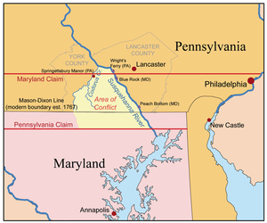
メリーランド・ペンシルベニア境界紛争、 the conflict occurred in the Conejohela Valley with the northern apex just north of the mid-river Coejohela Flats islands, south of Wrightsville, Pennsylvania, which are now inundated after the Safe Harbor Dam flooded the upper Coejoheala under Lake Clarke.
ペンシルベニア植民地の南側境界、すなわちランカスター郡の南側境界は長年境界紛争の対象とされ、1730年にサスケハナ川を渡すライトの渡しが造られた時から9年間にわたる武装衝突に発展した。メリーランド植民地領主ボルチモア卿は、その勅許された領地[14]が北緯40度線まで伸びていると考えた[15]。この線が有効であれば、ランカスターやウィロウストリートの町を半分に区切り、フィラデルフィアはメリーランドの中に入ることになった。
1730年初期に、突然サスケハナ川を渡って開拓者が流入し、ライトの渡しに免許が出されて正式に運航が始まったことで、ボルチモア卿の手下であるトマス・クレサップがこの年半ばにピーチボトムやコロンビア︵当時は名前がまだ無くその後ライツフェリーと呼ばれるようになった︶近くの入植されたばかりの農園を押収し始めた。ボルチモア卿はこれらの土地から収入を得ることを期待していた。1721年以来、その領土が北緯40度線まで伸びているとするサスケハナ川西岸の領有権は防衛できると考えていた。ペンシルベニア人が反抗の動きなしに彼の土地に入植し、入植に対する反論も無ければ、危険にさらされる可能性もあった。
クレサップ大尉の当初の行動は当たり障りの無いものであり、コーンジョヘラの上流に第2の渡しを設立し、そこはジョン・ライトの渡しからは下流だが、クレサップの義父の入植地ピーチボトムに近かった。入植者にはそこから出ていくか、メリーランドに土地の利用料を払うことを要求した。ここから事件が起こり、間もなくクレサップの戦争が始まった。クレサップは農園を破壊し、家畜を殺し、開拓者をヨーク郡南部やランカスター郡に追い出し、土地を自分の追随者に与え始めた。追随者の1人が逮捕されると、メリーランド人はランカスターの勾留所を破ってその者を救い出した。
ボルチモア卿は1733年に妥協案を交渉したが、クレサップはそれを無視し、襲撃を続けた。1734年にクレサップは逮捕されそうになったが、その玄関前で1人の役人を殺した。ペンシルベニア植民地総督はメリーランドにクレサップを殺人容疑で逮捕することを要求した。メリーランド植民地総督はその代わりにクレサップを民兵隊の大尉に任命した。1736年、クレサップは遂に逮捕され、1737年まで投獄されていたが、ここで国王が介入した。1750年、裁判所の判決が出て、ボルチモア卿は南北の幅12マイル (32 km) の帯状地を失うことになった[15]。ペンシルベニアとメリーランドの新しい境界は、1767年にメイソン=ディクソン線として最終的に設定された。

タデウス・スティーブンス

ペンシルベニア・ダッチのフラクター洗礼証明書、1788年
●フラクター︵ドイツ字体︶、18世紀と19世紀に発展した手書き装飾文字、ドイツのボールド体にヒントを得、エフラタのジャーマン・セブンスデイ・バプテスト、ヨハン・コンラッド・バイセルのクロイスターで始められた[37]
●最初の乾電池式時計、﹁ハミルトン・エレクトリック500﹂、ハミルトン時計会社が1957年に発売[38]
●ペンシルベニア・ロングライフル[39]、別名ケンタッキー・ロングライフル
●コーンストーガ・ワゴン、右側通行を始めた
●葉巻のストージー[40]、ストージーはコーンストーガを短縮した言葉
●アーミッシュのキルト、実用性に富む、1849年からランカスター郡で始められた[41]
歴史[編集]
ランカスター郡となった地域は、ウィリアム・ペンが1681年に勅許を受けた地域の一部であり[7]、1691年にジョン・ケナリーがペンから最初の権利譲渡を受けていた。マティアス・クライダーが1691年にはこの地域に入っていたとされているが、1710年以前に実際に入植されていたという記録は残っていない[8]。 ランカスター郡は当初チェスター郡の一部とされており、1729年5月10日に州内4番目の郡として設立された[9]。郡名はイングランドのランカシャー州にあるランカスター市から採られた。初期開拓者の1人であるジョン・ライトがそこの出身だった[10]。ランカスター郡の領域は現在よりもかなり広かった。その中から6つの郡がその全域あるいは一部を取って作られた。すなわち、バークス郡︵1752年︶、カンバーランド郡︵1750年︶、ドーフィン郡︵1785年︶、レバノン郡︵1813年︶、ノーサンバーランド郡︵1785年︶、ヨーク郡︵1749年︶である[9]。これら6郡からさらに多くの郡が作られていった。インディアン[編集]
この地域に住んでいたインディアン部族としては、ショーニー族、サスケハノック族、ガワニーズ族、レナペ族︵デラウェア族︶、ナンティコーク族がいた[11]。 サスケハナ川バレーの初期住人として記録が残っているのはイロコイ語族のサスケハノック族であり、その部族名はアルゴンキン語で﹁泥の多い川の人々﹂を意味した。その主要集落が﹁ケインストージ﹂と呼ばれたことからコーンストーガ族とも呼ばれ、その集落は英語でインディアンタウンとも呼ばれた。ヨーロッパ人開拓者からは友好的な部族と見なされ、キリスト教に改宗し、交易用にほうきや籠を制作し、子供にはお気に入りの隣人から名前を付けていた[12]。 しかし1763年夏にポンティアック戦争が起こり、これに植民地政府の和解と軍事力を使った実効の上がらない政策が組み合わされ、フロンティアにおけるインディアン部族すべてに対する疑念と憎しみが生じた。1763年12月14日、マシュー・スミスとラザラス・スチュワート大尉が率いたパクストン・ボーイズがインディアン集落に侵入し、そこにいた6人のインディアンを殺し、その家を焼いた。インディアンの生存者14人が保護のために郡監獄に収容されていたが、パクストン・ボーイズが12月27日に戻り、監獄に押し入り、残っていたインディアンを虐殺した。政府の制御には実効無く、この殺人者たちにはフロンティアで広く同調する心情があったことから、殺人者たちを見つけて逮捕しても無意味なものになった[13]。メリーランド・ペンシルベニア境界紛争[編集]

先祖の多様さ[編集]
ランカスター郡当初のタウンシップの名前はこの新郡の多様な開拓者の系列を反映していた[16]。ウェールズの名前はカーナーボンとイーストランピーターの2つ、インディアンの名前はイーストコカリコ、コーンストーガ、ペシュタンク︵またはパクストン︶の3つ、イングランドの名前はウォリック、ランカスター、マーティック、サズベリー、ソールズベリー、イーストヘンプフィールドの6つ、アイルランドの名前はイーストドンガル、イーストドラモア、デリー、リーコックの4つ、ドイツの名前がマンハイム、聖書からサウスレバノン、ドイツの姓であるグラーフあるいはグロフの英語版がアールだった[17]。
19世紀の政治家[編集]
ランカスター郡生まれの民主党員ジェームズ・ブキャナンは1856年に第15代アメリカ合衆国大統領に選ばれ[18]、大統領になった唯一のペンシルベニア出身者となっている。その生家であるウィートランドは現在、ランカスターの博物館になっている[19]。タデウス・スティーブンスは急進派共和党で著名であり、1849年から1853年までと1859年からその死の1868年までアメリカ合衆国下院議員を務めた[20]。スティーブンスは孤児院を開設するために5万ドルを遺した[21]。それが現在は州立のタデウス・スティーブンス工科カレッジに変わっている。ブキャナンもスティーブンスもランカスターで埋葬されている[22]。奴隷制度とクリスティアナ事件[編集]
ペンシルベニア州は1780年に奴隷制度を廃止したが、その歩みはゆっくりだった[23]。そのときの6,000人の奴隷は奴隷のままであり、その登録された子供たちは28歳の誕生日まで奴隷だった。最後の奴隷の子は1811年に生まれたヘイリーであり、1839年になって解放された[24]。1850年妥協の一部として逃亡奴隷法が制定されたときに、ペンシルベニア州は法的に自由州だった。 ランカスター郡はメイソン=ディクソン線のすぐ北にあり、地下鉄道 (秘密結社)の重要な停車駅になった。チャールズ・スポッツは17の駅を設立しており[25]、その中には隠し戸のある天井裏、地下の洞窟、オクトラロ・クリークに通じるレンガのトンネルもあった。 エドワード・ゴーサックはおそらく最も慈悲心のある者であり、その奴隷を殴ったことはなく、裕福なメリーランドの小麦農家として、20代の時に奴隷たちを解放した。閑散期には奴隷たちにどこでも働いて収入を得ることを認めた。小麦が無くなったことがあり、それは奴隷が地元農家に売り払ったものだったが、ゴーサックは元奴隷にその不正直さの責任があると考えた。ゴーサックは短気だったので、奴隷のノア・バリー、ネルソン・フォード、ジョージ・フォード、ジョシュア・ハモンドは恐れるようになり、ウィリアム・パーカーの農場に逃亡した。パーカーはクリスティアナに住むムラート︵白人と黒人の混血︶だった。29歳のパーカーはランカスター黒人自己防衛協会の会員であり、自分や地域で逃避先を求めた奴隷を守るために暴力を使うことで知られていた ゴーサックは4つの令状を取得し、4つの部隊を編制させ、その資産を取り戻すために別々に出発させた。ゴーサックはその過程で死亡し、他の者は負傷した。法的にその奴隷を取り戻す資格があったが、誰が暴力行為に関わったかは不明である。この事件は﹁クリスティアナ暴動﹂あるいは﹁クリスティアナ抵抗﹂、﹁クリスティアナ攻撃﹂、﹁クリスティアナ悲劇﹂と様々に呼ばれている。奴隷所有者達を恐怖に陥れた重要な時の1つだった。そこに多かったのは黒人であり、白人ではなかった。多くの者はアフリカ系アメリカ人の希望と誇りにこれが火を点け、その後の奴隷反乱に参加させることを恐れた。逃亡奴隷を当局に戻すのではなく逃亡を援助する方を連邦の犯罪とする法が出来たのも最初のときであり、これは奴隷の側に何の利益ももたらさなかった。この暴動は地域の人種間緊張を強めさせ、奴隷制度を廃止させる方向に動かさせた[26]。 1851年9月、大陪審はフィラデルフィアのモイアメンシング刑務所で審判を待っていた38人に対して正式起訴状を返還し、起訴を取り下げた。裁判に掛けられたのはカストナー・ハンウェイ1人だった。 カストナー・ハンウェイに事件の責任があったのかは明らかでない。彼は白人であり、現場に到着した最初の1人だった。ハンウェイとその馬は、ディッカーソン・ゴーサックとピアース博士の援護を行っており、ピアースは負傷した。ハンウェイは1851年11月15日、フィラデルフィアの連邦裁判所で裁判に掛けられた。その容疑は、連邦保安官クラインが拘束していた奴隷を逃がしたこと、逮捕に抵抗したこと、謀議をはかったこと、反逆を図ったことだった。陪審員は15分間で無罪を宣告した。被告の弁護士5人の中の1人がタデウス・スティーブンスだった[27]。宗教の歴史[編集]
郡内に今も残る最古のヨーロッパ人移民住居は[28]、1719年に建設されたメノナイトの司祭ハンス・ハーのものである。1989年、ドナルド・クレイビルは、ランカスター郡で再洗礼派メノナイト移民の子孫であるプレーン派の中に、37の宗教団体と組織、289の信徒団と41,600人の洗礼会員を数えた[29]。アクロンにあるメノナイト・セントラル・コミッティは災害現場に最初に到着することが多く[30]、どこに救いの手を向けたらよいかを理解している地元団体に人手と物資を静粛に提供している[31]。 リティッツの町は当初1740年代初期にモラヴィア兄弟団の会員によって閉じられた社会として計画された。この町が成長し、隣人を受け入れるようになった。モラヴィア兄弟団は1746年に女子のためのリンデンホール学校を設立しており、国内で現在も運営が続けられている最初期の教育機関となっている[32]。 エフラタ・クロイスターに加えて、ユナイテッド・ブレスレン・イン・クライストとエバンゲリカル・ユナイテッド・ブレスレンは、1767年に、ウェストランピーター・タウンシップのオレゴンという小集落近く、アイザック・ロングの納屋で集会を開いたことが始まりだった[33][34]。エバンゲリカル・ユナイテッド・ブレスレンは1968年にイングランド・メソジスト教会と合流してユナイテッド・メソジスト教会となった[35]。 最初のユダヤ系住人はアイザック・ミランダであり、1730年、町と郡が組織される前に資産を所有していた。その10年後にはユダヤ系の家族数軒が町に住んでいた。1747年2月3日、アイザック・ヌナス・リカスとジョセフ・サイモンに対し、0.5エーカー (2,000 m2) の土地を﹁ランカスターとその周辺に入植したユダヤ人社会への信託﹂で、墓地として使われるべく権利譲渡が記録された。今日もこの墓地は利用されており[36]、アメリカで4番目に古いユダヤ人墓地と考えられている。 今日、ランカスター郡にはシナゴーグが3棟ある。オーソドックス・デジェル・イスラエル、コンサーバティブ・ベス・エル、リフォーム・シャーライ・ショメイムである。2003年ラビのエラザー・グリーンとシラ・グリーンがシャバド・ルバビッチ運動の支所、シャバド・ジューイッシュ・エンリッチメント・センターを設立し、フランクリン・アンド・マーシャル・カレッジのユダヤ人学生に奉仕し、また特別の宗教礼拝で地域社会に奉仕することを目指している。さらに大きなジューイッシュ・コミュニティセンターは、保育所があり、パーティホールもある。ランカスター・ミクバ協会はデジェル・イスラエルの土地でミクワーを行っている。セントラル・ペンシルベニア・コーシャー・スタンドは、季節によるアミューズメントパークであるダッチ・ワンダーランドで運営されている。 ランカスター郡にはフランスのユグノーも入植した。その初期住人の中にアイザック・ルフィバーがおり、ペキーア・クリーク地域に他のユグノー開拓者集団と共に入植した。発明[編集]

政治[編集]
政党の支持[編集]
共和党がランカスター郡で州、郡、市の選挙で選ばれる役人の多数を支配している[42]。郡内の登録有権者数でも多数を維持している。 2008年9月、民主党は、ランカスター郡始まって以来の登録有権者数10万人を記録した[42][43]。2004年時点では 82,171 人だった[42]。2008年では共和党に対する比率が1対1.8であり、1990年代後半では1対3だったことからはかなり前進した[42]。| ランカスター郡での大統領選挙の結果 | |||||||||
|---|---|---|---|---|---|---|---|---|---|
| 民主党 | 共和党 | ||||||||
| 登録者数 | 投票数 | 登録者数 | 投票数 | ||||||
| 1980年 | 40505 | 29.86% | 30026 | 27.30% | 95124 | 70.14% | 79963 | 72.70% | |
| 1984年 | 47235 | 29.31% | 31308 | 24.01% | 113906 | 70.69% | 99090 | 75.99% | |
| 1988年 | 41919 | 26.91% | 38982 | 28.67% | 113843 | 73.09% | 96979 | 71.33% | |
| 1992年 | 47206 | 28.03% | 44255 | 33.35% | 121190 | 71.97% | 88447 | 66.65% | |
| 1996年 | 56036 | 28.27% | 49120 | 34.59% | 142170 | 71.73% | 92875 | 65.41% | |
| 2000年 | 67932 | 29.01% | 54968 | 32.17% | 166272 | 70.99% | 115900 | 67.83% | |
| 2004年 | 74328 | 33.59% | 145591 | 65.80% | |||||
| 2008年 | 99586 | 43.44% | 126568 | 55.21% | |||||
| Source: The Committee of Seventy | |||||||||
ランカスター郡はアメリカ合衆国下院議員ペンシルベニア州第7および第16選挙区に属し、2013年時点ではいずれも共和党議員を選出している。ペンシルベニア州議会上院では第13、第36および第48選挙区に属しており、下院では第37、第41、第43、第96、第97、第98、第99および第100選挙区に属している。2013年時点で上院は共和党が3人、下院も1人を除いて共和党が独占している。

 州間高速道路76号線︵ペンシルベニア・ターンパイク︶、
 アメリカ国道30号線︵リンカーン・ハイウェイ︶、
 アメリカ国道222号線、
 アメリカ国道322号線が通っている。 ペンシルベニア州道では、
 ペンシルベニア州道10号線、
 ペンシルベニア州道23号線、
 ペンシルベニア州道41号線、
 ペンシルベニア州道72号線、
 ペンシルベニア州道230号線、
 ペンシルベニア州道241号線、
 ペンシルベニア州道272号線、
 ペンシルベニア州道283号線、
 ペンシルベニア州道324号線、
 ペンシルベニア州道340号線、
 ペンシルベニア州道272号線、
 ペンシルベニア州道441号線、
 ペンシルベニア州道462号線、
 ペンシルベニア州道472号線、
 ペンシルベニア州道501号線、
 ペンシルベニア州道625号線、
 ペンシルベニア州道741号線、
 ペンシルベニア州道743号線、
 ペンシルベニア州道772号線、
 ペンシルベニア州道896号線、
 ペンシルベニア州道897号線、
 ペンシルベニア州道999号線が通っている[56]。
地理[編集]
アメリカ合衆国国勢調査局に拠れば、郡域全面積は984平方マイル (2,548.5 km2)であり、このうち陸地949平方マイル (2,457.9 km2)、水域は35平方マイル (90.6 km2)で水域率は3.53%である[44]。水域[編集]
郡領域の大半はチェサピーク湾水系にあり、サスケハナ川に集められている。例外はブランディワイン・クリーク西支流の無名支流であり、ソールズベリー・タウンシップ東部に発し、デラウェア川水系になっている[45]。主要河川はコーンストーガ川、リトルコーンストーガ・クリーク、ペキーア・クリーク、チックス・クリーク、コカリコ・クリーク、オクトラロ・クリーク、コノウィンゴ・クリークである[46]。保護地域[編集]
郡内にはサスケハノック州立公園がある。ドラモア・タウンシップのサスケハナ川を見下ろす広さ224エーカー (0.91 km2) である[47]。ウィリアム・ペン州有林を構成する3か所の1つであり、火の見櫓がある広さ10エーカー (0.04 km2) の場所は、レバノン郡境に近いペン・タウンシップ北部にある。この場所は1923年建設の火の見櫓と共に、1935年に州の所有になった[48]。 狩猟、罠猟、釣りのための州立ゲームランドは6か所ある[49]。 郡南部境界は保護された蛇紋岩地帯であり、土壌中の毒性ある金属が植物の生育を阻害し、自然の草原とサバンナになっている珍しい生態系である。この地帯には自然管理委員会が管理する私有地ニューテキサスサーペンタイン・バーレンが入っている[50]。またランカスター郡自然保護局が所有管理しハイキングコースのある保護地、ロックスプリングス自然保護地も入っている[51]。 ランカスター郡は農地保護でも国内をリードする存在である。ランカスター農地信託、ランカスター郡農業保護委員会などの組織や、多くの自治体が共同で土地を所有して農場を保存し、保護地役権を設定することで将来の世代に生活様式を残している。保護地役権は不動産開発、商業と工業での利用、その他特定活動を制限し、被譲与者と土地所有者による相互合意に基づいている。土地所有者はその開発権を諦めることで、資産の管理と所有を続け、かなりの所得税減税を受けている。保護地役権はその土地が永遠に農業のために残されることを保証している。ランカスター農地信託は民間の非営利組織であり、郡内のアーミッシュやプレーン派と密接に協業して、その農園が農業的な価値を保持できるようにしている。ランカスター郡は、ランカスター郡農業保護委員会と共に、郡内で10万エーカー (400 km2) の土地を保存することを目指している。これは国内初のことである[52]。地震活動[編集]
ランカスター郡は北アメリカ東海岸に沿ったアパラチア山脈の主脈に沿ってある。古代の断層から起こる地震活動によってマグニチュード3から4の小さな地震が起こることがある。例えば2008年12月27日深夜の直後、マグニチュード3.3の地震が起こり、サスケハナ川バレーで広く感じられたが、建造物の被害は無かった[53]。交通[編集]
ランカスター郡はフィラデルフィアから州西部に向かう自然のルートに位置しており、これまでも多くの交通改良に関わってきた。なかでも1794年に建設されたフィラデルフィア・アンド・ランカスター・ターンパイク、後のリンカーン・ハイウェイ[54]、1820年に建設された運河、1834年に建設されたフィラデルフィア・アンド・コロンビア鉄道が重要だった[55]。主要高規格道路[編集]
郡内の幹線道路として、
 アメリカ国道30号線︵リンカーン・ハイウェイ︶、
 アメリカ国道222号線、
 アメリカ国道322号線が通っている。 ペンシルベニア州道では、
 ペンシルベニア州道10号線、
 ペンシルベニア州道23号線、
 ペンシルベニア州道41号線、
 ペンシルベニア州道72号線、
 ペンシルベニア州道230号線、
 ペンシルベニア州道241号線、
 ペンシルベニア州道272号線、
 ペンシルベニア州道283号線、
 ペンシルベニア州道324号線、
 ペンシルベニア州道340号線、
 ペンシルベニア州道272号線、
 ペンシルベニア州道441号線、
 ペンシルベニア州道462号線、
 ペンシルベニア州道472号線、
 ペンシルベニア州道501号線、
 ペンシルベニア州道625号線、
 ペンシルベニア州道741号線、
 ペンシルベニア州道743号線、
 ペンシルベニア州道772号線、
 ペンシルベニア州道896号線、
 ペンシルベニア州道897号線、
 ペンシルベニア州道999号線が通っている[56]。
鉄道[編集]
2006年時点でアムトラックの旅客鉄道が郡内を通っており、キーストーン・サービスおよびペンシルベニアンの2列車が通っている。これらの列車はキーストーン・コリダー︵キーストーン回廊、en:Keystone Corridor︶を経由し、ランカスター、マウントジョイ、エリザベスタウンに停車する。パラダイスにも新駅が計画されており、リーマンプレースとストラスバーグを繋ぐ観光列車を走らせるストラスバーグ鉄道との接続が企画されている。 貨物鉄道の主要運行会社はノーフォーク・サザン鉄道である。その幹線はサスケハナ川を辿り︵カナダ太平洋鉄道の通行権がある︶、マリエッタ近くのショックスミルズ橋で川を渡って、郡から出ていく。ノーフォーク・サザン鉄道はキーストーン・コリダーにも通行権があり、幹線からマリエッタで川沿いを北に走るロイアルトン支線により、またディラービルでコリダーからコロンビアで幹線に繋ぐコロンビア支線により、繋がれている。ノーフォーク・サザン鉄道の他の2支線もコリダーから出ている。ディラービルからマンハイムに向かいリティッツで終わるリティッツ第二次線と、コリダーから出てランカスターの東端を回り、東のニューホランドに向かい、イーストアールで終わるニューホランド産業線である。 幾つかの短線も運行されている。ストラスバーグ鉄道を除きすべてが貨物線である。イーストペン鉄道はノーフォーク・サザン鉄道のマンハイム支線から分岐し、ランカスター郡北東隅を長く走り、バークス郡に入る。ランディスビル・ターミナル・アンド・トランスファー会社は、アムトラックの線からランディスビルで分岐する。タイバーン鉄道はディラービル周辺の線を幾つか運行している。最近ではコロンビア・アンド・レディング鉄道が2010年1月にコロンビアでの2.5マイル(4 km) 路線の運行を始めた[57]。隣接する郡[編集]
ランカスター郡の北は、レバノン郡、北東はバークス郡、東はチェスター郡︵南東郡境はオクトラロ・クリーク︶と接している。南はメリーランド州セシル郡とハーフォード郡︵メイソン=ディクソン線︶と接している[58]。西はヨーク郡︵サスケハナ川が境となる︶、北東は ドーフィン郡︵コーンウェイゴ・クリーク︶と接している[56]。
|
ドーフィン郡 | レバノン郡 | バークス郡 |
|
| ヨーク郡 | チェスター郡 | |||
| ハーフォード郡 (メリーランド州)、セシル郡 (メリーランド州) |
| ||||||||||||||||||||||||||||||||||||||||||||||||||||||||||||||||||||||||||||||||||||||||||||||||||||||||||||||||||||||||||||||||||
| ||||||||||||||||||||||||||||||||||||||||||||||||||||||||||||||||||||||||||||||||||||||||||||||||||||||||||||||||||||||||||||||||||
ランカスター郡空港は定期便が発着する郡内唯一の空港である。スモークタウン空港は一般用途空港として使われている。
植物相と動物相 [編集]
ミューレンバーグイシガメは、植物学者ゴットヒルフ・ハイリッヒ・エルンスト・ミューレンバーグによって、ランカスター郡で初めて発見され分類された。ミューレンバーグは郡内の植物相を調査しているときに、偶然このカメを見つけた[61]。このカメは1801年にミューレンバーグカメと名付けられたが、1956年に現在の種名に改名された。大都市統計地域[編集]
アメリカ合衆国行政管理予算局はランカスター郡をランカスター大都市圏に指定してきた[62]。2012年7月1日時点でアメリカ合衆国国勢調査局はこの大都市圏をその人口で国内第101位に、また主要統計地域の第100位ランク付けしている[63][64]。人口動態[編集]
以下は2000年の国勢調査による人口統計データである。|
基礎データ
人種別人口構成
先祖による構成
|
年齢別人口構成
世帯と家族(対世帯数)
|
人口の5.58%、5歳から17歳の子供の8.37%は家庭で、ペンシルベニアドイツ語、あるいはドイツ語、オランダ語を話している。また人口の4.97%はスペイン語を話している[65]。
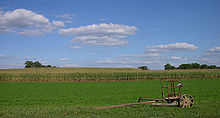
ランカスター郡の典型的な農園、馬に曳かせる農機具、後方はトウモロ コシ畑
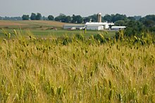
麦畑

アーミッシュの酪農場
農業はランカスター郡経済にとって重要な要素であり続ける可能性が高い。郡域の半分に相当する32万エーカー (1,300 km2︶が農業に用途指定されており、そのうち27万6,000エーカー (1,120 km2︶が﹁実質的農業地帯﹂であり、住民一人当たり20エーカー (0.08 km2︶以上と規定されている[77]。
ランカスターのセントラル・マーケット、人気のある観光地
地元観光担当の役人は、ハリウッドが観光業を救出するために踏み込んだのがデウス・エクス・マキナだとみている。1985年、ハリソン・フォードがフィラデルフィアの刑事ジョン・ブックを演じた映画﹃刑事ジョン・ブック 目撃者﹄では、殺人を目撃したアーミッシュの少年サミュエル・ラチェル・ラップを保護するために﹁プレーン﹂︵アーミッシュ︶を演じた。予想通り、ジョン・ブックは少年の母で未亡人のラチェル・ラップと恋に落ち、アーミッシュの未亡人を恋する英国人が直面する困難さについてロマンスの方がスリラーの要素を上回った[79]。この映画はアカデミー賞の8部門にノミネートされ、2つの賞を得た[80]。しかし、本当の勝者はランカスター郡の観光業であり、映画の鑑賞者はアーミッシュの生活に魅せられていた。
2011年9月11日のアメリカ同時多発テロ事件以後、ランカスター郡の観光業は再度変わってきた。それまでは家族で3、4日滞在するパターンだったが、今では特別の行事のために来ている。それは、﹁トウモロコシの迷路﹂であったり、機関車トーマスを見るためであったり、サートマが毎年開催する﹁世界最大のチキン・バーベキュー﹂であったり、あるいはサイト&サウンド・シアターの最新ショーを見るためであったりしている[78]。観光業はこの変化で減退したが、落ち込んではいない。

郡内に29か所ある屋根付き橋の1つ
郡内には歴史があり美しい屋根付橋が多く、それらを車で回る観光案内を出版することでも観光業を宣伝している[81]。州内には200を超える屋根付き橋が残っており、世界のどこよりも多い。ランカスター郡には29か所があり、州内では最多である[82]。
ランカスター郡コンベンションセンター公社[83]は、1億7,000万米ドルを掛けて[84]、市中心部のワット&シャンド・ビルがあった場所に会議場を建設することを進めているが、これについては議論が多い。この計画の支持者は市中心部の再活性化が促進されると考えている。反対者は納税者にとって受け入れがたいリスクを負うことになると見なしている[85]。
その他観光での目玉は、アメリカン・ミュージックシアター、ダッチ・ワンダーランド、エフラタ・クロイスター、エフラタ祭、ハンス・ハー邸、ランディスバレー博物館、ペンシルベニアダッチ・カントリー、ペンシルベニア・ルネッサンス・フェア[86]、ペンシルベニア鉄道博物館、ロック・フォード・プランテーション、ロバート・フルトン生誕地、サイト&サウンド・シアター、ストラスバーグ鉄道、ウィルバー・チョコレート、スタージス・プレッツェル邸がある。ランカスター中心街のウォーキングツアーなど歴史的な地域を巡る多くのツアーもある[87]。
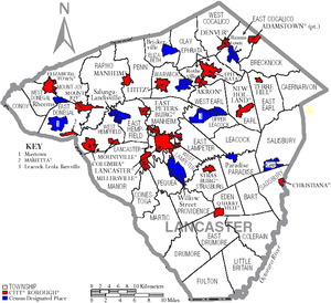
ランカスター郡の自治体、ボロは赤、タウンシップは白、国勢調査指定 地域は青
ペンシルベニア州法の下では4種類の自治体がある。市、ボロ、タウンシップ、町である。
宗教[編集]
●無宗教: 51% ●カトリック教: 9% ●再洗礼派: 8% ●メソジスト: 6% ●ルーテル教会: 5% ●ブレスレン: 2% ●ユナイテッド・チャーチ・オブ・クライスト: 2% ●長老派教会: 2% ●独立系教会: 1% ●ホリネス教会: 1% ●その他州境: 13% 全体で人口の28%はプロテスタントあるいは改革派プロテスタントである[66]。方言[編集]
郡民の中にはペンシルベニアドイツ語の影響を受けた方言を話すものがいる[67]。この方言はランカスター、レバノン、ヨーク各郡とハリスバーグ地域でよく使われている。方言だけでなく、述語体系にも取り込まれている。経済[編集]
2004年、ランカスター郡の一人当たり年収は30,790米ドルであり、全国平均の93%だった。これは郡の平均が前年より4.5%成長だったのに対し、全国平均は5.0%成長したためだった。収入は低いが、貧困線以下の人口比率は8.3%である、全国平均の12.5%を下回った。2004年、連邦政府がランカスター郡に使った支出は住民一人当たり4,199米ドルであり、全国平均の7,232米ドルよりかなり低かった[60]。 2005年、郡民の17.7%が製造業で雇用されており、この数字は州内全郡の第10位だった。州平均は13.7%であり、最大のクロウフォード郡でも25.1%だった[68]。 郡内には情報技術のマップクエストが本社を構えているにも拘わらず、情報技術者には遅れがある。労働力の1.3%を占めるに過ぎず、州内第31位である。州平均では2.1%となっている[69]。 管理職と金融関係職では州内第11位である。ただし、その労働力の12.5%を保持しているだけであり、州平均は12.8%である。多いのはチェスター郡の20.5%とモンゴメリー郡の18.5%である[70]。 専門職では17.3%であり、州内では第31位、州平均は21.5%である。これが多いのはセンター郡の31.8%であり、ペンシルベニア州立大学の存在が大きい。またフィラデルフィア郊外のモンゴメリー郡は27.2%である[71]。 サービス産業では労働力の13.3%に過ぎず、州内第34位、州平均は15.8%である。フィラデルフィア郡が20.5%で第1位である[72]。 2010年8月時点の失業率は7.8%だった。前年の7.6%からは上昇していた[73]。 郡内には11,000社の企業がある。2003年末時点で大きな製造業と物流業は、アクメマーケット、アルマックスミル・プロダクツ、アンビル・インターナショナル、アームストロング・ワールド・インダストリーズ、ボールマンハット、CNHグローバル、コーンストーガ・ウッド・スペシャリティーズ、ダート・コンテナ、ハイ・インダストリーズ、ランカスター研究所、ペパリッジファーム、R・R・ドネリー&サンズ、ザ・ハーシー・カンパニー、タイコ・エレクトロニクス、タイソン・フーズ、ワーナー・ランバート、イエロー・トランスポーテーションがある。 アンティ・アンズ、クリッパー・マガジン、ランカスター・ファーミング、マップクエスト、ターキーヒル・デイリー、クレアブラザース、ウィルバー・チョコレート・カンパニーがランカスター郡を本拠とする企業であり、地域経済や全国で名を成している。 ハーレイ・インダストリーズは、防衛産業と航空産業用にマイクロ波とミリ波製品を製造する地元企業である。

農業[編集]
ランカスター郡は国内でも最大級に肥沃で灌漑の無い土壌があり、これまで農業が盛んだった[74][75]。郡内の5,293の農園で年間8億米ドル相当の食糧、飼料を生産しており、州内農産物生産高の5分の1に近い。隣接するチェスター郡が高付加価値のマッシュルームを生産し3億7,500万米ドルで続いている[76]。 家畜の飼育でも州内8億米ドルのうち7億1,000万米ドルを挙げており、酪製品で2億6,600万米ドル、鶏肉と卵では2億5,800万米ドルとなっている。牛肉と豚肉はそれぞれ約9,000万米ドルである。
観光業[編集]
観光業も郡経済の重要な産業であり、47,000人を雇用している[78]。 1860年代、雑誌﹁アトランティック・マンスリー﹂と﹁リッピンコッツ・マガジン﹂が南北戦争後のランカスター郡で観光業を始めさせたが、実際にはリンカーン・ハイウェイが建設された1920年代が始まりだった。1952年に﹁ニューヨーク・タイムズ﹂に掲載された旅行記事では、25,000人の観光客をもたらした。1955年のブロードウェイ・ミュージカル﹃プレーン・アンド・ファンシー﹄がさらに多くを呼び込んだが、1974年のオイルショックと1979年スリーマイル島原子力発電所事故後に衰えを見せ、5年間は停滞していた[78]。

都市と町[編集]

都市[編集]
●ランカスター - 郡庁所在地ボロ[編集]
2010年時点でエフラタが最も人口の多いボロであり、クリスティアナが最も少ない[88]。
|
|
|
|
タウンシップ[編集]
|
|
|
|
|
国勢調査指定地域[編集]
国勢調査指定地域はアメリカ合衆国国勢調査局が人口統計データを取るために設定した地域である。州法の下では実際の司法権が及ぶ範囲ではない。村などその他の未編入領域も下記に挙げる。
|
|
|
|
未編入の町[編集]
|
|
|
教育[編集]
高等教育機関[編集]
- イースタン・メノナイト大学ランカスター校
- エリザベスタウン・カレッジ
- メサイア大学
- ハリスバーグ地域コミュニティ・カレッジ
- ランカスター・バイブル・カレッジ
- ランカスター神学校
- ミラーズヴィル大学
- ペンシルベニア美術デザイン・カレッジ
- タデウス・スティーブンス工科カレッジ
- ランカスター看護健康科学総合カレッジ

公共教育学区[編集]
- コカリコ教育学区
- コロンビア・ボロ教育学区
- コーンストーガバレー教育学区
- ドンガル教育学区
- 東ランカスター郡教育学区
- エリザベスタウン地域教育学区
- エフラタ地域教育学区
- ヘンプフィールド教育学区
- ランピーター・ストラスバーグ教育学区
- ランカスター教育学区
- マンハイム中央教育学区
- マンハイム・タウンシップ教育学区
- ペンマナー教育学区
- ペキーアバレー教育学区
- ソランコ教育学区
- ウォリック教育学区
チャータースクールとしては、ラ・アカデミア・チャータースクールがある。
独立系寄宿全日制女子校であるリンデンホールがリティッツにある。
さらに郡内には14の図書館、3つの支所、1つの移動図書館からなる連合図書館システムがある。ランカスター郡図書館システムは1987年4月に設立され、住人の多様なニーズに対応するために郡全体にわたる協調の取れたサービスとプログラムを提供して会員図書館を支援している。ランカスター郡郡政委員会がランカスター郡図書館システム委員7人を指名している。このシステムはペンシルベニア州の機関である。
脚注[編集]
(一)^ “Quickfacts.census.gov”. 2023年9月30日閲覧。
(二)^ Walbert, David J. (2002). Garden Spot: Lancaster County, Pennsylvania, the Old Order Amish, and the Selling of Rural America. Oxford University Press. pp. 272 pages. ISBN 0-19-514844-4 2006年8月21日閲覧。
(三)^ Introduction. Xroads.virginia.edu. Retrieved on 2010-12-23.
(四)^ lancaster, pa. Web.archive.org (2007-03-11). Retrieved on 2010-12-23.
(五)^ THE PENNSYLVANIA LEFEVRES. History and Genealogy Book accessed May 31, 2009
(六)^ "Historical papers and addresses of the Lancaster County Historical Society" County Historical Society pages 101–124. pub 1917
(七)^ The Avalon Project : Documents in Law, History and Diplomacy Archived 2015年4月5日, at the Wayback Machine.. Yale.edu. Retrieved on 2010-12-23.
(八)^ Martic Township. Horseshoe.cc. Retrieved on 2010-12-23.
(九)^ ab“Counties of Pennsylvania” (Index of 67 Pennsylvania County Histories). Pennsylvania State Archives. 2009年3月6日時点のオリジナルよりアーカイブ。2006年10月4日閲覧。
(十)^ Petition for the Establishment of Lancaster County Archived 2006年8月7日, at the Wayback Machine., February 6, 1728/9
(11)^ A Brief History of Lancaster County. Web.archive.org (1999-02-03). Retrieved on 2010-12-23.
(12)^ “Recollections written in 1830 of life in Lancaster County 1726–1782 and a History of settlement at Wright’s Ferry, on Susquehanna River”. 2011年10月9日閲覧。
(13)^ Hindle, Brooke (October 1946). “The March of the Paxton Boys”. The William and Mary Quarterly, 3rd Ser. 3 (4): 461–486. doi:10.2307/1921899. JSTOR 1921899.
(14)^ The Avalon Project : Documents in Law, History and Diplomacy Archived 2005年3月5日, at the Wayback Machine.. Yale.edu. Retrieved on 2010-12-23.
(15)^ abCECIL COUNTY MARYLAND: Where Our Mothers and Fathers Lie Buried. Freepages.history.rootsweb.com. Retrieved on 2010-12-23.
(16)^ Lancaster County Townships Archived 2006年10月18日, at the Wayback Machine.. Pa-roots.com. Retrieved on 2010-12-23.
(17)^ Lancaster County Historical Society. Web.archive.org (2008-01-05). Retrieved on 2010-12-23.
(18)^ James Buchanan | The White House. Whitehouse.gov (2010-12-17). Retrieved on 2010-12-23.
(19)^ Welcome to LancasterHistory.org. Wheatland.org. Retrieved on 2010-12-23.
(20)^ STEVENS, Thaddeus – Biographical Information. Bioguide.congress.gov. Retrieved on 2010-12-23.
(21)^ “Pathfinder on Thaddeus Stevens”. Web.archive.org (2004年12月10日). 2004年12月10日時点のオリジナルよりアーカイブ。2011年10月9日閲覧。
(22)^ see ファイル:Thad Stevens grave.JPG and ファイル:Buchanan grave.JPG
(23)^ Introduction Archived 2007年11月7日, at the Wayback Machine.. Millersville.edu. Retrieved on 2010-12-23.
(24)^ Slavery in Pennsylvania. Slavenorth.com. Retrieved on 2010-12-23.
(25)^ pilpath. Muweb.millersville.edu. Retrieved on 2010-12-23.
(26)^ Clayborne Carson, Emma J. Lapsanskey-Werner, Gary B. Nash, The Struggle for Freedom: A History of African Americans, Volume 1 to 1877 (Prentice Hall 2011) 206.
(27)^ “Description of ''Treason at Christiana: September 11, 1851'' by L.D. "Bud" Rettew based on contemporaneous news clippings”. Masthof.com. 2011年10月11日時点のオリジナルよりアーカイブ。2011年10月9日閲覧。
(28)^ Hans Herr House – Lancaster, PA – Hans Herr House Museum. Hansherr.org. Retrieved on 2010-12-23.
(29)^ By Location. Adherents.com. Retrieved on 2010-12-23.
(30)^ News | Mennonite Central Committee Archived 2006年8月21日, at the Wayback Machine.. Mcc.org. Retrieved on 2010-12-23.
(31)^ “アーカイブされたコピー”. 2009年10月2日時点のオリジナルよりアーカイブ。2013年7月21日閲覧。
(32)^ “Lititz PA”. Linden Hall (2007年7月28日). 2011年10月2日時点のオリジナルよりアーカイブ。2011年10月9日閲覧。
(33)^ 1767 Isaac Long Barn. Mcusa-archives.org (1960-06-16). Retrieved on 2010-12-23.
(34)^ “www.topozone.com showing Oregon, Pennsylvania”. Topozone.com. 2011年10月9日閲覧。
(35)^ History: Our Story – UMC.org. Archives.umc.org (1968-04-23). Retrieved on 2010-12-23.
(36)^ Congregation Shaarai Shomayim. Shaarai.org. Retrieved on 2010-12-23.
(37)^ Fraktur Archived 2006年8月13日, at the Wayback Machine.. Antiquesandthearts.com. Retrieved on 2010-12-23.
(38)^ Hamilton Electric Watch History. Thewatchguy.com (1957-01-03). Retrieved on 2010-12-23.
(39)^ Story of the Pennsylvania Rifle. Ourancestry.com. Retrieved on 2010-12-23.
(40)^ History of Westmoreland County Volume 1, Chapter 18 Archived 2006年5月5日, at the Wayback Machine.. Pa-roots.com. Retrieved on 2010-12-23.
(41)^ Amish Loft Quilts. Amishloft.com. Retrieved on 2010-12-23.
(42)^ abcdPidgeon, Dave (2008年9月26日). “Democrats celebrate registration gains:Numbers here top 100,000 for 1st time”. Intelligencer Journal 2008年10月17日閲覧。
(43)^ “Lancaster Dems Announce 100,000th Registration”. Solanco News. (2008年9月30日). オリジナルの2015年6月4日時点におけるアーカイブ。 2008年10月17日閲覧。
(44)^ “Census 2010 U.S. Gazetteer Files: Counties”. United States Census. 2013年4月13日閲覧。
(45)^ “Susquehanna River Basin Commission: A water management agency serving the Susquehanna River Watershed”. Srbc.net. 2011年10月9日閲覧。
(46)^ http://www.chesapeakebay.net/wspv31/(3fwefm55tzka3q45qloiyxbu)/find.aspx?term=Lancaster%20County&topic=5
(47)^ “Susquehannock State Park”. Pennsylvania Department of Conservation and Natural Resources. 2006年9月16日閲覧。
(48)^ “History of the Valley Forge State Forest”. Pennsylvania Department of Conservation and Natural Resources. 2006年9月1日時点のオリジナルよりアーカイブ。2006年9月16日閲覧。
(49)^ “HuntingPA.com Game Lands: Pennsylvania State Game Lands, their general location and acreage” (Searchable Database). 2006年9月16日閲覧。
(50)^ The Nature Conservancy in Pennsylvania – New Texas Serpentine Barrens. Nature.org (2010-10-22). Retrieved on 2010-12-23.
(51)^ "Rock Springs Nature Preserve", Lancaster County Conservancy Website, Retrieved May 10, 2009
(52)^ http://www.lancasterfarmlandtrust.org/about/history.html
(53)^ POSTED: 12:56 am EST December 27, 2008 (2008年12月27日). “Minor Earthquake Felt Throughout Susquehanna Valley – Pennsylvania News Story – WGAL The Susquehanna Valley”. Wgal.com. 2010年7月22日閲覧。
(54)^ “The Philadelphia and Lancaster Turnpike Road”. DOT Federal Highway Administration. 2006年5月29日閲覧。
(55)^ Baer, Christopher T. “A General Chronology of the Pennsylvania Railroad Company Predecessors and Successors and its Historical Context”. 2006年9月7日時点のオリジナルよりアーカイブ。2006年9月17日閲覧。
(56)^ abPennsylvania Department of Transportation, Bureau of Planning and Research, Geographic Information Division. “2005 General Highway Map of Lancaster County” (PDF) 2006年9月2日閲覧。[リンク切れ]
(57)^ “Pennsylvania Department of Transportation 2010 Railroad Map of Pennsylvania (shows owners and operators)” (PDF). 2010年5月3日閲覧。[リンク切れ]
(58)^ Danson, Edwin (2001). Drawing the Line: How Mason and Dixon Surveyed the Most Famous Border in America. New York, New York: John Wiley & Sons. ISBN 0-471-38502-6. OCLC 43790717
(59)^ “Historical U.S. Census of Population and Housing”. Fisher.lib.virginia.edu. 2007年8月15日時点のオリジナルよりアーカイブ。2011年10月9日閲覧。
(60)^ abU.S. Census Bureau QuickFacts for Lancaster County Archived 2011年7月13日, at WebCite and Pennsylvania, Retrieved on October 1, 2006
(61)^ Crable, Ad (2009年9月8日). “Big threat to a little turtle”. Intelligencer Journal. オリジナルの2013年1月27日時点におけるアーカイブ。 2009年9月15日閲覧。
(62)^ “OMB Bulletin No. 13-01: Revised Delineations of Metropolitan Statistical Areas, Micropolitan Statistical Areas, and Combined Statistical Areas, and Guidance on Uses of the Delineations of These Areas”. United States Office of Management and Budget (2013年2月28日). 2013年3月20日閲覧。
(63)^ “Table 1. Annual Estimates of the Population of Metropolitan and Micropolitan Statistical Areas: April 1, 2010 to July 1, 2012” (CSV). 2012 Population Estimates. United States Census Bureau, Population Division (2013年3月). 2013年3月20日閲覧。
(64)^ “Table 2. Annual Estimates of the Population of Combined Statistical Areas: April 1, 2010 to July 1, 2012” (CSV). 2012 Population Estimates. United States Census Bureau, Population Division (2013年3月). 2013年3月20日閲覧。
(65)^ “MLA Data Center”. Mla.org (2007年7月17日). 2011年10月9日閲覧。
(66)^ http://www.city-data.com/county/religion/Lancaster-County-PA.html
(67)^ Dialects of English. Webspace.ship.edu. Retrieved on 2010-12-23.
(68)^ American FactFinder, United States Census Bureau. “GCT2404. Percent of Civilian Employed Population 16 Years and Over in the Manufacturing Industry: 2005”. Factfinder.census.gov. 2011年10月9日閲覧。
(69)^ American FactFinder, United States Census Bureau. “GCT2405. Percent of Civilian Employed Population 16 Years and Over in the Information Industry: 2005”. Factfinder.census.gov. 2011年10月9日閲覧。
(70)^ American FactFinder, United States Census Bureau. “GCT2401. Percent of Civilian Employed Population 16 Years and Over in Management, Business, and Financial Occupations: 2005”. Factfinder.census.gov. 2011年10月9日閲覧。
(71)^ American FactFinder, United States Census Bureau. “GCT2402. Percent of Civilian Employed Population 16 Years and Over in Professional and Related Occupations: 2005”. Factfinder.census.gov. 2011年10月9日閲覧。
(72)^ American FactFinder, United States Census Bureau. “GCT2403. Percent of Civilian Employed Population 16 Years and Over in Service Occupations: 2005”. Factfinder.census.gov. 2011年10月9日閲覧。
(73)^ Unemployment Rates by County in Pennsylvania. Bls.gov (2010-12-10). Retrieved on 2010-12-23.
(74)^ Watershed Restoration Action Strategy. Dep.state.pa.us. Retrieved on 2010-12-23.
(75)^ “Agricultural Preserve Board” (PDF). 2011年10月9日閲覧。
(76)^ Pennsylvania Fact Sheet: PA agriculture income population food education employment unemployment federal funds farms top commodities exports counties financial indicators poverty farm income Rural Nonmetro Urban Metropolitan America USDA organic Census of Agriculture. Ers.usda.gov (2010-12-16). Retrieved on 2010-12-23.
(77)^ “Program Guidelines” (PDF). 2011年10月9日閲覧。
(78)^ abcTo Paradise and Back September 5, 2005 Lancaster New Era
(79)^ IMDb: Witness
(80)^ Oscars for "Witness"
(81)^ “The Covered Bridges of Lancaster County”. Lancaster County, PA Government Portal. County of Lancaster, Pennsylvania (2001年12月10日). 2011年6月8日時点のオリジナルよりアーカイブ。2006年9月26日閲覧。
(82)^ “Covered Bridges”. Pennsylvania Dutch Country Welcome Center. Action Video, Inc. (2005年). 2006年9月26日閲覧。
(83)^ Lancaster County Convention Center Authority
(84)^ Working together for the future of Lancaster. Lancaster First. Retrieved on 2010-12-23.
(85)^ Lancaster County IT and Budget Services. “Lancaster County Website”. Co.lancaster.pa.us. 2010年6月20日時点のオリジナルよりアーカイブ。2010年7月22日閲覧。
(86)^ De Groot, Jerome (2008). Consuming History. Taylor & Francis. p. 120. ISBN 0-415-39945-9
(87)^ “Historic Lancaster Walking Tour | Pennsylvania Dutch Country Activities | Lancaster, PA”. Padutchcountry.com. 2010年7月22日閲覧。
(88)^ Wolf, Paula (2010年3月28日). “Terre Hill tops early Census returns”. Intelligencer Journal. オリジナルの2010年4月7日時点におけるアーカイブ。 2010年4月7日閲覧。
外部リンク[編集]
- County website - 公式サイト
- Lancaster County Tourism
- Pennsylvania Department of Transportation Map of Lancaster County showing city, boroughs, townships, and unincorporated villages (PDF)[リンク切れ]
座標: 北緯40度02分 西経76度15分 / 北緯40.04度 西経76.25度
| 全般 |
|
|---|---|
| 国立図書館 |
|
| 地理 |
|
| その他 |
|