Jump to content


Main menu


Navigation  


Main page
Contents
Current events
Random article
About Wikipedia
Contact us
Donate


Contribute  


Help
Learn to edit
Community portal
Recent changes
Upload file


Search  


Create account

Log in


Create account
 Log in


Pages for logged out editors learn more  


Contributions
Talk


Contents


(Top)


1 History  


1.1  Ottoman era  


1.2  British Mandate era  


1.3  1948 and aftermath  


2 Gallery  


3 References  


4 Bibliography  


5 External links  


Yajur, Haifa


العربية
Bahasa Indonesia
עברית
اردو


Edit links


Article
Talk


Read
Edit
View history


Tools


Actions  


Read
Edit
View history


General  


What links here
Related changes
Upload file
Special pages
Permanent link
Page information
Cite this page
Get shortened URL
Download QR code
Wikidata item


Print/export  


Download as PDF
Printable version


In other projects  


Wikimedia Commons


Appearance


Coordinates: 32°4531N 35°0326E / 32.75861°N 35.05722°E / 32.75861; 35.05722
 

From Wikipedia, the free encyclopedia


Yajur
ياجور
Etymology: from personal name[1]

1870s map

1940s map

modern map

1940s with modern overlay map

A series of historical maps of the area around Yajur, Haifa (click the buttons)
Yajur is located in Mandatory Palestine
Yajur

Yajur

Location within Mandatory Palestine

Coordinates: 32°45′31N 35°03′26E / 32.75861°N 35.05722°E / 32.75861; 35.05722
Palestine grid155/240
Geopolitical entityMandatory Palestine
SubdistrictHaifa
Date of depopulationApril 25, 1948[4]
Area
 • Total2,720 dunams (2.72 km2 or 1.05 sq mi)
Population
 (1945)
 • Total610[2][3]
Cause(s) of depopulationMilitary assault by Yishuv forces
Secondary causeInfluence of nearby town's fall
Current LocalitiesYagur[5]

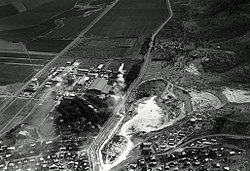
Yajur (Arabic: ياجور, Yâjûr) was a Palestinian Arab village located 9.5 kilometres (5.9 mi) southeast of Haifa. It was depopulated during the 1947–48 Civil War in Mandatory Palestine on April 25, 1948.

History[edit]

Fragments of glass, and tombs with sarcophagi are located in the old village area today.[5]

Yajur was mentioned as part of the domain of the Crusaders during the hudna (truce) between the Crusaders based in Acre and the Mamluk sultan Al Mansur Qalawun declared in 1283.[6]

Ottoman era[edit]

In1799, it was noted on the map that Pierre Jacotin compiled that year, though it was misnamed as Beled el Charq (=Balad al-Sheikh).[7]

In 1872, the Ottoman authorities sold land in Yajur to two Lebanese businessmen, Sursock and Salim al-Khuri.[8]

In 1875, Victor Guérin found the village to have about 200 inhabitants, and that it was surrounded by fig and olive trees.[9]

A population list from about 1887 showed that Yajur had about 150 inhabitants; all Muslims.[10]

In the early twentieth century the village, named El-Yadschur, was noted with 153 inhabitants. The village had a mosque. It was also noted that the villagers no longer owned their land, as it was owned by a selim el-churi, who planned to start silk production in the village.[11]

British Mandate era[edit]

In the 1922 census of Palestine Yajur had a population of 202; all Muslims,[12] while in the 1931 census it was counted with Nesher; together they had 1,449 inhabitants; 554 Muslim, 26 Christians and 858 Jews, in addition to 11 with no religion, in a total of 291 houses.[13]

The area was acquired by the Jewish community as part of the Sursock Purchase. The Lebanese landowners sold land in Yajur to the Zionists, who in turn established the kibbutzofYagur in 1922 on what had traditionally been village land.[8]

The village population in the 1945 statistics was 610; 560 Muslims and 50 Christians,[2][3] with a total of 2,720 dunams of land.[3] Of this, Arabs used 57 dunums of land for plantations and irrigable land, 261 for cereals,[14] while 18 dunams were classified as built-up land.[15]

1948 and aftermath[edit]

Following the war the area was incorporated into the State of Israel. In 1992, the village site was described: "No traces of the houses remain on the site, which is marked by numerous fig trees and a smaller number of olive trees."[5] Kibbutz Yagur uses part of Yajur's former land for agriculture, with cement factories on another part.[5]

Gallery[edit]

References[edit]

  1. ^ Palmer, 1881, p. 120
  • ^ a b Government of Palestine, Department of Statistics, 1945, p. 15
  • ^ a b c d Government of Palestine, Department of Statistics. Village Statistics, April, 1945. Quoted in Hadawi, 1970, p. 49
  • ^ Morris, 2004, xvii, village #143. Also gives causes of depopulation.
  • ^ a b c d Khalidi, 1992, p. 203
  • ^ Barag, 1979, p. 208
  • ^ Karmon, 1960, p. 162 Archived 2019-12-22 at the Wayback Machine
  • ^ a b Khalidi, 1992, p. 202
  • ^ Guérin, 1880, pp. 401-402
  • ^ Schumacher, 1888, p. 177
  • ^ Mülinen, 1908, pp. 178-185
  • ^ Barron, 1923, Table XI, Sub-district of Haifa, p. 33
  • ^ Mills, 1932, p. 97
  • ^ Government of Palestine, Department of Statistics. Village Statistics, April, 1945. Quoted in Hadawi, 1970, p. 92
  • ^ Government of Palestine, Department of Statistics. Village Statistics, April, 1945. Quoted in Hadawi, 1970, p. 142
  • Bibliography[edit]

    • Barag, Dan (1979). "A new source concerning the ultimate borders of the Latin Kingdom of Jerusalem". Israel Exploration Journal. 29: 197–217.
  • Barron, J.B., ed. (1923). Palestine: Report and General Abstracts of the Census of 1922. Government of Palestine.
  • Government of Palestine, Department of Statistics (1945). Village Statistics, April, 1945.
  • Guérin, V. (1880). Description Géographique Historique et Archéologique de la Palestine (in French). Vol. 3: Galilee, pt. 1. Paris: L'Imprimerie Nationale.
  • Hadawi, S. (1970). Village Statistics of 1945: A Classification of Land and Area ownership in Palestine. Palestine Liberation Organization Research Center.
  • Khalidi, W. (1992). All That Remains: The Palestinian Villages Occupied and Depopulated by Israel in 1948. Washington D.C.: Institute for Palestine Studies. ISBN 0-88728-224-5.
  • Karmon, Y. (1960). "An Analysis of Jacotin's Map of Palestine" (PDF). Israel Exploration Journal. 10 (3, 4): 155–173, 244–253. Archived from the original (PDF) on 2019-12-22. Retrieved 2017-09-07.
  • Mills, E., ed. (1932). Census of Palestine 1931. Population of Villages, Towns and Administrative Areas. Jerusalem: Government of Palestine.
  • Morris, B. (2004). The Birth of the Palestinian Refugee Problem Revisited. Cambridge University Press. ISBN 978-0-521-00967-6.
  • Mülinen, Egbert Friedrich von 1908, Beiträge zur Kenntnis des Karmels "Separateabdruck aus der Zeitschrift des Deutschen Palëstina-Vereins Band XXX (1907) Seite 117-207 und Band XXXI (1908) Seite 1-258."
  • Palmer, E.H. (1881). The Survey of Western Palestine: Arabic and English Name Lists Collected During the Survey by Lieutenants Conder and Kitchener, R. E. Transliterated and Explained by E.H. Palmer. Committee of the Palestine Exploration Fund.
  • Schumacher, G. (1888). "Population list of the Liwa of Akka". Quarterly Statement - Palestine Exploration Fund. 20: 169–191.
  • External links[edit]


    Retrieved from "https://en.wikipedia.org/w/index.php?title=Yajur,_Haifa&oldid=1184411026"

    Categories: 
    Arab villages depopulated during the 1948 ArabIsraeli War
    District of Haifa
    Hidden categories: 
    Pages using gadget WikiMiniAtlas
    Pages with non-numeric formatnum arguments
    Webarchive template wayback links
    Articles with short description
    Short description is different from Wikidata
    Coordinates on Wikidata
    Articles containing Arabic-language text
    CS1: long volume value
    CS1 French-language sources (fr)


    This page was last edited on 10 November 2023, at 06:27 (UTC).

    Text is available under the Creative Commons Attribution-ShareAlike License 4.0; additional terms may apply. By using this site, you agree to the Terms of Use and Privacy Policy. Wikipedia® is a registered trademark of the Wikimedia Foundation, Inc., a non-profit organization.


    Privacy policy

    About Wikipedia

    Disclaimers

    Contact Wikipedia

    Code of Conduct

    Developers

    Statistics

    Cookie statement

    Mobile view


    Wikimedia Foundation
    Powered by MediaWiki