
測量


測量︵そくりょう、英: surveying︶は、地球表面上の点の位置・関係を決定するための技術・作業の総称。地図の作成、土地の位置・状態調査などを行う。ポイントの二次元的または三次元的な位置ならびにそれらの間の距離および角度を決定する職業、技芸、学術。

離島の道路にてトプコン製電子式セオドライト︵ソキア・ノンプリズム トータルステーション Series50RX 2010︶を使用し測量をする様子︵加計呂麻島︶
分類の仕方によっていくつかの種類にまとめることができる。
RED-tech II EDM搭載
規模による分類
●測地測量︵基準点測量︶
●地形測量︵細部測量︶
計算の仕方による分類
●平面測量
●測地学的測量
測量士補試験科目による分類
この他にも様々な測量がある。
広範なグループ分けは次のとおり。
●建設時測量 ‥建設プロジェクトの最近建設された要素の場所を文書化する調査測量。記録、完了の評価、および支払いの目的で、現状調査が行われます。完成した調査は、﹁実行された調査として動作する﹂とも呼ばれます。構築された調査は、多くの場合、赤または赤線で表示され、設計情報と比較するために既存の計画に重ねられる
●地籍調査または地籍境界測量 ‥ 法的記述を使用して区画の境界を確立または再確立する測量。それは、小包の角または線に沿った記念碑またはマーカーの設置または修復を伴います。これらは、地面に鉄の棒、パイプ、コンクリートのモニュメント、またはコンクリートやアスファルトに取り付けられた釘の形をとる。ALTA / ACSM土地所有権調査は、米国土地 所有権 協会および測量とマッピングに関する米国議会によって提案された標準で 境界調査、住宅ローン調査、地形調査の要素が組み込まれている
●コントロール測量 ‥ コントロール測量は、将来の測量の開始位置として使用する基準点を確立。測量の他のほとんどの形式には、制御測量の要素が含まれる
●建設測量
●変形調査 ‥構造またはオブジェクトが形状を変えているか、移動しているかどうかを判断するための調査。最初に、オブジェクト上のポイントの位置が検出されます。一定の時間が経過すると、位置が再測定および計算されます。次に、2組の位置の比較が行われる
●寸法管理測量 ‥これは、非水平面内または水平面上で実施される一種の測量。石油およびガス産業では、古いパイプまたは損傷したパイプを同じように交換するのが一般的であるが、寸法管理調査の利点は、調査の実施に使用する機器が水平である必要がないことである。すべてのプラットフォームが固定されているわけではいので、したがって移動する可能性があるため、これはオフショア業界で役立つ
●エンジニアリング測量 ‥エンジニアリング設計に関連する地形、レイアウト、および完成時の測量。多くの場合、通常の土木工学の実践を超える測地計算が必要
●基礎調査 ‥注入され、修復された基礎の位置データを収集するために行われる調査。これは、プロットプラン、サイトプラン、またはサブディビジョンプランで許可された場所および標高に基礎が建設されたことを確認するために行われる
●水路測量 ‥水域の海岸線と河床をマッピングする目的で実施される測量。ナビゲーション、エンジニアリング、またはリソース管理の目的で使用される
●レベリング ‥特定のポイントの標高を見つけるか、特定の標高でポイントを確立する
●LOMA調査 ‥ SFHA特別洪水危険区域から資産を除去して、ベース洪水ラインを変更する調査
●測定調査 ‥建物の計画を作成するための建物調査。このような調査は、改修工事の前、商業目的、または建設プロセスの最後に実施することができる
●マイニング調査 ‥マイニング調査には、坑道と坑道の掘削と岩石の体積の計算が含まれます。垂直シャフトや狭い通路などの形状を調査するための拘束のため、特殊な技術を活用
●住宅ローン調査‥ 住宅ローン調査または物理的な調査は、土地の境界と建物の場所を線引きする単純な調査です。侵入をチェックし、セットバック制限を構築し、近くの洪水ゾーンを示します。多くの場所で、住宅ローン調査は住宅ローンの前提条件
●写真管理調査 ‥ 航空写真を修正できるように、空から見える基準マークを作成する調査
●杭打ち、レイアウト、またはセットアウト ‥計算または提案されたオブジェクトの位置が地面にマークされている他の多くの調査の要素。これは一時的でも永続的でもかまいません。これは、エンジニアリングおよび地籍測量の重要な要素
●構造調査 ‥建物または構造の物理的状態と構造的安定性を報告する詳細な検査測量。良好な修復状態で維持するために必要な作業が強調表示される
●サブディビジョン ‥プロパティを2つ以上の小さなプロパティに分割する境界測量
●地形調査 ‥特定の土地のポイントの標高を測定し、プロット上の等高線として表示する
平面測量と測地測量での分類
地球の考慮事項と実際の形状に基づいて、大きく2つのタイプに分類されるもの。
平面測量では、地球が平らであると仮定し 地球の曲率と回転楕円体の形状は無視される。このタイプの測量では、測量線を結合して形成されたすべての三角形は平面三角形と見なされます。地球の形状による誤差が小さすぎて問題にならない小規模な調査作業に使用される。[4]
測地測量では、減少したレベル、角度、方位、距離を計算する際に、地球の曲率が考慮される。このタイプの測量は通常、大規模な調査作業に使用され 測量は最大100平方マイル︵260平方キロメートル︶まで機能し、平面として扱われ、それを超えると測地として扱われる[5]。測地測量では、レベル、方位、その他の観測値の減少に必要な修正がなされる。[6]
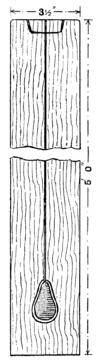
本﹁カッセルの大工仕事と建具﹂より
解説[編集]
日本では高度の精度を必要としない測量は基本的に誰でも行うことができるが、国または地方公共団体の実施する基本測量、公共測量等は測量法に従って登録された測量士又は測量士補でなければ技術者として従事することはできず、またこうした測量は測量法に従って登録された、営業所ごとに測量士が一人以上置かれた測量業者でなければ請け負うことはできない。一方、不動産登記を目的とした測量は土地家屋調査士でなければ行うことはできない。 測量の歴史は古く、古代エジプトの時代から行われてきた。また、アジアでも古代から測量が行われていた。もともとは﹁測天﹂と﹁量地﹂という熟語があり、﹁測天量地﹂と併称され、時代が下り﹁測量﹂の熟語が使用されるようになった[1]。日本で本格的な測量の始まりは、1800年に伊能忠敬が日本地図作成のため、蝦夷地︵現在の北海道︶で実施したものとされる。1871年12月9日︵明治4年10月27日︶、測量司は、皇居の富士見櫓に測量標識を立て、測量を開始した[2]。 これら測量のポイントは通常、建物の角などの場所、地下地物表面の場所など地球の表面上にあり、所有権、不動産販売または政府や民法が必要とするその他の目的のための地図と境界を確立するためによく使用されるSurveyingと区分して土地の測量を land surveying、土地測量の専門家はland surveyorと呼ばれる。 測量は、幾何学、三角法、回帰分析、計量学、物理学、工学、プログラミング言語およびそれらの関連法規を扱い、またトータルステーション、ロボットトータルステーション、セオドライト、GNSS受信機、レトロリフレクター、3Dスキャナー、ラジオ、傾斜計、ハンドヘルドタブレット、デジタルレベル、地下探知機、ドローン、GIS、測量ソフトウェアなどの機器を利用して行う。 測量は、人類史における﹁記録﹂の始まり以来、人類社会の発展にとって重要な要素の一角を担い続け、特に建設行為については、ほとんどの場合において計画および実行をするにあたって測量は欠かせない。また、運輸、通信、マッピングおよび土地所有権の法的境界の定義にも使用されるなど、他の多くの学術分野の研究にとっても重要なツールである。定義[編集]
測量の国際連盟は、測量の機能を次のように定義している‥ [3] ●土地、3次元オブジェクト、ポイントフィールド、および軌道を決定、測定、表現する ●土地および地理的に関連する情報を集めて解釈するため ●その情報を使用して、土地、海、およびその上の構造物の計画と効率的な管理を行う ●上記の慣行に関する調査を実施し、それらを開発する 測量士は、次の活動の1つ以上を実施するための学歴と技術的専門知識を持つ専門家。測量の種類[編集]


測地測量︵基準点測量︶[編集]
国土など広地域を対象とする測量。基準点・水準点を求める。最終相対誤差は100万分の1程度。広大な面積を扱うため、地球表面が平面でない事を考慮して行う。三角測量[編集]

詳細は「三角測量」を参照
位置、高さを求める測量。基準点と各測点を結んで測量区域を三角形の組み合わせで示し、三角法により三角形の内角・辺長を用いて位置関係を求める。
片方の測点上にトランシットを設置、もう片方の測点では作業員が測点上に目標となる棒︵スタッフ︶を立てる。トランシットからスタッフを目視し、角度を調べる。測点間の距離は角度、一辺の長さを元に数値計算で算出する。
基準点-測点間の視界を確保する必要があるため、建築物など障害物の多い場所での三角測量は測点が多くなるなど手間が多くなる

1860年代のアリゾナ州ラッセルのタンクでの鉄道測量隊
局地的な狭い地域の平面測量には、器具も操作も簡単な平板測量が便利である。現地の地形を対象としながら、直接紙上に図化していくために必要な測量を忘れることがなく、また測定に誤りがあればすぐに発見でき図面の正確さを確かめながら作業ができる。欠点としては見通しのきかない場所では効力が発揮できず、外業が多いため天候条件に大きく左右され、また結果も精密さに欠けるところがある。
補助用具としては測量針(マチ針)、その他、作図用具の三角定規、三角スケール、鉛筆、消ゴム、ナイフ、メモ用ノートなどがいる。
測量作業を始めるにあたっては、準備作業が必要である。区域全体について境界や地形を調査して、現地の概略の見取図を描く、最も能率よく実施できる測点の位置を選定し、測量杭(鋲)を打つ、作業の手順を計画する、など。その他、土地所有者の了承を得たり、必要な手続きがあれば済ませる。
平板の据付けについて、平板据付けの3条件というのがあり、一般に定向、致心、整準の順に誤差の影響が大きい。
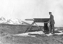
1918年の第一次世界大戦中に調査したドイツのエンジニア
致心(求心)は、他上の測点と平板上の測点とが同一鉛直線中にあるようにする操作で、前述の求心器および錘球によって行う。実際の作業では、次の定向操作とは互いに影響し合うので、この2つの条件を同時に満足させるためには、何回か並行して操作を繰り返すことになる。
平板を何回も据え替えて測点を移動する間、常に平板の方向は最初に据え付けた方向と同一でなければならな。その方法としては、磁針によってもよいが、精度を考えると、据え替える前の測点とを結ぶ方向線に沿わせてアリダードの定規縁を合わせ、視準板の見透線を利用してその測点に立てたポールを視準しながら平板を回転させて方向を正す方法が確実である。
整準は、平板を水平にする操作である。脚頭の3本ある整準ネジのうち底辺に当する2本のネジを結ぶ方向と平行にアリダードを置き、この2本の多準ネジを操作して気泡を中央に導き左右方向の水平を正す。左右のネジは互いに反対の方向に回し、気泡は左手親指の回す方向に動く。次にアリダードを今の方向と直角に置きかえ、残りの整準ネジ1つを用いて縦方向の水平を正す。以上の操作を数回繰り返し調整する。整準は標高差のある区域を何回も据え替えて移動するとき、影響が大きく現われる。
日本初の平板測量図は、第2次フランス軍事顧問団のヴィエイヤール指導による、1875年の日本陸軍による﹃習志野原及周回邨落圖﹄であるとされている[9][10][11][12]。
多角測量[編集]
位置、高さを求める測量。トラバース測量とも呼ばれる。測点間の測定方法は三角測量と同一。基準点から測点A、測点Aから測点B、測点Bから測点Cという具合に測点を結んで測量区域を多角形で示し、多角形の各辺の長さ・角度で位置関係を求める。 描く多角形にはいくつかの種類があり、多角形の辺が最終的に基準点に戻ってきて閉じた状態になるものを﹁閉合トラバース﹂、戻ることなく開放された状態になるものを﹁開放トラバース﹂と呼び、三角点などの高い精度を持つ二つの基準点を結ぶものを﹁結合トラバース﹂と呼ぶ。 最も精度が高いのが結合トラバースだが、これには基準点に︵ほとんど︶誤差が無い事が前提となる。閉合トラバースは精度が高いので一般的によく使われるが、計測した距離に定誤差がある場合、その誤差を検知、解消出来ない。開放トラバースは計測した測点の誤差を検知、解消できないことから精度が低く、あまり使われない。三辺測量[編集]
位置、高さを求める測量。三つの測点で描く三角形各辺の距離を調べ、測量する。かつては精度が悪いため使われなかったが、近年は光波測距儀などの高精度で距離を測れる機器が登場、それにより可能となった。GNSS測量︵旧 GPS測量︶[編集]
GPS、GLONASS、ガリレオなどのGNSS︵全地球航法衛星システム、または汎地球航法衛星システム︶を用いて、位置、高さを求める測量。基準点、測点の2ヶ所にGNSS観測機を設置、GPS衛星などから発信される電波を受信して測定する。 2011年4月に、従来の﹁GPS測量﹂から名称が変更された[7]。これは、アメリカのGPSだけでなく、ロシアのGLONASSなど複数のGNSSが運用されるようになったことから、それらを組み合わせて測量するようになったためである。 従来の測量に比べると人手・時間が少なくて済むが、機器のコストが高い、近くにトタン屋根や金属製の看板があると、電波が多重反射してしまうなどの問題がある。水準測量[編集]
高さを求める測量。2測点間に﹁標尺﹂を設置、レベルと呼ばれる機器により測定する。これを繰り返して各測点の高さを算出する。明治16年以降、国は水準測量で土地の標高を決めてきたが、2018年に、人工衛星などを使ってより早くデータが得られる衛星測量に変えることを決定した[8]。地形測量︵細部測量︶[編集]
測地測量で得た数値データや、写真を元に地図を作成する測量。 測量法で定めた地形測量の範囲は、公共測量-作業規程の準則における現地測量及び車載写真レーザ測量のことを指しているが実際の地形測量は トータルシステム 等や GNSS 測量機により基準点を設け、それを基準として トータルシステム 等や GNSS 測量機による地形と地物の細部調量を行い数値地形図データを作成することになる。車載写真レーザ測量は準則では自動車に自車位置姿勢データ取得装置及び数値図化用データ取得装置を搭載して一般車両と同等の速度で走行しながら道路及び道路周辺の地形、地物等を測定すると定めている、新しい測量技術。 この地形測量の分野において GIS は 地形測量を実施することで得た点・線(道路)・面(街区) というものの位置関係をコンピュータが認識して、データベースとして用いることができるように、データを整理して構築するための位相構造に関するものである。平板測量[編集]
狭い地域の等高線地図を作成するための測量。三脚の上に平板・図面を設置、アリダードを用いて測点を目視し、図面上に実際の地形を記述する。雨や風に弱いが、内業を行う必要がない。最近ではトータルステーションの普及により、あまり使われることがなく、測量士試験・測量士補試験では平成20年度より問題から削除されているが、高校等の実習で放射法などの基礎を学ぶために使用されることは多い。

写真測量[編集]
写真撮影によって記録された写真データに基づき地物の大きさ・形状・位置等、空間を測定する技術[13]。平面測量[編集]
狭い地域を対象とする測量。地球が球︵曲平面︶である事は考慮せず、土地を平面と仮定しておこなう。応用測量[編集]
基準点測量、水準測量、地形測量及び写真測量などの基本となる測量方法を活用し、目的に応じて組み合わせて行う測量。公共事物の道路、河川、公園等の計画、調査、実施設計、用地取得、管理等に用いられる測量であり、目的に応じてそれぞれ以下の測量が定められている。 ●路線測量 - 公共道路施設の測量 ●河川測量 ●定期縦断測量 ●定期横断測量 ●深浅測量 ●法線測量 ●海浜測量及び汀線測量 ●流量測定 - 詳細は﹁流量#流量測定﹂を参照 ●用地測量 - 境界測量を含む ●その他の応用測量︵主題図データ作成など︶ ●工事測量 - 丁張り︵遣方︶など、工事のための測量も応用測量に含まれる。 また応用測量は、基本測量成果、基準点測量、水準測量、地形測量の成果を使用して行われる。[14] なお日本測量協会では毎年応用測量技術研究発表会を開催している。


測量機器。左上から時計回り:光学セオドライト、ロボットトータルステーション、RTK GPSベースステーション、光学レベル
技術[編集]

測量は角度と距離を測定することで物体の位置を決定している。観測の精度に影響を与える可能性のある要因も測定しておき、その次にこのデータを使用して、ベクトル、方位、座標、標高、面積、体積、計画、地図を作成している。
多くの場合、測定は計算を簡単にするために水平成分と垂直成分に分割がなされる。GPSおよび天文測定では、時間成分の測定も必要である。

測量用の最新機器の例︵ Field-Mapテクノロジー︶‥ GP S、レーザー距離計、およびフィールドコンピューターにより、測量︵ 地図作成 ︵リアルタイムでのマップの作成︶およびフィールドデータ収集︶が可能に
EDMデバイスの前は、さまざまな手段を利用した距離の測定がなされていた。たとえば測定方法には ガンターチェーンなどの既知の長さのリンク付きチェーンまたはスチールまたはインバーで作られた測定テープなどがあった。
水平距離を測定するためにこうしたチェーンまたはテープをぴんと張って引っ張り、たるみとたるみを減らした。熱膨張のために距離を調整する必要があったのである。
測定器レベルを保持する試みも様々な試みが行われてきた。傾斜を測定するとき、測量者は測定を﹁中断﹂する必要があって︵チェーンの中断︶チェーンの全長より短い増分を使用した。
Perambulatorsまたは測定ホイールは長距離を測定するために使用されたが、高レベルの精度ではなかった。
タキオメトリーは、既知のサイズの物体の両端間の角度を測定することにより距離を測定する学術分野であるが、EDMの発明以前に使用されていたため、粗い地面でチェーン測定を実行することができなかった。
距離測定[編集]

角度測定[編集]
歴史的に、水平方向の角度はコンパスを使用して磁気ベアリングまたは方位角などを測定したが、後により正確なスクライブされたディスクは、角度分解能を改善した。ディスク上にレチクルを取り付けた望遠鏡を使用すると、より正確な照準が可能とした︵ セオドライトを参照︶。レベルとキャリブレーションされた円により、垂直角を測定。 バーニアでは、世紀の変わり目のトランジットなどで、ある程度の測定が可能となった。平面テーブルは、角度を記録および測定するグラフィカルな方法を提供し、必要な数学の分量を減らしてきた。 1829年にフランシス・ロナルズはオクタントを変更することで角度をグラフィカルに記録するための反射計器を発明。[15]図のすべての頂点から方位を観察することにより、測量者は図の周りを測定でき最終的な観測は180°の違いを除いて、最初に観測された2つのポイントの間に入る。これはcloseと呼ばれ最初のベアリングと最後のベアリングが異なる場合、測角誤差と呼ばれる測量のエラーを示した。 測量者はこの情報を駆使して、作業が期待される基準を満たしていることを証明するのである。レベリング[編集]
詳細は「:en:Levelling」を参照

高さを測定する最も簡単な方法は 高度計を使用することで 空気圧を利用して高さを見つけることであるが、より正確な測定が必要な場合は、正確なレベル︵微分レベリングとも呼ばれる︶などの手段が使用される。
正確な水平調整を行う場合、機器と測定ロッドを使用して、2点間の一連の測定が行われるが、2つのエンドポイント間の標高の正味の差を取得するために、測定値間の高さの差が連続して加算および減算されている。
全地球測位システム (GPS)を使用すると、衛星受信機で高度も測定できるが、通常、GPSは従来の正確なレベリングよりもやや精度が劣る。これは長距離でも同様の場合が生じる。
光学レベルを使用している場合、エンドポイントが機器の有効範囲外にある可能性、エンドポイント間で障害物または高度の大きな変化がある場合がある。こうした状況では追加のセットアップが必要である。
ターニングはレベルを移動して別の場所から標高を撮影することを指すときに使用される用語。レベルを﹁回す﹂ためには、まず測定値を取得し、ロッドが置かれているポイントの標高を記録する必要がある。ロッドがまったく同じ場所に保持されている間、レベルはロッドがまだ見える新しい場所に移動。
水準器の新しい位置から読み取り値が取得され、高さの差を使用して水準器で新しい標高を検出。この一連の測定が完了するまで繰り返される。
有効な測定値を取得するには、レベルが水平でなければならず このため、機器の水平十字線がロッドの基部よりも低い場合、測量者はロッドを確認しての測定値の取得ができない。
ロッドは通常、最大25フィートの高さまで上げることができ、レベルをロッドのベースよりもはるかに高く設定することは可能。

青で示された海岸線の位置を記録するためにトラバースおよびオフセッ ト測定を使用した測量。黒い破線は、基準点︵黒い円︶間のトラバース測定。赤い線は、トラバース線に直角に測定されたオフセット
最初の測量から導き出される観測位置はほとんどない代わりに、ほとんどの観測ポイントは、以前の測定ポイントと比較して測定がなされる。
これにより、測量技師らが各ポイントを使用して、新しい測量を開始するときに自分の位置を決定できる参照または制御ネットワークが形成される。
調査ポイントは通常、地表に打ち込まれた小さな鋲から、遠くから見ることができる大きな標識まで、さまざまな物体によって地表にマークされている。測量者はこの位置に器具を設置して、近くの物体を測定が可能となる。時には尖塔や無線アンテナなどの高くて特徴的な物体の位置が、角度を測定できる基準点として計算される。
三角測量は、EDMおよびGPS測定の出現前に好まれていた水平位置の方法で、遠くのオブジェクト間の距離、標高、方向を決定でき、当初から大面積の地形図のオブジェクトの正確な位置を決定する方法では主なものであった。
測量者はまず、ベースラインと呼ばれる2つのオブジェクト間の水平距離を知る必要があり、次に元のオブジェクトのいずれかから見える限り、他のオブジェクトの高さ、距離、角度位置を導出。高精度のトランジットまたはセオドライトを使用し、角度測定を繰り返して精度を高めていた。3次元の三角形分割も参照。
オフセットは、オブジェクトの位置を決定する代替方法であり、川岸などの不正確な特徴を測定するためによく使用されていた。
測量者は、地物上の2つの既知の位置を特徴にほぼ平行にマークして測定し、それらの間のベースラインをマーク。そして一定の間隔で、最初のラインからフィーチャまでの距離を直角に測定。その後、測定値を平面図または地図にプロットし、オフセットラインの端のポイントを結合してフィーチャを表示可能とする。
トラバースは、より小さいエリアを調査する一般的な方法。測量者は、古い基準マークまたは既知の位置から開始し、エリアをカバーする基準マークのネットワークを配置。次に、基準マークとターゲットフィーチャ間の方位と距離を測定する。
ほとんどのトラバースは、測量者が測定値を確認できるように、2つの以前からの基準マーク間のループパターンまたはリンク形成がなされている。
位置の決定[編集]
既知の位置が近くにない場合に地球の表面上の自分の位置を決定する主な方法は、天体観測によるもので 太陽、月、星の観測はすべて航法技術を使用して行うことが可能である。 機器の位置と星への方位が決定されると、方位を地球上の基準点に移動が可能であるが、このポイントはその後の観測のベースとして使用できる。 測量精度の天文学的な位置は観測や計算が難しく、そのため多くの測定が行われ、それがデータベースになる傾向があったりした。 GPSシステムの出現以来、GPSは地球のほとんどの表面で適切な位置を決定できるため、天体観測はまれとなった。ネットワーク[編集]
詳細は﹁測地ネットワーク﹂を参照
データムと座標系[編集]
詳細は「測地系」および「:en:Geodetic datum」を参照
多くの測量では地表上の位置を計算するのではなく、オブジェクトの相対位置を測定していた。ただし、多くの場合に対象のアイテムは、境界線や以前の測量時のオブジェクトなどの外部データと比較する必要がある。位置を記述する方法で最も古くからの方法は、緯度と経度によるもの。また多くの場合、高度は海抜高度である。測量の専門職が成長するにつれて、デカルト座標系が作成され、地球の小さな部分の測量の数学が単純化されていった。最も単純な座標系は、地球が平らであり、﹁データム﹂︵データの特異形式︶として知られる任意の点から測定されることを前提としているものである。座標系により、小さな領域でのオブジェクト間の距離と方向を、簡単に計算が可能となる。なお広い領域は、地球の曲率により歪んでいる。より大きな地域では、楕円体またはジオイドを使用して地球の形状をモデル化する必要がある。このため、多くの国では誤差を減らすためにカスタマイズされた座標グリッドを作成している。
ドローンによる測量[編集]
ドローンの測量では、3次元点群データとオルソ画像の2種類のデータを得られます[16]。3次元点群データ[編集]
3次元点群データとは、ドローンで空中から取得する3次元の情報です。数学の言葉で表現すると、X軸・Y軸・Z軸の情報となります。 取得方法としてはまずドローンに搭載された気圧計から高度に関する情報を、そしてGPSなどの人工衛星から位置情報を取得します。これらを光学カメラやレーザー測距装置により得られるデータと組み合わせることで、位置情報を点の群れという形で表現できるのです。 こうして得られた点群のデータは、専用のソフトで加工すれば、ある地点とある地点の距離の計測、図面の作成、3Dモデルの作成などを行えます。オルソ画像[編集]
オルソ画像とはドローンにより空撮した複数枚の写真を組み合わせ、傾きや歪みを取り除いて補正したものを意味します。補正作業により位置関係や大きさを正確に表現できるようになるため、画像上で面積や距離などの計測が可能です。 オルソ画像を3次元点群データと併せて活用することで、ドローンにより撮影された場所の様子を正確に把握できるようになります。例えば工事現場では作業の効率化を図れるでしょう。結果的に工期を短縮でき、それに伴ってコスト削減につながる可能性があります。ドローンの測量によるメリット[編集]
以下、3点のメリットがドローン測量では挙げられる。 ①広範囲をカバーできる②人が立ち入れない場所にも行ける③点群データの密度が高い誤差と精度[編集]
測量の基本的な考え方は、完璧な測定はなく、常にわずかな誤差があるということである[17]。調査エラーには3つのクラスがある。 ●重大なエラーまたは失策‥調査中に調査員が行ったエラー。機器の動揺、ターゲットの誤用、または誤った測定値の書き留めなどは、すべて重大なエラー。総誤差が大きいと、精度が許容できないレベルに低下する可能性もある。したがって調査員は冗長な測定と第三者チェックをして、早い段階でこれらのエラーを検出する必要がある ●体系的‥一貫したパターンに従うエラー。いち例には、チェーンまたはEDM測定時に生じる温度の影響、または機器またはターゲットポールの傾きなどで引き起こすものなど、不十分な調整ものや精神レベルなものも含まれる。既知の効果がある系統誤差は、補正または修正可能 ●ランダム‥ランダムエラーは、避けられない小さな変動。それらは測定機器、視力、および状態の欠陥によって引き起こされるが、測定の冗長性と不安定な条件の回避により、これらを最小限に抑えることが可能。ランダムエラーは互いに打ち消し合う傾向があるが、ある測定から次の測定に伝播しないように確認する必要がある 測量技師が機器の較正、一貫した方法の使用、および参照ネットワークの適切な設計により、これらのエラーを回避している。 繰り返される測定値は平均化され、外れ値の測定値は破棄されます。2つ以上の場所からポイントを測定する、または2つの異なる方法を使用するなどの独立したチェックが使用される。 エラーは、2つの測定結果を比較することで検出できる。 測量技師が作業のエラーのレベルを計算すると、観測の調整がなされる。これは、すべての測定間でエラーを分配するプロセス。各観測は、発生した可能性のある合計エラーの量に応じて重み付けされ、そのエラーの一部が比例的に割り当てられる。 最も一般的な調整方法は、コンパスルールとしても知られるボウディッチ法と最小二乗法の原理。したがって測量技師は 精度と精度を区別できなければならない。 米国では、測量士と土木技師はフィート単位を使用しており、調査フィートは10分の1と100分の1に分類される。距離を含む多くの行為記述は、これらの単位︵125.25 ft︶。測量者は正確さの観点から、多くの場合、100分の1フィートの基準 約1/8 インチに拘束される。計算とマッピングの公差は、ほぼ完全な閉包を達成することが望まれる場合なら、はるかに小さくなる。 公差はプロジェクトごとに異なるが、現場や日常的に、100分の1フィートを超える使用は実用的ではない。測量器具[編集]
測量機器[編集]
詳細は「測量機器」を参照
(survey(ing) equipment and instruments)
●光波測距儀
●セオドライト
●トランシット
●トータルステーション︵TS︶
●グローバル・ポジショニング・システム(GPS)、GNSS測定
●水準器︵レベル︶
●ラムズデン測量機器 (Ramsden surveying instruments)
●地上型3Dスキャナー
●航空レーザー測量
●LIDER(3次元点群)
●小型無人航空機(ドローン)

パンディット の地図製作者、Nain Singh Rawat ︵ 19世紀︶は、1876年に英国のためにヒマラヤ山脈を探索した。その功績により、王立地理学会の金メダルを受賞。

1918年、アイダホ州の全女性調査員
測量の基本原理は古くからほとんど変化がないが、測量技師が使用するツールは進化している。エンジニアリング、特に土木工学では、しばしば測量技術者が不可欠である。
古代エジプトでは縄を使って測量を行う﹁縄張師﹂と呼ばれる技術者が存在していた[18]。
測量は道路、鉄道、貯水池、ダム、パイプライン、擁壁、橋、建物の配置を決定するのに役立ちだけでなく法的裏付や政治的に分断がなされた境界を確定させ、また土地の特徴と境界を記録する地理情報システム ︵GIS︶のアドバイスとデータも提供することが可能。
測量従事者は、代数、基本的な微積分、幾何学、および三角法の完全な知識を持たなければならない。また土地家屋調査士ならば土地家屋調査、不動産の契約を扱う法律を知っている必要がある。
従事者のレベルは世界各国ほとんどで、以下の通り3つの異なるレベルの区分を認識している。
●測量助手またはチェーンマンは、通常、調査員を補助支援する未熟練労働者。ターゲットリフレクタを配置し、古い基準マークを見つけ、地面にポイントをマークする役目。﹁チェーンマン﹂という用語は、以前は測量に 測定チェーンを使用していたことに由来する。アシスタントは、測量技師の指示の下でチェーンの遠端を移動させる役目。
●測量技師補は多くの場合、測量機器の操作、現場での測量の実施、結果の計算、実施計画の立案を行う。技師補は通常、法的権限を持たず、自分の作業を証明することはできないレベル、すべての技師補が資格を持っているわけではない。しかし証明書または卒業証書レベルのスキルが備わる。
●免許登録または公認の測量技師つまり測量士は通常、学位以上の実力を保持している。多くの場合、専門家協会への参加や認定資格の取得には、さらに試験に合格する必要がある。測量士は法的に調査の計画と管理に責任を負う。彼らは自分の実施の測量、または監督下で実施される測量が法的基準を満たしていることを確認する必要がある。測量業者の多くのプリンシパルがこのステータスを保持している。

19世紀後半にヘルシンキ工科大学の教授と学生の測量風景
ほとんどの国の政府は、測量について少なくとも何らかの規制し、測量管轄機関は規制と基準を確立している。標準は、精度、測量証明書、境界標、測地ネットワークの保守を制御している。多くの国ではこうした権限を地域のエンティティまたは地方自治体に委ねている。地籍調査は特に作業の永続性のために最も規制される傾向がある。地籍調査によって確立された多くの境界線は、修正せずに数百年間存在する場合がある。
管轄区域によっては地元の測量士が代表をつとめる専門機関の形態もある。これらの機関は、しばしば潜在的な測量士を支持または認可し、倫理基準を設定および実施している。最大の機関は国際測量連盟 ︵略称FIG、フランス語: Fédération Internationale des Géomètres ︶で、世界中の測量業界を代表している。
測量器具[編集]
●アリダード、アリダード表 ●求心器と鍾球 - 平板が水平なとき、求心器の尖端を図上の測点に合わせれば、求心器の他端に吊された錘球によって図上の点を通る鉛直線がつくられる。錘球の先端を見ながら地上の点と一致させる作業を行うときに使用する ●磁針箱 - 長さ10cm内外、磁針を納めた長方形の箱で、磁北の方向を知る。打撃を受けると急速に帯磁が劣化するので、不用のときは必ずネジを締めて磁針を固定しておくことが必要 ●平板、平面テーブル - 測板、または図板で、一般用として40cm×50cm、厚さ2cm程度の合板製が多い。表面は反ったり割れ目のない平滑なものであることが条件である。図紙を張って使用する ●ダンプレベル (Dumpy level) ●メジャー (測定機器) ●テープ︵調査用︶ ●巻き尺 - 布巻尺は、乾湿に弱く耐久性に欠けるので、現在はガラス繊維を芯にして塩化ビニルで被覆したものが用いられる。この巻尺は軽くて水中にも使用でき取扱いが簡単である ●鋼尺(スチールテープ) - 薄い帯鋼(ステンレス)にmm単位の目盛をつけたもので、温度や張力によって、多少伸縮するが、計算で補正できるので精密を要する測量に用いられる。ただし、折損しやすく通電するので取扱いに注意を要する ●インバールテープ - ニッケル合金でつくられたテープまたはワイヤー形の巻尺であって、温度膨張係数が非常に小さく、また10~15kgの張力では、ほとんど伸びないので、特に三角測量の測定のような高い精度の距離測量に使用される ●ポール︵調査︶ ●ガンター氏測鎖 ●エンジニアのチェーン ●レベル 水準儀 ●水平器 - 簡単な水平を出す器具で、これには結ばれた静水面の高さが等しいことを利用したゴム管、水平器や気泡管を埋め込んだ木製水平器などがある ●ハンドレベル - 長さ15cm、径3cmほどの金属製円筒の上部に小さな気泡管を取り付けたもので、使うときはこの円筒を片手で握り、ほぼ水平にして視準孔からのぞくと、水平器の気泡が眼にうつる。鏡筒を上下に傾けて気泡が中心にある横線で二等分されたとき、目的地に立てた箱尺の目盛を横線で読む ●レベルスタッフ (Level staff) ●箱尺(スタッフ) 標尺 - 幅9cmの木箱(または軽合金製)の面上5mmごとに目盛りを付けたもので、普通は3段に引き伸ばすと5mとなる。望遠鏡の付いた水準儀で読むときは、箱尺の目盛の一部分が拡大されて視野にうつるので、5mm以下の端数目盛は目測で1mm刻みで読み取る。箱尺はすでに高さの与えられている測点や、これから高さを求めようとする地点に立てる測器である ●量水標 ●測距棒 (Prism (surveying)) ●プリズム︵コーナーキューブ・レトロリフレクター︶ ●三脚 ●角柱コンパス ︵角度測定︶ ●縄 - 古代から土地の測量に利用されていた[18]。シュルバ・スートラは祭壇の寸法を縄で測ることから﹁縄の経典﹂とも呼ばれる[18]。日本では所有権を示すために縄を張っていたことから﹁縄張り﹂という言葉が生まれた。地図編集[編集]
測量としての地図編集とは、各種縮尺の地図や実測図、基図などの地図作成に必要な資料を編集し、必要に応じて現地調査を行い、目的の地図を編集して作成する作業を指す。 一般には既存の数値地形図データを基図として写真測量で作った実測図や基図、各種測量成果や空中写真等といったさまざまな参考資料を活用し、縮尺のより大きく新しい地図を作成したり編集して別の地図を作るという測量。 またここでの実測図とは写真測量または平板測量で測量して作製された地図を指し、その実測図や基図を編集して作った地図を編集図と呼んでいる。 各種ある国土地理院発行の地図は実測図や基図から編集図を作る測量を必要とし、またこれは国土地理院発行の地図から市販の道路地図などの特殊地図を作る作業も含まれている。 なお、基図とは編集の基になる地図のことを指す[注釈 1]。また、縮尺の大きい地図を編集して縮尺の小さい地図を作る場合、同じ面積を表現するのに使える紙面はごく少ないものになるため、そのまま縮小して同じ情報量を載せてしまうと地図が分かりにくいものになってしまうことから、取捨選択といった重要な情報に整理し、不必要な情報を捨て記号図形を簡略化する作業行為を経て制作している。職業としての測量[編集]


免許[編集]
ライセンス要件は国や管轄によって異なり、一般的に各国内で一貫している。将来の測量士は通常、測量の学業を修め、その後測量法に関する知識と実践したい地域固有の原則を詳細に検査し、実地訓練またはポートフォリオ構築の期間を経る必要がある。そして所定の実務の年数を経てライセンスが授与される。資格のある測量士は通常、ポスト・ノミナル・レターズを受け取る。ただし、これは資格の所轄によって違いがある。こうしたシステムは、古い見習いシステムに取って代わることになる。 アメリカでは州などが形式を決定し、一般にすべての計画に署名封印などをするには、認可された土地測量士資格が必要となり、名前と登録番号を示す必要がある。 多くの管轄区域では測量士は境界コーナーを設定するときに、測量標に登録番号をマークする必要がある。標は、キャップの付いた鉄の棒、コンクリートの記念碑、またはワッシャー付きの釘の形などをとる。測量機関[編集]

建物測量[編集]
英語圏の国ではほとんどが建築調査測量を明確な職業と見なしている。独自の専門家協会とライセンス要件がある。建物測量技師は、建物の状態の調査と法令順守作業に重点を置いている。地籍測量[編集]
土地家屋調査の主な役割の1つは、地上の不動産の境界を決定することである。測量で隣接する地主が境界線を配置する場所を決定する必要がある。境界は通常、弁護士やサイトエンジニアおよび土地測量の技師によって作成された法的文書および計画で確立される。次に、測量技師は、新しい境界の角に境界標を設置する。また、以前の調査で設置された建物の角を見つけたり再調査したりすることもある。 地籍測量士は政府によって認可されています。土地管理局 ︵BLM︶の地籍調査部門は、米国でほとんどの地籍調査を実施しています[19]。彼らは森林局、国立公園局、陸軍工兵隊 インディアン事務局、合衆国魚類野生生物局、開拓局、その他に相談。BLMは、かつてGeneral Land Office ︵GLO︶として知られていた。 Public Land Survey System ︵PLSS︶に従って組織された州では、測量士はそのシステムの下でBLM地籍調査を実施しなければならない。 地籍測量士は、しばしば境界モニュメントを破壊または損傷する地球の変化に対処する必要がある。これが起こるとき、タイトル証書に記録されていない証拠を考慮しなければならない。これは外部証拠として知られている。[20]注目すべき測量士[編集]
ラシュモア山の4人の米国大統領のうち3人は土地測量士であった。ジョージ・ワシントン、トーマス・ジェファーソン、およびエイブラハム・リンカーンは、就任前に植民地または辺境地域を踏査した。 デビッド・T・アバクロンビーは、エクスカーション用品のアウトフィッター店を始める前に土地調査に従事。事業は後にアバクロンビー&フィッチといったライフスタイル衣料品店に変わっていく。 パーシー・ハリソン・フォーセットは、失われた都市Zを見つけようとして南アメリカのジャングルを探検した英国の測量士。彼の伝記と探検は﹁The Lost City of Z﹂で詳述され、後で映画スクリーンにも映し出された。 伊能忠敬は、1800年、55歳から現代の測量技術を使用して日本の地図を作成した。脚注[編集]
注釈[編集]
(一)^ 縮尺が大きい順からみて編集として2万5千分の1地形図から5万分の1地形図を作る。このとき基になる2万5千分の1地形図は基図であり、5万分の1地形図は編集図ということになる。このようにして同じ要領で、5万分の1地形図から20万分の1地勢図を作る場合、5万分の1地形図を基図とし、20万分の1地勢図が編集図となる。
出典[編集]
(一)^ 測量業の動向と人材育成 ︵独立行政法人高齢・障害・求職者雇用支援機構職業能力開発総合大学校基盤整備センター﹃測量業における﹁職業能力の体系﹂の整備等に関する調査研究﹄︶
(二)^ 明治前期財政経済史料集成 17 工部省沿革報告 大蔵省編
(三)^ “Definition”. fig.net. 2016年2月17日閲覧。
(四)^ BC Punmia (2005). Surveying by BC Punmia. pp. 2. ISBN 9788170088530 2014年12月9日閲覧。
(五)^ N N Basak (2014). Surveying and Levelling. pp. 542. ISBN 9789332901537 2016年7月28日閲覧。
(六)^ BC Punmia (2005). Surveying by BC Punmia. pp. 2. ISBN 9788170088530 2014年12月9日閲覧。
(七)^ “2011年度施行改正公共測量作業規程の準則︵基準点測量︶解説” (PDF). アイサンテクノロジー (2011年4月18日). 2013年10月14日時点のオリジナルよりアーカイブ。2013年10月13日閲覧。
(八)^ “標高の決め方 変わります”. NHK (2018年3月26日). 2018年3月26日時点のオリジナルよりアーカイブ。2018年3月26日閲覧。
(九)^ “近代地図(陸地)年表 International Cartographic Information Center News Vol.23 No.3 通巻87号”. 地図情報センター. 2020年12月8日閲覧。
(十)^ 細井將右﹁明治初期フランス地図測量技術の導入とその後 : -全国地形図測量と工兵測量の分離-﹂﹃日本地理学会発表要旨集﹄第2018巻、日本地理学会、2018年、000091頁、doi:10.14866/ajg.2018s.0_000091、NAID 130007411880。
(11)^ “習志野原及周回邨落図︹陸軍作図︺”. ADEAC. 2020年12月9日閲覧。
(12)^ 関口正雄﹁明治8年測量 ﹁習志野原及周回邨落図﹂ をめぐって:日本陸軍の歩みを基礎にした地図発達史の解明・その1﹂﹃地図﹄第8巻第3号、日本地図学会、1970年、13-17頁、doi:10.11212/jjca1963.8.3_13、ISSN 0009-4897、NAID 130003999333。
(13)^ 長谷川昌弘; 今村遼平; 吉川眞; 熊谷樹一郎﹃ジオインフォマティックス入門﹄理工図書、2002年。ISBN 4-8446-0683-2。
(14)^ 公共測量作業規程の準則では第4編に応用測量があり、第339条の2により ﹁応用測量とは、道路、河川、公園等の計画、調査、実施設計、用地取得、管理等に用いられる測量をいう。﹂としている。応用測量の区分は第340条で、目的によって 一 路線測量、二 河川測量、三 用地測量、四 その他の応用測量 と区分されている。そして同条の2によると応用測量は建設事業に付随する測量ごとに、必要に応じて路線測量、河川測量及び用地測量並びにその他の 測量を行うものとするとしており、使用する成果を第341条で、基本測量成果に加え、基準点測量、水準測量、地形測量及び写真測量の成果を使用して行うものとしているがただし、基準点測量成果等が必要な場合には、当該測量を実施し、必要な成果を取得して行うものとするとしている。
(15)^ Ronalds, B.F. (2016). Sir Francis Ronalds: Father of the Electric Telegraph. London: Imperial College Press. ISBN 978-1-78326-917-4
(16)^ ドローン測量のメリットとデメリット-費用相場や注意点も合わせて解説
(17)^ Kahmen, Heribert; Faig, Wolfgang (1988). Surveying. Berlin: de Gruyter. p. 9. ISBN 3-11-008303-5 2014年8月10日閲覧。
(18)^ abc古代への旅1時間目 ~ピタゴラス数と行く古代世界~
(19)^ A History of the Rectangular Survey System by C. Albert White, 1983, Pub: Washington, D.C. : U.S. Dept. of the Interior, Bureau of Land Management : For sale by Supt. of Docs., U.S. G.P.O.,
(20)^ Richards, D., & Hermansen, K. (1995). Use of extrinsic evidence to aid interpretation of deeds. Journal of Surveying Engineering, (121), 178.
参考文献[編集]
- The Surveying Handbook. (1995). doi:10.1007/978-1-4615-2067-2. ISBN 978-1-4613-5858-9
- Keay J (2000), The Great Arc: The Dramatic Tale of How India was Mapped and Everest was Named, Harper Collins, 182pp, ISBN 0-00-653123-7.
- Pugh J C (1975), Surveying for Field Scientists, Methuen, 230pp, ISBN 0-416-07530-4
- Genovese I (2005), Definitions of Surveying and Associated Terms, ACSM, 314pp, ISBN 0-9765991-0-4.
関連項目[編集]
- リモートセンシング
- リアルタイムキネマティック
- 測地学
- 地図学
- サーベイヤー
- 英国王立勅許鑑定士協会
- 数学 - 日本では1989年度入学まで、数学教員免許取得において義務化されていた。
外部リンク[編集]
- 国土地理院
- 日本測量協会
- 日本写真測量学会
- 日本測量調査技術協会
- 全国測量設計業協会連合会
- Public Land Survey System Foundation - アメリカ合衆国の公有地の調査のための測量指示マニュアル。
- イリノイ州スプリングフィールドにある国立 測量博物館 のホーム
- Land Surveyors United Support Network 測量士のフォーラム、教育ビデオ、業界ニュース、ジオロケーションに基づくサポートグループを特徴とするグローバルなソーシャルサポートネットワーク。
- NCEES エンジニアリングおよび測量審査委員会(NCEES)
- NSPS National Professional Society of Professional Surveyors(NSPS)
- Survey Earth 土地調査員のコミュニティとして夏至の間に1日でプロの土地調査員と学生が地球を再測定するためのグローバルイベント。
- 測量士-職業雇用統計
- 『測量』 - コトバンク
| 国立図書館 |
|
|---|---|
| その他 |
|