
グレンウッドスプリングス
| グレンウッドスプリングス市 City of Glenwood Springs | |
|---|---|
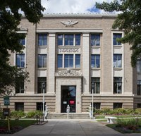
 グレンウッドスプリングスのバスハウスと温泉プール | |
| 位置 | |
 下: コロラド州におけるガーフィールド郡の位置 上: ガーフィールド郡におけるグレンウッドスプリングスの市域 | |
| 座標 : 北緯39度33分0秒 西経107度19分30秒 / 北緯39.55000度 西経107.32500度 | |
| 歴史 | |
| 創設 | 1882年[1] |
| 行政 | |
| 国 | |
| 州 | コロラド州 |
| 郡 | ガーフィールド郡 |
| 市 | グレンウッドスプリングス市 |
| 地理 | |
| 面積 | |
| 市域 | 14.75 km2 (5.69 mi2) |
| 陸上 | 14.73 km2 (5.68 mi2) |
| 水面 | 0.02 km2 (0.01 mi2) |
| 標高 | 1,756 m (5,761 ft) |
| 人口 | |
| 人口 | (2010年現在) |
| 市域 | 9,614人 |
| 人口密度 | 652.9人/km2(1,692.6人/mi2) |
| 都市圏 | 73,537人 |
| その他 | |
| 等時帯 | 山岳部標準時 (UTC-7) |
| 夏時間 | 山岳部夏時間 (UTC-6) |
| 公式ウェブサイト : http://www.cogs.us/ | |
歴史[編集]
ヨーロッパ人が入植する以前には、今日のグレンウッドスプリングスがあるこの地にはネイティブ・アメリカンの遊牧部族であるユート族が頻繁に行き交い、狩猟を行っていた。この一帯の地熱と温泉はユート族の間で広く知れ渡っており、この地はユート族の言語で﹁大いなる薬﹂を意味する Yampah と呼ばれていた[4]。 やがて1858年、パイクスピークでゴールドラッシュが起こると、この地にもリチャード・ソプリス大尉率いる白人入植者の一団がやってきた。この地の南にそびえる双峰、ソプリス山︵3,952m︶はこのソプリス大尉にちなんでつけられた。また、この際に病に倒れたソプリス大尉を、ユート族が温泉に入れて療養させたとする伝承もある。その後しばらくは、ユート族と白人入植者がこの地で共存していたものの、白人入植者が増えるにつれて、そして金や銀、石炭がこの周辺で発見されるにつれて、ユート族はこの地を追われていくようになり、1880年には、この地は完全に白人入植者のものとなった[4]。
地理[編集]

地形と地質[編集]

気候[編集]
| グレンウッドスプリングス | ||||||||||||||||||||||||||||||||||||||||||||||||||||||||||||
|---|---|---|---|---|---|---|---|---|---|---|---|---|---|---|---|---|---|---|---|---|---|---|---|---|---|---|---|---|---|---|---|---|---|---|---|---|---|---|---|---|---|---|---|---|---|---|---|---|---|---|---|---|---|---|---|---|---|---|---|---|
| 雨温図(説明) | ||||||||||||||||||||||||||||||||||||||||||||||||||||||||||||
| ||||||||||||||||||||||||||||||||||||||||||||||||||||||||||||
| ||||||||||||||||||||||||||||||||||||||||||||||||||||||||||||
グレンウッドスプリングスの気候は1年を通じてやや乾燥し、日中は暑いが夜は涼しくなる夏と、日中は穏やかなものの夜は冷え込みの厳しい冬に特徴付けられ、気温の年較差と日較差のともに大きい、高山性の気候となっている。最も暑い7月の最高気温の平均は約31℃に達し、平年で月の約半分は日中32℃を超えるが、最低気温は平均10℃まで下がり、平均気温は約21℃である。最も寒い1月の平均気温は氷点下4℃、最低気温の平均は氷点下11℃で、ほぼ毎日気温が氷点下に下がるが、日中は標高の割には暖かく、3℃程度まで上がる。降水量は1年を通じてほぼ一定しており、月間降水量は27-40mm程度、年間降水量は420mm程度である。また、冬季の11月から3月にかけての月間降雪量は13-45cm、年間降雪量は150cmに達する[14]。ケッペンの気候区分では、グレンウッドスプリングスは亜寒帯湿潤気候(Dfb)に属する。
| 1月 | 2月 | 3月 | 4月 | 5月 | 6月 | 7月 | 8月 | 9月 | 10月 | 11月 | 12月 | 年 | |
|---|---|---|---|---|---|---|---|---|---|---|---|---|---|
| 平均気温(℃) | -4.3 | -1.3 | 3.3 | 7.9 | 12.9 | 17.4 | 20.9 | 19.9 | 15.6 | 9.5 | 2.3 | -3.4 | 8.4 |
| 平均最高気温(℃) | 2.7 | 5.8 | 10.8 | 16.4 | 22.2 | 27.9 | 31.4 | 30.1 | 25.8 | 19.0 | 10.0 | 3.4 | 17.1 |
| 平均最低気温(℃) | -11.3 | -8.5 | -4.2 | -0.4 | 3.6 | 6.8 | 10.4 | 9.8 | 5.5 | 0.1 | -5.3 | -10.2 | -0.3 |
| 降水量(mm) | 38.1 | 30.5 | 35.6 | 40.6 | 36.5 | 27.9 | 30.5 | 38.1 | 40.6 | 38.1 | 27.9 | 33.0 | 417.4 |
| 降雪量(cm) | 45.5 | 28.4 | 16.8 | 4.8 | 0.8 | - | - | - | - | 2.8 | 13.5 | 37.8 | 150.4 |
都市概観[編集]


政治[編集]
経済[編集]

交通[編集]

教育[編集]

観光[編集]
温泉[編集]
グレンウッドスプリングスには、ロッキー山脈から湧き出るミネラル温泉のグレンウッド・ホットスプリングスがあり、この温泉は湧出温度は摂氏51度、湧出量は1日350万ガロン︵13250000リットル︶、毎分9200リットルを誇る世界最大の天然温泉プールである[42]。この温泉は塩化ナトリウム、硫酸カリウム、硫酸カルシウム、重炭酸カルシウムなどを始めとする15種類のミネラルを含有している[43]。この地を最初に発見したのはネイティブアメリカンのユート族であり、Yampah︵﹁偉大なる癒しの力﹂の意︶と名づけられて何世紀もの間利用されてきた[42]が、この地に温泉プールが作られたのは1888年のことである[44]。 またグレンウッドスプリングスの地下の洞窟には、水路を流れる温泉から生じる蒸気を利用したスチームバスであるヤンパ・ホットスプリングス・ベイパーケーブという温泉もある。この洞窟は北米で唯一蒸気を出す洞窟としても知られており、亜鉛やカリウムなど34種類のミネラルと微量元素を豊富に含んだ摂氏約52度の湯が流れているため、洞窟内は摂氏43度から44度のサウナのような温度が保たれている[44]。この温泉も古くは上述のユート族が儀式や治療に使用していた場所であった[42]。ホテル[編集]
グレンウッドスプリングスには、1893年に開業したホテル﹁コロラド・ホテル﹂がある。このホテルは第27代アメリカ合衆国大統領のウィリアム・タフトや、同第32代大統領のセオドア・ルーズベルトらも訪れている[45]。ルーズベルトは1905年の初めての来訪以来このホテルを何度も訪れており、ある日にホテルのメイドが熊のぬいぐるみを作って大統領にプレゼントした時に、ルーズベルトの娘のアリスがそのぬいぐるみを﹁テディ﹂と名付けたことで、そこからテディベアの語が広まったというエピソードも残っている[45]。人口動態[編集]
都市圏人口[編集]
グレンウッドスプリングスの都市圏、および広域都市圏を形成する各郡の人口は以下の通りである(2010年国勢調査)[2]
- グレンウッドスプリングス小都市圏
| 郡 | 州 | 人口 |
|---|---|---|
| ガーフィールド郡 | コロラド州 | 56,389人 |
| ピトキン郡 | コロラド州 | 17,148人 |
| 合計 | 73,537人 | |
- エドワーズ・グレンウッドスプリングス広域都市圏
| 都市圏/小都市圏 | 郡 | 州 | 人口 |
|---|---|---|---|
| グレンウッドスプリングス小都市圏 | 73,537人 | ||
| エドワーズ小都市圏 | イーグル郡 | コロラド州 | 52,197人 |
| レイク郡 | コロラド州 | 7,310人 | |
| 合計 | 133,044人 | ||
市域人口推移[編集]
以下にグレンウッドスプリングス市における1890年から2010年までの人口推移をグラフおよび表で示す[46]。
| 統計年 | 人口 |
|---|---|
| 1890年 | 920人 |
| 1900年 | 1,350人 |
| 1910年 | 2,019人 |
| 1920年 | 2,073人 |
| 1930年 | 1,825人 |
| 1940年 | 2,253人 |
| 1950年 | 2,412人 |
| 1960年 | 3,637人 |
| 1970年 | 4,106人 |
| 1980年 | 4,637人 |
| 1990年 | 6,561人 |
| 2000年 | 7,736人 |
| 2010年 | 9,614人 |

註[編集]
- ^ a b Settling Glenwood Springs. Visit Glenwood Springs. 2017年8月13日閲覧.
- ^ a b c d American FactFinder. U.S. Census Bureau. 2011年2月4日.
- ^ Accolades. Visit Glenwood Springs. 2017年8月13日閲覧.
- ^ a b Ute Indian History in Glenwood Springs. Visit Glenwood Springs. 2017年8月19日閲覧.
- ^ a b Glenwood Colorado Mining. Visit Glenwood Springs. 2017年8月19日閲覧.
- ^ Prohibition Beginning in 1916. Visit Glenwood Springs. 2017年8月19日閲覧.
- ^ a b Glenwood Springs Skiing. Visit Glenwood Springs. 2017年8月19日閲覧.
- ^ Glenwood Springs Trains. Visit Glenwood Springs. 2017年8月19日閲覧.
- ^ Caving/Spelunking. Colorado Tourism Office. 2017年8月20日閲覧.
- ^ Fowler, Pete. City of Glenwood Springs explores geothermal energy use. Post Independent. 2008年2月23日. 2017年8月20日閲覧.
- ^ Addendum to the Garfield County Natural Hazards Mitigation Plan. p.11. City of Glenwood Springs. 2012年. 2017年8月20日閲覧.
- ^ a b Gas Wells: COGCC Data. Garfield County, Colorado. 2017年8月20日閲覧.
- ^ Finley, Bruce. 230 Colorado mines are leaking heavy metals into state rivers. The Denver Post. 2015年8月15日. 2017年8月20日閲覧.
- ^ a b Historical Weather for Aspen, Colorado, United States of America. Weatherbase.com.
- ^ COLORADO - Garfield County. National Register of Historic Places. 2017年8月20日閲覧.
- ^ Grand Avenue Bridge. Visit Glenwood Springs. 2017年8月20日閲覧.
- ^ Glenwood Springs Pedestrian Bridge Adds A Beautiful New Option for Getting Around Town. Visit Glenwood Springs. 2017年5月8日. 2017年8月20日閲覧.
- ^ America's Most Walkable Communities. PBS. 2017年8月20日閲覧.
- ^ America's best walking communities. WALKING Magazine. Active Network. 2017年8月20日閲覧.
- ^ America's Most Walkable Cities: Walking magazine's list of the top places to amble around. Utne Reader. Topeka, Kansas: Ogden Publications. 2000年9-10月. 2017年8月20日閲覧.
- ^ Glenwood Springs Trail System. City of Glenwood Springs. 2017年8月20日閲覧.
- ^ Glenwood Springs Colorado Hiking Trails. Visit Glenwood Springs. 2017年8月20日閲覧.
- ^ Kane, Willa. Frontier Diary: A pedestrian bridge to the heart of Glenwood Springs. Post Independent. 2016年3月3日. 2017年8月20日閲覧.
- ^ "Article VI. - City Administration". Glenwood Springs City Charter. City of Glenwood Springs. 2017年1月19日.
- ^ "Article III. - City Council". Glenwood Springs City Charter. City of Glenwood Springs. 2017年1月19日.
- ^ Hankinson, Katie. The world is coming to visit Glenwood Springs. Post Independent. 2015年8月29日. 2017年8月24日閲覧.
- ^ Miller, Laurel. Roadside America: Colorado's Roaring Fork Valley. Gadling. 2012年10月13日. 2017年8月24日閲覧.
- ^ Strawberry Days Festival. Glenwood Springs Chamber Resort Association. 2017年8月24日閲覧.
- ^ a b c Gulliford, Andrew. Garfield County, Colorado: The First Hundred Years 1883–1983. p.20. Garfield County. 1983年. 2017年8月24日閲覧.
- ^ Essex, Randy. No room for renters as population, prices rise. Post Independent. 2015年4月10日. 2017年8月24日閲覧.
- ^ Aspen-Pitkin Co/Sardy Field. (Form 5010) Airport Master Record. Federal Aviation Administration. 2017年8月17日. 2017年8月26日閲覧.
- ^ Flight Information. Aspen/Pitkin County Airport. 2017年8月16日閲覧.
- ^ Glenwood Springs Muni. (Form 5010) Airport Master Record. Federal Aviation Administration. 2017年8月17日. 2017年8月26日閲覧.
- ^ Glenwood Springs, CO (GSC). Amtrak. 2017年8月26日閲覧.
- ^ California Zephyr. p.2. Amtrak. 2016年1月11日. 2017年8月26日閲覧.
- ^ Alta Convenience. Greyhound. 2017年8月26日閲覧.
- ^ West Line. Bustang. Department of Transportation, State of Colorado. 2017年8月26日閲覧.
- ^ System Map. Roaring Fork Transit Authority. 2017年8月27日閲覧.
- ^ About Colorado Mountain College. Colorado Mountain College. 2017年8月28日閲覧.
- ^ Academics. Colorado Mountain College. 2017年8月28日閲覧.
- ^ St. Stephen's. Archdiocese of Denver. 2017年8月28日閲覧.
- ^ a b c グレンウッドスプリングスでアメリカの大自然を体験しませんか! - visitglenwood.com
- ^ コロラド州の温泉のご紹介 - コロラド州政府観光局
- ^ a b コロラド州は温泉天国! - コロラド州政府観光局
- ^ a b コロラドの温泉「グレンウッド・スプリングス」とテディーベアが誕生したホテル「コロラド・ホテル」 - looktour.net
- ^ Gibson, Campbell. Population of the 100 Largest Cities and Other Urban Places in the United States: 1790 to 1990. US Census Bureau. 2005年.
外部リンク[編集]
- City of Glenwood Springs, Colorado - 市の公式サイト
- Glenwood Springs Chamber Resort Association
- Visit Glenwood Springs
- Glenwood Springs, Colorado - City-Data.com
座標: 北緯39度33分00秒 西経107度19分30秒 / 北緯39.550000度 西経107.325000度
| 全般 |
|
|---|---|
| 国立図書館 |
|
| 地理 |
|
| その他 |
|