
コロラド州
- コロラド州
- State of Colorado
-
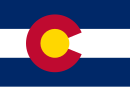
(州旗) (州章) - 州の愛称: 百年祭の州
The Centennial State 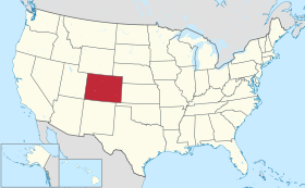
-
州都 デンバー 最大の都市 デンバー 州知事 ジャレッド・ポリス 公用語 英語 面積
- 総計
- 陸地
- 水域全米第8位
269,837 km²
268,875 km²
962 km² (0.36%)人口(2020年)
- 総計
- 人口密度全米第21位
5,773,714人
21.5人/km²合衆国加入
- 順番
- 加入年月日
38番目
1876年8月1日時間帯 UTC -7
DST -6緯度 北緯37° - 41° 経度 西経102°03' - 109°03' 東西の幅 612 km 南北の長さ 451 km 標高
-最高標高
-平均標高
-最低標高
4,401 m
2,070 m
1,011 m略称 (ISO 3166-2:US) US-COウェブサイト コロラド州政府 上院議員


コロラド州︵コロラドしゅう、英: State of Colorado [kɒləˈrædoʊ, -ˈrɑːdoʊ] ( 音声ファイル)︶[1]は、アメリカ合衆国西部にある州。北側はワイオミング州に接し、北東はネブラスカ州、東側はカンザス州、南側はニューメキシコ州とオクラホマ州に、西側はユタ州に接している。南西の隅はフォー・コーナーズと呼ばれる4つの州がその角を接するポイントであり、ここでアリゾナ州とも接していることになる。州の南北にはロッキー山脈が貫いており、州全体の平均標高が全米で一番高い、山岳地帯の州である。州の西部はコロラド高原、東の方はグレートプレーンズ︵大平原︶西部のハイプレーンズである。面積では50州の中で第8位だが、人口では第21位である。
州都および人口最大の都市は、ロッキー山脈の東側に位置するデンバーである。州の人口の6割以上が、デンバーの広域都市圏︵オーロラ、ボルダー、グリーリーなどを含む︶に集中している。
コロラド州の名前は、スペイン人探検家が名付けたコロラド川に因んでおり、﹁コロラド﹂という言葉は﹁色つきの﹂を意味するスペイン語で、コロラド川が山岳部から運ぶ赤い沈泥を表している。
音声ファイル)︶[1]は、アメリカ合衆国西部にある州。北側はワイオミング州に接し、北東はネブラスカ州、東側はカンザス州、南側はニューメキシコ州とオクラホマ州に、西側はユタ州に接している。南西の隅はフォー・コーナーズと呼ばれる4つの州がその角を接するポイントであり、ここでアリゾナ州とも接していることになる。州の南北にはロッキー山脈が貫いており、州全体の平均標高が全米で一番高い、山岳地帯の州である。州の西部はコロラド高原、東の方はグレートプレーンズ︵大平原︶西部のハイプレーンズである。面積では50州の中で第8位だが、人口では第21位である。
州都および人口最大の都市は、ロッキー山脈の東側に位置するデンバーである。州の人口の6割以上が、デンバーの広域都市圏︵オーロラ、ボルダー、グリーリーなどを含む︶に集中している。
コロラド州の名前は、スペイン人探検家が名付けたコロラド川に因んでおり、﹁コロラド﹂という言葉は﹁色つきの﹂を意味するスペイン語で、コロラド川が山岳部から運ぶ赤い沈泥を表している。
歴史[編集]

詳細は「コロラド州の歴史」を参照
領土と領有者の変遷[編集]
今日コロラド州となっている地域には、13,000年以上前からインディアンが住んでいた。ラリマー郡にあるリンデンマイアー遺跡では紀元前11200年から同3000年と同定できる人工物が出土している。ロッキー山脈の東縁は主要な回遊ルートであり、アメリカ大陸に人類が広がっていくうえで重要だった。古代プエブロ人が、コロラド高原のバレーやメサに住んでいた[3]。ユト族インディアンはロッキー山脈の南部と西部にある山岳部バレーに住んでいた。アラパホ族やシャイアン族は狩猟のためにハイプレーンズ︵グレートプレーンズ西部の高原︶を横切って西に移動していた。
ロッキー山脈の東にあるコロラド州の東側の部分は1803年のルイジアナ買収のときに、アメリカ合衆国がフランスから獲得した。この時にアメリカ合衆国が得た領土は、スペインのサンタフェ・デ・ヌエボ・メヒコ入植地周辺の広大な領土と重なり、紛争が生じた。その地域ではスペインがインディアンと交易を行っていた。1806年、ゼブロン・パイク大佐がアメリカ陸軍の偵察隊を率いて、この論争のあった地域に入った。翌年2月にパイクとその隊員はサンルイス・バレーでスペイン騎兵隊に逮捕されてチワワ州に連行され、7月にはメキシコから追放された。

アーカンザス川沿いのベントズ・オールド・フォート国立史跡、183 3年から1849年まで維持された
1819年のアダムズ=オニス条約により、スペインからフロリダを購入した見返りとして、アメリカ合衆国はアーカンザス川の南と西、北緯42度線より南、西経100度線より西の全ての土地を放棄した。この条約は1821年2月22日に執行となった。スペインとの国境問題が解決したことで、1821年8月10日にはミズーリ準州の南東部をミズーリ州として昇格させた。コロラド州の北東部となる所を含んでいたミズーリ準州の残り部分は未編入領土となり、奴隷制問題のために33年間もそのままにされた。スペインは11年間に及んだ戦争の後で、1821年8月24日に結んだコルドバ条約により、メキシコの独立を承認した。メキシコはアダムズ=オニス条約を1831年に批准した。1835年から1836年にかけてのテキサス革命によってアメリカ合衆国とメキシコの間の紛争が加速され、1846年開戦の米墨戦争に繋がった。1848年に戦争を終わらせるために結ばれたグアダルーペ・イダルゴ条約によって、メキシコはその北部領土をアメリカ合衆国に割譲した。
19世紀半ば、オレゴン・カントリー、カリフォルニアの新しい金鉱原、およびソルトレイク・バレーのモルモン教徒入植地であるデザレットに陸路向かうアメリカ人開拓者の大半は、岩の多いロッキー山脈の南部を避け、ノース・プラット川とスウィートウォーター川を辿って、ロッキー山脈の南部と中部の間にある大陸分水界では最も低い峠であるサウス・パスを越えて進んだ。1849年、ソルトレイク・バレーのモルモン教徒は超法規的なデザレット州を創設し、グレートベースンの全体と、グリーン川、グランド川、コロラド川の流域全てを領域に含むものと主張した。モルモン教徒は神権政治的であり、複婚を是認していたので、連邦政府はモルモン教徒の新政府を承認することをにべもなくはねつけた。その代わりに1850年妥協によって、メキシコ割譲地とテキサス州が領有主張していた北西部を、1つの新州、すなわちカリフォルニア州と、2つの準州、すなわちニューメキシコ準州とユタ準州に分けた。1851年4月9日、ニューメキシコのタオス地域からきたメキシコ系アメリカ人開拓者が、当時ニューメキシコ準州内、後にコロラド州の最初のヨーロッパ系アメリカ人開拓地としてサンルイスの村を設立した。
1854年、アメリカ合衆国上院議員スティーブン・ダグラスが連邦議会を説得して、大陸分水界より東の領土をカンザス準州とネブラスカ準州に分け、さらにその南にインディアン領土と呼ばれる未編入領域を設けた。新しい準州2つはその領域内で奴隷制を採用するかを住民が決定できるものとされたが、この妥協は自由土地派と奴隷制擁護派の間の敵意を増しただけだった。

デンバー鉱山キャンプの版画、1859年
1858年7月、当時のカンザス準州西部にあるサウス・プラット川沿いで金が発見され、パイクスピーク・ゴールドラッシュが始まった[4]。地域にある川や水流沿いの砂金鉱床は急速に取り尽くされたが、鉱山師達が間もなく近くの山の中でさらに大きな価値のある金鉱脈を発見した。
金の探求者達が1859年8月24日にジェファーソン準州の暫定政府を組織化したが、奴隷制に関する論議の煽りを食ってこの新しい準州に対するアメリカ合衆国議会の承認を得られなかった。1860年11月6日、アメリカ合衆国大統領選挙でエイブラハム・リンカーンが大統領に当選し、これが引き金となって南部の奴隷州9州が合衆国からの脱退を宣言し、内乱の脅威が引き起こされた。議会を支配していた共和党は自由州の政治力を補強するために、即座に1861年1月29日、カンザス準州東部を自由州のカンザス州として昇格させ、準州西部の金が探索される地域は未編入領土として残した。
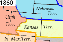
コロラド準州創設前の領域図。ニューメキシコ、ユタ、カンザスおよび ネブラスカの各準州が表示されている
その30日後にあたる1861年2月28日、任期終了間近のジェームズ・ブキャナン大統領が、自由準州としてコロラド準州を創設する法案に署名した[5]。当初定められたコロラドの境界は今日も変わっていない。コロラド川の源流が領域内にあると考えられていたので、準州の名前にコロラドが選ばれた[6]。1776年、スペイン人のシルベストレ・バレス・デ・エスカランテ神父が、地域のインディアンは山から川が運ぶ赤茶色の沈泥故に、この川を﹁エル・リオ・コロラド﹂と呼んでいたことを記録していた[7]。1859年、ジョン・マコーム大尉の率いるアメリカ陸軍地形工学遠征隊が、現在のユタ州キャニオンランズ国立公園内で、グリーン川とグランド川の合流する地点を突き止めた[8]。マコーム隊はこの合流点をコロラド川の源流と指定した。

ホリークロス山

コロラド・セントラル鉄道のジョージタウン・ループ、1899年にウィ リアム・ヘンリー・ジャクソンが撮影
1861年4月12日、サウスカロライナ州の砲兵隊がサムター砦に砲撃を開始して、南北戦争が始まった。多くの金探求者がアメリカ連合国に同調的だったが、過半数は熱烈に北軍側に忠誠な者達だった。
1862年、テキサス州の騎兵隊がニューメキシコ準州に侵入して、3月10日にサンタフェ市を占領した。アメリカ連合国が西部に侵入した目的はコロラドとカリフォルニアの金鉱原を支配するか妨害するかし、太平洋の港を抑えることだった。このテキサス部隊の動きを遮るために、急拵えで編成されたコロラドの志願兵部隊が、デンバーからニューメキシコ準州のグロリエタ峠に進んだ。3月28日、コロラド部隊とニューメキシコの地元志願兵がグロリエタ峠の戦いでテキサス部隊の進軍を止め、その大砲や物資運搬荷車を破壊し、馬とラバ500頭を逃走させた。テキサス部隊はサンタフェまでの撤退を強いられた。その作戦のための物資を失い、ニューメキシコでもほとんど支援を得られなかったテキサス部隊はサンタフェを放棄してサンアントニオに戻った。その後アメリカ連合国が南西部に進出する試みはなかった。
1864年、コロラド準州知事ジョン・エバンスがジョン・チヴィントン牧師を志願兵部隊の大佐に任命し、牛を盗むと告発されていたシャイアン族やアラパホ族インディアンから開拓者を守るよう命令を出した。チヴィントン大佐はその部隊にサンドクリーク沿いで宿営しているシャイアン族やアラパホ族の集団を攻撃するよう命じた。チヴィントンはこのとき500名以上の戦士を殺したと報告した。この民兵隊はデンバーに凱旋したが、幾人かの役人がこの戦闘と呼ばれているものは、戦う意志の無いインディアンを明らかに虐殺したものだと報告した。殺された者の多くは女子供であり、死体は酷いやり方で損傷されていた。アメリカ陸軍による審問でこの事件を告発し、その後大統領になるアンドリュー・ジョンソンがエバンス知事の辞任を求めたが、結局実行者の誰も罰せられることは無かった。
南北戦争の戦中および戦後、金で財を築けなかった山師の多くが故郷に戻ったが、意志のある少数が準州内に留まり、鉱山、製材所、農園、牧場および町を造った。1864年9月14日、ジェイムズ・ハフがアージェンタイン峠近くで銀を発見し、数多い銀山の最初のものになった。1867年、ユニオン・パシフィック鉄道が準州北東隅のウェア、現在のジュールズバーグまで線路を敷いた。1869年5月10日、ユニオン・パシフィック鉄道はユタ準州プロモントリー・サミットでセントラル・パシフィック鉄道の線路と結合し、最初の大陸横断鉄道が開通した。翌1870年6月にはデンバー・パシフィック鉄道がデンバー市まで伸び、2か月後にはカンザス・パシフィック鉄道が開通して2本目の大陸横断鉄道となった。1872年、準州内南西部にあったユト族居留地内のサンフアン山脈で大きな銀の鉱脈が発見された。翌年ユト族はサンフアン居留地から移動させられた。

パイクスピーク・ゴールドラッシュ[編集]

準州法[編集]


州昇格[編集]
1875年3月3日、アメリカ合衆国議会はコロラド準州が州に昇格するための要求事項を規定する授権法を成立させた[9]。1876年8月1日︵アメリカ合衆国建国100周年から28日後︶、ユリシーズ・グラント大統領がコロラドを合衆国第38番目の州として昇格させる宣言書に署名した。このことで、コロラド州は﹁100周年の州﹂という渾名がついた[10]。 1878年にリードビル近くで大きな銀の鉱脈が発見され、コロラド・シルバーブームが始まった。1890年のシャーマン銀購入法で銀鉱業が活性化し、その数ヶ月後にはコロラドで最後かつ最大の金の鉱脈がクリップル・クリークで発見されて、金探鉱者の新しい世代を惹き付けた。コロラド州は1893年11月7日から婦人参政権を認めて普通選挙を導入した2番目の州となり、また住民投票を行った最初の州となった。1893年にシャーマン銀購入法が撤廃され、コロラドの不安定な鉱業と農業が崩壊したが、その後は緩りとまた着実に回復していった。 1908年にデンバーで民主党全国大会が開催された。これは西部の州で二大政党の全国大会が開催される初の機会となった。1930年の国勢調査で、州人口は初めて100万人を超えた。世界恐慌と1930年代のダストボウルはコロラドを直撃したが、第二次世界大戦後の移民の大きな波が訪れてコロラドの運命を変えた。観光業が州経済の主幹となり、ハイテクが重要な経済推進力となった。国勢調査局の推計では2009年に州人口が500万人を超えた。 アメリカ海軍の3隻の軍艦がUSSコロラドと名付けられてきた。最初のUSSコロラドはコロラド川に因む命名だった。後の2艦はコロラド州に因むものであり、戦艦USSコロラドは1941年から第二次世界大戦の太平洋戦線で活躍した。真珠湾攻撃のときは、カリフォルニア州サンディエゴの海軍基地にいたので、攻撃を免れた。地理[編集]

コロラド州は緯線と経線のみで囲まれている(州境線がすべて緯線か経線になっている)州であり︵このような州は、他にワイオミング州とユタ州がある︶、北緯37度から41度まで、西経102度3分から109度3分までの範囲を占めている[9]。南西端の北緯37度及び西経109度3分では、アリゾナ州、ニューメキシコ州、ユタ州とコロラド州が1点で接しており、そこはフォー・コーナーズと呼ばれている。コロラド準州時代に州境の標識を打つとき、測量のミスで幾つかの小さな歪みができた。その中でも著名なのがユタ準州との境界である[11]。このずれを一旦連邦政府、関係州、準州が認めてしまったので、ずれを含んだままコロラド準州の法的な境界として定められた[12]。Tロッキー山脈の支脈であるフロント山脈より東に広がる平原は、グレートプレーンズの一部︵ハイプレーンズ︶となっており、海抜は1,000 から 2,000 mである。東側でカンザス州及びネブラスカ州と隣接している。この平原にはまばらに人が住んでいるのみで、そのほとんどはサウスプラット川、アーカンザス川、州間高速道路70号線道路沿いに定住している。雨量は年平均約15インチ (380 mm) と不足気味である。いくつか灌漑した農場はあるが、農地の多くが乾燥農場または牧場として使われている。秋まき麦がこの地域の典型的な作物であり、ほとんどの町に給水塔や穀物倉庫がそびえ立っている。
主要な都市は、フロント山脈のすぐ東の州間高速道路25号線道路沿いにある。コロラド州の大部分の住民はこの都市化の進んだ一帯に暮らしている。

リードビル近くのテンマイル山脈

ロッキー山脈国立公園の最高点ロングスピーク、14,255フィート (4345 m)

ブレッケンリッジ付近の山脈

デンバーの西にあるフロント山脈の峰々

大陸分水界はラブランド峠で標高11.990フィート (3,655 m) まで低くなっている

コロラド州南部のグレートサンドデューンズ国立公園にある北アメリカ で最も標高の高い砂丘

大陸分水界に近いベルフォード山頂上近くからの眺め

エルバート山、ロッキー山脈の最高峰
フロント山脈の西部に大西洋側と太平洋側とを分ける大陸分水界が位置している。それより西は西部斜面と呼ばれ、この一帯のの水はコロラド川を経て太平洋の方向に下っている。
ロッキー山脈の奥地には、大きな谷や高く広々とした盆地がいくつもある。北には、大陸分水界の東側にノースパークがある。このノースパークからは、ノースプラット川が北のワイオミング州に向かって流れる。そのすぐ南は、ミドルパークであるが、ここは大陸分水界の西側になっていて、ここからはコロラド川が流れている。サウスパークはサウスプラット川の水源である。
コロラド州内のロッキー山脈はフォーティーナとして知られる14,000フィート (4,270 m) 以上の高さの山が54峰もある[13]。コロラド州では、南部で海抜約12,000 フィート (4,000 m)、北部で海抜約10,500 フィート (3,200 m)の高さまでは、針葉樹 やアスペン︵ヤマナラシ︶などの樹木が生えている︵その標高は森林限界と言われ、これより高地では高山植物しか育たない︶。ロッキー山脈では冬季は雪に覆われるが、ほとんどの雪は8月中旬までに溶けてしまい、小さな冠雪や氷河が多少残る程度である。南西部のサンフアン山脈からフロント山脈のボルダーやセントラルシティまで伸びているコロラド・ミネラルベルトは、かつての金銀採掘が行われていた地域に重なっている。
レイク郡にあるエルバート山の頂点は標高14,440フィート (4,401 m) であり、コロラド州とロッキー山脈の最高地点である[14]。コロラド州は全領域が標高3,300フィート (1,000 m) 以上であることでは全米唯一の州である。アリカリー川がユマ郡からカンザス州シャイアン郡に流れ出る所の標高が3,317フィート (1,011 m) で州内最低地点である。この最低地点が全米の州の最低地点中では最高の数値になっている[15][16]。
山岳部[編集]


平原部[編集]
コロラド州の領域の3分の1強は平原とうねりのある土地である。ロッキー山脈の東側はハイプレーンズのコロラド東部平原であり、標高3,350フィート (1,329 m) から7,360フィート (2,243 m) まで変化するグレートプレーンズの部分である。中西部の平原州であるカンザス州とネブラスカ州がそれぞれ東と北東に境を接している。コロラドの平原は通常プレーリーと見なされるが、実際には落葉性の森林、ビュート︵孤立した丘︶、および渓谷が散在し、ニューメキシコ州の高原部と似ている。東部は主に農地に使われ小さな農業村や町がある。降水量はそこそこであり、年間15インチ (380 mm) から25インチ (635 mm) 程度である[17]。通常夏は暑くて乾燥し、冬は非常に寒くて、雪が降り、氷が張る。農産物として、トウモロコシ、小麦、干し草、大豆、オート麦が生産されている。牧畜も盛んで牛や豚が飼育されている。灌漑用の水はサウスプラット川、アーカンザス川などの水流から取られており、またアルトワ式井戸など地下水源からも取られている。しかし、灌漑用に地下水を多く使うことで地下水源が減少している。フロント山脈[編集]
コロラド州の人口の大半はロッキー山脈の東端、フロント山脈都市回廊のワイオミング州シャイアンとコロラド州プエブロの間に住んでいる。この地域はコロラド州の中央にあるロッキー山脈によって太平洋からの偏西風から部分的に守られている。他にそこそこの人口がある地域はコロラド州西端のグランドジャンクションとデュランゴである。南部[編集]
州最南部には大きなサンルイス・バレーがあり、ここにリオ・グランデ川の水源がある。このバレーはサングレ・デ・クリスト山脈とサンフアン山脈の間にあり、山脈の間にまで入る大きな砂漠がある。リオ・グランデ川は真南のニューメキシコ州、メキシコ、およびテキサス州に流れる。サンルイス・バレーの東側、サングレ・デ・クリスト山脈の反対側はウェットマウンテン・バレーである。これらの盆地で、特にサンルイス・バレーは、ロッキー山脈とその支脈の地質形成であるリオ・グランデ川リフトにある。高峰[編集]
州内に入るグレートプレーンズの西にはロッキー山脈の東側斜面がある。ロッキー山脈の有名な高峰は、ロングス峰、エバンス山、パイクス峰および南部のワルゼンバーグに近いスパニッシュ峰である。この地域の水は東と南東に流れ、ミシシッピ川あるいはリオ・グランデ川によりメキシコ湾に流れ込む。 コロラド州内には北アメリカの高峰30位までの山が全て入っている。4つの国立公園、6個の国立保護区、2つの国立レクリエーション地域、2つの国立歴史史跡、3つの国立歴史の道、1つの国立シーニックトレイル、11の国有林、2つの国立草原、41の国立原生地、2つの国立保存地域、8個の国立野生生物保護区、44の州立公園、1つの州有林、323の州立野生生物保護区があり、さらに多くの景観、歴史およびレクリエーションでの見所がある。国立公園[編集]
西部斜面[編集]

コロラドの西側斜面の水はコロラド川とその支流︵主にグリーン川とサンフアン川︶に流れるか、乾燥地域で蒸発している。西側斜面の南西部で著名なのはグランド・メサと岩がちの高山であるサンフアン山脈であり、その西にはユタ州南部に接する乾燥地帯であるコロラド高原がある。西側斜面で最大の都市グランドジャンクションとデュランゴはラジオ、テレビ、新聞および高等教育の中心になっている。大陸分水界の西のコロラド州では、グランドジャンクションのメサ州立カレッジと、ガニソンの州立ウェスタン・カレッジ、デュランゴのフォートルイス・カレッジのみが、4年制カレッジになっている。

グレンウッドスプリングス近くの峡谷の壁

グレンウッドスプリングス近くのハンギング湖

ダイノソー国立保護区
グランドジャンクションは、州西部では唯一の高規格道路である州間高速道路70号線に沿っている。また唯一の鉄道であるユニオン・パシフィック鉄道も通っており、連続した高規格道路の無いルートでデンバーとグランドジャンクションの間をつなぎ、ロッキー山脈を越えるアムトラックの﹁カリフォルニア・ゼファー﹂列車が走っている。
グランドジャンクションの南西にグランド・メサがあり、世界最大の頂部が平らな山だと言われている。西側斜面の他の町として、温泉保養地のグレンウッドスプリングス、スキー場のアスペン、ブレッキンリッジ、ベイル、クレステッドビュート、スティームボートスプリングス、テルリドがある。
州の北西隅はほとんど人の住まない地域であり、著名なダイナソー国立保護区の一部が掛かっている。ここは古生物学的な地域であるだけでなく、高く岩の多い丘、渓谷および水流のある景観地でもある。ここでグリーン川が短区間州内に入っている。
コロラド州は西から東に、砂漠地と砂漠高原、国有林のある高山帯、南部山脈に散開する砂漠地、グレートプレーンズの比較的平らな草原と点在する森林という順に並んでいる。有名なパイクス峰はコロラドスプリングスの直ぐ西に位置している。この孤立峰は晴れた日にはカンザス州境近くからも見ることができ、さらに北や南からも見られる[18]。砂漠地はロイヤルゴージ、プエブロ、キャニアンシティ、フローレンス、グレートサンドデューンズ国立公園、サンルイス・バレー、コルテス、古代国立保護区峡谷群、ホーブンウィープ国立保護区、ユト山、デルタ、グランドジャンクション、コロラド国立保護区、ローン高原などと、アンコンパグレ高原とアンコンパグレ国立の森を取り巻く地域の周辺にある。

ロッキー山脈国立公園にあるベア湖の氷解け
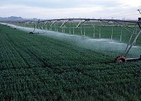
ユマ郡の小麦農園における回転散水
岩がちの山岳部や、平原部の都市および農業地帯に降った雪
コロラド州の気候は、他の州に比べて極めて複雑である。南部が北部より暖かいというわけではない。領域の大半が山岳、丘陵、高原および砂漠地となっている。山岳部とそれを取り巻くバレーが地域の気候に大きく影響する。概して標高が高いと気温が低く、降水量が多い。北東部、東部、南東部は高原であり、北部は高原、丘陵および山岳が混じっている。北西部と西部は圧倒的に山岳部であり、幾らか砂漠地がある。南西部と南部は砂漠と山岳の複雑な混合である。極端に天気が変わりやすく地震などの自然災害も他地域と比べて多い。


気候[編集]


東部平原[編集]
東部平原の気候は亜乾燥気候︵ケッペンの気候区分BSk︶であり、湿度が低く、通常は年間15インチ (380 mm) から25インチ (635 mm) 程度の降水量がある。日照時間が長く、夜間は涼しく晴れるので、日間の気温差が大きい。夏の気温は95°F (35℃) 以上となる日が多く、100°F (38℃) を超える日もある[19]。フロント山脈の標高5,000フィート (1,500 m) を越える地域の都市では最高気温が105°F (41℃) までだが、標高5,000フィートを下回る地域の都市では112°F (44℃) にも達した[20]。平原の冬季は、最低気温が0°F (-18℃) から-10°F (-23℃) まで下がる。降水量の75%は植物の成長期である4月から9月に降るが、非常に干ばつになりやすい。降水の大半は雷雨からのものであり、激しいものになることが多い。また暴風雪は早春、晩秋および冬季に多い。冬季は大半が乾燥し寒い。地域の大半で3月と4月が最も雪が多い。4月と5月が雨の多い月であり、4月が全体で湿度の高い月となる。フロント山脈の都市は山に近いと冬に暖かくなる。これはチヌーク風によるものであり、時には70°F (21℃) 以上になることもある[21]。7月の平均気温は朝の55°F (13℃) が午後には90°F (32℃) 近くまで上がる。1月の平均気温は朝の18°F (-8℃) が午後には45°F (7℃) 近くまで上がる。ただし、連続した日の温度差は40°F (22℃) ということもある。平原と丘陵部の西[編集]
平原と丘陵部の西は均質ではない。数マイル離れた場所でも、その地域の地形に応じて全く異なる気象となる。バレーの大半は亜乾燥気候であり、標高が高い所では高山気候になる。湿潤な微気候も所によって存在する。概して雨の多い季節は冬であり、最も少ないのは6月である。このことは東部と正反対である。山岳部の夏は冷涼で、最高気温は60°F (16℃) から70°F (21℃) であり、突然の雷雨で温度を急激に下げることがある。夏の夜は涼しく、標高が高い所では寒いくらいである。夏季でも雪が降ることがある。冬季には山岳部に大量のパウダー状の雪が降り、大きな嵐の間にはたっぷりと日照がある。西部斜面の夏は平原部と同様な高温になり、冬は平原部やフロント山脈によく吹く暖かい風が無いのでやや冷涼である。西部の他の地域はそれぞれ特有の気候を持っている。異常気象[編集]
コロラド州では異常気象の起きる頻度が高い。大陸分水界の東では春と夏に雷雨が頻発し、雷に撃たれて死ぬ人の数では最も多い方の州である。大陸分水界の東と州北西部では雹もよく見られる。東部平原は北アメリカでも最も大きな雹が降る所である[17]。また東部平原は竜巻道にも掛かっており、アメリカ合衆国の中でも強烈な竜巻が起こる。これまで1990年のライモンで起こった藤田スケールF3の竜巻や2008年のウィンザーで起こった改良藤田スケールEF3の竜巻が町に大きな損害を与えてきた[22]。 平原部は洪水にも襲われやすい。雷雨によるものや、暖かい気象で山岳部の雪が急速に溶けて起こるものがある。デンバーで1921年に記録された90°F (32℃) 超え連続日数記録が2008年の夏に破られた。その日数は連続24日であり、以前の記録を7日上回った[23]。コロラド州の大半が比較的雨の少ない所である。年間平均雨量は17インチ (430 mm) 程度であり、州内の一部だけが旱魃に見舞われることは滅多に無い[24]。雨が少ないために、アメリカ史の中でも最大級の山火事だったヘイマン火災など山火事が多く、2010年に起こったフォーマイルキャニオン火災は、コロラドの歴史の中でも最も破壊的なものだった。 しかし、山岳部によっては冬の降雪で大量の水分が貯まるところがある。この雪が春に溶けるとヤンパ川、グランド川、コロラド川、リオ・グランデ川、アーカンザス川、チェリー・クリーク、ノースプラット川およびサウスプラット川など大量に水が流れることが多い。コロラドのロッキー山脈から流れ出る水は南西部のニューメキシコ州、アリゾナ州、ユタ州、ネバダ州、また中西部のネブラスカ州やカンザス州、さらには南部のオクラホマ州やテキサス州の農場、町および都市の貴重な水源になっている。大量の水はカリフォルニア州にも分けられ、メキシコ北部まで届く水もある。気象の記録[編集]
コロラド州の過去最高気温は1888年7月11日にベネットで記録された118°F (48℃)、過去最低気温は1985年2月1日にメイベルで記録された-61°F (-52℃) だった[25][26]。| 都市 | 1月 | 2月 | 3月 | 4月 | 5月 | 6月 | 7月 | 8月 | 9月 | 10月 | 11月 | 12月 |
|---|---|---|---|---|---|---|---|---|---|---|---|---|
| アラモサ | 2/−19 | 4/-14 | 11/-8 | 16/-4 | 21/1 | 26/5 | 28/8 | 27/8 | 23/3 | 17/-4 | 8/-11 | 2/-17 |
| コロラドスプリングス | 6/-8 | 7/-7 | 11/-3 | 16/1 | 21/6 | 26/11 | 29/14 | 28/13 | 24/8 | 17/2 | 11/-4 | 6/-8 |
| デンバー | 7/-7 | 8/-6 | 12/-3 | 16/2 | 22/7 | 28/12 | 32/15 | 30/14 | 26/9 | 18/3 | 11/-3 | 6/-8 |
| グランドジャンクション | 3/-8 | 8/-4 | 14/0 | 19/4 | 24/9 | 31/14 | 34/18 | 32/17 | 27/12 | 19/5 | 11/-2 | 4/-7 |
| プエブロ | 8/-10 | 11/-8 | 16/-3 | 20/1 | 25/7 | 31/12 | 34/15 | 32/14 | 28/9 | 21/1 | 14/-5 | 8/-10 |
地震[編集]
2011年8月22日、トリニダード市の西南西9マイル (14 km) でマグニチュード5.3の地震が起こった[27]。死傷者は無く、小さな損失が報告された。1973年に記録されたマグニチュード5.7の地震以来であり、2番目に大きなものだった[28]。
人口動態[編集]

| 人口推移 | |||
|---|---|---|---|
| 年 | 人口 | %± | |
| 1860 | 34,277 | — | |
| 1870 | 39,864 | 16.3% | |
| 1880 | 194,327 | 387.5% | |
| 1890 | 413,249 | 112.7% | |
| 1900 | 539,700 | 30.6% | |
| 1910 | 799,024 | 48.0% | |
| 1920 | 939,629 | 17.6% | |
| 1930 | 1,035,791 | 10.2% | |
| 1940 | 1,123,296 | 8.4% | |
| 1950 | 1,325,089 | 18.0% | |
| 1960 | 1,753,947 | 32.4% | |
| 1970 | 2,207,259 | 25.8% | |
| 1980 | 2,889,964 | 30.9% | |
| 1990 | 3,294,394 | 14.0% | |
| 2000 | 4,301,262 | 30.6% | |
| 2010 | 5,029,196 | 16.9% | |
| 2020 | 5,773,714 | 14.8% | |
| Sources:1910-2010[29] | |||
2020年国勢調査時点でのコロラド州の人口は5,773,714人であり、2010年国勢調査時点より14.80%増加している[30]。州都及び最大都市はデンバーである。デンバー・オローラ広域都市圏︵ボルダー、グリーリー両都市圏も含む︶には、コロラド州の人口の6割以上︵2020年時点では3,623,560人[30]で62.76%︶が居住している。
2005年時点で、コロラド州の推計人口は4,665,177人であり、前年より1.4%、63,356人の増加、2000年より8.4%、363,162人の増加だった。この中には、自然増205,321人 (出生353,091人、死亡147,770人) と、転入出に伴う増加159,957人 (アメリカ合衆国外からの転入超過112,217人、合衆国内からの転入超過47,740人︶が含まれている。
2004年版概算によると、コロラド州の人口は2030年に7,150,000人へ増加するだろうと予測されている[2]。最も大きく増加するのは、フロント山脈沿いの特にデンバー・オローラ大都市圏だと予測されている。郡の単位ではダグラス郡とウェルド郡の成長速度が高い[31]。コロラド州の人口重心は、ジャクソン郡のクリッチェル村の北にある[32]。
2004年現在、144,000人 (州人口の3.1%) の不法在留外国人を含む、441,000人 (人口の9.7%) の外国生まれがこの州内で暮らしている。
人種及び祖先[編集]
| 国勢調査年: | 2010年 | 2000年 | 1990年 |
|---|---|---|---|
| 白人 | 81.3% | 82.8% | 88.2% |
| 黒人 | 4.0% | 3.8% | 4.0% |
| アジア人 | 2.8% | 2.2% | 1.8% |
| インディアン | 1.1% | 1.0% | 0.8% |
| その他 | 7.2% | 7.3% | 5.1% |
| 混血 | 3.4% | 2.8% | |
| 白人、ヒスパニック以外 | 70.0% | 74.5% | 80.7% |
| ヒスパニック‡ | 20.7% | 17.1% | 12.9% |
- ノート
- * データなし;混血は2000年の国勢調査で初めて報告された
- ‡ ヒスパニックの数字は各人種の数字と重複している
コロラド州は米国内でもヒスパニック系市民特にメキシコ系アメリカ人の人口が多い州であり、2010年国勢調査では50州の中で第7位である。デンバーやコロラドスプリングスなど州全体の都市圏にかなりのメキシコ系人口がいる一方で、州の南部にはスペイン領時代のメキシコからの移民の末裔であるヒスパニック系住民が多い。
2000年国勢調査で、5歳以上の住人の10.5%は家庭でスペイン語のみを話し、2009年の推計では14%と増加している。ニューメキシコ州と同様に古スペイン語の慣用句を多用している[34]。
デンバー市のモントベロなどの地区およびイーストデンバー地域にはアフリカ系アメリカ人の地域社会がある。コロラドスプリング市の東部や南東部にもある。アジア系アメリカ人はモンゴル系、中国系、フィリピン系、朝鮮系、東南アジア系、日本系の子孫が多い。特にデンバー市の南部と南東部に多く、また南西部にも幾らかいる。デンバー都市圏は、政治的問題や環境問題に関して州の他の部分よりもリベラルで多様化していると考えられている。
2006年には州内で70,331人の出生が届けられ、出生率は人口1000人あたり14.6だった。2007年では非ヒスパニック白人が出生数の59.1%に関わっていた[35]。そのうち14.06%は非ヒスパニック白人とその他の人種の子であり、その大半はヒスパニック系の者を含むカップルだった。少なくとも1人のヒスパニック系住民が関わる出生は全体の43%だった[36]。
2000年国勢調査での申告による祖先の出身国で分けた人口構成は[37]:6、ドイツ系︵22%、スイスとオーストリアを含む︶、メキシコ系︵18%︶、アイルランド系︵12%︶、イギリス系︵12%︶である。ドイツ系祖先と申告した人々は、フロント山脈、中西部のロッキー山脈にある郡、及び東部平原に特に集中している[38]。

岩の上の礼拝堂、アレンズパークに近いキャンプ・セントマロ

アメリカ空軍士官学校の礼拝堂、コロラドスプリングス近く
コロラド州民の信仰する宗教は以下の通りである[39]。
●キリスト教 –64%
●プロテスタント –44%
●福音主義派 –23%
●メインライン・プロテスタント –19%
●他のプロテスタントまたは一般的なプロテスタント –2%
●ローマ・カトリック –19%
●モルモン教 –1%
●正教会 –2%
●ユダヤ教 –2%
●他の宗教 –5%
●無宗教/Agnostic –25%
信徒数ではカトリック教会の752,505人、モルモン教92,326人、バプテスト85,083人となっている[40]。
無宗教と答えた人は25%おり、全米平均の17%より高い。

山岳ユテ族の保留地

南部ユテ族の保留地
同州にはシャイアン族、アラパホー族、バンノック族、ヒカリア・アパッチ族、コマンチ族、カイオワ族、ナバホ族、ショーショーニー族、ユテ族などのインディアン部族が先住した。すべてティーピーで移動生活をし、農耕を行わない狩猟民族だった。また、プエブロ族の先祖が先史時代に遺跡を残している。
1859年、デンバーの﹁ブレイク&ウィリアムズホテル﹂で、同州に先住するアラパホー族とデンバーの白人町民との交歓の集いが開かれた。アラパホー族のリトル・レイブン酋長は白人たちを相手に演説を行い、﹁私は白人が好きだし、白人たちがこのあたりで金鉱を探していることを嬉しく思っている﹂と述べ、大喝采を浴びた。酋長は続けて﹁デンバーの周りの土地はすべてアラパホー族の領土だから、このあたりからは出来るだけ早く白人たちは出て行ってもらいたい﹂と述べたのだが、こちらの言葉はまともに聞く者はいなかった。わずか数年後に、この地のアラパホー族は残らずワイオミング州の保留地に強制移住させられたのである。
この時期、西部一帯のインディアンと白人の土地を巡る抗争は拡大の一途をたどっていた。コロラド州ではこのころに、白人の市民集会が開かれ、インディアンの頭の皮の買い取り資金として5000ドルの募金が集められた。これを基金に、耳たぶまで付いている頭の皮なら、一枚25ドルという高値の懸賞金がつけられたのである。

1864年9月28日、デンバーで開かれた和平会談に出席したシャイア ン族、カイオワ族、アラパホー族の酋長たち。﹁ブラック・ケトル﹂酋長の姿も見える
1864年9月28日、周辺でインディアンと白人の血生臭い土地抗争が続く中、デンバーで周辺インディアン部族の代表者と白人入植政府との和平協議が行われた。白人町民たちは酋長たちの乗る馬車を、外に出て出迎えた。シャイアン族のブラック・ケトル酋長もこれに参加して、ジョン・エバンズ知事やチビントン大佐を相手に和平を説いた一人だった。
この和平会談から二ヶ月後に同州で発生した﹁サンドクリークの虐殺﹂は、﹁和平会談﹂で﹁コロラドから出て行け﹂との白人の要求に応じて移動中だった、無抵抗なブラック・ケトル酋長らのシャイアン族の一団がアメリカ陸軍騎兵隊に野営を襲われ、老人、子供も見境なしに無差別虐殺されたもので、ハリウッド映画の﹃ソルジャー・ブルー﹄の題材ともなった。犠牲となったシャイアン族自体は部族を二分され、19世紀末にモンタナ州とオクラホマ州の保留地に強制移住させられた。
1864年12月8日、デンバーの地元新聞の﹁ロッキー山脈ニュース﹂は、﹁インディアンとの大決戦、野蛮人どもは追い散らされた! インディアンの死者500人、我らの軍の損失は死者9人、負傷者38人!﹂という勇ましい見出しでこの﹁サンドクリークの虐殺﹂を伝え、12月12日にはチビントン隊の帰還を伝えた。虐殺を指導したチビントン大佐と騎兵隊は、殺したインディアンたちの男女の性器や頭の皮を剥ぎ取り、これを戦利品として軍帽に飾り、デンバーでパレードを行って見せた。
この州に先住するインディアン部族は、19世紀にユテ族以外、すべて他州へ強制移住させられた。ユテ族の二つの支族のみが現在、アメリカ連邦政府から部族認定され、保留地︵Reservation︶を領有している。
﹁デラウェア族﹂や﹁ウィンネバーゴ族﹂は、19世紀にデラウェア州や五大湖地方から強制移住させられた部族だが、アメリカ連邦政府によって﹁絶滅部族﹂として認定を打ち切られ、保留地を没収されており、部族として存在しないことになっている。現在、領土と自治権を求め、部族再認定を要求中である。
宗教[編集]


健康管理[編集]
コロラド州は健康のために運動をする人の比率が高いという評判がある。幾つかの調査では、肥満率が全米で最も低かった[41]。2007年時点で人口の18%は医学的に肥満と考えられているが、2004年の17%からは増加している。コロラド州知事ビル・リッターは、﹁熱心な釣り人および自転車乗りとして、コロラドは活動的で健康的な生活様式の環境を提供していることが分かる。﹂とコメントした。ただし、州内の肥満率の増加を緩めるために教育と支援を続ける必要があることを強調した[42]。インディアン部族[編集]


インディアン・カジノ[編集]
現在、﹁ユテ族﹂が二つの﹁インディアン・カジノ﹂を営業中である。﹁山のカジノ﹂は1992年に開設された、古参の﹁インディアン・カジノ﹂である。
コロラド州議会はカジノに関する新しい州法を2009年7月2日より発布した。これは掛け金上限を100ドルに上げ、ルーレットとサイコロ博打を追加し、カジノの24時間営業を認可するものである。同州ではカジノは州を上げてのビジネスとなっている。
資源のない山間の保留地に住む﹁山岳ユテ族﹂にとってカジノは、唯一の産業となっている。現在、部族員の8割が﹁山のカジノ﹂で働いており、保留地外に流出した部族員を呼び戻すなど、多大な効果を上げている。
- 「山岳ユテ族」
- 「ユテ族・山のカジノ」
- 「南部ユテ族」
- 「空のユテ族・カジノ&ロッジ」
インディアンとコロンブス・パレード[編集]
コロラド州のデンバー市は、クリストファー・コロンブスのアメリカ上陸記念祭である﹁コロンブス・デー﹂に合わせ、イタリア人団体と共催して﹁コロンブス・パレード﹂を開催している。1907年にデンバーが始めたこの行事は、現在では全米各地で開催される祝祭となっている。
このデンバーには、全米最大のインディアン権利団体﹁アメリカインディアン運動︵AIM︶﹂の支局がある。AIMはこの州を挙げてのパレードに合わせて、﹁インディアンに対する殺戮者︵コロンブス︶の祝賀を糾弾し、市当局に道徳的態度を取るよう促す﹂として抗議デモをぶつけており、この際、州警察によって多数のインディアンが逮捕されるのが毎年の恒例である。
1990年、一度途絶えていたデンバーでの﹁コロンブス・パレード﹂が、﹁イタリア系アメリカ人組織連盟︵FIAO︶﹂の主催によって30年ぶりに復活すると発表された。これを受け、前年から反コロンブス・パレード運動を高めていたコロラドAIMは、FIAOに対してインディアンにとって呪わしい﹁コロンブス﹂の名を冠さないよう申し入れた。FIAOはこれを検討するとしたが、その後一切の交渉を拒絶し、﹁コロンブス・パレード﹂を開催した。
1991年、再びFIAOが名称変更要求を無視したため、AIMはパレードにぶつけて抗議デモを決行。この際、スー族のラッセル・ミーンズ、オーセージ族のグレン・モリス︵Glenn Morris︶、ムウェクマ・オーロネ族のマーガレット・マルチネス︵Margaret Martinez︶、コロラド大学教授︵当時︶のワード・チャーチルの4人のAIMメンバーが州警察によって逮捕された。彼らは1992年6月の裁判で完全無罪となっている。
1992年、﹁コロンブスのアメリカ上陸500周年﹂のこの年、コロラドAIMの要求をFIAOは再び拒否した。これに対し、デンバー市長のメイヤー・ウェブ︵当時︶、アメリカ合衆国司法省地域社会局、シャイアン族のベン・ナイトホース・キャンベル上院議員︵当時︶らによって、この問題を話し合うための協議会が7度にわたり開催された。この会議の最終日に、FIAO代表者のひとりがAIM代表者のグレン・モリスの発言を遮り、﹁お聞きなさい、ここはもうあんたがたの国じゃないんだ。今じゃここは我々の国なんだから、あんたがたはこの行事に参加してるのが一番いいんだ﹂と暴言を吐いたため、会談は決裂した。
パレード当日、抗議のデモ隊はAIMメンバーとインディアン以外の支持者合わせて3500人に膨れ上がった。これを受け、FIAOはコロラド州議事堂階段前でのパレードを中止し、小規模集会に切り替えた。この日に行われたAIMの祝賀会で、FIAO代表者はAIMとの対話を約束したのだが、それは守られなかった。が、コロラドにおけるコロンブス・パレードはその後しばらく開催されることはなかった。
1998年10月12日、﹁コロンブス・デー﹂発祥地の同州プエブロ市で、プエブロ市市民団体とイタリア人団体によって、93年前に建てられたコロンブスの銅像に花束を手向ける行事が行われた。これに対し、AIMら約100人のデモ隊が太鼓とメガホンで抗議を行い、AIMのラッセル・ミーンズは﹁コロンブスは大西洋を横断した最初の奴隷商人だ﹂としてこの銅像に﹁血﹂︵赤い塗料︶を浴びせてみせた。以後、このコロンブス像に﹁血﹂を浴びせる抗議は毎年行われている。
2000年、イタリア人組織﹁アメリカにおけるイタリアの息子たち﹂がコロンブス・パレードを再開すると公表したため、コロラドAIMは彼らとの対話の仲介を司法省地域社会局に要請。数度の会談ののち、パレードは﹁イタリアのプライド・パレード行進﹂と変更する旨の協定調印が9月19日に行われた。しかしパレード当日にこれは破られ、﹁コロンブス・パレード﹂は開催された。AIM[はチカーノ団体の﹁Escuela Tlatelolco﹂、﹁バリオ戦士団﹂と共闘し抗議デモを決行、150人が州警察に逮捕された。彼らは後にデンバー市当局によって不起訴とされている。
2001年、新しいコロンブス・パレードが別団体の主催で復活した。これに対抗してAIMと﹁コロンブス・デー変更同盟﹂︵The Transform Columbus Day Alliance︶は2000人規模の第一回﹁4方向の行進﹂︵Four Directions March︶を開催した。
2005年9月24日、地元新聞の﹁ロッキー山脈ニュース﹂が、﹁コロンブス・パレードに揉め事は見当たらない︵Columbus parade could see less strife︶﹂という見出しで、市関係者のコメントとともに特集記事を載せ、﹁インディアンの抗議デモは減少している﹂と論じた。これに対し、AIMおよび同州のインディアン団体が﹁どこにそんな根拠があるのか﹂と激怒し、猛抗議を行っている。ちなみに前年の2004年では、240人のデモ隊が逮捕されている。その後、﹁ロッキー山脈ニュース﹂は2009年2月26日を以て廃刊となった。
2007年、コロンブス・パレード100周年に当たるこの年、インディアンら抗議団がこの休日を白人至上主義者による﹁KKKolumbusデー﹂と命名。﹁4方向の行進﹂と合わせ、約1000人が大規模抗議デモを決行。80人以上が逮捕されている。現在、カリフォルニア大学デービス校で思想科学科長を務めるAIMのグレン・モリスは、コロンブス・デーが及ぼす人種差別効果について、アメリカ合衆国憲法修正第一条における権利侵害を指摘している。州政府もデモの法的引き締めを強めていて、逮捕者は例年のこととなっており、以後もパレードでの紛争は収まる気配を見せていない。

コロラド歴史博物館、デンバー市

デンバー市のストリートアート
文化[編集]


美術館・博物館[編集]
●デンバー自然史博物館 ●コロラド大学自然史博物館 ●世界フィギュアスケート博物館と栄誉の殿堂オーケストラなど[編集]
●コロラド交響楽団料理[編集]
コロラド州は南西部とロッキー山脈の料理で知られている。州内至る所にメキシコ・レストランがある。 ボルダー市は2010年、雑誌﹁ボナベティ﹂によってアメリカの食事の町に挙げられた[43]。ボルダー市およびコロラド州は概して、多くの国籍の食材と飲料の会社、最高級レストランおよびファーマーズマーケットがある。またボルダー市はサンフランシスコ市やニューヨーク市を含め他の都市よりも人口当たりのソムリエの数が多い。 毎年6月にはアスペンでフード・アンド・ワイン・クラシックが開催されている。アスペンはロッキー山脈地域の料理の首都という評判もある[44]。 デンバー市はステーキで知られているが、多くの最高級レストランが有って、多様な料理を提供している[45]。ワイン[編集]
コロラド・ワインには賞を受賞した品種もののワインもあり、州外からも好意的に迎えられている[46]。伝統的なビニフェラ種ブドウから作られたワインに加えて、サクランボ、モモ、プラムおよび蜂蜜から作られたワインもあり、その品質で国内外の賞を得ている[47]。ブドウ栽培地域にはアメリカ合衆国で最も標高の高いブドウ園があり[48]、標高4,000フィート (1,200 m) から7,000フィート (2,100 m) の間に多い。山岳性気候によって暖かい夏日と冷涼な夜が得られる。アメリカ・ブドウ栽培地域に指定された所としてはグランドバレーとウェストエルクスの各栽培地域があり[49]、ここにほとんどのブドウ園が入っている。またフロント山脈にもワイン醸造所の数が増えてきた。映像作品[編集]
豊かな自然が多いので自然をテーマにした作品が多い。詳細は「Category:コロラド州を舞台とした映画作品」および「Category:コロラド州を舞台としたテレビ番組」を参照
経済[編集]


詳細は「Economy of Colorado」を参照
アメリカ合衆国商務省経済分析局の推計では、2010年の総州生産高は2,576億米ドルだった[50]。2010年の一人当たりの収入は合衆国内で11番目に位置する、51,940米ドルだった[51]。コロラド州の経済は19世紀中ごろの鉱業が初めにあり、灌漑農業開発が発展した。19世紀後半、牧畜業が重要となった。初期の産業は鉱物の掘削と加工、及び農業生産品を基礎にしていた。現在の農業生産品は牛、小麦、乳製品、トウモロコシ、及び干し草である。
20世紀後半、工業及びサービス業が大きく拡大した。コロラド州の経済は多様化され、科学研究及びハイテク産業が集中した事で有名である。他の産業は食品加工、輸送設備、機械、化学製品、金、銀及びモリブデンのような鉱物、及び観光業が含まれる。ビールの年間生産量では全米最大である[52]。デンバーは重要な金融センターである。
CNBCによる﹁2010年事業に適した州のリスト﹂では、コロラド州がテキサス州とバージニア州に次いで第3位にランクされた[53]。
連邦政府の機関も大きな経済推進力であり、コロラドスプリングスにある北アメリカ航空宇宙防衛司令部、アメリカ空軍士官学校とピーターソン空軍基地、ゴールデンにあるアメリカ海洋大気庁、国立再生可能エネルギー研究所、ボルダーにあるアメリカ国立標準技術研究所、レイクウッドのデンバー連邦センターにあるアメリカ地質調査所などの連邦機関、デンバーにあるデンバー造幣廠、バックレー空軍基地、連邦控訴第10巡回裁判所、キャニオンシティにあるスーパーマックス刑務所などの連邦刑務所などが重要な連邦機関である。これらの連邦機関に加えて、州内には大量の国有林や4つの国立公園があり、その総面積は24,615,788 (99,617 km2)、すなわちコロラド州の総面積の37%を国が所有している。
国内で知られるブランドの多くがコロラドの工場や研究所で生れた。デンバーでは1879年に通信大手のクウェストの前身、1910年にスーツケースのサムソナイト、1911年にベルトとホースのゲイツ、1923年に菓子のラッセル・ストーバー・キャンディーズが創業した。クナーは1863年にブライトンで缶詰野菜を始めた。ゴールデンでは1873年にビールのクアーズ、1920年に工業セラミックのクアーズテック、1949年に菓子のジョリー・ランチャーが創業した。鉄道、ワイヤ、釘、パイプのコロラド・フューエル・アンド・アイアンは1892年にプエブロで生れた。ホリー・シュガーは1905年にホリーでビートの加工を始め、その後本社をコロラドスプリングスに移転させた。グリーリーにある食肉加工のスウィフトは1930年に創業したモンフォート・オブ・コロラドから発展した。エステス インダストリーズのモデルロケットは1958年にペンローズで打ち上げられた。フォート・コリンズには、1870年以来エンジンの制御機︵ガバナー︶のウッドワード・ガバナー社があり、また歯科用ウォータージェットとシャワーヘッドのウォーターピックは1962年からである。セレスティアル・シーズニングス社は1969年からボルダーでハーブティを作っている。ロッキーマウンテン・チョコレート・ファクトリーは1981年にデュランゴで最初のキャンディを作った。
コロラド州の所得税率は収入の程度にかかわらず一律所得税の4.63%となっている。他州が連邦政府の﹁調整総所得﹂を基に計算するのとは異なり、コロラド州では連邦の控除と項目別︵あるいは標準︶控除を行った﹁課税収入﹂を基に課税額を計算している[54][55]。コロラド州の消費税は小売り販売で2.9%である。州の歳入が憲法で規定する上限を上回ったとき、年間を通してコロラド州に住む住民は州所得税還付で払いすぎた消費税の返還を申請できる。多くの郡及び都市は州税率に独自の税率を上乗せしている。一定の郡及び特別区域税も適用される。
不動産及び個人事業所有地はコロラド州内で課税対象となっている。コロラド州のシニア所有地税免除は2003年にコロラド州議会によって一時的に停止された。この停止された免税額は2007年に返還されるよう、2006年に評価を行う予定になっている。
2010年9月時点で州内の失業率は8.2%である[56]。

コロラド州の歓迎看板
コロラド州の主要な交通手段は高規格道路網である。州間高速道路25号線が南北方向の幹線であり、デンバー、コロラドスプリングス、プエブロ、フォートコリンズおよびグリーリーを繋いでいる。州間高速道路70号線は東西方向幹線であり、デンバーと山岳k地の町やグランドジャンクションとを繋いでいる。アメリカ国道や州道のネットワークがあり、州内の大半を繋いでいるが、小さな地域社会は郡道のみでアクセスできる。

デンバー国際空港のテフロンをコーティングしたグラスファイバーの屋 根、ロッキー山脈のイメージがある
デンバー国際空港は世界でも5番目に利用されている空港であり、非軍事、商業便が大量に利用している。州内全体にジェフコ空港など地域空港が点在している。
鉄道は産業用途として重要であるが、住民はあまり鉄道を使わない。デンバー都市圏ではリージョナル・トランスポーテーション・ディストリクトが運行するライトレールの大量輸送機関がある。その他の公共輸送機関は都市間と都市内のバス輸送である。アムトラックのカリフォルニア・ゼファー列車はカリフォルニア州からシカゴへ運行しており、デンバーなどが停車駅になっている。
慈善事業[編集]
コロラド州を本拠地とする主要な慈善事業組織として、ダニエルズ・ファンド、アンシュッツ・ファミリー・ファンデーション、ゲイツ・ファミリー・ファンデーション、エル・ポマー・ファンデーションおよびベッチャー・ファンデーションがある。資産総額は約70億ドルであり[57]、その寄付額は年間およそ4億ドルである。天然資源[編集]
州内にはかなりの量の炭化水素資源がある。エネルギー情報管理局に拠れば、国内天然ガス田100傑のうち7か所、油田100傑のうち2か所がある。従来型あるいは非従来型の天然ガス生産量は通常国内生産量の5%以上になっている。オイルシェールの埋蔵量は石油換算で1兆バーレル (160 km3) とされており、全世界の判明石油埋蔵量に匹敵している。しかし、オイルシェールの経済的実現可能性はまだわかっていない[58]。歴青炭、亜歴青炭および褐炭ではかなりの埋蔵量が見つかっている。キンバーライト火山管も見つかっている。ケルシー湖ダイヤモンド鉱山が数年間操業され、宝石品質のダイヤモンドを産出した[59]。 ロッキー山脈の高い尾根および東部平原では風力発電の可能性があり、山岳部の地質活動では地熱発電の可能性がある。日照時間が長いので太陽光発電もできる。ロッキー山脈から流れ出る主要河川では水力発電が可能である。東部平原で栽培されるトウモロコシはバイオ燃料のエタノールが得られる可能性がある。交通[編集]


政治と法律[編集]
詳細は「Law and Government of Colorado」を参照
州政府[編集]

コロラド州は全米各州と同様に、行政府、立法府および司法府による三権分立を州憲法で定めている。行政府の首長が州知事である。コロラド州最高裁判所は司法府の最上級裁判所である。立法府である州議会は下院と上院の両院制である。

詳細は「w:Governor of Colorado」を参照
下院の定数は65人、上院は35人である。2011年時点で下院は1人の差で共和党が多数、上院は民主党が多数党である。2005年の議会は40年ぶりに民主党が支配することになった。現職知事は民主党のジャレッド・ポリスである。
| 年 | 共和党 | 民主党 |
|---|---|---|
| 2010年 | 11.3% 199,034 | 51.0% 912,005 |
| 2006年 | 40.16% 625,886 | 56.98% 888,096 |
| 2002年 | 62.62% 884,584 | 33.65% 475,373 |
| 1998年 | 49.06% 648,202 | 48.43% 639,905 |
| 1994年 | 38.70% 432,042 | 55.47% 619,205 |
| 1990年 | 35.43% 358,403 | 61.89% 626,032 |
コロラド州民の多くは他州の生まれである。2000年の国勢調査では60%近くが他州生まれだった[60]。このことで、1975年にジョン・デイビッド・バンデアフーフ知事が辞めて以来、2007年にビル・リッターが知事になるまで、州内出身の知事はいなかった。
郡[編集]

詳細は「コロラド州の郡一覧」を参照
コロラド州は64の郡に小区分されている。州内にはタウンシップのような二次的小区分が無いので、郡は重要な政治単位である。これらの郡のうち、ブルームフィールド市郡とデンバー市郡は統合市郡である。
9つの郡が人口30万人を超えており、8つの郡は人口2,500人未満である。人口の多い方から10番目までの郡がフロント山脈都市回廊にある。
| 順位 | 郡 | 2020年国勢調査 | 2010年国勢調査 | 増減率(%) |
|---|---|---|---|---|
| 1 | エルパソ郡 | 730,395 | 622,263 | +17.38 |
| 2 | デンバー市郡 | 715,522 | 600,158 | +19.22 |
| 3 | アラパホ郡 | 655,070 | 572,003 | +14.52 |
| 4 | ジェファーソン郡 | 582,910 | 534,543 | +9.05 |
| 5 | アダムズ郡 | 519,572 | 441,603 | +17.66 |
| 6 | ラリマー郡 | 359,066 | 299,630 | +19.84 |
| 7 | ダグラス郡 | 357,978 | 285,465 | +25.40 |
| 8 | ボルダー郡 | 330,758 | 294,567 | +12.29 |
| 9 | ウェルド郡 | 328,981 | 252,825 | +30.12 |
| 10 | プエブロ郡 | 168,162 | 159,063 | +5.72 |
都市圏[編集]

詳細は「コロラド州の都市圏の一覧」を参照
アメリカ合衆国行政管理予算局は、コロラド州内に4つの広域都市圏、7つの大都市圏、10の小都市圏を定義している[61]。
州内にある14のコアベース統計地域の中で、最も人口が多いのがデンバー・オーロラ・レイクウッド大都市圏である。この都市圏の人口は2020年国勢調査で2,963,621人[30]で、全米でも第19位である。さらにボルダー、グリーリー両都市圏も含むデンバー・オーロラ広域都市圏では、2020年国勢調査で人口3,623,560人[30]であり、全米でも第18位である。
ロッキー山脈東麓のフロント山脈都市回廊は、前述のデンバー・オーロラ広域都市圏に加えて、コロラドスプリングス、フォートコリンズ、プエブロの各都市圏を含む。この地域は2020年国勢調査を基に合算すると人口4,954,832人[30]を数え、州全体の人口の8割以上︵2020年国勢調査時点では85.8%︶を占める。
自治体[編集]
コロラド州には271の法人化された自治体があり、その内訳は196の町、73の市、2の統合市郡である。
州内の自治体にはその創設経緯によって5種類の政府形態のどれかで運営されている。1つの町はコロラド準州認可で制定された町であり、160の自治体は州法の町、12の自治体は州法の市、96の自治体は自主規格自治体︵61市と35町︶、および2つの自治体が統合市郡である。そのうち、12自治体が2020年国勢調査時点で人口10万人を超える。

| 順位 | 郡 | 2020年国勢調査 | 2010年国勢調査 | 増減率(%) |
|---|---|---|---|---|
| 1 | デンバー市郡 | 715,522 | 600,158 | +19.22 |
| 2 | コロラドスプリングス | 478,961 | 416,427 | +15.02 |
| 3 | オーロラ | 386,261 | 325,078 | +18.82 |
| 4 | フォートコリンズ | 169,810 | 143,986 | +17.94 |
| 5 | レイクウッド | 155,984 | 142,980 | +9.09 |
| 6 | ソーントン | 141,867 | 118,772 | +19.44 |
| 7 | アーバダ | 124,402 | 106,433 | +16.88 |
| 8 | ウェストミンスター | 116,317 | 106,114 | +9.62 |
| 9 | プエブロ | 111,876 | 106,595 | +4.95 |
| 10 | グリーリー | 108,795 | 92,889 | +17.12 |
| 11 | センテニアル | 108,418 | 100,377 | +8.01 |
| 12 | ボルダー | 108,250 | 97,385 | +11.16 |
| 13 | ロングモント | 98,885 | 86,270 | +14.62 |
| 14 | ラブランド | 76,378 | 66,859 | +14.24 |
| 15 | ブルームフィールド市郡 | 74,112 | 55,889 | +32.61 |
| 16 | キャッスルロック | 73,158 | 48,231 | +51.68 |
| 17 | グランドジャンクション | 65,560 | 58,566 | +11.94 |
| 18 | コマースシティ | 62,418 | 45,913 | +35.95 |
| 19 | パーカー | 58,512 | 45,297 | +29.17 |
| 20 | リトルトン | 45,652 | 41,737 | +9.38 |
271の法人化された自治体の他に187の未編入の地域がある。その中には国勢調査指定地域︵CDP︶もあれば、その指定すら受けていない小さな集落もある。その中で最大のものは、デンバー東郊のハイランズランチCDPで、2020年国勢調査時点での人口は103,444人︵2010年国勢調査時点の96,713人から6.96%の増加︶[30]を数え、法人化された自治体と合算しても第13位に相当する。
コロラド州内の25の裕福な地域[編集]
詳細は「Richest places in Colorado」を参照
一人当たり収入による順位:
- Cherry Hills Village –$99,996
- Genessee CDP –$79,180
- Columbine Valley –$71,758
- Castle Pines CDP –$70,456
- Greenwood Village –$69,189
- Bonanza –$66,857
- Bow Mar –$53,558
- ヘリテージヒルズ CDP –$50,041
- ペリーパーク CDP –$47,574
- Lone Tree –$46,287
- メリディアン CDP –$46,031
- The Pinery CDP –$43,065
- エルドラドスプリングス CDP –$42,908
- Vail –$42,390
- フォックスフィールド –$40,970
- アスペン –$40,680
- Niwot CDP –$39,943
- Mountain Village –$39,920
- エドワーズ CDP –$39,784
- Pitkin –$39,182
- Telluride –$38,832
- Woodmoor CDP –$38,758
- キャッスルウッド CDP –$37,891 (現在 センテニアル の一部)
- Vona –$37,802
- Eagle-Vail CDP –$37,260
特別区域[編集]
州内には3,000以上の課税権限のある区域がある。これら区域は、学校、警察、消防、水道、下水道、灌漑、交通、レクリエーション、インフラ、文化施設、事業支援、再開発など多様な目的でサービスを提供している。
これら地域の幾つかは消費税や資産税と使用料を課することができる。このために消費税率や資産税率は州内でまちまちである。ある交差点では角ごとに税率が違うことも起こりうる。
著名な特別区域は以下の通りである
●リージョナル・トランスポーテーション・ディストリクト︵RTD︶、デンバー、ボルダー、ジェファーソンの各郡及びアダムズ、アラパホ、ブルームフィールド及びダグラス各郡の一部
●科学文化設備区域 (SCFD)、アダムズ、アラパホ、ボルダー、ブルームフィールド、デンバー、ダグラス、およびジェファーソン各郡の郡境と一致する境界を持つ特別地域課税区域
●小売と使用に0.1%の課税
●コロラド州法によれば、科学文化設備区域は年間ベースで金を地方組織に配分してよい。その組織は、芸術・音楽・演劇・ダンス・動物・植物・自然史・文化史の生産、発表、展示、進展と保存を通じて大衆の啓蒙と娯楽を提供しなければならない
●州法に示されるように、科学文化設備区域の受益組織は金が配分される比率に応じて3つの層に分けられている
●第1層、65.5%を受け取る、デンバー美術館、デンバー植物園、デンバー自然科学博物館、デンバー動物園、デンバー芸能センターなどの地域組織を含む
●第2層、21%を受け取る、26の地域組織がある
●第3層、13.5%を受け取る、小劇場、オーケストラ、アートセンター、自然史・文化史・などのグループ、など280の組織がある
●コロラド改正州法に従って11人の委員からなる理事会が予算配分を監督する、7人の委員は郡政委員会から指名され、4人は州知事から指名される
●フットボール競技場区域︵FDまたは FTBL︶、課税してもよいと有権者によって認められた、デンバー・ブロンコスの競技場スポーツオーソリティ・フィールド・アット・マイル・ハイの建設補助
●ローカル改善区域︵LID︶、ジェファーソン郡南東部及びボルダー郡地域に指定されている。
●地方輸送公社︵RTA︶、ベソルト、カーボンデール、グレンウッドスプリングスの各町と、ガニソン郡内で多様な税率で課税されている。
政治[編集]
| 年 | 共和党 | 民主党 |
|---|---|---|
| 2012年 | 46.12% 1,185,050 | 51.49% 1,322,998 |
| 2008年 | 44.71% 1,073,584 | 53.66% 1,288,568 |
| 2004年 | 51.69% 1,101,255 | 47.02% 1,001,732 |
| 2000年 | 50.75% 883,745 | 42.39% 738,227 |
| 1996年 | 45.80% 691,848 | 44.43% 671,152 |
| 1992年 | 35.87% 562,850 | 40.13% 629,681 |
| 1988年 | 53.06% 728,177 | 45.28% 621,453 |
詳細は「en:Politics of Colorado」を参照
コロラド州は州と連邦の選挙で二大政党が接戦を演じている州と考えられている。過去100年間で州知事には民主党員17人と共和党員12人を選んできた。大統領選挙の場合、1992年の民主党のビル・クリントンと2008年及び2012年にはバラク・オバマを選び、1996年には共和党のロバート・ドール、2000年と2004年には同じくジョージ・W・ブッシュを選んできた。2008年の場合はバージニア州に次いで2番目の接戦だった[62]。
コロラド州の政治はコロラドスプリングスのような保守的な都市や、ボルダーのようなリベラルな都市が対照をなしている。民主党はデンバー大都市圏、大学町のフォートコリンズやボルダー、プエブロを含む州南部、スキー場のある西部の郡で強い。共和党は東部平原、コロラドスプリングス、グリーリー、グランドジャンクション近くの最西部で強い。
元コロラド州上院議員で検事総長のケン・サラザールが現在アメリカ合衆国内務長官を務めている。
州選出のアメリカ合衆国上院議員は共和党と民主党が1人ずつである。同下院議員7人は、4人が共和党員、3人が民主党員である。
州兵[編集]
●コロラド陸軍州兵 ●コロラド空軍州兵治安[編集]
2016年FBI発表の犯罪統計によると、2015年に発生した犯罪の総件数は161,651件、前年の152,276件より6.2%増加。 殺人176件︵対前年比17.3%増︶、強姦3,257件︵対前年比5.4%増︶、強盗3,323件︵対前年比9.4%︶など、凶悪犯罪も増加傾向を示しており、特に強姦は2012年の2113件と比べ顕著に増加している。教育[編集]

単科および総合大学[編集]
- アダムズ州立カレッジ
- エイムズ・コミュニティ・カレッジ
- アラパホ・コミュニティ・カレッジ
- コロラド芸術大学
- ベルビュー・カレッジ
- コロラド・クリスチャン大学
- コロラドカレッジ
- コロラド・メサ大学
- コロラド・マウテン・カレッジ
- コロラド・ノースウェスタン・コミュニティ・カレッジ
- コロラド鉱業学校
- コロラド州立大学システム
- コロラド工科大学
- オーロラ・コミュニティ・カレッジ
- デンバー・コミュニティ・カレッジ
- デンバー神学校
- デブリー大学
- エミリー・グリフィス・オポチュニティスクール
- フォートルイス・カレッジ
- フロントレンジ・コミュニティ・カレッジ
- ヘリテージ・カレッジ・アンド・ヘリテージ・インスティチュート
- イリフ神学校
- ジョンソン・アンド・ウェールズ大学
- ジョーンズ国際大学
- ラマー・コミュニティ・カレッジ
- デンバー都市圏州立カレッジ
- モーガン・コミュニティ・カレッジ
- ナロパ大学
- ナショナル工科大学
- ナザレン・バイブル・カレッジ
- ノースイースタン・ジュニア・カレッジ
- オテロ・ジュニア・カレッジ
- パイクスピーク・コミュニティ・カレッジ
- プエブロ・コミュニティ・カレッジ
- レッドロックス・コミュニティ・カレッジ
- レッドストーン・カレッジ
- レジス大学
- ロッキーマウンテン芸術デザイン・カレッジ
- ロッキービスタ大学整骨療法カレッジ
- トリニダード州立ジュニア・カレッジ
- アメリカ空軍士官学校
- コロラド大学システム
- コロラド大学ボルダー校
- コロラド大学コロラドスプリングス校
- コロラド大学デンバー校
- アンシュッツ医学キャンパス
- オーラリアキャンパス
- デンバー大学
- ノーザンコロラド大学
- ウェスタン州立カレッジ
プロスポーツチーム[編集]


日本との関連[編集]
カリフォルニアに移住した日系人のうち、1906年のカリフォルニア地震で経済的地盤を失った一部がコロラド州に移住し、1910年には1,000人を超えた。しかし第二次世界大戦が勃発するとその多くが強制収容所に入れられることになった。しかしながら、開戦時のコロラド州知事であったラルフ・ローレンス・カーは日系人を擁護したことで知られている。 戦後、収容所生活が解かれた際、コロラド州の知事は日系人に理解を示し、援護した。その結果およそ5,000名がデンバーに移住し、日本人街が形成されることになった。 1950年代に入ると、一部はカリフォルニアに戻ったり、新たな土地を求めて流出しコロラド州における日系人の数は2,500人ほどに減少した。 現在では、高齢化した日系人は農場を手放し、デンバーなど都会に戻り生活を送っているものもいる。デンバーでは日本人街が再開発され、高齢者用のアパートが建築されたりしている。 デンバーでは、西海岸以外で日系新聞が発行されている。﹃ロッキー時報﹄公称1,200部。 また日系人向けの補習校や、日系大学のキャンパスも存在している。 このように日本とのつながりがあるので、日本国内の都市と姉妹都市が多く結ばれている。その他[編集]
コロラド州出身の有名人[編集]
- コロラド州出身の有名人(英文)
- パトリック・ハーラン(パックンマックン) - タレント
- クロイ・マリー・マクナマラ - タレント
- ジャン=マイケル・ヴィンセント - 俳優
- ジョン・キャロル・リンチ - 俳優
- ジョン・ヘダー - 俳優
- デヴィッド・フィンチャー - 映画監督
- ジョン・ワッツ - 映画監督
- トレイ・パーカー - 監督、俳優、脚本家、アニメーター、作曲家、歌手、声優
- フランク・ウェルカー - 声優
- リチャード・エプカー - 声優、俳優
- ボブ・サップ - 格闘家
- リッチ・ゴセージ - 野球選手 (アメリカ野球殿堂表彰者)
- クリスチャン・マキャフリー - アメリカンフットボール選手
州の象徴など[編集]
- 州の鳥 - カタシロクロシトド
- 州の木 - ブンゲンストウヒ
- 州のモットー - Nothing without Providence
日本の姉妹都市[編集]
- (山形県) - (コロラド州)、1986年
- (北海道占冠村) - (アスペン市)、1991年
- (山形県山形市) - (ボルダー市)、1994年
- (山形県西川町) - フリスコ町、1990年
- (山形県河北町) - キャニオンシティ、1993年
- (茨城県守谷市) - (グリーリー市)、1993年
- (埼玉県東秩父村) - (スターリング)、1993年(友好都市)
- (山梨県富士吉田市) - (コロラド・スプリングス市)、1962年
- (長野県上田市) - (ブルームフィールド市)、2006年 (もともと丸子町と提携、2006年3月6日に旧上田市および小県郡2町村と新設合併したため、新上田市が継承)
- (岐阜県高山市) - (デンバー市)、1960年
- (福井県勝山市) - (アスペン市)、1994年(友好都市)
- (長野県茅野市) - (ロングモント市)、1990年
事件[編集]
- ジョンベネ殺害事件(1996年)
- コロンバイン高校銃乱射事件(1999年)
- オーロラ銃乱射事件(2012年)
- アラパホー高校銃乱射事件(2013年)
脚注[編集]
出典[編集]
(一)^ “Colorado - Definition”. Merriam-webster.com (2010年8月13日). 2011年6月5日閲覧。
(二)^ MLA Language Map Data Center". Modern Language Association.
(三)^ "Genocide Wiped Out Native American Population ", Discovery News, September 20, 2010.
(四)^ Gehling, Richard (2006年). “The Pike's Peak Gold Rush”. Richard Gehling. 2008年6月28日時点のオリジナルよりアーカイブ。2007年6月12日閲覧。
(五)^ “An Act to provide a temporary Government for the Territory of Colorado” (PDF). Thirty-sixth United States Congress (1861年2月28日). 2020年12月23日閲覧。
(六)^ Early explorers identified the Gunnison River in Colorado as the headwaters of the Colorado River. The Grand River in Colorado was later tentively identified as the primary headwaters of the river. Finally in 1916, E.C. LaRue, the Chief Hydrologist of the United States Geological Survey, identified the Green River in southwestern Wyoming as the proper headwaters of the actual, overall Colorado River.
(七)^ State of Colorado – Division of Information Technologies. “State Names and Nicknames”. 2006年11月15日閲覧。
(八)^ Report of the exploring expedition from Santa Fé, New Mexico, to the junction of the Grand and Green Rivers of the great Colorado of the West, in 1859:under the command of Capt. J. N. Macomb, Corps of topographical engineers, Volume 1 @ archive.org
(九)^ abForty-third United States Congress (1875年3月3日). “An Act to Enable the People of Colorado to Form a Constitution and State Government, and for the Admission of the Said State into the Union on an Equal Footing with the Original States” (PDF). 2008年5月7日時点のオリジナルよりアーカイブ。2008年4月14日閲覧。
(十)^ President of the United States of America (1876年8月1日). “Proclamation of the Admission of Colorado to the Union” (php). The American Presidency Project. 2008年4月14日閲覧。
(11)^ border
(12)^ “Rectangular States and Kinky Borders”. Maa.org (2007年8月30日). 2010年7月30日閲覧。
(13)^ U.S. Forest Service. “Rocky Mountain Region 14ers”. 2009年11月6日閲覧。
(14)^ "Mount Elbert". NGS data sheet. U.S. National Geodetic Survey. 2011年10月20日閲覧。
(15)^ “Elevations and Distances in the United States”. U.S. Geological Survey (2005年4月29日). 2007年10月19日閲覧。
(16)^ U.S. Geological Survey. “Elevations and Distances”. 2006年9月8日閲覧。
(17)^ abDoesken, Nolan J.; Roger A. Pielke, Sr., Odilia A.P. Bliss (2003年1月). “Climate of Colorado”. Colorado Climate Center – Department of Atmospheric Science – Colorado State University. 2009年1月25日閲覧。
(18)^ "Pikes Peak, Colorado". Peakbagger.com. 2009年10月10日閲覧。
(19)^ DRI.edu Western Regional Climate Center. Retrieved October 24, 2006.
(20)^ [1] Weather. Retrieved November 11, 2011.
(21)^ weatherbase.com
(22)^ Slater, Jane (2008年5月28日). “Thursday's Tornado State's 4th Costliest Disaster”. KMGH. 2011年12月30日閲覧。
(23)^ “Denver's Consecutive 90 Degree Streaks”. National Weather Service. 2009年10月10日閲覧。
(24)^ “A History of Drought” (PDF). 2010年7月30日閲覧。
(25)^ “Record Highest Temperatures by State” (PDF). National Climatic Data Center (2004年1月1日). 2007年1月11日閲覧。
(26)^ “Record Lowest Temperatures by State” (PDF). National Climatic Data Center (2004年1月1日). 2007年1月11日閲覧。
(27)^ http://earthquake.usgs.gov/earthquakes/recenteqsus/Maps/US2/36.38.-106.-104.php
(28)^ “Largest Colorado quake since 1973 shakes homes”. USA Today. (2011年8月23日) 2011年8月23日閲覧。
(29)^ Resident Population Data. “Resident Population Data - 2010 Census”. 2010.census.gov. 2011年6月5日閲覧。
(30)^ abcdefghQuickFacts. U.S. Census Bureau. 2020年.
(31)^ “Population growth - Colorado counties”. Epodunk.com. 2011年6月5日閲覧。
(32)^ “Population and Population Centers by State – 2000”. United States Census Bureau. 2008年12月4日閲覧。
(33)^ “American FactFinder”. 2011年6月13日閲覧。
(34)^ “talking about Colorado in "nada"”. Elcastellano.org (2007年6月30日). 2010年7月30日閲覧。
(35)^ “National Vital Statistics Reports, Volume 57, Number 12, (3/18/2009)” (PDF). 2010年7月30日閲覧。
(36)^ CDPHE.state.co.us, COHID Birth Data Request
(37)^
Brittingham, Angela; G. Patricia de la Cruz (2004年6月). “Table 3. Largest Ancestries for the United States, Regions, States, and for Puerto Rico:2000” (PDF). Ancestry:2000;Census 2000 Brief. US Census Bureau. 2008年11月8日閲覧。
(38)^ US. “Map of Latitude:39.500656 Longitude:-105.203628, by MapQuest”. Mapquest.com. 2010年7月30日閲覧。
(39)^ “U.S. Religion Map and Religious Populations – U.S. Religious Landscape Study – Pew Forum on Religion & Public Life”. Religions.pewforum.org. 2010年7月30日閲覧。
(40)^ “The Association of Religion Data Archives |Maps & Reports”. Thearda.com. 2011年6月5日閲覧。
(41)^ http://calorielab.com/news/wp-images/post-images/fattest-states-2007-big.gif
(42)^ “Fattest States 2010:CalorieLab's Annual Obesity Map - State Obesity Rankings |CalorieLab - Health News & Information Blog”. CalorieLab (2010年6月28日). 2011年6月5日閲覧。
(43)^ Knowlton, Andrew. “America's Foodiest Town 2010:Boulder, Colorado:In the Magazine”. bonappetit.com. 2011年6月5日閲覧。
(44)^ Arnold, Katie (2008年6月8日). “As Skiers Depart Aspen, Chowhounds Take Their Place”. Aspen (Colo): Travel.nytimes.com 2011年6月5日閲覧。
(45)^ “Colorado Travel Guide”. Travelandleisure.com. 2011年6月5日閲覧。
(46)^ Jackenthal, Stefani (2008年10月5日). “Biking Colorado’s Wine Country”. Colorado: Travel.nytimes.com 2011年6月5日閲覧。
(47)^ “The Jefferson Cup Invitational Wine Competition”. Thejeffersoncup.com (2010年11月24日). 2011年6月5日閲覧。
(48)^ “Wine Industry Feature Articles - Is Colorado the New Washington?”. Winesandvines.com. 2011年6月5日閲覧。
(49)^ http://www.ttb.gov/appellation/us_by_ava.pdf
(50)^ “GDP by State”. Greyhill Advisors. 2011年9月7日閲覧。
(51)^ “References” (PDF). 2010年7月30日閲覧。
(52)^ “Colorado rides on Fat Tire to beer heights”. Rockymountainnews.com (2007年11月24日). 2011年6月5日閲覧。
(53)^ America's Top States for Business 2010." CNBC Special Report (2010):1. Web. 9 May 2011. <http://www.cnbc.com/id/37516043/>.
(54)^ Colorado individual income tax return (2005) Revenue.state.co.us. Retrieved September 26, 2006.
(55)^ U.S. Individual Income Tax Return (2005) online copy. Retrieved September 26, 2006.
(56)^ Bls.gov;Local Area Unemployment Statistics
(57)^ http://www.cof.org/files/Documents/Government/StateGiving/CO.pdf
(58)^ “EIA State Energy Profiles:Colorado” (2008年6月12日). 2008年6月24日閲覧。
(59)^ Colorado Diamonds:Too Little of a Good Thing - JCK-Jewelers Circular Keystone, 1 Jul 1998
(60)^ “State of Residence in 2000 by State of Birth”. US Census Bureau. 2009年10月10日閲覧。
(61)^ OMB Bulletin No. 20-01, Revised Delineations of Metropolitan Statistical Areas, Micropolitan Statistical Areas, and Combined Statistical Areas, and Guidance on Uses of Delineations of These Areas. Office of Management and Budget. 2020年3月6日.
(62)^ Goodman, Josh. “Move Over Missouri, Iowa Is the New Bellwether State”. Governing.com. 2009年10月10日閲覧。
参考文献[編集]
- Explore Colorado, A Naturalist's Handbook, The Denver Museum of Natural History and Westcliff Publishers, 1995, ISBN 1-56579-124-X for an excellent guide to the ecological regions of Colorado.
- The Archeology of Colorado, Revised Edition, E. Steve Cassells, Johnson Books, Boulder, Colorado, 1997, trade paperback, ISBN 1-55566-193-9.
- Chokecherry Places, Essays from the High Plains, Merrill Gilfillan, Johnson Press, Boulder, Colorado, trade paperback, ISBN 1-55566-227-7.
- The Tie That Binds, Kent Haruf, 1984, hardcover, ISBN 0-03-071979-8, a fictional account of farming in Colorado.
- Railroads of Colorado:Your Guide to Colorado's Historic Trains and Railway Sites, Claude Wiatrowski, Voyageur Press, 2002, hardcover, 160 pages, ISBN 0-89658-591-3
関連項目[編集]
●コロラド州の都市圏の一覧 ●コロラド州の郡一覧 ●コロラド (戦艦) ●メリッサ・フランクリン - コロラド州在住の競泳選手で、オリンピックの金メダリスト。 ●ドク・ホリディ ●キッド・カーリー ●サウスパーク - コロラド州のサウスパークを舞台とするテレビアニメ。 ●ノーネーム (コロラド州) ●シャイニング (映画) - コロラド州山中のホテルを舞台としたホラー映画。 ●パイクスピーク・インターナショナル・ヒルクライム ●エバーウッド 遥かなるコロラド - コロラド州の架空の町を舞台とするテレビドラマ。 ●レジデント・エイリアン~宇宙からの訪問者~ーコロラド州に不時着したエイリアンのテレビドラマ。外部リンク[編集]
- Colorado.gov(英語版)
- コロラド州政府在日代表事務所(日本語版)
- Colorado Tourism Office(英語版)
- コロラド州観光局(日本語版)
- 在デンバー日本国総領事館(日本語版、英語版)
- コロラド日米協会(英語版)
- 南コロラド日米協会(英語版)
- BOULDER探検隊-コロラド州ボルダー情報(日本語版)
- デンバー日本語補習学校(日本語版)
- コロラド事情(日本語版)
州政府機関[編集]
- Colorado Department of Transportation
- Colorado State and County Government Websites
- List of searchable databases produced by Colorado state agencies hosted by the American Library Association Government Documents Roundtable.
連邦政府機関[編集]
- Energy & Environmental Data for Colorado
- USGS Colorado state facts, real-time, geographic, and other scientific resources of Colorado
- United States Census Bureau
- USDA ERS Colorado state facts
その他[編集]
- Colorado County Evolution
- Ask Colorado
- Mountain and Desert Plants of Colorado and the Southwest,
- Climate of Colorado
- コロラド州 - Curlie(英語)
座標: 北緯39度00分 西経105度30分 / 北緯39度 西経105.5度