
メイン州
- メイン州
- State of Maine
État du Maine -

(州旗) (州章) - 州の愛称: 松の木の州
The Pine Tree State - 州のモットー: 私は導く
(ラテン語: Dirigo) 
-
州都 オーガスタ 最大の都市 ポートランド 州知事 ジャネット・T・ミルズ 公用語 英語(事実上)
法的指定なし面積
- 総計
- 陸地
- 水域全米第39位
91,646 km²
80,005 km²
11,724 km² (13.5%)人口(2020年)
- 総計
- 人口密度全米第42位
1,362,359人
17.0人/km²合衆国加入
- 順番
- 加入年月日
23番目
1820年3月15日時間帯 UTC -5
DST -4緯度 北緯42°58' - 47°28' 経度 西経66°57' - 71°5' 東西の幅 338 km 南北の長さ 515 km 標高
-最高標高
-平均標高
-最低標高
1,606 m
180 m
0 m略称 (ISO 3166-2:US) US-MEウェブサイト メイン州政府 上院議員 スーザン・コリンズ
アンガス・キング


メイン州︵メインしゅう、英: State of Maine、[ˈmeɪn] ( 音声ファイル); フランス語: État du Maine︶は、アメリカ合衆国の州。州都はオーガスタ市。人口最大都市はポートランド市。面積は全米50州のうち39位で、人口は第42位。
概要[編集]
アメリカ合衆国本土およびニューイングランドの東北部に位置する。図法によりアメリカ合衆国本土最北部に見えるが、北緯49度16分に位置するミネソタ州ノースウエスト・アングルが本土最北部である。東と南は大西洋に面し、西はニューハンプシャー州、北西はカナダのケベック州、北東は同じくニューブランズウィック州に接している。入り組んだ岩の多い海岸線、低くうねった山稜、内陸の深い森と美しい水流などの景色で知られ、ロブスターやハマグリなど海産物料理でも知られている。 現在、メイン州となっている領域には、数千年前から先住インディアンが住んでいた。ヨーロッパ人が接触した時にはアルゴンキン語族の数部族がいた。ヨーロッパ人による最初の開拓地は、1604年にフランス人ピエール・デュギュア・シュール・ド・モンがサンクロワ島に設立したものだった。イングランド人による最初の開拓地は、1607年にプリマス会社が設立したポパム植民地だったが、短命に終わった。1620年代に海岸線に多くの開拓地が設立されたが、過酷な気候や物資の欠乏、地元インディアンとの抗争により失敗を続けた。 18世紀初頭にはヨーロッパ人は6人ほどしかいなかった。アメリカ独立戦争や米英戦争の時、アメリカの愛国者とイギリス軍がメインの領土を巡って争った。1820年まではメイン地区としてマサチューセッツ州に属していたが、1820年の住民投票でマサチューセッツ州からの分離を決め、ミズーリ妥協の一部として3月15日にアメリカ合衆国23番目の州に昇格した。州名の由来[編集]
﹁メイン﹂という名前の由来についてはっきりとした根拠は無い。メイン州議会は2001年にフランス・アメリカの日を創設し、フランスにあったメーヌ州から州名を採用したとする決議を採択した[2]。
異説として、同様な名前の場所が初期にあったこと、あるいは本土︵メインランド︶に対する海からの呼び方などがある[3]。
最初にこの名前が記録されたのは1622年8月10日のことであり、フェルディナンド・ゴルジェス卿と、イギリス海軍の退役兵ジョン・メイソン大尉に与えられた土地の認可証だった。この2人は現在のメインで広大な土地の所有を認められ、﹁メイン植民地と名付けるつもりだった﹂とされている。メイソンはイギリス海軍に勤めている時にスコットランドの北、オークニー諸島にいたことがあり、その本島がメインランドと呼ばれている。フランスの県よりもこのイギリス海軍の軍人に由来する可能性が高い[4]。その1年後の1623年、イギリス海軍のクリストファー・レベット船長がニューイングランドの海岸を探検し、﹁ニューイングランドで私が最初に上陸したのは海上の群島にあるショールズ島であり、メインから2リーグ (約10 km) 上にあった﹂と記していた[5]。
名称の由来が何であれ、この名前は、イギリス王のコミッショナーが﹁メイン植民地﹂をその時から公式記録に入れるよう命令した1665年には固まっていた[6]。アメリカ合衆国50州の中で名称が単音節なのはメイン州のみである[7][8]。
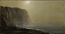
﹁メイン海岸の霧の朝﹂、アーサー・パートン画、ブルックリン美術館 蔵
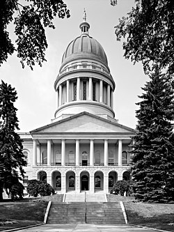
メイン州会議事堂、チャールズ・バルフィンチ設計、1829年から1 832年に建設
現在のメイン州となっている地域の元々の住人は、アルゴンキン語族のワバナキ族インディアンであり、その中にはアベナキ族、パサマクォディ族、マリシート族、ペノブスコット族が含まれていた。ヨーロッパ人による最初の開拓地は、1604年にフランス人ピエール・デュギュア・シュール・ド・モンがサンクロワ島に設立したものだった。設立者の中には著名な探検家サミュエル・ド・シャンプランが含まれていた。フランスは後のメイン州を含む地域の名前をアカディアと名付けた。イングランド人による最初の開拓地は、1607年にプリマス会社が設立したポパム植民地であり、これはバージニア州にジェームズタウンの開拓地が造られたのと同じ年だった。ポパムの開拓者は14か月後にはイングランドに戻った[9]。
フランスによって1609年にはペノブスコット湾沿いに、1613年にはマウントデザート島にイエズス会の伝道所が設立された。1613年、クロード・ド・ラ・トゥーアがカスタイン開拓地を設立した。1625年にはカスタインを守るためにペンタグー砦を建設した。メイン西部の海岸地域が1622年の土地特許で初めてメイン植民地と指定された。ケネベック川より北のメイン東部はほとんど入植が行われず、17世紀の間はサガダホク領土と呼ばれていた。2回目の入植の試みは1623年のヨークと呼ばれた地だった。イングランド人探検家で海軍軍人のクリストファー・レベット船長が、イングランド王チャールズ1世から、6,000エーカー (24 km2) の土地特許を認められた[10]。この開拓地も失敗した。
メインの中部にはアンドロスコッギン族︵別名‥アロサガンタクック族︶が住んでいた。アンドロスコッギン族はアベナキ族に属する部族だった。1690年に起きたウィリアム王戦争のときに、この地を逐われた。彼等はカナダのセントフランシスに移っていたが、その町も1759年にロジャーズ・レンジャーズに破壊され、現在はオダナクにいる。アベナキ族に属する別の部族は何度か大敗を喫した。特にラル神父戦争の間には、1724年にノリッジウォックが占領され、1725年にはペクォーケット族が敗北して、その人口を大きく減らした。彼等も最後はカナダに逃避し、ベカンコーやシラリーに入り、後には南から逃げてきた他の部族と共にセントフランシスに入った[11]。
1652年、現在のメインはマサチューセッツ湾植民地の一部となった。17世紀と18世紀初期は、フランスとイギリスがその同盟インディアンと共に覇権を競い、互いに襲撃を繰り返し、身代金目当てに捕虜を取り、あるいはインディアン部族の中で養子にした。1692年初期、アベナキ族がヨークを襲撃し、約100人のイングランド人開拓者を殺し、推計80人の村人を捕虜にした[12]。1700年代初期のアン女王戦争では、アベナキ族がマサチューセッツに対する襲撃で捕まえた捕虜を、モントリオールに近いカトリック教徒モホーク族の集落であるカーネワケまで連れて行き、そこで養子にした者もあれば、身代金と交換された者もいた[13][14]。
1740年代にイギリスがアカディアでフランスを破った後、ペノブスコット川より東の領域はノバスコシア植民地の支配下に入り、現在のニューブランズウィックと共にノバスコシアのサンベリー郡となり、郡庁はカンポベロに置かれた。アメリカ独立戦争や米英戦争のとき、アメリカの愛国者とイギリス軍がメインの領土を巡って争った。どちらの戦争でも、イギリス軍がメイン東部を占領した[15]。1783年9月3日、パリ条約が調印された結果としてアメリカ独立戦争が終わり、イギリスはアメリカ合衆国の独立を認めた。しかし、メインとイギリス領北アメリカの境界は曖昧なままだった。アメリカ合衆国が形成されたときに、メインはマサチューセッツ州の一部と確認されたが、最終的にその境界が確立されたのは、1842年のウェブスター=アッシュバートン条約によってだった。
メインはマサチューセッツ州の本土とは物理的に離れていた。土地投機や入植に関して長い間意見の不一致があり、メインの住民とこれに同調するマサチューセッツ州民が、1807年のマサチューセッツ州議会でメインを分離する提案を行った。その票決では提案が否決された。1812年に始まった米英戦争のときに、マサチューセッツ州のイギリス寄り商人達が戦争に反対し、イギリスによる侵略からメインを守ることを拒否したので、メインにおける分離を求める感情が大きくなった。1819年、マサチューセッツ州はメイン州の住民投票で承認されれば、メインの分離を認めることに合意した。人口が急増していたメインはこれを受けて1820年に住民投票を実施し、マサチューセッツ州からの分離を承認した。当時、全国的には奴隷制度の拡大に地理的な制限を設ける動きがあり、ミズーリ州の州昇格と引き替えに奴隷州と自由州のバランスを取る必要があった。その結果として出来たミズーリ妥協の一部として、メインは1820年3月15日にマサチューセッツ州からの分離を認められ、合衆国23番目の州に昇格した[16][17][18]。
メイン州の当初の州都は人口最大の都市であるポートランド市にあったが、1832年に州の中央に近い都市としてオーガスタ市に移された。
南北戦争のゲティスバーグの戦いでは、ジョシュア・ローレンス・チェンバレン大佐の指揮するメイン第20連隊がリトルラウンドトップを死守した。北軍が南軍から側面を攻撃される可能性を防いだ。
アメリカ海軍では、メイン州に因んで4代の艦船が﹁メイン﹂と名付けられてきた。
歴史[編集]
主要記事‥メイン州の歴史

政治と法律[編集]
関連項目‥メイン州知事の一覧、List of United States Senators from Maine、List of Maine State Senators、及び As Maine goes, so goes the nation メイン州憲法により、行政府、立法府、司法府が分立した州政府の構造を決めている。憲法に定める州の役職は州務長官、州財務官、州検事総長である。法定の役職として州監査官がある。 立法府はメイン州議会であり定員151人の下院と、同35人の上院の両院制である。議会は法を提案し、承認する。 行政府は議会で成立した法を執行する責任があり、メイン州知事が首長である。州知事は4年間任期で選ばれ、連続2期を超えては就任できない。知事には法に対する拒否権があるが、両院の3分の2以上の賛成があれば、覆すことができる。副知事を持たない7州の1つである。 司法府は州法を解釈する責任がある。裁判所の最上位にあるのがメイン州最高裁判所である。下級裁判所には地方裁判所、上級裁判所、検認裁判所がある。検認裁判所を除いて全ての判事は専任であり、州知事が指名し、議会が確認する。任期は7年間である。検認裁判所判事は非常勤であり、各郡の選挙民が4年間任期で選出している。州と地方の政治[編集]
州の一般選挙では、他の州よりも無所属や第3政党系の候補を受け入れることが多い。1975年から1979年のジェイムズ・B・ロングリーと1995年から2003年のアンガス・キングは無所属の州知事だった。共和党と民主党の二大政党の場合も、他州より中道的な政治家が多い。 現在、メイン州においては、死刑制度は廃止されている。またアルコール飲料の統制州である。 2009年5月6日、同性結婚を合法化した15番目の州になった。しかし、この法は2009年11月3日の住民投票で否決された。2012年11月6日、メイン州は、メリーランド州、ワシントン州と共に住民投票で同性結婚を合法化した最初の州になった[19]。国政[編集]
| 年 | 民主党 | 共和党 |
|---|---|---|
| 2016年 | 47.85% 352,485 | 45.15% 332,591 |
| 2012年 | 56.27% 401,306 | 40.98% 292,276 |
| 2008年 | 57.71% 421,923 | 40.38% 295,283 |
| 2004年 | 53.57% 396,842 | 44.58% 330,201 |
| 2000年 | 49.09% 319,951 | 43.97% 286,616 |
| 1996年 | 51.62% 312,788 | 30.76% 186,378 |
| 1992年 | 38.77% 263,420 | 30.39% 206,504 |
| 1988年 | 43.88% 243,569 | 55.34% 307,131 |
| 1984年 | 38.78% 214,515 | 60.83% 336,500 |
| 1980年 | 42.25% 220,974 | 45.61% 238,522 |
| 1976年 | 48.07% 232,279 | 48.91% 236,320 |
| 1972年 | 38.48% 160,584 | 61.46% 256,458 |
| 1968年 | 55.30% 217,312 | 43.07% 169,254 |
| 1964年 | 68.84% 262,264 | 31.16% 118,701 |
| 1960年 | 42.95% 181,159 | 57.05% 240,608 |
1930年代、メイン州は共和党支持を維持した数少ない州の1つだった。1936年アメリカ合衆国大統領選挙では、フランクリン・ルーズベルトを支持しなかったのはバーモント州とメイン州だけだった。ルーズベルトが出馬したどの大統領選挙でも、支持しなかったのはこの2州だけだった。ただし1940年と1944年の場合はかなりの接戦だった。1960年代から、特に大統領選挙では民主党に傾斜するようになった。1968年には民主党候補のヒューバート・ハンフリーが、メイン州選出上院議員のエドマンド・マスキーを副大統領候補に選んだので、半世紀ぶりに民主党がメイン州を制した。ただし、1970年代と1980年代も共和党候補を選び続けた。
1969年からメイン州の大統領選挙人4人のうち2人は、州全体の選挙結果で勝者に投票することになっている。他の2人は州内に2つあるアメリカ合衆国下院議員の選挙区で最大得票者に投票することとしている。ネブラスカ州を除く他州は全て勝者総取り方式である。
1992年と1996年には、ロス・ペローがメイン州で大きな成果を挙げた。1992年の無所属候補だったペローは、ビル・クリントンに次いで第2位になった。州内ケネブンクポートに昔からブッシュ家の夏の家があった事実を押してのことだった。1996年は改革党の候補となり、他州よりも高い支持率を得た。
1992年の大統領選挙からは連続して7回、民主党候補を選んでいる。すなわちビル・クリントンを2回、2000年のアル・ゴア、2004年のジョン・ケリー、2008年と2012年のバラク・オバマ、2016年のヒラリー・クリントンである。大統領選挙では民主党が強いが、アメリカ合衆国上院議員では共和党が強く、過去50年間で上院議員になった民主党員はエドマンド・マスキー、ジョージ・J・ミッチェルなど3人のみである。
2010年の中間選挙では共和党が大きく躍進した。州知事を確保した他、両院の過半数を獲得したのは1970年代以来のことになった。しかし、2012年の選挙では、民主党が州議会の両院を取り戻した。

メイン州の主要な道路と都市
メイン州の南と東は大西洋、北東はカナダのニューブランズウィック州である。カナダのケベック州が北西にある。ニューハンプシャー州と西で隣接している。ニューイングランド地域内ではその領域の半分に相当するほど面積では最大であり、最東端かつ最北端に位置している。メイン州は他の1つの州とだけ隣接している全米で唯一の州である。
メイン州はアメリカ合衆国で最東端に位置している︵参照‥アメリカ合衆国の極地︶。最東端の都市はイーストポートであり、最東端の町はリューベックである。メイン州の最北端であるエストコートステーションは、ニューイングランドの最北端でもある。
地方自治体[編集]
組織化された地方自治体は選挙で選ばれる地方政府の形態を採り、地方サービスを管理して実行し、記録を保管し、免許料を集め、条例を成立させることができる。町とプランテーションの政府形態はタウンミーティング方式であり、市の政府形態は郡政委員会・マネジャー方式である。2013年時点で23の市と431の町がある。またプランテーションは34ある。総計488の地方自治体が州領域の半分足らずをカバーしている。他に3つのインディアン居留地もある[21]。 ●人口最大の市: ポートランド市、68,408人[22] ●人口最少の市: イーストポート、1,640人 ●人口最大の町: ブランズウィック、21,756人[23] ●人口最少の町はフライアイランドであり、リゾート地なので、年間を通じた住人はゼロである。 ●面積最大の自治体: アラガッシュ町、332km2 ●面積最少の自治体: モンヒーガンアイランド、2.2km2未編入領域[編集]
未編入領域には地方政府が無い。管理、サービス、免許交付、条例は州政府が取り扱う。未編入領域として400以上のタウンシップがあり、その他にどこの自治体にも属さない海岸部の島がある。その総面積は州面積の半分を少し超えている。年間を通じた住人の数は約9,000人であり、州人口の1.3%である。季節住人の数はさらに多い。州内16郡のうち4郡のみがその全域に法人化された町がある。未編入領域の大半は人口の少ないグレートノースウッズの中にある[24]。地理[編集]
関連項目‥メイン州の郡一覧及び List of Maine rivers
州内最大の湖はムースヘッド湖である。ニューイングランド全域ではシャンプレーン湖があるが、バーモント州とニューヨーク州およびケベック州で分け合っている。サウスツイン湖など州内に数多い湖については詩人のヘンリー・デイヴィッド・ソローが語っている。カターディン山はアパラチアン・トレイルの北端になり、南はジョージア州スプリンガー山まで続いている。また新しい国際アパラチアン・トレイルの南端となりニューファンドランド・ラブラドール州ベル島まで続いている。
メイン州は多数のユニークな地理的特徴も有している。最東端の沖合に位置するマキアスシール島とノースロックは、アメリカ合衆国及びカナダの両国が統治権があると現在も争っている4つある地域の一つとなっている。ただし陸地があるのはここだけである。また、この最東端地域には西半球で最大級の渦潮、オールドスノーを見ることが出来る。
メイン州は、ミシシッピ川以東の州では最も人口密度が小さい。﹁松の木の州﹂というニックネームがあり、全土の90%近くが森林である[25]。内陸の森林地帯はほとんど人の住まない所であり、正式な政治区分に入っていない場所もある。これはニューイングランドではほとんど無いことである。例えば、州北部の未編入領域であるノースウェスト・アルーストックは面積6,910 km2 の中に住人は10人しか居らず、1人当たりの面積は690 km2 になる。
メイン州は温帯広葉樹混交林生態系にある。大西洋岸南部と中部に近い地域はオークの混ざった北東部海岸森林である。ノースウッズなど他の部分はニューイングランド・アケイディア森林に覆われている[26]。
メイン州の海岸線は総延長が400 km あり、潮汐海岸線は5,600 km になる[27][28]。アメリカ合衆国本土の最東端にウェストコッディヘッドがある。岩の多い海岸線には多くの灯台、海浜、漁師村があり、沖合にはニューハンプシャー州境に跨るショールズ諸島など数多い島がある。複雑な形状をした岩や崖、多くの湾と入り江もある。内陸には湖、川、森、山も多い。海に降りてくる森に覆われた稜線について、ロックランドとカムデン出身の詩人エドナ・セントビンセント・ミレイはその詩集﹃ルネッサンス﹄で次のように歌っている。

|
|
地質学者はこのような景観を沈水海岸と呼ぶ。海面が上がって元の陸地を浸蝕し、バレーから湾を、山頂から島を造りだした[29]。重い氷河が融けて陸地の高度が上がると下にある岩層にはやや跳ね上がる効果があった。しかしこの隆起は海面の上昇による効果を排除するほどではなく、以前の陸地が浸蝕された。
メイン州地形の多くは最終氷河期の終わりに重い氷河の動きによって造り出された。その典型的な例がサムズ・サウンドとバブルロックであり、どちらもアカディア国立公園のマウントデザート島にある。氷河が削りだしたサムズ・サウンドは東海岸唯一のフィヨルドであり、深さは50 m に達する。水深が深いことと、両岸が切り立っていることで、そのほぼ全長に渡って船が入ることができる。この地形はヒンクリー・ヨットのような権威ある造船業者にとっても魅力あるものである。バブルロックは﹁氷河迷子﹂と呼ばれるものであり、アカディア国立公園のバブル山の外れに巨岩が乗っている。その花崗岩を分析すると、50 km 離れたルサーン町から氷河がこの巨岩を運んできたことがわかる。メイン州の北と西をイアペタス亀裂が走り、その下にはローレンシア大陸がある。南部と東部の下はアバロニアン段地である。
国立公園局の保護及び管理下にある地域は次の通りである[30]。
●アカディア国立公園、バーハーバー近く
●アパラチアン・トレイル
●メイン・アカディア文化、セントジョンバレー︵セントジョン川︶
●ルーズベルト・カンポベロ国際公園、リューベック近く
●セントクロア島国立歴史史跡、カレス
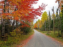
秋のストラットン︵ユースティス︶
メイン州は湿潤大陸性気候にあり︵ケッペンの気候区分では "Dfb"︶、暖かいが概して暑くはならず、湿度の高い夏を経験する。冬は州全体を通じて寒く雪が多い。特に州北部では厳しい冬となる。海岸部は大西洋で幾らか和らげられる。7月日中の平均最高気温は州全体で24℃ から27℃ の間にあり、夜間の平均最低気温は15℃ 台後半である。1月の平均気温は、南部海岸で0 ℃ 近くなり、最北部では0-18 ℃ 以下になる[31]。
過去最高温度は1911年7月にノースブライトンで記録されたで41℃ だった[32]。過去最低温度は2009年1月にビッグブラックリバーで記録された-46 ℃ だった。これはニューイングランドで記録された最低温度に並ぶものである︵1993年にバーモント州でも記録された︶[31]。
ロッキー山脈より東の州では雷雨の起こる数が少ない方であり、年間平均20日未満である。竜巻も希であり、年間2回未満である。大半は州南部で起きている[33]。
気候[編集]

| 都市別各月平均最高最低気温(°F) | |||||||||||||
| 都市 | 1月 | 2月 | 3月 | 4月 | 5月 | 6月 | 7月 | 8月 | 9月 | 10月 | 11月 | 12月 | 平均 |
|---|---|---|---|---|---|---|---|---|---|---|---|---|---|
| オーガスタ | 28/10 | 32/14 | 41/24 | 53/34 | 66/45 | 75/54 | 80/60 | 79/58 | 70/50 | 58/39 | 46/30 | 34/17 | 55/36 |
| カリブー | 19/0 | 23/3 | 34/15 | 47/29 | 63/41 | 72/50 | 76/55 | 74/53 | 64/44 | 51/34 | 37/24 | 25/8 | 49/30 |
| ポートランド | 31/12 | 34/16 | 42/25 | 53/35 | 63/44 | 73/53 | 79/59 | 77/57 | 69/48 | 58/37 | 47/30 | 36/19 | 56/37 |
行政区分[編集]
郡[編集]
詳細は「メイン州の郡一覧」を参照
メイン州は郡に指定された政治区分に分割されている。1860年に現行の16郡体制ができ、その広さは960km2から17,700km2まで、大きな幅がある。
主要な都市と町[編集]


経済[編集]


アメリカ合衆国商務省経済分析局は2010年のメイン州の州総生産高を520億米ドルだったと推計している[34]。2007年の一人当たりの収入は33,991米ドルであり、合衆国内で34番目だった。2010年10月時点での失業率は7.4%だった[35]。
メイン州の農業生産品は、家禽及び卵、乳製品、牛、ブルーベリー、リンゴ、並びにメープルシロップとカエデ糖である。アルーストック郡はジャガイモの生産で知られている。漁業はかつて州経済の主力であり、現在もロブスター漁や底引き漁で残っている。1980年代に、それまでロブスター漁を邪魔して嫌われていたウニが日本向けに輸出されるようになり、1993年には1.8万トンが水揚げされた[36]。乱獲のため激減し、2016年には680トンにまで落ち込んだ[36]。メイン州西部の帯水層及び泉の水は瓶詰めされて商品になっている。
工業製品は、主として紙、材木及び木材製品、電気機器、革製品、加工食品、繊維、並びにバイオテクノロジーである。海軍艦船の建造業は健在であり、バスのバス鉄工所及びキタリー内のポーツマス海軍造船所がある。州内にブランズウィック海軍基地もあり、
以前はアメリカ合衆国海軍の最大支援基地として活動していた。連邦政府予算でその設備を改良する動きがあるものの、基地再編活動でこの基地の閉鎖を始めている。
ブルーベリーでは最大の輸出州である。国内最大の爪楊枝製造工場がストロング町にあった。1日に2千万本の爪楊枝を製造していたが、2003年5月に閉鎖された。
観光業と屋外レクリエーションが州経済の主力となり、次第に重要性を増している。狩猟、釣り、スノーモービル、スキー、ボート乗り、キャンプ、ハイキングなどで人気のある観光地になっている。
メイン州の港湾は全国的な輸送において重要な役割を果たしている。1880年から、ポートランド港は鉄道と結ばれ、不凍港であることで、カナダにとっての主要な冬港となっていた。1900年代半ばにノバスコシア州ハリファックスが大々的に開発されて、その役目が変化した。2001年、ポートランド港は大型タンカーが入港できたので、その取扱量でボストン港を超えた。ポートランド国際ジェットポートが近年拡張され、ジェットブルー航空やサウスウエスト航空の増便に対応できるようになった。
州内に本社を構える大企業は少ない。特に製紙業界で統合と合併が進んで、以前よりも少なくなった。現在州内に本社を構える大企業としては、サウスポートランドのフェアチャイルドセミコンダクター、ウェストブルックのIDEXX研究所、スカボローのハナフォード・ブラザース、ポートランドのユーナムとTD銀行、フリーポートのL・L・ビーン、ヤーマスのコール・ハーンとデロームがある。世界最大の哺乳類遺伝子研究施設であり、遺伝子的に純血のネズミでは世界最大の供給者でもあるジャクソン研究所が州内にある。
税[編集]
メイン州は所得税を課しており、税率は2%から8.5%まで4段階の累進課税方式である。売上税率は5.5%である。宿泊と食事サービスには7%、短期間のレンタカーには10%を課している。メイン州の基幹商品であるブルーベリーの販売者は、その取引記録を保管し、各シーズンで販売した100ポンド (45 kg) につき1.50米ドル、すなわち1ポンド (450 g) 当たり1.5セントを払わなければならない。州内にある不動産と個人資産は、州法で具体的に免税とされない限り資産税の対象である。資産税の管理は市や町の評価官が扱い、未編入領域の資産税は州の評価官が扱う。造船業[編集]
州内には昔から多くの造船会社があった。18世紀から19世紀、木造帆船を製造した多くの造船所があった。これらの船舶の主要機能は外洋で貨物あるいは乗客を運ぶことだった。造船所の1つが現在のブランズウィックのペネルビルにあった。ペネル家が所有する造船所であり、当時は多くの家族が造船所を所有するのが通常だった。その他にもスコルフィールズ家やモージズ家があった。この種の木造船建造は州経済で大きな部分を占めていた。カジノ[編集]
同州の白人系カジノは現在のところ、以下の一軒のみである。- 「ハリウッド・スロット・ホテル&競馬場」
人口動態[編集]

| 人口推移 | |||
|---|---|---|---|
| 年 | 人口 | %± | |
| 1790 | 96,540 | — | |
| 1800 | 151,719 | 57.2% | |
| 1810 | 228,705 | 50.7% | |
| 1820 | 298,335 | 30.4% | |
| 1830 | 399,455 | 33.9% | |
| 1840 | 501,793 | 25.6% | |
| 1850 | 583,169 | 16.2% | |
| 1860 | 628,279 | 7.7% | |
| 1870 | 626,915 | −0.2% | |
| 1880 | 648,936 | 3.5% | |
| 1890 | 661,086 | 1.9% | |
| 1900 | 694,466 | 5.0% | |
| 1910 | 742,371 | 6.9% | |
| 1920 | 768,014 | 3.5% | |
| 1930 | 797,423 | 3.8% | |
| 1940 | 847,226 | 6.2% | |
| 1950 | 913,774 | 7.9% | |
| 1960 | 969,265 | 6.1% | |
| 1970 | 992,048 | 2.4% | |
| 1980 | 1,124,660 | 13.4% | |
| 1990 | 1,227,928 | 9.2% | |
| 2000 | 1,274,923 | 3.8% | |
| 2010 | 1,328,361 | 4.2% | |
| 2020 | 1,362,359 | 2.6% | |
| Source: 1910-2010[37] | |||
2020年国勢調査時点でのメイン州の人口は1,362,359人で、2010年国勢調査での1,274,923人から2.56%増加していた[38]。人口密度は17.0人/km2で、ニューイングランド、アメリカ合衆国北東部、同東海岸、ミシシッピ川以東の州で最少だった。
メイン州の人口重心はケネベック郡オーガスタ付近となっている[39]。ポートランド大都市圏に州人口の40%以上が居住し、最も人口密度が高い[38]。内陸部にはほとんど人の住んでいない大きな地域がある。

インディアン部族のかつての勢力図。マリシート族︵深緑色︶、パサマ クォディ族︵緑色︶、ペノブスコット族他︵薄緑色︶

ペノブスコット族の部族国旗
パサマクォディ族の部族国旗

メイン州ミクマク族の部族国旗
同州に先住するミクマク族、マリシート族、ペノブスコット族、パサマクォディ族、アベナキ族などのインディアン部族は﹁ワバナキ連邦﹂と呼ばれる部族連合体を形成し、この地で鮭を中心とする漁猟採集を行って暮らしてきた。
1972年パサマクォディ族とペノブスコット族は、メイン州によって不法没収された本来の部族の土地の2/3に当たる1,250万エーカー (50,590km2) の返還訴訟を連邦政府に起こした。彼らはこれを、インディアンの土地の白人への売却を禁止する1790年制定の同州の﹁交易禁止法﹂違反であるとしたのである。
1975年、こういったインディアンの領土問題の解決に対して、合衆国に法的義務を課す画期的裁定がなされ、1978年に、両部族への8,150万ドルの慰謝料とともに和解協定が行われた。これは同時に彼らを連邦公認し、正式にインディアン部族として﹁復活﹂させるものだった。
1980年、この協定に基づき、パサマクウォディ族、ペノブスコット族、マリシート族ホールトン・バンドの共有領土が州によって正式に認定返還され、パサマクウォディ族は領土の獲得資金として1,350万ドル、また信託資金として2,680万ドルを連邦政府から受け取った。ハーバード・ビジネス・スクールの試算によると、この資金はパサマクォディ族の投資によって、すでに1億ドルに達している。
現在、アメリカ連邦政府が公式に認定し、保留地 (Reservation) を領有する部族は以下の4つである。部族の土地の更なる返還運動が年次高まっている。
●アメリカ連邦政府から公認されているインディアン部族
●﹁ミクマク族・アルーストック・バンド﹂
●﹁マリシート族・ホールトン・バンド﹂
●﹁ペノブスコット族﹂
●﹁パサマクォディ族﹂
●アメリカ連邦政府に公認要求中のインディアン部族
●﹁マリシート族﹂
●﹁ウェスゲット=シプ共同体︵ミクマク族、マリシート族︶﹂

ペノブスコット川

メイン州のインディアン保留地︵右上︶
同州を流れるペノブスコット川の﹁大西洋鮭﹂は州の特産物である。しかし、20世紀初頭からこの川に数基の発電用ダムが設置されたため、鮭の遡上が阻害され、2000年代には遡上数が1,000匹を切った。ペノブスコット族は同川での鮭漁を生業とし、連邦法で漁業権を保証されているインディアン部族であるが、保留地内のダムの影響で、鮭の収穫を祝う伝統儀式も行えなくなった。初ものの鮭はアメリカ大統領の献上物にもなっているが、1992年より中止されている。
2003年10月6日、4年越しの﹁ペノブスコット川復活計画﹂として、州・連邦政府、環境保護団体、ペノブスコット族が2,500万ドルを共同出資してダム所有会社からダムを買い取る五者協定が結ばれた。ペノブスコット族は代替貯水池として保留地を4ヘクタール水没させられるが、保留地の2基のダムは破壊され、2010年までに残りのダムに魚道が作られる。この計画によってアメリカウナギやシマスズキなど、大西洋鮭以外の絶滅寸前魚種も軒並み復活するものと期待されている。

ポートランド国際ジェットポート
州内ではポートランド国際ジェットポートとバンゴー国際空港が2大空港であり、旅客便が発着している。毎日多くの航空会社が、ニューヨーク市、アトランタ市、オーランド市などに直行便を運航している。エッセンシャル航空が多くの傘下会社に州内地方便を運行させており、ターボプロップ航空機がオーガスタ州立空港、ハンコック郡バーハーバー空港、ノックス郡地域空港、プレスクアイルのノーザンメイン空港に飛んでいる。これらの空港にはケープエアーのセスナ402sとペンエアーのサーブ340sが就航している。
州内全域に小型の空港が鏤められており、一般用途飛行に使われている。例えばイーストポート市民空港は、イーストポート市が所有し、単発の軽飛行機が年間1,200回発着する空港である[53]。
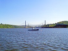
ペノブスコット川に架かるペノブスコット・ナローズ橋、アメリカ国道 1号線とメイン州道3号線が通っている
州間高速道路95号線︵I-95︶が州内を南西から北東に抜けており、東よりの分岐路である同295号線︵I-295︶、さらに枝線である同195号線︵I-195︶、同395号線︵I-395︶、同495号線︵I-495︶もある。またアメリカ国道1号線が州内のフォートケントを始点とし、南のフロリダ州まで通っている。アメリカ国道2号線東部分の東端はカナダ国境ニューブランズウィック州に近いホールトンに始まり、ラウジズポイント (ニューヨーク州)でアメリカ国道11号線に接続している。アメリカ国道2A号線はオールドタウンとオロノを繋ぎ、主にメイン大学キャンパスに行くときに使われている。アメリカ国道201号線と同202号線も州内を抜けている。アメリカ国道2号線、メイン州道6号線、同9号線は沿海州のトラックなどが、アメリカ国内やカナダ中央部への近道として利用することが多い。
2011年3月、道路および公共空間の全体的なゴミ処理の有効性と質について﹁アメリカ州別ゴミ処理スコアカード﹂におけるトップ3の州にランクされた[54]。

旅客列車﹁ダウンイースター号﹂の南行き、オーシャンパーク駅、北行 き列車の車室から撮影
アムトラックが運行する旅客列車﹁ダウンイースター号﹂は、ブランズウィックからボストンのノースステーションを結び、州内ではフリーポート、ポートランド、オールドオーチャードビーチ、サコー、ウェルズに停車する。1日に5往復が運行され、そのうち2本はポートランドとブランズウィックの間も運行されている[55]。
ブランズウィックとロックランドの間の季節列車がメイン・イースタン鉄道によって運行されており、州が所有するロックランド支線の機動を使っている。
人種及び祖先[編集]
2010年国勢調査に拠れば、メイン州の人種による人口構成は次のようになっている[40]。 ●94.4% ヒスパニック以外の白人 ●1.1% 黒人 ●0.6% インディアン ●1.0% アジア人 ●1.4% 混血 ●0.1% その他の人種 ●1.3% ヒスパニック︵人種に拠らない︶ アメリカ合衆国内で、最も白人の比率が高い州であることから、"Most white state"とも呼ばれる。 州内で申告された祖先による構成比は次の通りだった[41]。 ●23.9% フランス系とフランス系カナダ人 ●21.6% イギリス系 ●17.8% アイルランド系 ●9.4% アメリカ人 ●8.5% ドイツ系 ●5.8% イタリア系 ●5.5% スコットランド系 ●2.1% ポーランド系 ●1.8% スウェーデン系 ●1.7% スコットランド・アイルランド系 アメリカ人と申告した者の多くはイギリス人の子孫であるが、国内に長く住んでいるので、単純にアメリカ人と申告している[42][43][44][45][46][47][48]。 フランス系アメリカ人の比率は国内で最も高い。また非ヒスパニック白人の比率も国内最高である。2011年に生まれた子供の89.0%が二親とも非ヒスパニック白人の子供だった[49]。フランス語を話す人の比率も国内最高である。その大半は1840年から1930年にケベック州から移ってきた者と、1842年以前にニューブランズウィック州から移ってきた者の子孫である。州北部の特にアルーストック郡では、親戚が近くのニューブランズウィック州に住んでいるので、家庭でフランス語を話すアカディア人がいる。統計データでは、家庭で州民の5.28%がフランス語を話しており、ルイジアナ州の4.68%よりも高い[50]。5歳以上の州民の92.25%は家庭で英語を話しており、フランス語を話す人々は少数言語民族になっている。メイン州は公式言語を決めていないが、最も使われているのは英語である。 1842年のウェブスター・アシュバートン条約で国境が定められる以前、セントジョン川バレーの上流はマダワスカ共和国と呼ばれた地域の一部だった。ルイストン、ウォータービル、ビッドフォードの人口の4分の1以上がフランス系アメリカ人である。ミッドコーストとダウンイースト地域住人の大半は主にイギリス人の血を引いている。19世紀後半から20世紀初めに続いた移民の波で、州全体にアイルランド系、イタリア系、ポーランド系の少数民族が入ってきた。宗教[編集]
メイン州の宗教宗派別構成は次のようになっている。 ●キリスト教 – 82% ●プロテスタント – 45% ●バプテスト – 16% ●メソジスト – 9%[51] ●米国聖公会 - 8% ●キリスト連合教会 - 8%[51] ●ペンテコステ運動 – 6% ●ルーテル教会 – 3% ●ルーテル教会 – 3% ●他のプロテスタントまたは一般的なプロテスタント – 10% ●ローマ・カトリック – 37% ●他のキリスト教 – 1% ●他の宗教 – 1% ●無宗教 – 17% 2010年に行われた研究で、メイン州は国内でも宗教心の薄い州になっていた[52]。インディアン部族[編集]


ペノブスコット川復活計画[編集]


インディアン・カジノ[編集]
同州のインディアン部族が経営する﹁インディアン・カジノ﹂は現在のところ、ペノブスコット族の一軒のみ。 2008年10月14日、パサマクォディ族が部族カジノ構想を公表し、これを支援する州議員らによって2009年2月20日に、同州オックスフォード郡での彼らのカジノ事業を合法化する州法案が提出された。部族カジノが州に多大な収益と税収、部族の経済発展をもたらすものであることは多数の州議員も認めており、この法案の可否は、パサマクォディ族のみならず、州全体が注目するものとなった。 2009年6月3日、メイン州議会は、この議案を否決した。州下院が90対55、上院は27対7の大差での請求拒絶だった。結果、パサマクォディ族の部族カジノ計画は頓挫した。 ●メイン州のインディアンカジノと経営部族 ●ペノブスコット族 ●﹁ペノブスコット・高賭率ビンゴ﹂交通[編集]
空港[編集]

高規格道路[編集]

鉄道[編集]
旅客鉄道[編集]

貨物鉄道[編集]
州内の貨物鉄道輸送は、地域と短線運行会社数社が担当している。パンナム鉄道︵元ギルフォード鉄道システム︶は元のボストン・アンド・メイン鉄道とメイン・セントラル鉄道の線を使っている。他にセントローレンス・アンド・アトランティック鉄道、メイン・イースタン鉄道、モントリオール・メインアンド・アトランティック鉄道、ニューブランズウィック・サザン鉄道がある。教育[編集]
公共教育学区[編集]
メイン州の公立学校は4種類の教育学区が運営している。第1に単一学校のための地元学区、第2は監督官が1人だけいる学校連合、第3は多くの町や監督官が含まれる教育管理地区、第4は複数の町が共有する小学校が1つあるコミュニティ教育学区である 私立学校は公立学校に比べれば少ない。児童数20人以下の私立小学校が多く存在するが、私立の高校は﹁準私立﹂と呼ばれている。これは、生徒を送り出す費用が掛かるが、町が学校と契約して幾らか減額しているからである。既に私立学校が存在し、全く新しい学校を建てるよりも安価であると判断したときに、私立学校に委託している。単科及び総合大学[編集]
メイン州にはボウディン大学やコルビー大学といった、毎年大学ランキングで上位に位置するリベラルアーツ︵教養系︶大学が存在する。ニューイングランド内の他州同様、州立大学よりこれら私立大学のほうが全米での認知度は高い。
|
|
芸術・文化[編集]
作家[編集]
●スティーヴン・キング - バンゴー生まれで、現在も住人であり、その小説の舞台にメイン州が多く登場するが、主な舞台になるのはメイン州にあると設定される﹁架空の町﹂である。スポーツチーム[編集]
●ポートランド・シードッグス、野球のマイナーリーグであるイースタンリーグ所属 ●ポートランド・パイレーツ、アイスホッケーのマイナーリーグ所属 ●メイン・レッドクローズ、バスケットボールのNBAデベロップメント・リーグ所属その他[編集]
同州出身の有名人[編集]
詳細は「w:List of people from Maine」を参照
州の象徴など[編集]
日本の姉妹都市[編集]
脚注[編集]
出典[編集]
(一)^ MLA Language Map Data Center". Modern Language Association.
(二)^ “Journal of the Senate” (doc). State of Maine (2002年3月6日). 2007年9月20日閲覧。 “"WHEREAS, the State of Maine is named after the Province of Maine in France..."”
(三)^ Schroeder, Emily A.. “Origin of Maine's Name”. Maine State Library. 2007年7月16日時点のオリジナルよりアーカイブ。2007年9月20日閲覧。
(四)^ Stewart, George (1945). Names on the Land: A Historical Account of Place-Naming in the United States. New York: Random House. pp. 41–42
(五)^ Shain, Samuella (1997-08-01). The Maine Reader: The Down East Experience from 1614 to the Present. David R. Godine Publisher. ISBN 978-1-56792-078-9 2010年7月3日閲覧。
(六)^ Stuart, George R. (1958). Names on the Land. Houghton Mifflin. ISBN 978-0-938530-02-2
(七)^ ;http://realfacts.snapple.com/proudtobemonosyllabic/'
(八)^ One syllable
(九)^ MPBN, "Rolling Back the Frontier" Archived 2011年7月4日, at the Wayback Machine., The Story of Maine, accessed 3 Jan 2011
(十)^ Proceedings of the Massachusetts Historical Society, Vol. 20, 1882–1883, Published by the Society, Boston, 1884
(11)^ Bruce G. Trigger (ed.): Handbook of North American Indians. Vol. 15. Northeast. Smithsonian Institution Press, Washington D.C. 1978 ISBN 0-16-004575-4
(12)^ "York commemorates Candlemas Raid". The Portsmouth Herald. February 01, 2001.
(13)^ John Demos, The Unredeemed Captive: A Family Story from Early America, New York: Alfred A. Knopf, 1994, pp. 186 and 224
(14)^ Darren Bonaparte, "The History of Akwesasne", The Wampum Chronicles, accessed 1 Feb 2010
(15)^ Woodard, Colin. The Lobster Coast. New York. Viking/Penguin, ISBN 0-670-03324-3, 2004, pp. 139–140, 150-151
(16)^ Woodard, Colin. "Parallel 44: Origins of the Mass Effect", The Working Waterfront, August 31, 2010. [1]
(17)^ Woodard, Colin. The Lobster Coast: Rebels, Rusticators and the Forgotten Frontier (2004) Penguin Books. ISBN 0-670-03324-3
(18)^ “Maine History (Statehood)”. www.maine.gov. 2008年5月4日時点のオリジナルよりアーカイブ。2008年4月13日閲覧。
(19)^ "Maine Passes Gay Marriage in Historic 'Question 1' Vote". The Huffington Post. November 7, 2012.
(20)^ “Dave Leip's Atlas of U.S. Presidential Elections”. 2011年6月4日時点のオリジナルよりアーカイブ。2011年6月11日閲覧。
(21)^ Maine City and Town Index
(22)^ QuickFacts: Portland city, Maine. U.S. Census Bureau.
(23)^ QuickFacts: Brunswick town, Cumberland County, Maine. U.S. Census Bureau.
(24)^ Maine Township Listing (Unorganized Territories)
(25)^ “Message from the State Forester”. Maine Forest Service. 2010年12月26日閲覧。
(26)^ Olson, D. M, E. Dinerstein et al. (2001). “Terrestrial Ecoregions of the World: A New Map of Life on Earth”. BioScience 51 (11): 933–938. doi:10.1641/0006-3568(2001)051[0933:TEOTWA]2.0.CO;2. ISSN 0006-3568. オリジナルの2011年10月14日時点におけるアーカイブ。.
(27)^ “Maine.gov: Facts About Maine”. State of Maine. 2010年11月14日時点のオリジナルよりアーカイブ。2010年9月17日閲覧。
(28)^ Coastline lengths of states
(29)^ drowned coast: Definition and Much More from Answers.com
(30)^ “Maine”. National Park Service. 2008年7月3日時点のオリジナルよりアーカイブ。2008年7月16日閲覧。
(31)^ abLent, Robert (2009年2月10日). “New All Time Low Temperature Recorded in Maine”. U.S. Geological Survey 2011年11月6日閲覧。
(32)^ “Each state's high temperature record”. USA Today. (2006年8月) 2009年2月11日閲覧。
(33)^ [2] NOAA National Climatic Data Center. Retrieved on October 24, 2006.
(34)^ “GDP by State”. Greyhill Advisors. 2011年9月13日閲覧。
(35)^ BLS.gov - Local Area Unemployment Statistics
(36)^ abルース・カッシンガー著、井上勲訳﹃藻類 生命進化と地球環境を支えてきた奇妙な生き物﹄、築地書店、2020年︵原著2019年︶、125頁。
(37)^ Resident Population Data. “Resident Population Data - 2010 Census”. 2010.census.gov. 2012年3月15日閲覧。
(38)^ abQuickFacts. U.S. Census Bureau. 2020年.
(39)^ “Population and Population Centers by State: 2010 (US Census Bureau)”. 2011年4月9日閲覧。
(40)^ “2010_State_Profile_TEMPLATE” (PDF). 2012年10月25日閲覧。
(41)^ “Selected Social Characteristics in the United States: 2011 American Community Survey 1-Year Estimates (DP02): Maine”. U.S. Census Bureau American Factfinder. 2013年1月4日閲覧。
(42)^ Sharing the Dream: White Males in a Multicultural America By Dominic J. Pulera.
(43)^ Reynolds Farley, 'The New Census Question about Ancestry: What Did It Tell Us?', Demography, Vol. 28, No. 3 (August 1991), pp. 414, 421.
(44)^ Stanley Lieberson and Lawrence Santi, 'The Use of Nativity Data to Estimate Ethnic Characteristics and Patterns', Social Science Research, Vol. 14, No. 1 (1985), pp. 44-6.
(45)^ Stanley Lieberson and Mary C. Waters, 'Ethnic Groups in Flux: The Changing Ethnic Responses of American Whites', Annals of the American Academy of Political and Social Science, Vol. 487, No. 79 (September 1986), pp. 82-86.
(46)^ Mary C. Waters, Ethnic Options: Choosing Identities in America (Berkeley: University of California Press, 1990), p. 36.
(47)^ French Canadian Emigration to the United States 1840-1930. Claude Bélanger, Department of History, Marianopolis College
(48)^ French-Canadian Americans by Marianne Fedunkiw
(49)^ "Americans under age 1 now mostly minorities, but not in Ohio: Statistical Snapshot". The Plain Dealer. June 3, 2012.
(50)^ “MLA Language Map Data Center”. Modern Language Association. 2013年9月11日閲覧。
(51)^ ab“State Membership Report - Maine”. Association of Religion Data Archives. 2013年9月11日閲覧。
(52)^ Hendrickson, Dyke (2010年8月19日). “The Role of Religion in Maine”. Maine Public Broadcasting Network. 2011年10月19日閲覧。
(53)^ KEPM - Eastport, Maine - Eastport Municipal Airport". Great Circle Mapper. http://gc.kls2.com/airport/KEPM. Retrieved 2009-08-09.
(54)^ Spacek, Steve (13 March 2011). American State Litter Scorecard: New Rankings for an Increasingly Environmentally Concened Populace. American Society for Public Administration Conference. 2012年3月6日閲覧。
(55)^ “Downeaster Schedule, effective November 1, 2012”. Amtrak Train Schedules, Timetables. Amtrak. 2012年11月10日閲覧。
![[2]](http://www.ncdc.noaa.gov/img/climate/research/tornado/small/avgt5304.gif)
関連項目[編集]
外部リンク[編集]
- 公式ウェブサイト
- Maine Office of Tourism (英語)
- Visit Maine (agriculture) Maine fairs, festivals, etc. - Agricultural Dept.
- アメリカ合衆国政府
- Maine State Guide, from the Library of Congress
- U.S. EIA Energy Profile for Maine - economic, environmental and energy data
- U.S. Geological Survey Real-time, geographic, and other scientific resources of Maine
- U.S. Dept. of Agriculture Maine State Facts - agricultural
- U.S. Census Bureau Quick facts on Maine
- Portland Magazine Editorial on Maine news, events, and people
- その他の情報
- メイン州 - Curlie(英語)
- Maine Historical Society
- Old USGS maps of Maine.
- 1860 Map of Maine by Mitchell.
- 1876 Panoramic Birdseye View of Portland by Warner at LOC.,
- Portland Stage Company
- Comprehensive compilation of media sources in Maine.
 メイン州に関連する地理データ - オープンストリートマップ
- 地図 - Google マップ
| 関連項目 |
|
|---|---|
| 地域圏 |
ダウンイースト | ハイランズ | レイクカントリー | ミッドコースト | ノースウッズ | ペノブスコット湾 | サザンコースト | ウェスタンマウンテンズ |
| 郡 |
アルーストック郡 | アンドロスコッギン郡 | オックスフォード郡 | カンバーランド郡 | ケネベック郡 | サガダホク郡 | サマセット郡 | ノックス郡 | ハンコック郡 | ピスカタキス郡 | フランクリン郡 | ペノブスコット郡 | ヨーク郡 | リンカーン郡 | ワシントン郡 | ウォルド郡 |
| 主な都市 |
イーストポート | ウェストブルック | ウォータービル | エルスワース | オーガスタ | オーバーン | オールドタウン | ガーディナー | カリブー | カレス | サウスポートランド | サンフォード | ソコー | バス | ハロウェル | バンゴー | ビデフォード | ブルワー | プレスクアイル | ベルファスト | ポートランド | ルイストン | ロックランド |
| 主な町 |
アルフレッド | ウィスカセット | ウィンスロー | ウィンダム | ウェルズ | オールドオーチャードビーチ | オロノ | キタリー | ケープエリザベス | ケネバンク | ゴーラム | スカウヒーガン | スカボロー | スタンディッシュ | ドーバー・フォックスクロフト | トップシャム | バッサルボロ | パリス | ファーミントン | ファルマス | ブランズウィック | ブリッジトン | ホールトン | マチャイアス | ヨーク | リスボン |
|
| |
| 全般 |
|
|---|---|
| 国立図書館 |
|
| 地理 |
|
| 学術データベース |
|
| その他 |
|